close
Trail Conditions
- Unknown
- Snow Groomed
- Snow Packed
- Snow Covered
- Snow Cover Inadequate
- Freeze/thaw Cycle
- Icy
- Prevalent Mud
- Wet
- Variable
- Ideal
- Dry
- Very Dry
Trail Flow (Ridden Direction)
Trailforks scans users ridelogs to determine the most popular direction each trail is ridden. A good flowing trail network will have most trails flowing in a single direction according to their intension.
The colour categories are based on what percentage of riders are riding a trail in its intended direction.
The colour categories are based on what percentage of riders are riding a trail in its intended direction.
- > 96%
- > 90%
- > 80%
- > 70%
- > 50%
- < 50%
- bi-directional trail
- no data
Trail Last Ridden
Trailforks scans ridelogs to determine the last time a trail was ridden.
- < 2 days
- < 1 week
- < 2 weeks
- < 1 month
- < 6 months
- > 6 months
Trail Ridden Direction
The intended direction a trail should be ridden.
- Downhill Only
- Downhill Primary
- Both Directions
- Uphill Primary
- Uphill Only
- One Direction
Contribute Details
Colors indicate trail is missing specified detail.
- Description
- Photos
- Description & Photos
- Videos
Trail Popularity ?
Trailforks scans ridelogs to determine which trails are ridden the most in the last 9 months.
Trails are compared with nearby trails in the same city region with a possible 25 colour shades.
Think of this as a heatmap, more rides = more kinetic energy = warmer colors.
- most popular
- popular
- less popular
- not popular
ATV/ORV/OHV Filter
Max Vehicle Width
inches
Radar Time
x
Activity Recordings
Trailforks users anonymized public ridelogs from the past 6 months.
- mountain biking recent
- mountain biking (>6 month)
- hiking (1 year)
- moto (1 year)
Activity Recordings
Trailforks users anonymized public skilogs from the past 12 months.
- Downhill Ski
- Backcountry Ski
- Nordic Ski
Jump Magnitude Heatmap
Heatmap of where riders jump on trails. Zoom in to see individual jumps, click circles to view jump details.
Trails Deemphasized
Trails are shown in grey.
Only show trails with NO bikes.
Save the current map location and zoom level as your default home location whenever this page is loaded.
SavePopular Trail Networks
view all areas »Activities Click to view
- Mountain Bike
282 trails
- E-Bike
40 trails
- Hike
282 trails
- Trail Running
283 trails
Region Details
- 39
- 14
- 43
- 116
- 54
- 15
- 1
Region Status
Open as of May 23, 2022Local Trail Association
Stats
- Avg Trail Rating
- Trails (view details)
- 319
- Trails Mountain Bike
- 282
- Trails E-Bike
- 40
- Trails Hike
- 282
- Trails Trail Running
- 283
- Trails Horse
- 43
- Trails Dirtbike/Moto
- 14
- Trails ATV/ORV/OHV
- 9
- Trails Downhill Ski
- 18
- Total Distance
- 592 miles
- Total Descent
- 138,909 ft
- Total Vertical
- 6,483 ft
- Highest Trailhead
- 12,854 ft
- Reports
- 1,807
- Photos
- 510
- Ridden Counter
- 58,777
Sub Regions
-
Animas City Mountain
- 6
- 5
- 2
-
Dalla Mountain Park
- 3
- 4
- 1
-
Fort Lewis College
- 4
- 3
- 2
-
Grandview Ridge
- 16
- 1
- 1
-
Hermosa Creek
- 1
- 4
- 5
- 2
-
Hidden Valley
- 4
- 2
-
Horse Gulch
- 1
- 6
- 16
- 10
- 4
-
Log Chutes
- 1
- 5
- 4
- 2
-
Missionary Ridge
- 1
- 13
- 6
- 1
-
Overend Mountain Park
- 1
- 6
- 15
- 7
- 1
-
Purgatory Resort
- 6
- 10
- 2
- 1
- 1
-
Three Springs
- 3
- 13
- 4
-
Twin Buttes
- 1
- 8
-
Vallecito Reservoir
- 5
- 2
Popular Durango Mountain Biking Trails
Durango Mountain Bike Routes
| title | rating | distance |
|---|---|---|
| 2ndAve - Twin Buttes | 9 miles | |
| 2ndAve - Intermediate Test Tracks | 8 miles | |
| Blackhawk Pass Loop via Hermosa | 25 miles | |
| Jones, Pinkerton, Dutch, Hermosa Creek Loop | 19 miles | |
| 2ndAve - Dry Fork Lollipop | 15 miles | |
| Rico's Backdoor | 36 miles | |
| IHBC MTB Expert 2021 | 9 miles | |
| Elbert Creek to Dutch Creek Shuttle | 22 miles | |
| First Fork to Red Creek | 11 miles | |
| Animas Counter-loop | 6 miles |
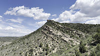
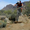
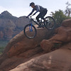
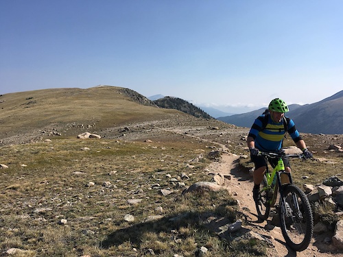
Photos of Durango Mountain Bike
trail: Cliff Rock Loop
72 |
May 15, 2021 @ 5:53am
May 15, 2021
trail: Dry Fork
50 |
Oct 3, 2020 @ 10:37am
Oct 3, 2020
trail: Dry Fork
62 |
Sep 18, 2020 @ 4:56pm
Sep 18, 2020
trail: Hogsback
476 |
Dec 12, 2018 @ 11:07am
Dec 12, 2018
trail: Twin Buttes
76 |
Nov 3, 2018 @ 3:51pm
Nov 3, 2018
trail: Hogsback
608 |
Oct 16, 2018 @ 9:42pm
Oct 16, 2018
trail: Twin Buttes
85 |
Oct 29, 2017 @ 11:58am
Oct 29, 2017
trail: Cliff Rock Loop
160 |
Oct 18, 2017 @ 3:25am
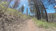
Oct 18, 2017Videos of Durango Mountain Bike
trail: Telegraph
|
Jun 30, 2022
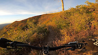
trail: Haflin Creek
|
Jun 4, 2022
trail: Hermosa Creek
23 |
May 17, 2022
trail: Haflin Creek
90 |
Oct 15, 2021
trail: Log Chutes DH
126 |
Jul 15, 2021
trail: Pinkerton-Flagstaff
124 |
Oct 23, 2020
trail: Haflin Creek
1:10 |
311 |
Nov 22, 2019
trail: Pautskey Point
1:13 |
358 |
Jan 19, 2018
Current Trail Warnings
| status | trail | date | condition | user | info |
|---|---|---|---|---|---|
| Raider Ridge Alternate | Jul 5, 2022 @ 9:58am 17 hours | Dry | jasbushey | This alternate has been closed off due to... | |
| Cap's | Jun 22, 2022 @ 7:06am Jun 22, 2022 | Ideal | jasbushey | Tree down requiring chainsaw around blind... | |
| Old Car Loop | Jun 12, 2022 @ 10:56am Jun 12, 2022 | Unknown | jdivock | Trail looks to no longer exist including... |
Recent Trail Reports
| status | trail | date | condition | info | user |
|---|---|---|---|---|---|
| Jones Creek | Jul 5, 2022 @ 5:42pm 9 hours | Wet | nlhuge | ||
| Dutch Creek | Jul 5, 2022 @ 5:42pm 9 hours | Wet | nlhuge | ||
| Animas Mountain | Jul 5, 2022 @ 6:52am 20 hours | Ideal | jasbushey | ||
| Dome to da Loam | Jul 5, 2022 @ 6:52am 20 hours | Ideal | jasbushey | ||
| Skills | Jul 2, 2022 @ 4:18pm Jul 2, 2022 | Unknown | WillWalsh | ||
| RidgeView | Jun 26, 2022 @ 8:43am Jun 26, 2022 | Ideal | Quincybuickerood | ||
| Horse Gulch | Jun 25, 2022 @ 4:04pm Jun 25, 2022 | Ideal | spokesmanmtb | ||
| Telegraph | Jun 25, 2022 @ 4:01pm Jun 25, 2022 | Ideal | spokesmanmtb | ||
| Chapman Hill Flow | Jun 24, 2022 @ 11:49am Jun 24, 2022 | Dry | jasbushey | ||
| Talker | Jun 24, 2022 @ 11:48am Jun 24, 2022 | Dry | jasbushey |
Activity Feed
| username | action | type | title | date | |
|---|---|---|---|---|---|
 | nlhuge | add | report | Jones Creek and 1 more | Jul 5, 2022 @ 10:26pm 5 hours |
| Missyfox | ridden | trail | Cuchillo | Jul 5, 2022 @ 8:38pm 6 hours |
| DerektV4ZqF | ridden | trail | Cuchillo | Jul 5, 2022 @ 2:45pm 12 hours |
 | msmcfate | add | photo | in Cottonwood, Arizona, United States | Jul 5, 2022 @ 2:04pm 13 hours |
| msmcfate | add | trail | Jacob's Ladder | Jul 5, 2022 @ 1:15pm 14 hours |
Recent Comments
| username | type | title | comment | date | |
|---|---|---|---|---|---|
 | trail | Thanks for the heads up! LOL | Jun 29, 2022 @ 1:54pm Jun 29, 2022 | ||
 | trail | Fast and fun! | Jun 29, 2022 @ 9:32am Jun 29, 2022 | ||
 | trail | I climbed this trail today (was great!) and... | Jun 25, 2022 @ 4:04pm Jun 25, 2022 | ||
 | report | Thanks for the report! Next time I'd put it... | Jun 22, 2022 @ 7:05am Jun 22, 2022 | ||
 | report | * towards the bottom | Jun 19, 2022 @ 3:59pm Jun 19, 2022 |
Local Badges
-

10 Black Trails263 awarded -

Big Ride 30k5,635 awarded -

10 Blue Trails664 awarded -

Descent 10k Badge281 awarded -

Climbing 10k Badge252 awarded -

Completionist0 awarded
National Scenic Trails & Official Routes
-
Colorado Trail (Bike)
- Mountain Bike
Bike & Skill Parks
| name | type | city | rating |
|---|---|---|---|
| Purgatory Resort | bike park | Durango | |
| Durango BMX Track | skill park | Durango |
Upcoming Local Events
Local Products
Local Products
Activity Type Stats
| activitytype | trails | distance | descent | descent distance | total vertical | rating | global rank | state rank | photos | reports | routes | ridelogs |
|---|---|---|---|---|---|---|---|---|---|---|---|---|
| Mountain Bike | 282 | 497 miles | 116,132 ft | 279 miles | 5,915 ft | #75 | #30 | 506 | 1,799 | 28 | 51,900 | |
| E-Bike | 40 | 138 miles | 30,659 ft | 80 miles | 5,108 ft | #174 | #51 | 3 | 1,357 | 606 | ||
| Hike | 282 | 539 miles | 121,545 ft | 293 miles | 6,483 ft | #57 | #29 | 2 | 1,784 | 12 | 1,776 | |
| Trail Running | 283 | 539 miles | 121,683 ft | 293 miles | 6,483 ft | #58 | #29 | 1,784 | 12 | 2,421 | ||
| Horse | 43 | 181 miles | 40,919 ft | 102 miles | 6,280 ft | 511 | 5 | |||||
| Dirtbike/Moto | 14 | 57 miles | 12,986 ft | 34 miles | 4,183 ft | 510 | 11 | |||||
| ATV/ORV/OHV | 9 | 33 miles | 6,683 ft | 20 miles | 3,953 ft | 488 | 3 | |||||
| Downhill Ski | 18 | 9 miles | 7,060 ft | 8 miles | 1,716 ft | 469 |
- By canadaka
 Trailforks & contributors
 - Admins: jpmcghee, msmcfate, cmcquade, Trails 2000, SWCCA
- #4908 - 40,584 views
- durango activity log | embed map of Durango mountain bike trails | durango mountain biking points of interest
Downloading of trail gps tracks in kml & gpx formats is enabled for Durango.
You must login to download files.