close
Trail Conditions
- Unknown
- Snow Groomed
- Snow Packed
- Snow Covered
- Snow Cover Inadequate
- Freeze/thaw Cycle
- Icy
- Prevalent Mud
- Wet
- Variable
- Ideal
- Dry
- Very Dry
Trail Flow (Ridden Direction)
Trailforks scans users ridelogs to determine the most popular direction each trail is ridden. A good flowing trail network will have most trails flowing in a single direction according to their intension.
The colour categories are based on what percentage of riders are riding a trail in its intended direction.
The colour categories are based on what percentage of riders are riding a trail in its intended direction.
- > 96%
- > 90%
- > 80%
- > 70%
- > 50%
- < 50%
- bi-directional trail
- no data
Trail Last Ridden
Trailforks scans ridelogs to determine the last time a trail was ridden.
- < 2 days
- < 1 week
- < 2 weeks
- < 1 month
- < 6 months
- > 6 months
Trail Ridden Direction
The intended direction a trail should be ridden.
- Downhill Only
- Downhill Primary
- Both Directions
- Uphill Primary
- Uphill Only
- One Direction
Contribute Details
Colors indicate trail is missing specified detail.
- Description
- Photos
- Description & Photos
- Videos
Trail Popularity ?
Trailforks scans ridelogs to determine which trails are ridden the most in the last 9 months.
Trails are compared with nearby trails in the same city region with a possible 25 colour shades.
Think of this as a heatmap, more rides = more kinetic energy = warmer colors.
- most popular
- popular
- less popular
- not popular
ATV/ORV/OHV Filter
Max Vehicle Width
inches
Radar Time
x
Activity Recordings
Trailforks users anonymized public ridelogs from the past 6 months.
- mountain biking recent
- mountain biking (>6 month)
- hiking (1 year)
- moto (1 year)
Activity Recordings
Trailforks users anonymized public skilogs from the past 12 months.
- Downhill Ski
- Backcountry Ski
- Nordic Ski
Jump Magnitude Heatmap
Heatmap of where riders jump on trails. Zoom in to see individual jumps, click circles to view jump details.
Trails Deemphasized
Trails are shown in grey.
Only show trails with NO bikes.
Save the current map location and zoom level as your default home location whenever this page is loaded.
Save
No description for Boise has been added yet!
Login or register to submit one.
Activities Click to view
- Mountain Bike
206 trails
- E-Bike
5 trails
- Hike
208 trails
- Trail Running
208 trails
- Horse
19 trails
Region Details
- 26
- 21
- 49
- 94
- 11
- 2
Region Status
Open as of Mar 26, 2022Stats
- Avg Trail Rating
- Trails (view details)
- 272
- Trails Mountain Bike
- 206
- Trails E-Bike
- 5
- Trails Hike
- 208
- Trails Trail Running
- 208
- Trails Horse
- 19
- Trails Dirtbike/Moto
- 59
- Trails ATV/ORV/OHV
- 7
- Trails Downhill Ski
- 1
- Total Distance
- 373 miles
- Total Descent
- 74,924 ft
- Total Vertical
- 4,928 ft
- Highest Trailhead
- 7,475 ft
- Reports
- 3,242
- Photos
- 537
- Ridden Counter
- 51,916
 Articles
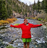
Trail Towns: Boise, Idaho
Nov 16, 2021 from trailrunnermag.com
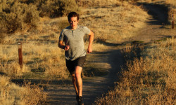
Idaho's capital city might not have mountain-town elevation, but the trail access and alpine desert climate make for ideal trail running.

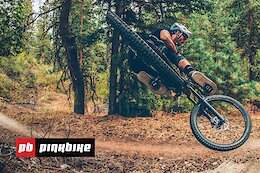
Destination Showcase: Boise, Idaho
Mar 2, 2021 from pinkbike.com
Everything you need to know about riding in Boise, Idaho.
Sub Regions
-
Bishop Kelly
- 1
-
Bogus Basin
- 5
- 26
- 2
-
Boise Foothills
- 8
- 13
- 2
-
Hidden Springs Town Trails
- 10
- 8
-
Hillside to Hollow Reserve
- 1
- 7
- 1
-
Hulls Gulch
- 2
- 2
- 3
-
Lucky Peak
- 2
- 5
-
Military Reserve Park
- 2
- 8
- 7
- 1
-
Polecat Gulch
- 2
- 4
-
Seaman's Gulch
- 2
- 2
-
Table Rock
- 1
- 4
- 15
- 2
Popular Boise Mountain Biking Trails
Boise Mountain Bike Routes
| title | rating | distance |
|---|---|---|
| Corrals to Bobs | 8 miles | |
| Bogus Basin ATM-EastSide Loop | 21 miles | |
| Eric's Loop | 15 miles | |
| Highlands-Corrals-Bob's Loop | 8 miles | |
| shuttleboi Mahalo-Dry Creek | 13 miles | |
| 845W3 | 20 miles | |
| Red Tail Landslide | 5 miles | |
| Chukar Peggy's | 10 miles | |
| Bogus Downhill2 | 28 miles | |
| Bogus To Collister | 19 miles |
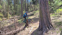
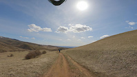
Photos of Boise Mountain Bike
trail: The Face
0 |
Jul 4, 2022 @ 6:06pm
1 day
trail: The Face
0 |
Jul 4, 2022 @ 6:05pm
1 day
trail: Deer Point
1 |
Jul 4, 2022 @ 6:05pm
1 day
trail: Chukar Butte
94 |
Jun 14, 2017 @ 2:49pm
Jun 14, 2017
trail: Bob's Trail
1,338 |
Jul 6, 2014 @ 6:16pm
Jul 6, 2014
trail: Bob's Trail
817 |
Jun 5, 2014 @ 1:03pm
Jun 5, 2014
trail: 8th Street MX Trail
579 |
Nov 3, 2007 @ 10:56pm
Nov 3, 2007
trail: 8th Street MX Trail
449 |
Oct 19, 2004 @ 6:49pm
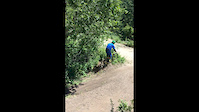
Oct 19, 2004Videos of Boise Mountain Bike
trail: Lower Hulls Gulch
|
May 15, 2022
trail: Table Rock Quarry
25 |
Sep 26, 2021
trail: Upper Quarry Trail
25 |
Sep 26, 2021
trail: Eastside
97 |
May 18, 2021

trail: Hard Guy
65 |
Mar 21, 2021
trail: Hard Guy
79 |
Mar 21, 2021
trail: G-19
0:08 |
329 |
Jul 29, 2020
trail: Lower Hulls Gulch
0:13 |
|
Apr 10, 2020
Current Trail Warnings
| status | trail | date | condition | user | info |
|---|---|---|---|---|---|
| Scott's Trail | Jun 29, 2022 @ 3:12pm Jun 29, 2022 | Dry | CXSparkles | Rutted and loose |
Recent Trail Reports
| status | trail | date | condition | info | user |
|---|---|---|---|---|---|
| Watchmen Trail | Jul 3, 2022 @ 11:35am 3 days | Dry | MonteStark | ||
| Shane's | Jul 3, 2022 @ 11:35am 3 days | Dry | MonteStark | ||
| Cottonwood Creek | Jul 3, 2022 @ 11:35am 3 days | Dry | MonteStark | ||
| Pat's | Jul 2, 2022 @ 7:44am Jul 2, 2022 | Ideal | Ahbe | ||
| DB Connector Trail | Jul 2, 2022 @ 7:44am Jul 2, 2022 | Ideal | Ahbe | ||
| Mr Big | Jul 2, 2022 @ 7:44am Jul 2, 2022 | Ideal | Ahbe | ||
| Freddys Stack Rock (Lower) | Jul 2, 2022 @ 7:44am Jul 2, 2022 | Ideal | Ahbe | ||
| Freddys Stack Rock (Upper) | Jul 2, 2022 @ 7:44am Jul 2, 2022 | Ideal | Ahbe | ||
| Corrals Trail | Jul 2, 2022 @ 5:46am Jul 2, 2022 | Ideal | Branmuffin | ||
| Around the Mountain | Jul 1, 2022 @ 6:00am Jul 1, 2022 | Dry | MonteStark |
Activity Feed
| username | action | type | title | date | |
|---|---|---|---|---|---|
 | rschulte1963 | wishlist | route | Another Boise Tour Loop | Jul 5, 2022 @ 7:38am 19 hours |
 | MonteStark | add | report | Shane's and 1 more | Jul 5, 2022 @ 5:56am 21 hours |
| MonteStark | add | report | Watchmen Trail | Jul 5, 2022 @ 5:56am 21 hours |
| Mcchickenn | add | photo | in My City and 3 more | Jul 4, 2022 @ 6:04pm 1 day |
| mattries | wishlist | route | Corrals to Bobs | Jul 4, 2022 @ 5:35pm 1 day |
Recent Comments
| username | type | title | comment | date | |
|---|---|---|---|---|---|
| trail | Fun trail. Agree with the other comments, but... | Jul 3, 2022 @ 10:04am 3 days | ||
 | trail | This trail is composed of some of the biggest... | Jun 27, 2022 @ 12:15pm Jun 27, 2022 | ||
| report | Cheers s f be my dad BBC b reader n rn end f... | Jun 18, 2022 @ 2:33pm Jun 18, 2022 | ||
 | trail | The section just after the 2 track has been... | Jun 8, 2022 @ 11:50am Jun 8, 2022 | ||
| report | M Love | May 22, 2022 @ 6:03pm May 22, 2022 |
Local Badges
-

10 Blue Trails632 awarded -

10 Green Trails483 awarded -

Big Ride 30k7,706 awarded -

Epic Ride 50k1,959 awarded -

Climbing 10k Badge374 awarded -

Completionist0 awarded
Bike & Skill Parks
| name | type | city | rating |
|---|---|---|---|
| Bogus Basin | bike park | Boise | |
| Boise Greenbelt Dirt Jumps | skill park | Boise | |
| J.A. & Kathryn Albertson Family Foundation Bike Park | skill park | Boise |
Local Trail Supporters
- Ridge to Rivers
![Hidden Springs Town Association]()
![Oregon Trail NHT]()
Pinkbike Articles
Mar 2, 2021
 Destination Showcase: Boise, Idaho
Everything you need to know about riding in Boise, Idaho.
Dec 29, 2020
 Photo Story: Ian Hylands' 2020 Year in Photos
Some bangers in there, and always cool to see good product photography as well.
Activity Type Stats
| activitytype | trails | distance | descent | descent distance | total vertical | rating | global rank | state rank | photos | reports | routes | ridelogs |
|---|---|---|---|---|---|---|---|---|---|---|---|---|
| Mountain Bike | 206 | 286 miles | 51,827 ft | 129 miles | 4,928 ft | #80 | #32 | 477 | 3,239 | 43 | 71,201 | |
| E-Bike | 5 | 14 miles | 5,869 ft | 9 miles | 4,003 ft | #2,428 | #413 | 16 | 2,413 | 1 | 890 | |
| Hike | 208 | 301 miles | 51,214 ft | 130 miles | 4,928 ft | #58 | #30 | 37 | 3,232 | 2 | 3,956 | |
| Trail Running | 208 | 301 miles | 51,214 ft | 130 miles | 4,928 ft | #59 | #30 | 7 | 3,232 | 4 | 4,465 | |
| Horse | 19 | 27 miles | 7,933 ft | 14 miles | 4,121 ft | #48 | #39 | 1,324 | 2 | |||
| Dirtbike/Moto | 59 | 81 miles | 27,661 ft | 47 miles | 3,307 ft | 775 | 1 | 8 | ||||
| ATV/ORV/OHV | 7 | 20 miles | 7,887 ft | 14 miles | 2,844 ft | 775 | 6 | |||||
| Downhill Ski | 1 | 2,956 ft | 295 ft | 1 | 1,165 |
- By brenthillier
 NSMBA TRAILFORKS & contributors
 - Admins: chuktA, IdahoEnduroSeries, macgyver96, SWIMBA
- #3536 - 29,146 views
- boise activity log | embed map of Boise mountain bike trails | boise mountain biking points of interest
Downloading of trail gps tracks in kml & gpx formats is enabled for Boise.
You must login to download files.