close
Trail Conditions
- Unknown
- Snow Groomed
- Snow Packed
- Snow Covered
- Snow Cover Inadequate
- Freeze/thaw Cycle
- Icy
- Prevalent Mud
- Wet
- Variable
- Ideal
- Dry
- Very Dry
Trail Flow (Ridden Direction)
Trailforks scans users ridelogs to determine the most popular direction each trail is ridden. A good flowing trail network will have most trails flowing in a single direction according to their intension.
The colour categories are based on what percentage of riders are riding a trail in its intended direction.
The colour categories are based on what percentage of riders are riding a trail in its intended direction.
- > 96%
- > 90%
- > 80%
- > 70%
- > 50%
- < 50%
- bi-directional trail
- no data
Trail Last Ridden
Trailforks scans ridelogs to determine the last time a trail was ridden.
- < 2 days
- < 1 week
- < 2 weeks
- < 1 month
- < 6 months
- > 6 months
Trail Ridden Direction
The intended direction a trail should be ridden.
- Downhill Only
- Downhill Primary
- Both Directions
- Uphill Primary
- Uphill Only
- One Direction
Contribute Details
Colors indicate trail is missing specified detail.
- Description
- Photos
- Description & Photos
- Videos
Trail Popularity ?
Trailforks scans ridelogs to determine which trails are ridden the most in the last 9 months.
Trails are compared with nearby trails in the same city region with a possible 25 colour shades.
Think of this as a heatmap, more rides = more kinetic energy = warmer colors.
- most popular
- popular
- less popular
- not popular
ATV/ORV/OHV Filter
Max Vehicle Width
inches
Radar Time
x
Activity Recordings
Trailforks users anonymized public ridelogs from the past 6 months.
- mountain biking recent
- mountain biking (>6 month)
- hiking (1 year)
- moto (1 year)
Activity Recordings
Trailforks users anonymized public skilogs from the past 12 months.
- Downhill Ski
- Backcountry Ski
- Nordic Ski
Jump Magnitude Heatmap
Heatmap of where riders jump on trails. Zoom in to see individual jumps, click circles to view jump details.
Trails Deemphasized
Trails are shown in grey.
Only show trails with NO bikes.
Save the current map location and zoom level as your default home location whenever this page is loaded.
Save
No description for Ocala has been added yet!
Login or register to submit one.
Activities Click to view
- Mountain Bike
68 trails
- E-Bike
56 trails
- Hike
52 trails
- Trail Running
52 trails
Region Details
- 5
- 2
- 29
- 20
- 11
- 1
Region Status
Open as of Jul 26, 2020Stats
- Avg Trail Rating
- Trails (view details)
- 72
- Trails Mountain Bike
- 68
- Trails E-Bike
- 56
- Trails Hike
- 52
- Trails Trail Running
- 52
- Trails Horse
- 5
- Trails Dirtbike/Moto
- 1
- Total Distance
- 109 miles
- Total Descent
- 3,497 ft
- Total Vertical
- 74 ft
- Highest Trailhead
- 120 ft
- Reports
- 2,674
- Photos
- 1,222
- Ridden Counter
- 50,436
Sub Regions
-
Christmas Section
- 1
- 1
-
Ern N Burn
- 4
- 1
- 1
-
Landbridge
- 3
- 1
-
Nayl's
- 1
- 2
-
Pruitt Section
- 1
- 1
-
Santos
- 1
- 7
- 9
- 6
-
Spider Kingdom
- 4
- 2
- 1
-
Vortex
- 1
- 8
- 2
- 3
- 1
Popular Ocala Mountain Biking Trails
Ocala Mountain Bike Routes
| title | rating | distance |
|---|---|---|
| OMBA Epic Route | 46 miles | |
| 2020 Santos Fat Tire Festival Epic | 47 miles | |
| HUMPDAY HUSTLE 2022 | 6 miles | |
| Santos 15 Mile Loop | 16 miles | |
| Ride Run Roll - Bike Route | 8 miles | |
| Santos Expert's Expedition | 32 miles | |
| RON'S ride | 4 miles | |
| Santos Out and Back? | 60 miles | |
| Land Bridge 21 short | 21 miles | |
| Santos 42 | 42 miles |
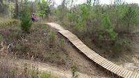
Photos of Ocala Mountain Bike
trail: Ern N Burn Trail
11 |
Jun 1, 2022 @ 1:20am
Jun 1, 2022
trail: Vortex
7 |
May 30, 2022 @ 8:28am
May 30, 2022
trail: Vortex
10 |
May 30, 2022 @ 8:27am
May 30, 2022
trail: Christmas Trail
5 |
Apr 13, 2022 @ 9:52am
Apr 13, 2022
trail: Christmas Trail
15 |
Apr 13, 2022 @ 9:51am
Apr 13, 2022
trail: Indigo Flow
19 |
Mar 23, 2022 @ 9:05am
Mar 23, 2022
trail: Tricycle Trail
84 |
Oct 26, 2018 @ 11:19am
Oct 26, 2018
trail: Tricycle Trail
104 |
Oct 3, 2017 @ 4:21am
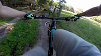
Oct 3, 2017Videos of Ocala Mountain Bike
trail: John Brown
78 |
Feb 21, 2022

trail: Dr. Ruth
119 |
Jan 11, 2021
trail: Vortex
202 |
Nov 30, 2020
trail: Indigo Flow
1:24 |
628 |
Nov 5, 2019
trail: Vortex
0:07 |
751 |
Aug 17, 2016
trail: Lil Hammock
0:09 |
328 |
Mar 18, 2016

trail: Vortex
0:53 |
343 |
Dec 27, 2015
trail: Dog Bone
1:05 |
623 |
Jan 21, 2015
Current Trail Warnings
| status | trail | date | condition | user | info |
|---|---|---|---|---|---|
| Nayls South | Jun 28, 2022 @ 5:34am Jun 28, 2022 | Dry | hproctor | ||
| Christmas Trail | Jun 26, 2022 @ 6:33am Jun 26, 2022 | Dry | jelako | Tree down |
Recent Trail Reports
| status | trail | date | condition | info | user |
|---|---|---|---|---|---|
| Pine Tree | Jul 1, 2022 @ 3:49pm Jul 1, 2022 | Ideal | Jcrutchfield | ||
| Blue Hiway | Jul 1, 2022 @ 3:49pm Jul 1, 2022 | Ideal | Jcrutchfield | ||
| Canopy | Jul 1, 2022 @ 3:49pm Jul 1, 2022 | Ideal | Jcrutchfield | ||
| Speedway | Jul 1, 2022 @ 3:49pm Jul 1, 2022 | Ideal | Jcrutchfield | ||
| John Brown | Jul 1, 2022 @ 8:43am Jul 1, 2022 | Wet | lml427 | ||
| Canal Diggings Loop | Jun 26, 2022 @ 11:58am Jun 26, 2022 | Ideal | xBhQxe | ||
| Vortex Access | Jun 26, 2022 @ 9:11am Jun 26, 2022 | Variable | brianl27 | ||
| Dogtail Trail | Jun 26, 2022 @ 9:11am Jun 26, 2022 | Ideal | brianl27 | ||
| Spider Kingdom South | Jun 26, 2022 @ 9:11am Jun 26, 2022 | Ideal | brianl27 | ||
| Dog Bone | Jun 26, 2022 @ 9:11am Jun 26, 2022 | Dry | brianl27 |
Activity Feed
| username | action | type | title | date | |
|---|---|---|---|---|---|
 | Jcrutchfield | add | report | Blue Hiway and 1 more | Jul 1, 2022 @ 7:11pm Jul 1, 2022 |
| Jcrutchfield | add | report | Pine Tree and 5 more | Jul 1, 2022 @ 7:11pm Jul 1, 2022 |
 | lml427 | add | report | John Brown | Jul 1, 2022 @ 9:04am Jul 1, 2022 |
| FITT4Life | wishlist | route | HUMPDAY HUSTLE 2022 | Jun 29, 2022 @ 10:25am Jun 29, 2022 |
| FITT4Life | ridden | route | HUMPDAY HUSTLE 2022 | Jun 29, 2022 @ 10:25am Jun 29, 2022 |
Recent Comments
| username | type | title | comment | date | |
|---|---|---|---|---|---|
| report | 6/11/2022 ride, medium tree down heading into... | Jun 11, 2022 @ 11:56am Jun 11, 2022 | ||
| report | Down tree | Jun 11, 2022 @ 7:49am Jun 11, 2022 | ||
| trail | I think this is one of the most underrated... | May 29, 2022 @ 6:33pm May 29, 2022 | ||
| trail | Trail was fun but a bit overgrown in some sections | May 29, 2022 @ 6:32pm May 29, 2022 | ||
 | trail | Rideable at the moment and fun. | May 11, 2022 @ 8:11pm May 11, 2022 |
Local Badges
-

10 Green Trails543 awarded -

Big Ride 30k4,025 awarded -

10 Blue Trails728 awarded -

Epic Ride 50k1,280 awarded -

Completionist11 awarded -

Epic Ride Climb 2k10 awarded
Bike & Skill Parks
| name | type | city | rating |
|---|---|---|---|
| Santos Skill Park | skill park | Ocala | |
| Vortex | skill park | Ocala |
Activity Type Stats
| activitytype | trails | distance | descent | descent distance | total vertical | rating | global rank | state rank | photos | reports | routes | ridelogs |
|---|---|---|---|---|---|---|---|---|---|---|---|---|
| Mountain Bike | 68 | 97 miles | 3,258 ft | 27 miles | 75 ft | #86 | #35 | 1,214 | 2,670 | 12 | 30,620 | |
| E-Bike | 56 | 86 miles | 2,913 ft | 24 miles | 75 ft | #36 | #8 | 1 | 2,655 | 1 | 328 | |
| Hike | 52 | 82 miles | 2,441 ft | 23 miles | 72 ft | #90 | #45 | 2 | 2,644 | 304 | ||
| Trail Running | 52 | 82 miles | 2,441 ft | 23 miles | 72 ft | #91 | #45 | 1 | 2,644 | 1 | 66 | |
| Horse | 5 | 28 miles | 525 ft | 9 miles | 52 ft | 4 | 401 | 24 | ||||
| Dirtbike/Moto | 1 | 3,743 ft | 3 ft | 387 ft | 10 ft | 401 | 27 |
- By brenthillier
 NSMBA TRAILFORKS & contributors
 - Admins: SORBA, OMBA
- #3671 - 8,222 views
- ocala activity log | embed map of Ocala mountain bike trails | ocala mountain biking points of interest
Downloading of trail gps tracks in kml & gpx formats is enabled for Ocala.
You must login to download files.