close
Trail Conditions
- Unknown
- Snow Groomed
- Snow Packed
- Snow Covered
- Snow Cover Inadequate
- Freeze/thaw Cycle
- Icy
- Prevalent Mud
- Wet
- Variable
- Ideal
- Dry
- Very Dry
Trail Flow (Ridden Direction)
Trailforks scans users ridelogs to determine the most popular direction each trail is ridden. A good flowing trail network will have most trails flowing in a single direction according to their intension.
The colour categories are based on what percentage of riders are riding a trail in its intended direction.
The colour categories are based on what percentage of riders are riding a trail in its intended direction.
- > 96%
- > 90%
- > 80%
- > 70%
- > 50%
- < 50%
- bi-directional trail
- no data
Trail Last Ridden
Trailforks scans ridelogs to determine the last time a trail was ridden.
- < 2 days
- < 1 week
- < 2 weeks
- < 1 month
- < 6 months
- > 6 months
Trail Ridden Direction
The intended direction a trail should be ridden.
- Downhill Only
- Downhill Primary
- Both Directions
- Uphill Primary
- Uphill Only
- One Direction
Contribute Details
Colors indicate trail is missing specified detail.
- Description
- Photos
- Description & Photos
- Videos
Trail Popularity ?
Trailforks scans ridelogs to determine which trails are ridden the most in the last 9 months.
Trails are compared with nearby trails in the same city region with a possible 25 colour shades.
Think of this as a heatmap, more rides = more kinetic energy = warmer colors.
- most popular
- popular
- less popular
- not popular
ATV/ORV/OHV Filter
Max Vehicle Width
inches
Radar Time
x
Activity Recordings
Trailforks users anonymized public ridelogs from the past 6 months.
- mountain biking recent
- mountain biking (>6 month)
- hiking (1 year)
- moto (1 year)
Activity Recordings
Trailforks users anonymized public skilogs from the past 12 months.
- Downhill Ski
- Backcountry Ski
- Nordic Ski
Jump Magnitude Heatmap
Heatmap of where riders jump on trails. Zoom in to see individual jumps, click circles to view jump details.
Trails Deemphasized
Trails are shown in grey.
Only show trails with NO bikes.
Save the current map location and zoom level as your default home location whenever this page is loaded.
Save
No description for Eagle Mountain has been added yet!
Login or register to submit one.
Links
Region Supporters & Maintainers
![Eagle Mountain (Utah)]()
Eagle Mountain (Utah)Builder
Activities Click to view
- Mountain Bike
273 trails
- E-Bike
193 trails
- Hike
257 trails
- Trail Running
253 trails
- Horse
71 trails
- Dirtbike/Moto
157 trails
- Observed Trials
20 trails
- ATV/ORV/OHV
72 trails
Region Details
- 74
- 3
- 36
- 84
- 53
- 19
- 1
Region Status
Open as of Mar 26, 2022Stats
- Avg Trail Rating
- Trails (view details)
- 270
- Trails Mountain Bike
- 273
- Trails E-Bike
- 193
- Trails Hike
- 257
- Trails Trail Running
- 253
- Trails Horse
- 71
- Trails Dirtbike/Moto
- 157
- Trails Observed Trials
- 20
- Trails ATV/ORV/OHV
- 72
- Total Distance
- 242 miles
- Total Descent
- 39,705 ft
- Total Vertical
- 3,124 ft
- Highest Trailhead
- 7,673 ft
- Reports
- 3,944
- Photos
- 993
- Ridden Counter
- 57,402
Sub Regions
-
Lake Mountains
- 12
- 43
- 29
- 16
- 1
-
Manning Canyon
- 2
- 7
-
Mountain Ranch Bike Park
- 14
- 35
- 15
- 3
Popular Eagle Mountain Mountain Biking Trails
Eagle Mountain Mountain Bike Routes
| title | rating | distance |
|---|---|---|
| Jakarta Lollypop Loop | 6 miles | |
| Tour of Eagle Mountain | 21 miles | |
| 12 mile highlight of Eagle Mountain (minus the blacks) | 12 miles | |
| Alta MTB purple | 10 miles | |
| Purple Mountains Majesty | 11 miles | |
| Save the Clock Tower | 15 miles | |
| up down around loop | 4 miles | |
| Eagle MT "Green" 5 mile Loop | 5 miles | |
| MRHS Time Trial | 4 miles | |
| Tour of Eagle Mnt | 13 miles |
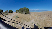
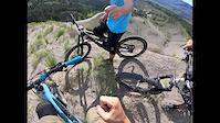
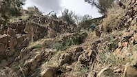
Photos of Eagle Mountain Mountain Bike
trail: Creed
424 |
Jun 20, 2017 @ 8:06pm
Jun 20, 2017
trail: Creed
335 |
Jun 20, 2017 @ 8:01pm
Jun 20, 2017
trail: Deadwood
369 |
Apr 22, 2017 @ 3:21pm
Apr 22, 2017
trail: Billy Idol (Treadstone)
167 |
Apr 22, 2017 @ 3:20pm
Apr 22, 2017
trail: Billy Idol (Treadstone)
145 |
Mar 13, 2017 @ 8:58am
Mar 13, 2017
trail: Jackrabbit
227 |
Apr 28, 2016 @ 1:33pm
Apr 28, 2016
trail: Jackrabbit
240 |
Apr 28, 2016 @ 1:33pm
Apr 28, 2016
trail: Deadwood
526 |
Oct 16, 2015 @ 3:29pm
Oct 16, 2015Videos of Eagle Mountain Mountain Bike
trail: Rock-a-Billy
18 |
Nov 4, 2020
trail: King in Yellow
0:34 |
82 |
Sep 6, 2020
trail: Tapeworm
0:17 |
107 |
Aug 2, 2020
trail: Cayendo
1:02 |
70 |
Jun 27, 2020
trail: Cayendo
0:58 |
51 |
Jun 20, 2020
trail: Fistfull of Dollars
0:59 |
2298 |
Jun 9, 2020
trail: Jakarta
0:08 |
586 |
Apr 25, 2020

trail: The Wall
0:13 |
78 |
Feb 1, 2020
Recent Trail Reports
| status | trail | date | condition | info | user |
|---|---|---|---|---|---|
| Space Dust | Jul 4, 2022 @ 10:49am 2 days | Ideal | shadwrack | ||
| Supersonic | Jul 1, 2022 @ 8:06am Jul 1, 2022 | Dry | Aydenbaker | ||
| ACME | Jun 25, 2022 @ 8:44am Jun 25, 2022 | Dry | bbv65bbv | ||
| Deadwood | Jun 25, 2022 @ 8:44am Jun 25, 2022 | Dry | bbv65bbv | ||
| Atv 2 | Jun 23, 2022 @ 5:53pm Jun 23, 2022 | Ideal | mtbrider66 | ||
| Cow Tracks | Jun 23, 2022 @ 5:53pm Jun 23, 2022 | Ideal | mtbrider66 | ||
| Ridgeline (Hidden Hollow) | Jun 23, 2022 @ 5:53pm Jun 23, 2022 | Ideal | mtbrider66 | ||
| OHV Access | Jun 17, 2022 @ 7:05am Jun 17, 2022 | Dry | BCBassett | ||
| Wile E. Coyote | Jun 17, 2022 @ 7:05am Jun 17, 2022 | Dry | BCBassett | ||
| OHV 2 | Jun 17, 2022 @ 7:05am Jun 17, 2022 | Dry | BCBassett |
Activity Feed
| username | action | type | title | date | |
|---|---|---|---|---|---|
 | Adamhclark | update | trail | Radio Free Europe and 3 more | Jul 5, 2022 @ 3:21pm 12 hours |
| Adamhclark | update | trail | Crop Duster and 8 more | Jul 5, 2022 @ 2:31pm 12 hours |
| Adamhclark | add | trail | I-15 and 3 more | Jul 5, 2022 @ 1:31pm 13 hours |
 | lawkath | wishlist | route | Eagle Mountain UHSCL Course | Jul 4, 2022 @ 9:04pm 1 day |
| Japrat2 | wishlist | region | Mountain Ranch Bike Park | Jul 4, 2022 @ 4:52pm 1 day |
Recent Comments
| username | type | title | comment | date | |
|---|---|---|---|---|---|
| trail | A bit of a bugger going uphill for someone not... | Jun 24, 2022 @ 7:33pm Jun 24, 2022 | ||
 | trail | 3 jump lines have been completely redone and... | Jun 17, 2022 @ 10:58pm Jun 17, 2022 | ||
| trail | Hard to stay on trail. LOTS of options. Plenty... | Jun 6, 2022 @ 8:31pm Jun 6, 2022 | ||
| trail | well taken care of flat gravel road that moves... | Jun 1, 2022 @ 12:35am Jun 1, 2022 | ||
| trail | probably great for other modes of... | Jun 1, 2022 @ 12:32am Jun 1, 2022 |
Local Badges
-

10 Blue Trails900 awarded -

Big Ride 30k1,387 awarded -

Completionist3 awarded -

Descent 10k Badge148 awarded -

Climbing 100k Badge2 awarded -

Epic Ride Climb 2k24 awarded
Bike & Skill Parks
| name | type | city | rating |
|---|---|---|---|
| Mountain Ranch Bike Park | skill park | Eagle Mountain |
Local Trail Supporters
- BLM
![]()
- Burley Excavation
Activity Type Stats
| activitytype | trails | distance | descent | descent distance | total vertical | rating | global rank | state rank | photos | reports | routes | ridelogs |
|---|---|---|---|---|---|---|---|---|---|---|---|---|
| Mountain Bike | 273 | 242 miles | 39,705 ft | 110 miles | 3,123 ft | #89 | #36 | 944 | 3,930 | 34 | 27,766 | |
| E-Bike | 193 | 208 miles | 32,290 ft | 92 miles | 3,123 ft | #208 | #63 | 2 | 3,502 | 5 | 854 | |
| Hike | 257 | 234 miles | 37,766 ft | 105 miles | 3,123 ft | #65 | #32 | 18 | 3,852 | 1 | 148 | |
| Trail Running | 253 | 233 miles | 36,860 ft | 104 miles | 3,123 ft | #67 | #33 | 3,849 | 3 | 1,602 | ||
| Horse | 71 | 86 miles | 8,711 ft | 30 miles | 3,031 ft | #233 | #145 | 1,392 | 1 | 1 | ||
| Dirtbike/Moto | 157 | 174 miles | 26,716 ft | 75 miles | 3,031 ft | #21 | #16 | 29 | 1,541 | 339 | ||
| Observed Trials | 20 | 16 miles | 1,129 ft | 4 miles | 1,280 ft | #20 | #6 | 172 | 2 | |||
| ATV/ORV/OHV | 72 | 95 miles | 7,110 ft | 34 miles | 3,031 ft | #82 | #41 | 1,492 | 21 |
- By canadaka
 Trailforks & contributors
 - Admins: UtahJohn, jpmcghee, jasonmalczyk, LMTA, UVTA
- #4740 - 30,178 views
- eagle mountain activity log | embed map of Eagle Mountain mountain bike trails | eagle mountain mountain biking points of interest polygons
Downloading of trail gps tracks in kml & gpx formats is enabled for Eagle Mountain.
You must login to download files.