close
Trail Conditions
- Unknown
- Snow Groomed
- Snow Packed
- Snow Covered
- Snow Cover Inadequate
- Freeze/thaw Cycle
- Icy
- Prevalent Mud
- Wet
- Variable
- Ideal
- Dry
- Very Dry
Trail Flow (Ridden Direction)
Trailforks scans users ridelogs to determine the most popular direction each trail is ridden. A good flowing trail network will have most trails flowing in a single direction according to their intension.
The colour categories are based on what percentage of riders are riding a trail in its intended direction.
The colour categories are based on what percentage of riders are riding a trail in its intended direction.
- > 96%
- > 90%
- > 80%
- > 70%
- > 50%
- < 50%
- bi-directional trail
- no data
Trail Last Ridden
Trailforks scans ridelogs to determine the last time a trail was ridden.
- < 2 days
- < 1 week
- < 2 weeks
- < 1 month
- < 6 months
- > 6 months
Trail Ridden Direction
The intended direction a trail should be ridden.
- Downhill Only
- Downhill Primary
- Both Directions
- Uphill Primary
- Uphill Only
- One Direction
Contribute Details
Colors indicate trail is missing specified detail.
- Description
- Photos
- Description & Photos
- Videos
Trail Popularity ?
Trailforks scans ridelogs to determine which trails are ridden the most in the last 9 months.
Trails are compared with nearby trails in the same city region with a possible 25 colour shades.
Think of this as a heatmap, more rides = more kinetic energy = warmer colors.
- most popular
- popular
- less popular
- not popular
ATV/ORV/OHV Filter
Max Vehicle Width
inches
Radar Time
x
Activity Recordings
Trailforks users anonymized public ridelogs from the past 6 months.
- mountain biking recent
- mountain biking (>6 month)
- hiking (1 year)
- moto (1 year)
Activity Recordings
Trailforks users anonymized public skilogs from the past 12 months.
- Downhill Ski
- Backcountry Ski
- Nordic Ski
Jump Magnitude Heatmap
Heatmap of where riders jump on trails. Zoom in to see individual jumps, click circles to view jump details.
Trails Deemphasized
Trails are shown in grey.
Only show trails with NO bikes.
Save the current map location and zoom level as your default home location whenever this page is loaded.
SaveAuckland City is the largest and most populous urban area in New Zealand
Activities Click to view
- Mountain Bike
737 trails
- E-Bike
210 trails
- Hike
496 trails
- Trail Running
502 trails
- Horse
54 trails
Region Details
- 149
- 23
- 128
- 294
- 35
- 40
- 2
- 2
Region Status
Open as of Mar 3, 2020Stats
- Avg Trail Rating
- Trails (view details)
- 746
- Trails Mountain Bike
- 737
- Trails E-Bike
- 210
- Trails Hike
- 496
- Trails Trail Running
- 502
- Trails Horse
- 54
- Trails Dirtbike/Moto
- 48
- Trails Observed Trials
- 38
- Total Distance
- 385 miles
- Total Descent
- 79,990 ft
- Total Vertical
- 1,452 ft
- Highest Trailhead
- 1,453 ft
- Reports
- 7,993
- Photos
- 1,431
- Ridden Counter
- 138,330
Sub Regions
-
Ambury Park
- 2
- 2
-
Arch Hill
- 1
- 4
- 1
-
Birkenhead Domain
- 1
-
Fourforty MTB Park
- 3
- 12
- 6
- 7
- 1
-
Heron Park
- 2
-
Hunua Trails
- 3
- 17
- 3
-
Long Bay Regional Park
- 2
-
Maraetai Forest
- 3
- 23
- 4
- 7
-
Orewa trails
- 6
-
Puhinui Reserve
- 10
-
Riverhead Forest
- 36
- 128
- 9
- 8
- 1
-
Royal Albany Trail
- 1
- 22
- 1
-
Runway MTB Park
- 1
- 6
- 2
-
Sanders Reserve
- 1
- 3
-
Scandrett Regional Park
-
Totara Park
- 2
- 11
- 12
-
Unsworth Reserve
- 1
- 3
- 6
- 3
-
Waharau
- 1
-
Waitakere Ranges
- 1
-
Waitawa Regional Park
- 1
- 6
- 8
- 1
-
Waiuku Forest
- 5
-
West Coast Riders Club
- 5
- 9
- 3
- 2
-
Whitford Forest
- 1
- 10
- 2
-
Woodhill Mountain Bike Park
- 3
- 21
- 29
- 7
- 6
- 1
- 1
Popular Auckland Mountain Biking Trails
Auckland Mountain Bike Routes
| title | rating | distance |
|---|---|---|
| Woodhill Pik'n'mix | 13 miles | |
| Royal Route | 9 miles | |
| Stroop the Thing in Riverhead | 9 miles | |
| Valley Loop Track | 8 miles | |
| Hunua Trails Introduction Loop | 9 miles | |
| Totara Race Nite Course 1 | 4 miles | |
| Woodhill 25 | 16 miles | |
| Blue Long Route | 6 miles | |
| Riverhead Blue Loop | 12 miles | |
| Riverhead XC20 | 12 miles |
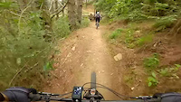
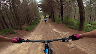
Photos of Auckland Mountain Bike
trail: Nimo - xc
15 |
Jun 15, 2022 @ 4:52pm
Jun 15, 2022
trail: Snakes & Ladders
27 |
May 28, 2022 @ 12:51am
May 28, 2022
trail: Bert & Ernie
9 |
May 26, 2022 @ 8:44pm
May 26, 2022
trail: Bert & Ernie
8 |
May 26, 2022 @ 8:44pm
May 26, 2022
trail: Bert & Ernie
23 |
May 26, 2022 @ 8:44pm
May 26, 2022
trail: Snakes & Ladders
25 |
May 23, 2022 @ 2:48am
May 23, 2022
trail: BSX Track
243 |
Jan 30, 2017 @ 5:45pm
Jan 30, 2017
trail: BSX Track
222 |
Jan 30, 2017 @ 5:40pm
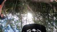
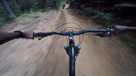
Jan 30, 2017Videos of Auckland Mountain Bike
trail: Gum Diggers
67 |
May 28, 2021

trail: Huck Yeah
118 |
Apr 26, 2021
trail: Huck Yeah
|
Apr 26, 2021
trail: Pink Stoat
97 |
Mar 28, 2021
trail: Smoker
281 |
Jan 7, 2021
trail: Release Valve
73 |
Dec 19, 2020
trail: Anzac To Picnic DH
129 |
Dec 12, 2020
trail: Upper Blackwood (downhill)
109 |
Nov 5, 2020
Current Trail Warnings
| status | trail | date | condition | user | info |
|---|---|---|---|---|---|
| Logan's Run | Jul 3, 2022 @ 11:41am 3 days | Prevalent Mud | MattD42 | not safe also quite smelly | |
| Sweet As | Jun 25, 2022 @ 1:29am Jun 25, 2022 | Variable | solojohn | Now closed for winter 22 to avoid damage. | |
| Screamers | Jun 25, 2022 @ 1:29am Jun 25, 2022 | Wet | solojohn | Now closed for winter 22 to try avoid... |
Recent Trail Reports
| status | trail | date | condition | info | user |
|---|---|---|---|---|---|
| Sesame Street | Jul 2, 2022 @ 3:38pm Jul 2, 2022 | Ideal | mr-charles | ||
| No Vacancy | Jul 2, 2022 @ 3:38pm Jul 2, 2022 | Ideal | mr-charles | ||
| Togs Togs Undies | Jul 2, 2022 @ 3:38pm Jul 2, 2022 | Ideal | mr-charles | ||
| Over And Out | Jul 2, 2022 @ 3:38pm Jul 2, 2022 | Ideal | mr-charles | ||
| Snakes & Ladders | Jun 26, 2022 @ 2:48pm Jun 26, 2022 | Ideal | LBurn22 | ||
| Chicken Run | Jun 21, 2022 @ 9:17pm Jun 21, 2022 | Ideal | crayz77 | ||
| Tasting Platter | Jun 21, 2022 @ 9:17pm Jun 21, 2022 | Ideal | crayz77 | ||
| Tasting Platter Summer Alternative | Jun 21, 2022 @ 9:17pm Jun 21, 2022 | Ideal | crayz77 | ||
| Booty Call | Jun 21, 2022 @ 9:17pm Jun 21, 2022 | Ideal | crayz77 | ||
| Judgement Call | Jun 21, 2022 @ 9:17pm Jun 21, 2022 | Ideal | crayz77 |
Activity Feed
| username | action | type | title | date | |
|---|---|---|---|---|---|
 | mr-charles | add | video | Kid Rides - Woodhill MTB - 5-year-old takes on the Over and Out | Jul 5, 2022 @ 3:43pm 11 hours |
| mr-charles | add | report | Sesame Street and 3 more | Jul 5, 2022 @ 3:38pm 11 hours |
| JoergCKvnGj | ridden | trail | Stumpy | Jul 5, 2022 @ 1:46pm 13 hours |
| JoergCKvnGj | wishlist | route | Enduro 2019, One of the best loops | Jul 5, 2022 @ 1:45pm 13 hours |
| MarcWz7dPG | ridden | trail | Beveridge Track | Jul 4, 2022 @ 12:41pm 2 days |
Recent Comments
| username | type | title | comment | date | |
|---|---|---|---|---|---|
| trail | You should call it "Geez-Us"... lol | Jun 29, 2022 @ 6:58pm Jun 29, 2022 | ||
| trail | More technical that a lot of Woodhill. Good... | Jun 26, 2022 @ 2:47pm Jun 26, 2022 | ||
 | trail | Math through trees and grass in between city... | Jun 25, 2022 @ 9:34pm Jun 25, 2022 | ||
| trail | Good bridges and paved walks around estuary | Jun 25, 2022 @ 9:04pm Jun 25, 2022 | ||
| trail | A path along an old sea wall | Jun 25, 2022 @ 5:57pm Jun 25, 2022 |
Local Badges
-

10 Green Trails967 awarded -

Big Ride 30k14,560 awarded -

10 Blue Trails1,048 awarded -

Descent 10k Badge578 awarded -

10 Black Trails185 awarded -

Climbing 10k Badge576 awarded
Bike & Skill Parks
| name | type | city | rating |
|---|---|---|---|
| Fourforty MTB Park | bike park | Auckland | |
| Albany Primary School | skill park | Auckland | |
| Birkenhead Pump Track | skill park | Auckland | |
| East City BMX Club | skill park | Auckland | |
| Grey Lynn Pump Track | skill park | Auckland |
Activity Type Stats
| activitytype | trails | distance | descent | descent distance | total vertical | rating | global rank | state rank | photos | reports | routes | ridelogs |
|---|---|---|---|---|---|---|---|---|---|---|---|---|
| Mountain Bike | 737 | 367 miles | 77,917 ft | 182 miles | 1,453 ft | #18 | #2 | 1,420 | 7,976 | 55 | 117,239 | |
| E-Bike | 210 | 115 miles | 18,760 ft | 56 miles | 659 ft | #39 | #2 | 6 | 6,815 | 29 | 4,246 | |
| Hike | 496 | 264 miles | 46,946 ft | 126 miles | 1,319 ft | #60 | #2 | 4 | 7,475 | 1,624 | ||
| Trail Running | 502 | 267 miles | 48,179 ft | 129 miles | 1,319 ft | #61 | #2 | 7,496 | 1 | 2,842 | ||
| Horse | 54 | 44 miles | 4,406 ft | 21 miles | 463 ft | #70 | #1 | 1 | 3,052 | 17 | ||
| Dirtbike/Moto | 48 | 41 miles | 4,383 ft | 20 miles | 463 ft | 3,050 | 9 | |||||
| Observed Trials | 38 | 37 miles | 3,484 ft | 17 miles | 463 ft | 49 | 6 |
- By NZNDURO & contributors
- Admins: ralley
- #3978 - 18,077 views
- auckland activity log | embed map of Auckland mountain bike trails | auckland mountain biking points of interest polygons
Downloading of trail gps tracks in kml & gpx formats is enabled for Auckland.
You must login to download files.