close
Trail Conditions
- Unknown
- Snow Groomed
- Snow Packed
- Snow Covered
- Snow Cover Inadequate
- Freeze/thaw Cycle
- Icy
- Prevalent Mud
- Wet
- Variable
- Ideal
- Dry
- Very Dry
Trail Flow (Ridden Direction)
Trailforks scans users ridelogs to determine the most popular direction each trail is ridden. A good flowing trail network will have most trails flowing in a single direction according to their intension.
The colour categories are based on what percentage of riders are riding a trail in its intended direction.
The colour categories are based on what percentage of riders are riding a trail in its intended direction.
- > 96%
- > 90%
- > 80%
- > 70%
- > 50%
- < 50%
- bi-directional trail
- no data
Trail Last Ridden
Trailforks scans ridelogs to determine the last time a trail was ridden.
- < 2 days
- < 1 week
- < 2 weeks
- < 1 month
- < 6 months
- > 6 months
Trail Ridden Direction
The intended direction a trail should be ridden.
- Downhill Only
- Downhill Primary
- Both Directions
- Uphill Primary
- Uphill Only
- One Direction
Contribute Details
Colors indicate trail is missing specified detail.
- Description
- Photos
- Description & Photos
- Videos
Trail Popularity ?
Trailforks scans ridelogs to determine which trails are ridden the most in the last 9 months.
Trails are compared with nearby trails in the same city region with a possible 25 colour shades.
Think of this as a heatmap, more rides = more kinetic energy = warmer colors.
- most popular
- popular
- less popular
- not popular
ATV/ORV/OHV Filter
Max Vehicle Width
inches
Radar Time
x
Activity Recordings
Trailforks users anonymized public ridelogs from the past 6 months.
- mountain biking recent
- mountain biking (>6 month)
- hiking (1 year)
- moto (1 year)
Activity Recordings
Trailforks users anonymized public skilogs from the past 12 months.
- Downhill Ski
- Backcountry Ski
- Nordic Ski
Jump Magnitude Heatmap
Heatmap of where riders jump on trails. Zoom in to see individual jumps, click circles to view jump details.
Trails Deemphasized
Trails are shown in grey.
Only show trails with NO bikes.
Save the current map location and zoom level as your default home location whenever this page is loaded.
Save
No description for Göteborg has been added yet!
Login or register to submit one.
AKA: Gothenburg
This region uses the Uk/Euro style trail grading system.
Activities Click to view
- Mountain Bike
1,265 trails
- E-Bike
9 trails
- Hike
1,151 trails
- Trail Running
1,162 trails
- Horse
18 trails
- Dirtbike/Moto
1 trails
Region Details
- 183
- 309
- 501
- 190
- 76
- 4
Region Status
Open as of 20 hoursStats
- Avg Trail Rating
- Trails (view details)
- 1,270
- Trails Mountain Bike
- 1,265
- Trails E-Bike
- 9
- Trails Hike
- 1,151
- Trails Trail Running
- 1,162
- Trails Horse
- 18
- Trails Dirtbike/Moto
- 1
- Trails Observed Trials
- 1
- Total Distance
- 393 miles
- Total Descent
- 56,009 ft
- Total Vertical
- 492 ft
- Highest Trailhead
- 494 ft
- Reports
- 11,655
- Photos
- 1,441
- Ridden Counter
- 150,603
Sub Regions
-
Angered
- 13
- 20
- 5
- 3
-
Änggårdsbergen
- 44
- 60
- 23
- 21
- 1
-
Backa med omnejd
- 19
- 11
- 2
-
Bergsjön/Kortedala
- 8
- 6
- 3
-
Björlanda
- 10
- 31
- 6
- 2
-
Delsjöområdet
- 82
- 125
- 37
- 24
- 2
-
Hisingsparken med omnejd
- 36
- 62
- 13
- 8
-
Olofstorp
- 4
- 13
- 3
- 1
-
Rödbo
- 4
- 8
- 2
-
Ruddalen
- 33
- 13
- 3
-
Säve
- 4
- 17
- 7
-
Sjöbergen/Stora Billingen
- 10
- 10
- 2
- 1
-
Skärvallsberget
- 3
- 9
- 1
-
Torslanda
- 24
- 85
- 72
- 13
- 1
-
Vättlefjäll
- 12
- 26
- 8
- 3
Popular Göteborg Mountain Biking Trails
Göteborg Mountain Bike Routes
| title | rating | distance |
|---|---|---|
| Änggårdsbergen Blue Mania | 5 miles | |
| Delsjön MTB-Banan Extended | 5 miles | |
| Delsjön Singletrack Hard | 9 miles | |
| Änggårdsbergen Lätt | 5 miles | |
| Easy Rudie, Easy | 4 miles | |
| Änggårdsbergen runt | 9 miles | |
| Delsjön classics | 11 miles | |
| Änggårdsbergens Ryggar | 8 miles | |
| ESS Glennduro GBG 2018 | 15 miles | |
| Furåstjärn rundan | 8 miles |
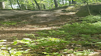
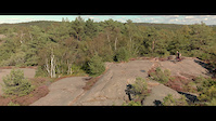
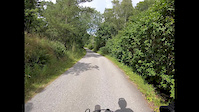
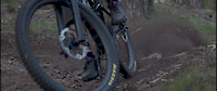
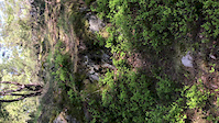
Photos of Göteborg Mountain Bike
trail: Stenälskaren
11 |
Jun 29, 2022 @ 10:17am
Jun 29, 2022
trail: Trollstigen
2 |
Jun 28, 2022 @ 2:34am
Jun 28, 2022
trail: Getryggen XC
1 |
Jun 28, 2022 @ 2:20am
Jun 28, 2022
trail: Getryggen XC
1 |
Jun 28, 2022 @ 2:18am
Jun 28, 2022
trail: Getryggen DH/HC
1 |
Jun 28, 2022 @ 2:18am
Jun 28, 2022
trail: Preacher's Flow
591 |
Jun 1, 2016 @ 10:56pm
Jun 1, 2016
trail: Flowiga
1,593 | | 1 comments
May 23, 2014 @ 12:51pm
May 23, 2014
trail: Flowiga
1,037 |
May 23, 2014 @ 12:51pm
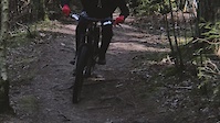
May 23, 2014Videos of Göteborg Mountain Bike
trail: Chikanen
64 |
Jan 3, 2021

94 |
Jan 3, 2021
trail: Trenduro
2:34 |
125 |
Aug 26, 2020
trail: Dungen Runt
2:26 |
42 |
Jul 9, 2020
trail: Getryggen Backside
0:24 |
91 |
Jun 4, 2020
trail: Overwatch
1:27 |
126 |
Jun 1, 2020
trail: Drop’n’roll
0:33 |
|
May 23, 2020
trail: Delikata
0:48 |
137 |
Apr 13, 2020
Current Trail Warnings
| status | trail | date | condition | user | info |
|---|---|---|---|---|---|
| Griseknorren | Jun 19, 2022 @ 7:37am Jun 19, 2022 | Ideal | vegansson |
Recent Trail Reports
| status | trail | date | condition | info | user |
|---|---|---|---|---|---|
| Hällen | Jul 2, 2022 @ 4:18am Jul 2, 2022 | Ideal | wikisara | ||
| Brudarebacken DH-Bana | Jul 2, 2022 @ 4:18am Jul 2, 2022 | Ideal | wikisara | ||
| Miljöpartiet | Jul 2, 2022 @ 4:18am Jul 2, 2022 | Ideal | wikisara | ||
| Mastrajd Nedre | Jul 2, 2022 @ 4:18am Jul 2, 2022 | Ideal | wikisara | ||
| Stenhällsbacken | Jul 2, 2022 @ 4:18am Jul 2, 2022 | Ideal | wikisara | ||
| Best Trail | Jun 30, 2022 @ 1:10am Jun 30, 2022 | Ideal | olind | ||
| Leos Trail | Jun 30, 2022 @ 1:10am Jun 30, 2022 | Ideal | olind | ||
| Munther B | Jun 30, 2022 @ 1:10am Jun 30, 2022 | Ideal | olind | ||
| Transversalen | Jun 30, 2022 @ 1:10am Jun 30, 2022 | Ideal | olind | ||
| The Playtrail | Jun 27, 2022 @ 1:47am Jun 27, 2022 | Dry | Trush61 |
Activity Feed
| username | action | type | title | date | |
|---|---|---|---|---|---|
 | JottePH | wishlist | route | Änggårdsbergen Lätt | Jul 5, 2022 @ 1:27pm 14 hours |
| Kallemtb | vote | trail | Södra Sjöslingan | Jul 5, 2022 @ 10:55am 16 hours |
| JCedergrip | wishlist | route | Delsjön - Easy and 1 more | Jul 5, 2022 @ 5:28am 22 hours |
| Heffegrek | wishlist | route | Skatås MTB spåret and 1 more | Jul 5, 2022 @ 4:09am 23 hours |
| Heffegrek | ridden | route | Skatås MTB spåret | Jul 5, 2022 @ 4:09am 23 hours |
Recent Comments
| username | type | title | comment | date | |
|---|---|---|---|---|---|
| trail | Grymt kul med ett alternativ till att vända i... | Jun 1, 2022 @ 2:54pm Jun 1, 2022 | ||
| trail | Bättre än jag trodde. Tog den uppför och... | May 29, 2022 @ 11:21am May 29, 2022 | ||
 | trail | Last part very hard to follow | May 23, 2022 @ 1:07am May 23, 2022 | ||
| report | Men t | May 6, 2022 @ 7:06am May 6, 2022 | ||
| trail | Apr 22, 2022 @ 12:53am Apr 22, 2022 |
Local Badges
-

Big Ride 30k6,269 awarded -

Completionist1 awarded -

Epic Ride 50k2,086 awarded -

Top 10 Trails34 awarded -
Completionist1 awarded -

Descent 10k Badge405 awarded
Bike & Skill Parks
| name | type | city | rating |
|---|---|---|---|
| Actionpark Göteborg | skill park | Göteborg | |
| Kallebäcks-Dirten | skill park | Göteborg | |
| Pumptrack Slottsskogsvallen | skill park | Göteborg | |
| Skatås Pumptrack | skill park | Göteborg | |
| Torslanda skillpark | skill park | Göteborg |
Activity Type Stats
| activitytype | trails | distance | descent | descent distance | total vertical | rating | global rank | state rank | photos | reports | routes | ridelogs |
|---|---|---|---|---|---|---|---|---|---|---|---|---|
| Mountain Bike | 1,265 | 390 miles | 55,656 ft | 212 miles | 492 ft | #20 | #1 | 1,437 | 11,651 | 68 | 115,874 | |
| E-Bike | 9 | 4 miles | 213 ft | 2 miles | 367 ft | #107 | 10,405 | 1,725 | ||||
| Hike | 1,151 | 370 miles | 49,849 ft | 197 miles | 492 ft | #14 | #1 | 4 | 11,500 | 4 | 1,945 | |
| Trail Running | 1,162 | 374 miles | 50,341 ft | 200 miles | 492 ft | #14 | #1 | 11,511 | 5 | 14,860 | ||
| Horse | 18 | 9 miles | 551 ft | 4 miles | 394 ft | #606 | #27 | 3,557 | 11 | |||
| Dirtbike/Moto | 1 | 1,148 ft | 7 ft | 269 ft | 46 ft | #12 | 3,545 | 19 | ||||
| Observed Trials | 1 | 761 ft | 3 ft | 59 ft | 49 ft | 5 | 2 |
- By peejay68 & contributors
- Admins: ollesvenskonthetrail, JALLE, OrjanX, Fidokillen, martinlindstr, Cykeljohan, GSC, TyroneSlothrop, VattleBokaren, JBohden
- #5341 - 46,227 views
- göteborg activity log | embed map of Göteborg mountain bike trails | göteborg mountain biking points of interest polygons
Downloading of trail gps tracks in kml & gpx formats is enabled for Göteborg.
You must login to download files.