close
Trail Conditions
- Unknown
- Snow Groomed
- Snow Packed
- Snow Covered
- Snow Cover Inadequate
- Freeze/thaw Cycle
- Icy
- Prevalent Mud
- Wet
- Variable
- Ideal
- Dry
- Very Dry
Trail Flow (Ridden Direction)
Trailforks scans users ridelogs to determine the most popular direction each trail is ridden. A good flowing trail network will have most trails flowing in a single direction according to their intension.
The colour categories are based on what percentage of riders are riding a trail in its intended direction.
The colour categories are based on what percentage of riders are riding a trail in its intended direction.
- > 96%
- > 90%
- > 80%
- > 70%
- > 50%
- < 50%
- bi-directional trail
- no data
Trail Last Ridden
Trailforks scans ridelogs to determine the last time a trail was ridden.
- < 2 days
- < 1 week
- < 2 weeks
- < 1 month
- < 6 months
- > 6 months
Trail Ridden Direction
The intended direction a trail should be ridden.
- Downhill Only
- Downhill Primary
- Both Directions
- Uphill Primary
- Uphill Only
- One Direction
Contribute Details
Colors indicate trail is missing specified detail.
- Description
- Photos
- Description & Photos
- Videos
Trail Popularity ?
Trailforks scans ridelogs to determine which trails are ridden the most in the last 9 months.
Trails are compared with nearby trails in the same city region with a possible 25 colour shades.
Think of this as a heatmap, more rides = more kinetic energy = warmer colors.
- most popular
- popular
- less popular
- not popular
ATV/ORV/OHV Filter
Max Vehicle Width
inches
Radar Time
x
Activity Recordings
Trailforks users anonymized public ridelogs from the past 6 months.
- mountain biking recent
- mountain biking (>6 month)
- hiking (1 year)
- moto (1 year)
Activity Recordings
Trailforks users anonymized public skilogs from the past 12 months.
- Downhill Ski
- Backcountry Ski
- Nordic Ski
Jump Magnitude Heatmap
Heatmap of where riders jump on trails. Zoom in to see individual jumps, click circles to view jump details.
Trails Deemphasized
Trails are shown in grey.
Only show trails with NO bikes.
Save the current map location and zoom level as your default home location whenever this page is loaded.
SaveWellington is amazing for mountain biking and has something for everyone. All you need is a bike and some enthusiasm
There is a huge range of tracks from the famous Makara Peak to Mount Victoria, right on the city's doorstep. A range of hire bikes can be found through local bike shops, and if you're pushed for time and want to get the most out of your visit, you can have a local guide show you around. Check out the DIRECTORY to find what you need.
Parts of Wellington's walkways are open to mountain bikes except for the Eastern Walkway and the City to Sea Walkway, which are closed to mountain bikes.
source: Wellington City Council
Links
Activities Click to view
- Mountain Bike
195 trails
- E-Bike
34 trails
- Hike
204 trails
- Trail Running
206 trails
Region Details
- 30
- 4
- 32
- 77
- 23
- 5
Region Status
Open as of 7 hoursStats
- Avg Trail Rating
- Trails (view details)
- 214
- Trails Mountain Bike
- 195
- Trails E-Bike
- 34
- Trails Hike
- 204
- Trails Trail Running
- 206
- Trails Horse
- 3
- Total Distance
- 143 miles
- Total Descent
- 50,336 ft
- Total Vertical
- 1,594 ft
- Highest Trailhead
- 1,596 ft
- Reports
- 5,480
- Photos
- 727
- Ridden Counter
- 76,833
Sub Regions
-
Centennial Reserve
- 2
- 3
- 3
- 1
- 1
-
Hawkins Hill
- 3
-
Mākara Peak Mountain Bike Park
- 6
- 16
- 5
- 1
-
Mt Vic
- 3
- 4
- 5
-
Northern Hills
- 5
- 7
-
Southern Suburbs
- 1
- 8
- 2
- 1
-
Te Ahumairangi
- 2
- 6
- 4
-
Te Kopahou Reserve
- 2
- 3
-
Waimapihi Reserve
- 1
- 8
-
Western Hills
- 1
- 4
- 10
- 1
- 1
-
Wrights Hill
- 4
- 9
- 1
- 2
- 1
Popular Wellington Mountain Biking Trails
Wellington Mountain Bike Routes
| title | rating | distance |
|---|---|---|
| Makara Peak Grand Loop Climb | 5 miles | |
| Makara Peak: Middle Peak Loop | 5 miles | |
| Makara easy-ish loop | 7 miles | |
| Makara Peak Fern Loop (Koru and Lazy Fern) | 3 miles | |
| Mākara Peak Creek to Peak Climb | 4 miles | |
| Skyline (The Full Version) | 24 miles | |
| Mākara Peak Flow Downhill | 3 miles | |
| Mākara Peak North Loop | 2 miles | |
| Makara Peak Kids and Beginners Loop | 2 miles | |
| New Polhill Loop | 4 miles |
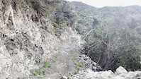
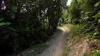
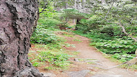
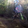
Photos of Wellington Mountain Bike
trail: Ikigai
1 |
May 15, 2022 @ 8:57pm
May 15, 2022
trail: Ikigai
15 |
May 15, 2022 @ 8:57pm
May 15, 2022
trail: Ikigai
3 |
May 12, 2022 @ 4:31pm
May 12, 2022
trail: Ikigai
17 |
May 12, 2022 @ 4:31pm
May 12, 2022
trail: Whā Out
4 |
Apr 25, 2022 @ 7:06pm
Apr 25, 2022
trail: Whā Out
7 |
Apr 25, 2022 @ 7:04pm
Apr 25, 2022
trail: Whā Out
22 |
Apr 25, 2022 @ 7:04pm
Apr 25, 2022
trail: Skyline
15 |
Mar 20, 2022 @ 10:54am
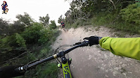
Mar 20, 2022Videos of Wellington Mountain Bike
trail: Pōhatu (Middle Section)
154 |
May 24, 2022

trail: Pōhatu (Middle Section)
|
May 24, 2022
trail: North Face
54 |
Mar 16, 2022
trail: Pōhatu
62 |
Mar 16, 2022

18 |
Feb 12, 2022
trail: Trevor
85 |
Dec 4, 2021

trail: Roller Coaster
49 |
Sep 4, 2021

trail: Mystic Portal
267 |
Apr 23, 2021
Current Trail Warnings
| status | trail | date | condition | user | info |
|---|---|---|---|---|---|
| Three Brothers (Part 3) | Jul 3, 2022 @ 3:19pm 2 days | Prevalent Mud | passive649 Makara | Boggy and slippery following trail work.... | |
| Hataitai Zigzag | Jun 7, 2022 @ 10:31pm Jun 7, 2022 | Variable | sploom | Trail closed due to track work |
Recent Trail Reports
| status | trail | date | condition | info | user |
|---|---|---|---|---|---|
| Smokin' | Jul 5, 2022 @ 7:48pm 7 hours | Variable | passive649 Makara | ||
| Transient | Jul 2, 2022 @ 4:39pm Jul 2, 2022 | Variable | Davidriblack | ||
| Windmill | Jul 2, 2022 @ 4:39pm Jul 2, 2022 | Ideal | Davidriblack | ||
| Car Parts | Jul 2, 2022 @ 4:39pm Jul 2, 2022 | Variable | Davidriblack | ||
| Roller Coaster | Jul 2, 2022 @ 4:39pm Jul 2, 2022 | Dry | Davidriblack | ||
| Highbury Fling | Jul 2, 2022 @ 4:39pm Jul 2, 2022 | Ideal | Davidriblack | ||
| Ikigai | Jul 2, 2022 @ 4:39pm Jul 2, 2022 | Variable | Davidriblack | ||
| Sawmill | Jul 2, 2022 @ 4:39pm Jul 2, 2022 | Dry | Davidriblack | ||
| Serendipity | Jul 2, 2022 @ 4:39pm Jul 2, 2022 | Variable | Davidriblack | ||
| Live Wires | Jun 26, 2022 @ 5:18pm Jun 26, 2022 | Prevalent Mud | MattWilliams88 |
Activity Feed
| username | action | type | title | date | |
|---|---|---|---|---|---|
 | passive649 | add | report | Smokin' | Jul 5, 2022 @ 7:48pm 7 hours |
 | mtb-tech-geek | vote | poi | Wild at Heart Swing Bridge | Jul 5, 2022 @ 1:34am 1 day |
| tawamtbr | ridden | trail | Bottom Carpark and 6 more | Jul 4, 2022 @ 6:25pm 1 day |
| tawamtbr | ridden | trail | Southern Walkway and 4 more | Jul 4, 2022 @ 6:24pm 1 day |
| tawamtbr | ridden | trail | Old Coach Road and 4 more | Jul 4, 2022 @ 6:23pm 1 day |
Recent Comments
| username | type | title | comment | date | |
|---|---|---|---|---|---|
| trail | Smooth rock based track | Jun 25, 2022 @ 9:37pm Jun 25, 2022 | ||
| trail | Good singletrack with a mix of up and down... | Jun 25, 2022 @ 8:36pm Jun 25, 2022 | ||
| trail | Good walk to some rocks from the airport if... | Jun 25, 2022 @ 6:24pm Jun 25, 2022 | ||
| trail | This would be SICK if it actually happened! | Jun 23, 2022 @ 10:07pm Jun 23, 2022 | ||
| trail | Gee, interesting reply. Not sure anyone is... | Jun 2, 2022 @ 2:12am Jun 2, 2022 |
Local Badges
-

Top 10 Trails459 awarded -

Big Ride 30k5,475 awarded -

Descent 10k Badge437 awarded -

Climbing 10k Badge433 awarded -

Epic Ride 50k1,427 awarded -

Epic Ride Climb 2k500 awarded
Bike & Skill Parks
| name | type | city | rating |
|---|---|---|---|
| Con Air | skill park | Wellington | |
| Karitane Jumps | skill park | Wellington | |
| Karori BMX Track | skill park | Wellington | |
| Makara Peak Skills Area | skill park | Wellington | |
| Miramar Pump Track | skill park | Wellington |
Activity Type Stats
| activitytype | trails | distance | descent | descent distance | total vertical | rating | global rank | state rank | photos | reports | routes | ridelogs |
|---|---|---|---|---|---|---|---|---|---|---|---|---|
| Mountain Bike | 195 | 133 miles | 48,379 ft | 67 miles | 1,594 ft | #36 | #4 | 724 | 5,463 | 47 | 104,959 | |
| E-Bike | 34 | 25 miles | 6,762 ft | 12 miles | 1,302 ft | #62 | #7 | 4,582 | 13 | 4,296 | ||
| Hike | 204 | 135 miles | 47,933 ft | 65 miles | 1,594 ft | #29 | #1 | 3 | 5,389 | 1 | 1,089 | |
| Trail Running | 206 | 139 miles | 47,989 ft | 66 miles | 1,594 ft | #29 | #1 | 5,390 | 14 | 5,108 | ||
| Horse | 3 | 4,977 ft | 85 ft | 1,457 ft | 200 ft | 1,968 |
- By brenthillier
 NSMBA TRAILFORKS & contributors
 - Admins: ralley, WMTBC, WTT
- #3650 - 62,895 views
- wellington activity log | embed map of Wellington mountain bike trails | wellington mountain biking points of interest
Downloading of trail gps tracks in kml & gpx formats is enabled for Wellington.
You must login to download files.