close
Trail Conditions
- Unknown
- Snow Groomed
- Snow Packed
- Snow Covered
- Snow Cover Inadequate
- Freeze/thaw Cycle
- Icy
- Prevalent Mud
- Wet
- Variable
- Ideal
- Dry
- Very Dry
Trail Flow (Ridden Direction)
Trailforks scans users ridelogs to determine the most popular direction each trail is ridden. A good flowing trail network will have most trails flowing in a single direction according to their intension.
The colour categories are based on what percentage of riders are riding a trail in its intended direction.
The colour categories are based on what percentage of riders are riding a trail in its intended direction.
- > 96%
- > 90%
- > 80%
- > 70%
- > 50%
- < 50%
- bi-directional trail
- no data
Trail Last Ridden
Trailforks scans ridelogs to determine the last time a trail was ridden.
- < 2 days
- < 1 week
- < 2 weeks
- < 1 month
- < 6 months
- > 6 months
Trail Ridden Direction
The intended direction a trail should be ridden.
- Downhill Only
- Downhill Primary
- Both Directions
- Uphill Primary
- Uphill Only
- One Direction
Contribute Details
Colors indicate trail is missing specified detail.
- Description
- Photos
- Description & Photos
- Videos
Trail Popularity ?
Trailforks scans ridelogs to determine which trails are ridden the most in the last 9 months.
Trails are compared with nearby trails in the same city region with a possible 25 colour shades.
Think of this as a heatmap, more rides = more kinetic energy = warmer colors.
- most popular
- popular
- less popular
- not popular
ATV/ORV/OHV Filter
Max Vehicle Width
inches
Radar Time
x
Activity Recordings
Trailforks users anonymized public ridelogs from the past 6 months.
- mountain biking recent
- mountain biking (>6 month)
- hiking (1 year)
- moto (1 year)
Activity Recordings
Trailforks users anonymized public skilogs from the past 12 months.
- Downhill Ski
- Backcountry Ski
- Nordic Ski
Jump Magnitude Heatmap
Heatmap of where riders jump on trails. Zoom in to see individual jumps, click circles to view jump details.
Trails Deemphasized
Trails are shown in grey.
Only show trails with NO bikes.
Save the current map location and zoom level as your default home location whenever this page is loaded.
Save
No description for Rugeley has been added yet!
Login or register to submit one.
This region uses the Uk/Euro style trail grading system.
Activities Click to view
- Mountain Bike
156 trails
- E-Bike
154 trails
- Hike
88 trails
- Trail Running
99 trails
- Horse
85 trails
- Dirtbike/Moto
0 trails
- Observed Trials
0 trails
- ATV/ORV/OHV
0 trails
Region Details
- 83
- 2
- 13
- 44
- 9
- 5
Region Status
Open as of Jun 29, 2022Stats
- Avg Trail Rating
- Trails (view details)
- 156
- Trails Mountain Bike
- 156
- Trails E-Bike
- 154
- Trails Hike
- 88
- Trails Trail Running
- 99
- Trails Horse
- 85
- Total Distance
- 67 miles
- Total Descent
- 11,570 ft
- Total Vertical
- 513 ft
- Highest Trailhead
- 784 ft
- Reports
- 2,282
- Photos
- 4,632
- Ridden Counter
- 86,328
 Articles
Video: RutFest Returns With More Loamy Madness
Mar 24, 2020 from pinkbike.com
Trail Maps let 200 riders loose on a whole load of loamy turns
Sub Regions
-
Cannock Chase
- 2
- 13
- 42
- 4
-
Stile Cop
- 2
- 5
- 5
Popular Rugeley Mountain Biking Trails
Rugeley Mountain Bike Routes
| title | rating | distance |
|---|---|---|
| Follow the Dog | 6 miles | |
| Follow the Dog & The Monkey Trail (Full Loop) | 12 miles | |
| Cannock I don't want to miss a thing | 16 miles | |
| Blue Trail Cannock Chase | 3 miles | |
| Chase Off-Piste-Little of Everything | 15 miles | |
| Racers Guild Racing - Little Bringe race | 1,243 ft | |
| Racers Guild Racing - New Line race | 1,125 ft | |
| Racers Guild Racing - Black Course race | 1,598 ft | |
| Racers Guild Racing - Wonderland race | 1,194 ft | |
| Racers Guild Racing - Ridge Run race | 1,417 ft |
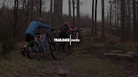
Photos of Rugeley Mountain Bike
trail: Lower Cliff
22 |
Mar 18, 2022 @ 12:22pm
Mar 18, 2022
trail: Are We There Yet?
35 |
Dec 30, 2021 @ 1:34pm
Dec 30, 2021
trail: Access Road
4 |
Dec 24, 2021 @ 2:21pm
Dec 24, 2021
trail: Zig Zak
14 |
Dec 24, 2021 @ 2:19pm
Dec 24, 2021
trail: Breeze The Trees
20 |
Dec 24, 2021 @ 1:56pm
Dec 24, 2021
trail: Rollercoaster
58 |
Mar 13, 2021 @ 6:19am
Mar 13, 2021
trail: Over The Rainbow
51 |
Nov 12, 2020 @ 8:28am
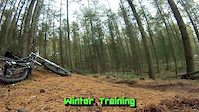
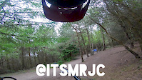
Nov 12, 2020Videos of Rugeley Mountain Bike
trail: Red Course
23 |
Apr 8, 2022
trail: Rollercoaster
24 |
Mar 16, 2022

trail: Black Course
53 |
Aug 16, 2021
trail: Red Course
85 |
May 12, 2021
trail: Balboa
118 |
Mar 10, 2021

trail: Lower Cliff
0:46 |
155 |
Jul 19, 2020
trail: Ridge Run
1:55 |
112 |
Jul 16, 2020
trail: Snap It
3:46 |
78 |
May 21, 2020
Recent Trail Reports
| status | trail | date | condition | info | user |
|---|---|---|---|---|---|
| Breeze The Trees | Jun 29, 2022 @ 2:19am Jun 29, 2022 | Ideal | Mtbtrailrider70 | ||
| High Voltage | Jun 29, 2022 @ 2:19am Jun 29, 2022 | Ideal | Mtbtrailrider70 | ||
| Zig Zak | Jun 29, 2022 @ 2:19am Jun 29, 2022 | Ideal | Mtbtrailrider70 | ||
| Ogre The Hill | Jun 29, 2022 @ 2:19am Jun 29, 2022 | Ideal | Mtbtrailrider70 | ||
| Bomb Hole | Jun 29, 2022 @ 2:19am Jun 29, 2022 | Ideal | Mtbtrailrider70 | ||
| Billy Goat's Gruff | Jun 29, 2022 @ 2:19am Jun 29, 2022 | Ideal | Mtbtrailrider70 | ||
| Time For A Brew | Jun 29, 2022 @ 2:19am Jun 29, 2022 | Dry | Mtbtrailrider70 | ||
| Evil Slab | Jun 29, 2022 @ 2:19am Jun 29, 2022 | Ideal | Mtbtrailrider70 | ||
| Son of Chainslapper | Jun 29, 2022 @ 2:19am Jun 29, 2022 | Ideal | Mtbtrailrider70 | ||
| Snow White | Jun 29, 2022 @ 2:19am Jun 29, 2022 | Ideal | Mtbtrailrider70 |
Activity Feed
| username | action | type | title | date | |
|---|---|---|---|---|---|
 | ChrisThePole | wishlist | route | Follow the Dog & The Monkey Trail (Full Loop) | Jul 5, 2022 @ 12:42pm 14 hours |
| ChrisThePole | wishlist | trail | Stegosaurus | Jul 5, 2022 @ 12:41pm 14 hours |
| dcj1606 | ridden | trail | Access Road | Jul 5, 2022 @ 1:49am 1 day |
| dcj1606 | ridden | trail | Rollercoaster and 45 more | Jul 5, 2022 @ 1:38am 1 day |
| ChrisThePole | wishlist | route | Follow the Dog and 1 more | Jul 4, 2022 @ 3:29pm 1 day |
Recent Comments
| username | type | title | comment | date | |
|---|---|---|---|---|---|
| trail | this section were closed on 09102022 | Jan 11, 2022 @ 3:42am Jan 11, 2022 | ||
| trail | Currently blocked by Forestry work 2/9/21 | Sep 2, 2021 @ 6:46am Sep 2, 2021 | ||
| report | Now back open | Jan 25, 2020 @ 9:37am Jan 25, 2020 | ||
| trail | Best section at Cannock, really good fun. | Nov 12, 2019 @ 6:36am Nov 12, 2019 | ||
| trail | Short steep climb. Lower Cliff descent makes... | Nov 12, 2019 @ 6:35am Nov 12, 2019 |
Local Badges
-

Big Ride 30k2,246 awarded -

Completionist0 awarded -

Climbing 10k Badge157 awarded -

Epic Ride 50k402 awarded -

Epic Ride Climb 2k11 awarded -

Climbing 100k Badge3 awarded
Bike & Skill Parks
| name | type | city | rating |
|---|---|---|---|
| Aldersley BMX Track | skill park | Rugeley | |
| Blackhorse BMX Track | skill park | Rugeley | |
| Derby BMX Track & Pumptrack | skill park | Rugeley | |
| Hilton Pumptrack | skill park | Rugeley | |
| Mile Oak Pumptrack | skill park | Rugeley |
Activity Type Stats
| activitytype | trails | distance | descent | descent distance | total vertical | rating | global rank | state rank | photos | reports | routes | ridelogs |
|---|---|---|---|---|---|---|---|---|---|---|---|---|
| Mountain Bike | 156 | 67 miles | 11,572 ft | 32 miles | 512 ft | #47 | #2 | 4,632 | 2,270 | 13 | 26,370 | |
| E-Bike | 154 | 67 miles | 11,512 ft | 32 miles | 512 ft | #13 | #2 | 2,244 | 4 | 2,070 | ||
| Hike | 88 | 50 miles | 6,749 ft | 23 miles | 502 ft | #3,948 | #172 | 2,151 | 170 | |||
| Trail Running | 99 | 54 miles | 7,159 ft | 24 miles | 502 ft | #623 | #20 | 2,152 | 136 | |||
| Horse | 85 | 50 miles | 6,549 ft | 22 miles | 502 ft | #226 | #8 | 830 | 2 |
- By WilliamTM Chase Trails & contributors
- Admins: wisey, gav-s, MathieuC, cemoorelife
- #4405 - 4,116 views
- rugeley activity log | embed map of Rugeley mountain bike trails | rugeley mountain biking points of interest
Downloading of trail gps tracks in kml & gpx formats is enabled for Rugeley.
You must login to download files.