close
Trail Conditions
- Unknown
- Snow Groomed
- Snow Packed
- Snow Covered
- Snow Cover Inadequate
- Freeze/thaw Cycle
- Icy
- Prevalent Mud
- Wet
- Variable
- Ideal
- Dry
- Very Dry
Trail Flow (Ridden Direction)
Trailforks scans users ridelogs to determine the most popular direction each trail is ridden. A good flowing trail network will have most trails flowing in a single direction according to their intension.
The colour categories are based on what percentage of riders are riding a trail in its intended direction.
The colour categories are based on what percentage of riders are riding a trail in its intended direction.
- > 96%
- > 90%
- > 80%
- > 70%
- > 50%
- < 50%
- bi-directional trail
- no data
Trail Last Ridden
Trailforks scans ridelogs to determine the last time a trail was ridden.
- < 2 days
- < 1 week
- < 2 weeks
- < 1 month
- < 6 months
- > 6 months
Trail Ridden Direction
The intended direction a trail should be ridden.
- Downhill Only
- Downhill Primary
- Both Directions
- Uphill Primary
- Uphill Only
- One Direction
Contribute Details
Colors indicate trail is missing specified detail.
- Description
- Photos
- Description & Photos
- Videos
Trail Popularity ?
Trailforks scans ridelogs to determine which trails are ridden the most in the last 9 months.
Trails are compared with nearby trails in the same city region with a possible 25 colour shades.
Think of this as a heatmap, more rides = more kinetic energy = warmer colors.
- most popular
- popular
- less popular
- not popular
ATV/ORV/OHV Filter
Max Vehicle Width
inches
Radar Time
x
Activity Recordings
Trailforks users anonymized public ridelogs from the past 6 months.
- mountain biking recent
- mountain biking (>6 month)
- hiking (1 year)
- moto (1 year)
Activity Recordings
Trailforks users anonymized public skilogs from the past 12 months.
- Downhill Ski
- Backcountry Ski
- Nordic Ski
Jump Magnitude Heatmap
Heatmap of where riders jump on trails. Zoom in to see individual jumps, click circles to view jump details.
Trails Deemphasized
Trails are shown in grey.
Only show trails with NO bikes.
Save the current map location and zoom level as your default home location whenever this page is loaded.
Save
No description for Bracknell has been added yet!
Login or register to submit one.
This region uses the Uk/Euro style trail grading system.
Activities Click to view
- Mountain Bike
69 trails
- Hike
27 trails
- Trail Running
27 trails
Region Details
- 22
- 1
- 13
- 31
- 2
Region Status
Open as of Jun 26, 2022Stats
- Avg Trail Rating
- Trails (view details)
- 69
- Trails Mountain Bike
- 69
- Trails E-Bike
- 61
- Trails Hike
- 27
- Trails Trail Running
- 27
- Trails Dirtbike/Moto
- 4
- Total Distance
- 18 miles
- Total Descent
- 1,588 ft
- Total Vertical
- 219 ft
- Highest Trailhead
- 470 ft
- Reports
- 2,639
- Photos
- 472
- Ridden Counter
- 84,196
Sub Regions
-
Crowthorne Woods
-
Swinley Forest
- 1
- 12
- 26
- 2
Bracknell Mountain Bike Routes
| title | rating | distance |
|---|---|---|
| Swinley Forest Red Route | 8 miles | |
| Swinley Forest Blue Route | 5 miles | |
| Swinley Blue & Red Full | 13 miles | |
| Swinley Forest Green Route | 2,992 ft | |
| Direct route to start of Red, or Ride out on Blue | 1 mile | |
| Swinley best bits | 10 miles | |
| 60 minutes Pirbright and Deepcut Barracks | 15 miles | |
| Direct route to Red 1 | 2 miles | |
| Swinley Cork Screw and Bomb holes | 1,867 ft | |
| 15 mile Swinley Forest Ride | popular ridelog | 15 miles |
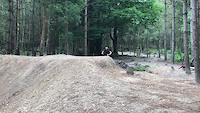
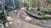
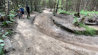
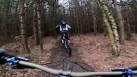
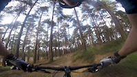
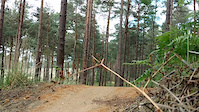
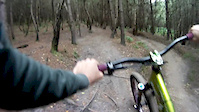
Photos of Bracknell Mountain Bike
trail: Blue 14
14 |
Jun 30, 2022 @ 12:14am
Jun 30, 2022
trail: Red 2
102 |
Dec 8, 2021 @ 11:56am
Dec 8, 2021
trail: Red 20
53 |
Sep 15, 2021 @ 7:47am
Sep 15, 2021
trail: Red 20
33 |
Sep 1, 2021 @ 7:09am
Sep 1, 2021
trail: Red 20
35 |
Sep 1, 2021 @ 7:08am
Sep 1, 2021
trail: Red 20
42 |
Sep 1, 2021 @ 7:08am
Sep 1, 2021
trail: Babymaker
48 |
Aug 21, 2021 @ 1:21pm
Aug 21, 2021
trail: Babymaker
34 |
Aug 21, 2021 @ 1:21pm
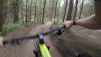
Aug 21, 2021Videos of Bracknell Mountain Bike
trail: Babymaker
225 |
Aug 12, 2021
trail: Babymaker
0:07 |
747 |
Jun 16, 2020
trail: Babymaker
0:09 |
455 |
Jun 16, 2020
trail: Babymaker
0:12 |
682 |
Jun 16, 2020
trail: Red 15
4:52 |
1239 |
Feb 17, 2019
trail: Blue 16
0:41 |
982 |
Oct 20, 2017
trail: Blue 16
0:11 |
779 |
May 27, 2017
trail: Babymaker
1:24 |
802 |
Aug 18, 2014
Current Trail Warnings
| status | trail | date | condition | user | info |
|---|---|---|---|---|---|
| Blue 16 | Jul 2, 2022 @ 3:51pm Jul 2, 2022 | Ideal | Way marker sign has been broken. | ||
| Blue 10 | Jun 26, 2022 @ 6:28am Jun 26, 2022 | Ideal | CousinAvi | ||
| Red 1 | Jun 26, 2022 @ 6:28am Jun 26, 2022 | Ideal | CousinAvi |
Recent Trail Reports
| status | trail | date | condition | info | user |
|---|---|---|---|---|---|
| Blue 1 | Jun 26, 2022 @ 6:28am Jun 26, 2022 | Ideal | CousinAvi | ||
| Blue 2 | Jun 26, 2022 @ 6:28am Jun 26, 2022 | Ideal | CousinAvi | ||
| Blue 3 | Jun 26, 2022 @ 6:28am Jun 26, 2022 | Ideal | CousinAvi | ||
| Blue 4 | Jun 26, 2022 @ 6:28am Jun 26, 2022 | Ideal | CousinAvi | ||
| Blue 5 | Jun 26, 2022 @ 6:28am Jun 26, 2022 | Ideal | CousinAvi | ||
| Blue 7 | Jun 26, 2022 @ 6:28am Jun 26, 2022 | Ideal | CousinAvi | ||
| Blue 9 | Jun 26, 2022 @ 6:28am Jun 26, 2022 | Ideal | CousinAvi | ||
| Blue 11 | Jun 26, 2022 @ 6:28am Jun 26, 2022 | Ideal | CousinAvi | ||
| Blue 12 | Jun 26, 2022 @ 6:28am Jun 26, 2022 | Ideal | CousinAvi | ||
| Red 2 | Jun 26, 2022 @ 6:28am Jun 26, 2022 | Ideal | CousinAvi |
Activity Feed
| username | action | type | title | date | |
|---|---|---|---|---|---|
 | nagx56 | wishlist | region | Swinley Forest | Jul 5, 2022 @ 12:55am 1 day |
| geonorg234 | wishlist | region | Swinley Forest | Jul 3, 2022 @ 10:22pm 2 days |
| Craiggoat | wishlist | region | Swinley Forest | Jul 3, 2022 @ 1:17pm 3 days |
| Craiggoat | wishlist | route | Swinley Forest Red Route and 1 more | Jul 3, 2022 @ 1:16pm 3 days |
| Neil-s | wishlist | trail | Red 5 | Jul 1, 2022 @ 11:54am Jul 1, 2022 |
Recent Comments
| username | type | title | comment | date | |
|---|---|---|---|---|---|
| report | Was actually the 5th July we rode it. Some... | Jul 7, 2021 @ 3:20pm Jul 7, 2021 | ||
| trail | Open again now | Mar 13, 2021 @ 3:17am Mar 13, 2021 | ||
| report | Tiny trail link, can't really be closed. | Jan 1, 2021 @ 6:33am Jan 1, 2021 | ||
 | trail | Currently shut due to being waterlogged | Dec 1, 2020 @ 3:36pm Dec 1, 2020 | ||
| report | Closed | Mar 30, 2020 @ 3:04pm Mar 30, 2020 |
Local Badges
-

Big Ride 30k2,004 awarded -

Completionist74 awarded -

Epic Ride 50k510 awarded -

Epic Ride Descent 2k6 awarded -

Epic Ride Climb 2k6 awarded -

Climbing 100k Badge1 awarded
Bike & Skill Parks
| name | type | city | rating |
|---|---|---|---|
| Wargrave BMX Track | skill park | Bracknell |
Activity Type Stats
| activitytype | trails | distance | descent | descent distance | total vertical | rating | global rank | state rank | photos | reports | routes | ridelogs |
|---|---|---|---|---|---|---|---|---|---|---|---|---|
| Mountain Bike | 69 | 18 miles | 1,588 ft | 7 miles | 220 ft | #71 | #5 | 472 | 2,624 | 9 | 21,122 | |
| E-Bike | 61 | 16 miles | 1,217 ft | 6 miles | 220 ft | 2,306 | 2 | 1,187 | ||||
| Hike | 27 | 5 miles | 279 ft | 2 miles | 200 ft | #863 | #32 | 2,263 | 74 | |||
| Trail Running | 27 | 5 miles | 279 ft | 2 miles | 200 ft | #869 | #33 | 2,263 | 357 | |||
| Dirtbike/Moto | 4 | 1,722 ft | 82 ft | 1,450 ft | 98 ft | 947 |
- By sk82jack & contributors
- Admins: wisey, gav-s, MathieuC, cemoorelife, TTS
- #3700 - 5,443 views
- bracknell activity log | embed map of Bracknell mountain bike trails | bracknell mountain biking points of interest
Downloading of trail gps tracks in kml & gpx formats is enabled for Bracknell.
You must login to download files.