close
Trail Conditions
- Unknown
- Snow Groomed
- Snow Packed
- Snow Covered
- Snow Cover Inadequate
- Freeze/thaw Cycle
- Icy
- Prevalent Mud
- Wet
- Variable
- Ideal
- Dry
- Very Dry
Trail Flow (Ridden Direction)
Trailforks scans users ridelogs to determine the most popular direction each trail is ridden. A good flowing trail network will have most trails flowing in a single direction according to their intension.
The colour categories are based on what percentage of riders are riding a trail in its intended direction.
The colour categories are based on what percentage of riders are riding a trail in its intended direction.
- > 96%
- > 90%
- > 80%
- > 70%
- > 50%
- < 50%
- bi-directional trail
- no data
Trail Last Ridden
Trailforks scans ridelogs to determine the last time a trail was ridden.
- < 2 days
- < 1 week
- < 2 weeks
- < 1 month
- < 6 months
- > 6 months
Trail Ridden Direction
The intended direction a trail should be ridden.
- Downhill Only
- Downhill Primary
- Both Directions
- Uphill Primary
- Uphill Only
- One Direction
Contribute Details
Colors indicate trail is missing specified detail.
- Description
- Photos
- Description & Photos
- Videos
Trail Popularity ?
Trailforks scans ridelogs to determine which trails are ridden the most in the last 9 months.
Trails are compared with nearby trails in the same city region with a possible 25 colour shades.
Think of this as a heatmap, more rides = more kinetic energy = warmer colors.
- most popular
- popular
- less popular
- not popular
ATV/ORV/OHV Filter
Max Vehicle Width
inches
Radar Time
x
Activity Recordings
Trailforks users anonymized public ridelogs from the past 6 months.
- mountain biking recent
- mountain biking (>6 month)
- hiking (1 year)
- moto (1 year)
Activity Recordings
Trailforks users anonymized public skilogs from the past 12 months.
- Downhill Ski
- Backcountry Ski
- Nordic Ski
Jump Magnitude Heatmap
Heatmap of where riders jump on trails. Zoom in to see individual jumps, click circles to view jump details.
Trails Deemphasized
Trails are shown in grey.
Only show trails with NO bikes.
Save the current map location and zoom level as your default home location whenever this page is loaded.
SaveHobart is located on the estuary of the Derwent River in the state's south-east. Geologically Hobart is built predominantly on Jurassic dolerite around the foothills interspersed with smaller areas of Triassic siltstone and Permian mudstone. Hobart extends along both sides of the Derwent River; on the western shore from the Derwent valley in the north through the flatter areas of Glenorchy which rests on older Triassic sediment and into the hilly areas of New Town, Lenah Valley. Both of these areas rest on the younger Jurassic dolerite deposits, before stretching into the lower areas such as the beaches of Sandy Bay in the south, in the Derwent estuary. South of the Derwent estuary lies Storm Bay and the Tasman Peninsula.
The Eastern Shore also extends from the Derwent valley area in a southerly direction hugging the Meehan Range in the east before sprawling into flatter land in suburbs such as Bellerive. These flatter areas of the eastern shore rest on far younger deposits from the Quaternary. From there the city extends in an easterly direction through the Meehan Range into the hilly areas of Rokeby and Oakdowns, before reaching into the tidal flatland area of Lauderdale.
Hobart has access to a number of beach areas including those in the Derwent estuary itself; Sandy Bay, Cornelian Bay, Nutgrove, Kingston, Bellerive, and Howrah Beaches as well as many more in Frederick Henry Bay such as; Seven Mile, Roaches, Cremorne, Clifton, and Goats Beaches.
source: Wikipedia
Links
Activities Click to view
- Mountain Bike
571 trails
- E-Bike
214 trails
- Hike
530 trails
- Trail Running
529 trails
Region Details
- 105
- 12
- 181
- 206
- 59
- 5
Region Status
Open as of Dec 29, 2021Stats
- Avg Trail Rating
- Trails (view details)
- 615
- Trails Mountain Bike
- 571
- Trails E-Bike
- 214
- Trails Hike
- 530
- Trails Trail Running
- 529
- Trails Horse
- 54
- Trails Dirtbike/Moto
- 6
- Trails ATV/ORV/OHV
- 7
- Total Distance
- 543 miles
- Total Descent
- 119,190 ft
- Total Vertical
- 4,513 ft
- Highest Trailhead
- 4,513 ft
- Reports
- 2,427
- Photos
- 696
- Ridden Counter
- 53,210
Sub Regions
-
Cascades (South Hobart)
- 4
- 22
- 17
- 2
-
Geilston Bay
- 9
- 10
- 3
-
Glenorchy Mountain Bike Park
- 5
- 4
- 5
- 1
-
Kellevie
- 3
- 6
-
Kellevie MTB Park
-
Knocklofty Reserve
- 5
- 16
- 2
-
kunanyi / Mount Wellington
- 5
- 28
- 5
-
Lenah Valley
- 2
- 2
- 1
-
Maria Island
-
Meadowbank MTB
- 4
- 1
- 1
-
Meehan Range
- 1
- 20
- 35
- 7
-
Mount Nelson
- 12
- 20
- 6
- 1
-
Pilcher
- 7
- 6
- 1
-
Queens Domain
- 2
- 6
- 7
-
Queenstown
- 2
- 7
- 1
- 1
-
Ridgeway Park
- 1
- 11
- 12
- 3
-
Single Hill
- 3
- 4
-
Tangara Trail
- 2
- 52
- 13
-
Tranmere Hills
- 1
- 11
- 5
- 3
-
Waverley Flora Reserve
- 2
- 4
- 2
Popular Hobart Mountain Biking Trails
Hobart Mountain Bike Routes
| title | rating | distance |
|---|---|---|
| Mega Hoot | 4 miles | |
| South Hobart Loop | 9 miles | |
| Townside to Belbins Loop | 12 miles | |
| New Town > South Arm Loop | 50 miles | |
| Yamas route | 5 miles | |
| Lachlan Loop | 21 miles | |
| Dave's Meehan Favourite | 10 miles | |
| My Local | 3 miles | |
| Tuesday MTB Route A | 6 miles | |
| Tranmere Fun - Enduro Style | 6 miles |
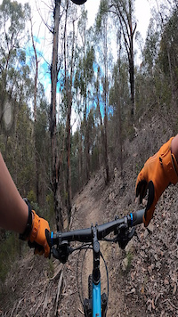
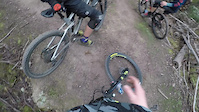
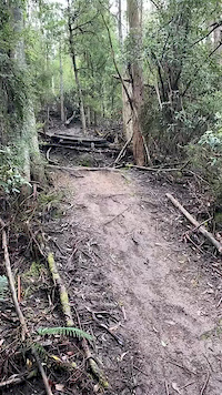
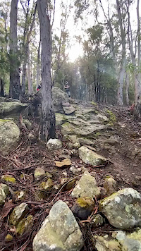
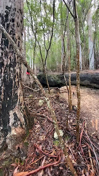
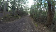
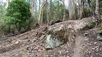
Photos of Hobart Mountain Bike
trail: Waterfall
7 |
Apr 18, 2022 @ 9:01pm
Apr 18, 2022
trail: Natural Selection
7 |
Apr 18, 2022 @ 8:58pm
Apr 18, 2022
trail: Natural Selection
18 |
Apr 18, 2022 @ 8:58pm
Apr 18, 2022
trail: Natural Selection
9 |
Apr 18, 2022 @ 5:57pm
Apr 18, 2022
trail: Natural Selection
20 |
Apr 18, 2022 @ 5:57pm
Apr 18, 2022
trail: Waterfall
8 |
Apr 2, 2022 @ 1:28am
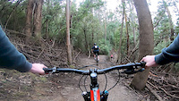
Apr 2, 2022Videos of Hobart Mountain Bike
trail: Death Log
42 |
Oct 6, 2021
trail: Pubes
135 |
Nov 4, 2020
trail: Fork Skin
0:06 |
434 |
Sep 13, 2020
trail: Cornish
0:08 |
751 |
Sep 13, 2020
trail: Cornish
0:05 |
669 |
Sep 13, 2020
trail: Upper Loam Line
0:15 |
293 |
Sep 13, 2020
trail: Drops
3:07 |
388 |
Jul 21, 2020
trail: Sexual Soil
0:06 |
1092 |
Apr 10, 2020
Current Trail Warnings
| status | trail | date | condition | user | info |
|---|---|---|---|---|---|
| Crosscut | Jun 28, 2022 @ 10:08pm Jun 28, 2022 | Prevalent Mud | Sekt | Tree cleared. Significant mud, please... | |
| Barossa Creek Sprint | Jun 14, 2022 @ 9:26pm Jun 14, 2022 | Unknown | canisfortis | A large number of logs/tress across the... |
Recent Trail Reports
| status | trail | date | condition | info | user |
|---|---|---|---|---|---|
| Kalang High Road | Jul 5, 2022 @ 2:38am 1 day | Variable | brettmansfield | ||
| The Orchard | Jul 5, 2022 @ 2:35am 1 day | Variable | brettmansfield | ||
| Northern Access Trail | Jul 4, 2022 @ 8:12pm 1 day | Variable | humpy125 | ||
| Yellow Hippo | Jul 4, 2022 @ 8:12pm 1 day | Variable | humpy125 | ||
| Climb the Hippo | Jul 4, 2022 @ 8:12pm 1 day | Ideal | humpy125 | ||
| Knocklofty Summit Track | Jul 4, 2022 @ 8:12pm 1 day | Variable | humpy125 | ||
| Brickworks Track | Jul 4, 2022 @ 8:12pm 1 day | Variable | humpy125 | ||
| Boundary rider | Jul 4, 2022 @ 8:12pm 1 day | Ideal | humpy125 | ||
| Knocklofty Main Fire Trail | Jul 4, 2022 @ 8:12pm 1 day | Variable | humpy125 | ||
| Fiona Allan Memorial Walk | Jul 4, 2022 @ 8:12pm 1 day | Variable | humpy125 |
Activity Feed
| username | action | type | title | date | |
|---|---|---|---|---|---|
 | brettmansfield | add | report | The Orchard and 1 more | Jul 5, 2022 @ 2:37am 1 day |
| brettmansfield | vote | trail | The Orchard | Jul 5, 2022 @ 2:35am 1 day |
| brettmansfield | ridden | trail | The Orchard and 1 more | Jul 5, 2022 @ 2:35am 1 day |
| humpy125 | add | report | Northern Access Trail and 10 more | Jul 4, 2022 @ 10:56pm 1 day |
| brettmansfield | add | trail | Barossa Farm | Jul 4, 2022 @ 10:36pm 1 day |
Recent Comments
| username | type | title | comment | date | |
|---|---|---|---|---|---|
 | report | Cleared by CoH today. | Jun 28, 2022 @ 10:08pm Jun 28, 2022 | ||
| report | So true. | Apr 30, 2022 @ 3:22pm Apr 30, 2022 | ||
| report | Excellent track, great surface, really well... | Apr 28, 2022 @ 5:01pm Apr 28, 2022 | ||
| trail | Its finally open | Apr 20, 2022 @ 11:30pm Apr 20, 2022 | ||
| trail | It says something about the trail that the... | Apr 18, 2022 @ 8:53pm Apr 18, 2022 |
Local Badges
-

10 Green Trails383 awarded -

Climbing 10k Badge215 awarded -

10 Blue Trails417 awarded -

Big Ride 30k3,082 awarded -

Completionist5 awarded -

Descent 10k Badge226 awarded
Bike & Skill Parks
| name | type | city | rating |
|---|---|---|---|
| Meadowbank MTB | bike park | Hobart | |
| Geilston Bay Jump Track | skill park | Hobart | |
| Lauderdale BMX Track | skill park | Hobart | |
| Waterworks Pump Track | skill park | Hobart |
Local Trail Supporters
- Hobart City Council
![City of Hobart]()
Activity Type Stats
| activitytype | trails | distance | descent | descent distance | total vertical | rating | global rank | state rank | photos | reports | routes | ridelogs |
|---|---|---|---|---|---|---|---|---|---|---|---|---|
| Mountain Bike | 571 | 460 miles | 105,502 ft | 232 miles | 3,720 ft | #78 | #9 | 659 | 2,426 | 25 | 53,392 | |
| E-Bike | 214 | 238 miles | 39,016 ft | 109 miles | 3,704 ft | #164 | #26 | 3 | 2,190 | 8 | 1,996 | |
| Hike | 530 | 476 miles | 93,665 ft | 216 miles | 4,514 ft | #76 | #7 | 28 | 2,329 | 1,514 | ||
| Trail Running | 529 | 475 miles | 93,612 ft | 216 miles | 4,514 ft | #79 | #8 | 2,329 | 5 | 2,498 | ||
| Horse | 54 | 58 miles | 6,516 ft | 25 miles | 1,650 ft | 3 | 432 | |||||
| Dirtbike/Moto | 6 | 57 miles | 5,755 ft | 26 miles | 2,234 ft | 430 | 9 | |||||
| ATV/ORV/OHV | 7 | 70 miles | 6,158 ft | 32 miles | 2,234 ft | 3 | 430 | 4 |
- By SchrodingersGat
 MRTG & contributors
 - Admins: Jake-Hannah, Addzz, MTBA, SchrodingersGat, Sekt
- #9725 - 33,498 views
- hobart activity log | embed map of Hobart mountain bike trails | hobart mountain biking points of interest
Downloading of trail gps tracks in kml & gpx formats is enabled for Hobart.
You must login to download files.