close
Trail Conditions
- Unknown
- Snow Groomed
- Snow Packed
- Snow Covered
- Snow Cover Inadequate
- Freeze/thaw Cycle
- Icy
- Prevalent Mud
- Wet
- Variable
- Ideal
- Dry
- Very Dry
Trail Flow (Ridden Direction)
Trailforks scans users ridelogs to determine the most popular direction each trail is ridden. A good flowing trail network will have most trails flowing in a single direction according to their intension.
The colour categories are based on what percentage of riders are riding a trail in its intended direction.
The colour categories are based on what percentage of riders are riding a trail in its intended direction.
- > 96%
- > 90%
- > 80%
- > 70%
- > 50%
- < 50%
- bi-directional trail
- no data
Trail Last Ridden
Trailforks scans ridelogs to determine the last time a trail was ridden.
- < 2 days
- < 1 week
- < 2 weeks
- < 1 month
- < 6 months
- > 6 months
Trail Ridden Direction
The intended direction a trail should be ridden.
- Downhill Only
- Downhill Primary
- Both Directions
- Uphill Primary
- Uphill Only
- One Direction
Contribute Details
Colors indicate trail is missing specified detail.
- Description
- Photos
- Description & Photos
- Videos
Trail Popularity ?
Trailforks scans ridelogs to determine which trails are ridden the most in the last 9 months.
Trails are compared with nearby trails in the same city region with a possible 25 colour shades.
Think of this as a heatmap, more rides = more kinetic energy = warmer colors.
- most popular
- popular
- less popular
- not popular
ATV/ORV/OHV Filter
Max Vehicle Width
inches
Radar Time
x
Activity Recordings
Trailforks users anonymized public ridelogs from the past 6 months.
- mountain biking recent
- mountain biking (>6 month)
- hiking (1 year)
- moto (1 year)
Activity Recordings
Trailforks users anonymized public skilogs from the past 12 months.
- Downhill Ski
- Backcountry Ski
- Nordic Ski
Jump Magnitude Heatmap
Heatmap of where riders jump on trails. Zoom in to see individual jumps, click circles to view jump details.
Trails Deemphasized
Trails are shown in grey.
Only show trails with NO bikes.
Save the current map location and zoom level as your default home location whenever this page is loaded.
Save
No description for Launceston has been added yet!
Login or register to submit one.
Activities Click to view
- Mountain Bike
145 trails
- E-Bike
29 trails
- Hike
130 trails
- Trail Running
130 trails
Region Details
- 19
- 2
- 35
- 57
- 26
- 6
Region Status
Caution as of Jun 24, 2022Stats
- Avg Trail Rating
- Trails (view details)
- 145
- Trails Mountain Bike
- 145
- Trails E-Bike
- 29
- Trails Hike
- 130
- Trails Trail Running
- 130
- Trails Horse
- 4
- Trails Dirtbike/Moto
- 3
- Trails ATV/ORV/OHV
- 2
- Total Distance
- 178 miles
- Total Descent
- 34,677 ft
- Total Vertical
- 4,706 ft
- Highest Trailhead
- 4,811 ft
- Reports
- 1,095
- Photos
- 495
- Ridden Counter
- 57,463
Sub Regions
-
Ben Lomond
- 7
- 1
-
Blackberm
-
Blue Derby
- 1
- 11
- 17
- 11
- 4
-
Hollybank Reserve
- 1
- 2
- 1
-
Kate Reed Nature Recreation Area
- 9
- 13
- 2
-
Mt Barrow
-
Mt. Stronach
- 1
- 2
- 1
-
Trevallyn Nature Recreation Area
- 9
- 12
- 8
- 1
-
Wyena Gravity Trails
- 3
Popular Launceston Mountain Biking Trails
Launceston Mountain Bike Routes
| title | rating | distance |
|---|---|---|
| Return to sender form town | 8 miles | |
| town to kings wall return | 11 miles | |
| Town to Krushka's loop | 10 miles | |
| Mt Barrow and Ben Lomond climbs | 56 miles | |
| Derby Fun Green Loop | 4 miles | |
| Tas Grav Mapping Rd 4 | 17 miles | |
| Ride Blue Derby Route 3 - Return To Sender | 8 miles | |
| Derby 24 | 15 miles | |
| 2022 GIANT Tas Grav Round 4 race | 19 miles | |
| 2022 GIANT Tas Grav Round 4 race | 19 miles |
Photos of Launceston Mountain Bike
trail: Ginger Ridge
1 |
Jul 5, 2022 @ 3:25am
24 hours
trail: Ginger Ridge
7 |
Jul 5, 2022 @ 3:25am
24 hours
trail: Ginger Ridge
11 |
Jul 4, 2022 @ 4:24pm
1 day
trail: Ginger Ridge
2 |
Jul 3, 2022 @ 11:16pm
2 days
trail: Ginger Ridge
4 |
Jul 3, 2022 @ 11:16pm
2 days
trail: Ginger Ridge
3 |
Jul 3, 2022 @ 11:15pm
2 days
trail: Ginger Ridge
5 |
Jul 3, 2022 @ 11:15pm
2 days
trail: Ginger Ridge
5 |
Jul 3, 2022 @ 11:15pm
2 daysVideos of Launceston Mountain Bike
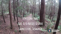
trail: Fenceline
22 |
Nov 13, 2021

trail: Lower Air Ya Garn
183 |
Feb 25, 2021

trail: Lower Air Ya Garn
181 |
Feb 3, 2021

trail: Wochya-Upta
114 |
Jan 9, 2021
trail: Kumma-Gutza
2:09 |
5486 |
May 29, 2020
trail: Flickity Sticks
0:15 |
126 |
May 10, 2020

trail: Return To Sender
7:41 |
191 |
Mar 3, 2020
trail: Detonate
0:08 |
1389 |
Nov 25, 2019
Recent Trail Reports
| status | trail | date | condition | info | user |
|---|---|---|---|---|---|
| Valley Ponds | Jun 24, 2022 @ 6:42pm Jun 24, 2022 | Variable | Stredda CCMBC | ||
| Cascade Dam Road | Jun 24, 2022 @ 3:34pm Jun 24, 2022 | Wet | Stredda CCMBC | ||
| Mt Paris Dam Track | Jun 8, 2022 @ 9:18pm Jun 8, 2022 | Unknown | CarlPr | ||
| Jacobs Ladder | Jun 5, 2022 @ 6:22pm Jun 5, 2022 | Snow Covered | CarlPr | ||
| Ginger Ridge | Jun 1, 2022 @ 4:58am Jun 1, 2022 | Ideal | oAthJf | ||
| Tall Timbers | May 28, 2022 @ 10:18pm May 28, 2022 | Variable | BennyGov | ||
| No Sweat | May 28, 2022 @ 10:18pm May 28, 2022 | Variable | BennyGov | ||
| Sidewinder | May 20, 2022 @ 10:43pm May 20, 2022 | Ideal | BennyGov | ||
| Value For Money | May 20, 2022 @ 10:43pm May 20, 2022 | Ideal | BennyGov | ||
| Deadmans Knob | May 20, 2022 @ 10:43pm May 20, 2022 | Ideal | BennyGov |
Activity Feed
| username | action | type | title | date | |
|---|---|---|---|---|---|
 | isaacchpman153 | ridden | trail | Shearpin and 4 more | Jul 5, 2022 @ 10:16pm 5 hours |
| oAthJf | add | photo | in My City and 1 more | Jul 5, 2022 @ 3:25am 24 hours |
| oAthJf | add | photo | in My City | Jul 4, 2022 @ 4:24pm 1 day |
| oAthJf | add | photo | in My City and 9 more | Jul 3, 2022 @ 11:09pm 2 days |
| Jarrod369 | vote | trail | Shovel Shmasha | Jul 3, 2022 @ 7:14pm 2 days |
Recent Comments
| username | type | title | comment | date | |
|---|---|---|---|---|---|
| trail | a bit overrated but still good | May 24, 2022 @ 4:38pm May 24, 2022 | ||
| trail | Shuttle Road can climb it (half the time of... | Apr 27, 2022 @ 3:21pm Apr 27, 2022 | ||
| trail | Great ride, epic descent through some rocky... | Apr 21, 2022 @ 2:48am Apr 21, 2022 | ||
| trail | But sandy at the moment | Apr 3, 2022 @ 6:20pm Apr 3, 2022 | ||
| trail | Fun track to ride | Mar 23, 2022 @ 5:12pm Mar 23, 2022 |
Local Badges
-

10 Blue Trails905 awarded -

Big Ride 30k3,553 awarded -

10 Green Trails481 awarded -

10 Black Trails519 awarded -

Completionist1 awarded -
Completionist2 awarded
Bike & Skill Parks
| name | type | city | rating |
|---|---|---|---|
| Derby Pump Track | skill park | Launceston | |
| Kate Reed Skillpark | skill park | Launceston | |
| Pomona Road Jumps | skill park | Launceston | |
| Southern Cross Jumps | skill park | Launceston | |
| Spiky mtb jump line | skill park | Launceston |
Local Trail Supporters
- Rotary Club of Scottsdale
![World Trail]()
Activity Type Stats
| activitytype | trails | distance | descent | descent distance | total vertical | rating | global rank | state rank | photos | reports | routes | ridelogs |
|---|---|---|---|---|---|---|---|---|---|---|---|---|
| Mountain Bike | 145 | 178 miles | 34,675 ft | 78 miles | 4,708 ft | #82 | #10 | 483 | 1,090 | 23 | 34,585 | |
| E-Bike | 29 | 71 miles | 7,001 ft | 21 miles | 4,295 ft | #124 | #21 | 7 | 812 | 12 | 1,504 | |
| Hike | 130 | 148 miles | 27,740 ft | 62 miles | 4,675 ft | #74 | #6 | 5 | 1,030 | 1 | 283 | |
| Trail Running | 130 | 148 miles | 27,740 ft | 62 miles | 4,675 ft | #76 | #7 | 1,030 | 2 | 536 | ||
| Horse | 4 | 29 miles | 1,352 ft | 7 miles | 4,288 ft | 232 | 8 | |||||
| Dirtbike/Moto | 3 | 10 miles | 26 ft | 804 ft | 2,913 ft | 232 | 1 | 6 | ||||
| ATV/ORV/OHV | 2 | 8 miles | 23 ft | 614 ft | 2,913 ft | 232 | 1 | 9 |
- By Mcphisto1978
 & contributors
 - Admins: Jake-Hannah, Addzz, MTBA, SchrodingersGat, LMBC
- #5572 - 8,438 views
- launceston activity log | embed map of Launceston mountain bike trails | launceston mountain biking points of interest
Downloading of trail gps tracks in kml & gpx formats is enabled for Launceston.
You must login to download files.