close
Trail Conditions
- Unknown
- Snow Groomed
- Snow Packed
- Snow Covered
- Snow Cover Inadequate
- Freeze/thaw Cycle
- Icy
- Prevalent Mud
- Wet
- Variable
- Ideal
- Dry
- Very Dry
Trail Flow (Ridden Direction)
Trailforks scans users ridelogs to determine the most popular direction each trail is ridden. A good flowing trail network will have most trails flowing in a single direction according to their intension.
The colour categories are based on what percentage of riders are riding a trail in its intended direction.
The colour categories are based on what percentage of riders are riding a trail in its intended direction.
- > 96%
- > 90%
- > 80%
- > 70%
- > 50%
- < 50%
- bi-directional trail
- no data
Trail Last Ridden
Trailforks scans ridelogs to determine the last time a trail was ridden.
- < 2 days
- < 1 week
- < 2 weeks
- < 1 month
- < 6 months
- > 6 months
Trail Ridden Direction
The intended direction a trail should be ridden.
- Downhill Only
- Downhill Primary
- Both Directions
- Uphill Primary
- Uphill Only
- One Direction
Contribute Details
Colors indicate trail is missing specified detail.
- Description
- Photos
- Description & Photos
- Videos
Trail Popularity ?
Trailforks scans ridelogs to determine which trails are ridden the most in the last 9 months.
Trails are compared with nearby trails in the same city region with a possible 25 colour shades.
Think of this as a heatmap, more rides = more kinetic energy = warmer colors.
- most popular
- popular
- less popular
- not popular
ATV/ORV/OHV Filter
Max Vehicle Width
inches
Radar Time
x
Activity Recordings
Trailforks users anonymized public ridelogs from the past 6 months.
- mountain biking recent
- mountain biking (>6 month)
- hiking (1 year)
- moto (1 year)
Activity Recordings
Trailforks users anonymized public skilogs from the past 12 months.
- Downhill Ski
- Backcountry Ski
- Nordic Ski
Jump Magnitude Heatmap
Heatmap of where riders jump on trails. Zoom in to see individual jumps, click circles to view jump details.
Trails Deemphasized
Trails are shown in grey.
Only show trails with NO bikes.
Save the current map location and zoom level as your default home location whenever this page is loaded.
Save
No description for Lower Hutt has been added yet!
Login or register to submit one.
Activities Click to view
- Mountain Bike
109 trails
- E-Bike
77 trails
- Hike
104 trails
- Trail Running
103 trails
- Horse
2 trails
- Dirtbike/Moto
0 trails
- ATV/ORV/OHV
0 trails
- Snowmobile
0 trails
- Snowshoe
0 trails
- Downhill Ski
0 trails
- Backcountry Ski
0 trails
- Nordic Ski
0 trails
Region Details
- 20
- 5
- 23
- 35
- 4
- 15
- 1
Region Status
Open as of Jan 15, 2022Stats
- Avg Trail Rating
- Trails (view details)
- 112
- Trails Mountain Bike
- 109
- Trails E-Bike
- 77
- Trails Hike
- 104
- Trails Trail Running
- 103
- Trails Horse
- 2
- Total Distance
- 119 miles
- Total Descent
- 36,455 ft
- Total Vertical
- 2,284 ft
- Highest Trailhead
- 2,303 ft
- Reports
- 1,463
- Photos
- 269
- Ridden Counter
- 29,549
Sub Regions
-
Belmont Regional Park
- 5
- 22
- 3
- 1
-
Wainuiomata Trail Park (WTP)
- 2
- 17
- 10
- 11
- 1
Popular Lower Hutt Mountain Biking Trails
Lower Hutt Mountain Bike Routes
| title | rating | distance |
|---|---|---|
| Labyrinth Loop | 3 miles | |
| 4 Degrees, Electric, Weta Loop | 3 miles | |
| WTP Long Drop | 2 miles | |
| 2020 W6W course | 3 miles | |
| PNP 2020 MTB R1 Long Waiu | 5 miles | |
| Puke Ariki Traverse | 14 miles | |
| NZSS XCO Individual 2020 | 4 miles | |
| NZSS XCO Team Relay | 2 miles | |
| PNP 2020 MTB R1 Short Waiu | 4 miles | |
| BAMBA Option 2 - Easy Loop | 3 miles |
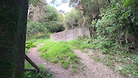
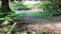
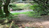
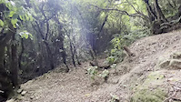
Photos of Lower Hutt Mountain Bike
trail: Te Whiti Riser
10 |
Jul 4, 2022 @ 2:32pm
2 days
trail: Horse Push Bridleway
9 |
Mar 5, 2022 @ 5:05pm
Mar 5, 2022
trail: Horse Push Bridleway
18 |
Mar 5, 2022 @ 5:05pm
Mar 5, 2022
trail: 491
100 |
Jun 24, 2017 @ 6:18pm
Jun 24, 2017
trail: 491
92 |
Jun 24, 2017 @ 6:18pm
Jun 24, 2017
trail: Bull Run
895 |
May 31, 2015 @ 10:29pm
May 31, 2015
trail: Bull Run
488 |
Jan 25, 2015 @ 6:30pm
Jan 25, 2015Videos of Lower Hutt Mountain Bike


Recent Trail Reports
| status | trail | date | condition | info | user |
|---|---|---|---|---|---|
| Beeline | Jun 26, 2022 @ 12:03am Jun 26, 2022 | Variable | cmwgn | ||
| Freewheel | Jun 26, 2022 @ 12:00am Jun 26, 2022 | Wet | cmwgn | ||
| Nga Tuna | Jun 25, 2022 @ 3:12am Jun 25, 2022 | Wet | jeffBNZ | ||
| Waddington Winder | Jun 23, 2022 @ 7:57pm Jun 23, 2022 | Wet | JNugjN | ||
| Red Track | May 28, 2022 @ 5:04pm May 28, 2022 | Ideal | jonorees | ||
| Jungle Gym | May 28, 2022 @ 5:04pm May 28, 2022 | Ideal | jonorees | ||
| Labyrinth | May 28, 2022 @ 5:04pm May 28, 2022 | Variable | jonorees | ||
| Snail Trail | May 28, 2022 @ 5:04pm May 28, 2022 | Ideal | jonorees | ||
| Lower Super Plus | May 25, 2022 @ 11:43pm May 25, 2022 | Ideal | nzreefie | ||
| Not the Bees | May 25, 2022 @ 8:10pm May 25, 2022 | Variable | deskpop |
Activity Feed
| username | action | type | title | date | |
|---|---|---|---|---|---|
 | tawamtbr | ridden | trail | Electric Avenue and 4 more | Jul 4, 2022 @ 6:28pm 1 day |
| tawamtbr | ridden | trail | Te Whiti Riser and 11 more | Jul 4, 2022 @ 6:27pm 1 day |
| barrettbrother | add | photo | in My City | Jul 4, 2022 @ 2:32pm 2 days |
| Caseysj | difficultyvote | trail | Freewheel | Jul 2, 2022 @ 9:58pm Jul 2, 2022 |
| Kitteh | ridden | trail | Labyrinth and 7 more | Jul 2, 2022 @ 12:30pm Jul 2, 2022 |
Recent Comments
| username | type | title | comment | date | |
|---|---|---|---|---|---|
| trail | All of y’all are just hating on the trail bc... | Jun 16, 2022 @ 12:38am Jun 16, 2022 | ||
 | trail | Great climbing track but signage needs to be... | May 29, 2022 @ 4:39am May 29, 2022 | ||
| trail | Rocky and narrow in some places but otherwise... | May 2, 2022 @ 8:44pm May 2, 2022 | ||
| trail | Confirm that this trail ends on private... | Apr 30, 2022 @ 7:45pm Apr 30, 2022 | ||
 | trail | This road from the power pylons down to the... | Apr 15, 2022 @ 6:39pm Apr 15, 2022 |
Local Badges
-

Completionist0 awarded -

10 Green Trails323 awarded -

10 Blue Trails238 awarded -

Big Ride 30k1,942 awarded -
Completionist0 awarded -

Epic Ride Climb 2k140 awarded
Bike & Skill Parks
| name | type | city | rating |
|---|---|---|---|
| Avalon Dirt Jumps | skill park | Lower Hutt | |
| Stratton Street Skills Area | skill park | Lower Hutt | |
| Waiu Park Skills Area | skill park | Lower Hutt |
Upcoming Local Events
Activity Type Stats
| activitytype | trails | distance | descent | descent distance | total vertical | rating | global rank | state rank | photos | reports | routes | ridelogs |
|---|---|---|---|---|---|---|---|---|---|---|---|---|
| Mountain Bike | 109 | 116 miles | 36,237 ft | 51 miles | 2,283 ft | #131 | #8 | 269 | 1,462 | 42 | 30,266 | |
| E-Bike | 77 | 65 miles | 22,566 ft | 32 miles | 1,476 ft | #46 | #3 | 1,383 | 5 | 1,732 | ||
| Hike | 104 | 115 miles | 33,629 ft | 48 miles | 2,283 ft | #104 | #4 | 1,427 | 2 | 515 | ||
| Trail Running | 103 | 115 miles | 33,301 ft | 48 miles | 2,283 ft | #106 | #4 | 1,419 | 2 | 970 | ||
| Horse | 2 | 1 mile | 449 ft | 3,593 ft | 771 ft | #545 | #5 | 615 |
- By canadaka
 Trailforks & contributors
 - Admins: ralley
- #13228 - 11,330 views
- lower hutt activity log | embed map of Lower Hutt mountain bike trails | lower hutt mountain biking points of interest polygons
Downloading of trail gps tracks in kml & gpx formats is enabled for Lower Hutt.
You must login to download files.