close
Trail Conditions
- Unknown
- Snow Groomed
- Snow Packed
- Snow Covered
- Snow Cover Inadequate
- Freeze/thaw Cycle
- Icy
- Prevalent Mud
- Wet
- Variable
- Ideal
- Dry
- Very Dry
Trail Flow (Ridden Direction)
Trailforks scans users ridelogs to determine the most popular direction each trail is ridden. A good flowing trail network will have most trails flowing in a single direction according to their intension.
The colour categories are based on what percentage of riders are riding a trail in its intended direction.
The colour categories are based on what percentage of riders are riding a trail in its intended direction.
- > 96%
- > 90%
- > 80%
- > 70%
- > 50%
- < 50%
- bi-directional trail
- no data
Trail Last Ridden
Trailforks scans ridelogs to determine the last time a trail was ridden.
- < 2 days
- < 1 week
- < 2 weeks
- < 1 month
- < 6 months
- > 6 months
Trail Ridden Direction
The intended direction a trail should be ridden.
- Downhill Only
- Downhill Primary
- Both Directions
- Uphill Primary
- Uphill Only
- One Direction
Contribute Details
Colors indicate trail is missing specified detail.
- Description
- Photos
- Description & Photos
- Videos
Trail Popularity ?
Trailforks scans ridelogs to determine which trails are ridden the most in the last 9 months.
Trails are compared with nearby trails in the same city region with a possible 25 colour shades.
Think of this as a heatmap, more rides = more kinetic energy = warmer colors.
- most popular
- popular
- less popular
- not popular
ATV/ORV/OHV Filter
Max Vehicle Width
inches
Radar Time
x
Activity Recordings
Trailforks users anonymized public ridelogs from the past 6 months.
- mountain biking recent
- mountain biking (>6 month)
- hiking (1 year)
- moto (1 year)
Activity Recordings
Trailforks users anonymized public skilogs from the past 12 months.
- Downhill Ski
- Backcountry Ski
- Nordic Ski
Jump Magnitude Heatmap
Heatmap of where riders jump on trails. Zoom in to see individual jumps, click circles to view jump details.
Trails Deemphasized
Trails are shown in grey.
Only show trails with NO bikes.
Save the current map location and zoom level as your default home location whenever this page is loaded.
SaveThe Great Lake Taupo region is centrally located in the middle of the North Island, approximately 3 ½ hours drive from Auckland and 4 ½ hours drive from Wellington.
source: http://www.greatlaketaupo.com/
Activities Click to view
- Mountain Bike
78 trails
- E-Bike
69 trails
- Hike
34 trails
- Trail Running
33 trails
Region Details
- 2
- 1
- 30
- 33
- 1
- 2
Region Status
Open as of Mar 28, 2022Local Trail Association
Stats
- Avg Trail Rating
- Trails (view details)
- 81
- Trails Mountain Bike
- 78
- Trails E-Bike
- 69
- Trails Hike
- 34
- Trails Trail Running
- 33
- Total Distance
- 153 miles
- Total Descent
- 22,366 ft
- Total Vertical
- 2,754 ft
- Highest Trailhead
- 3,830 ft
- Reports
- 943
- Photos
- 388
- Ridden Counter
- 34,029
Sub Regions
-
Craters Mountain Bike Park / Wairakei Forest.
- 19
- 20
- 1
- 1
-
Great Lake Trails
- 7
-
Huka Trails
- 8
- 5
- 1
Popular Taupo Mountain Biking Trails
Taupo Mountain Bike Routes
| title | rating | distance |
|---|---|---|
| Huka Trails | 19 miles | |
| ACG Ride | 12 miles | |
| 32K Wairakei Forest loop | 20 miles | |
| Volcanic Epic - Stage 2 (Taupo) #2 Provisional race | 31 miles | |
| Volcanic Epic - Stage 2 (Taupo) Provisional race | 33 miles | |
| Pack&Pedal Summer Series Long race | 9 miles | |
| race | 45 miles | |
| race | 18 miles | |
| race | 35 miles | |
| race | 25 miles |
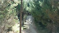
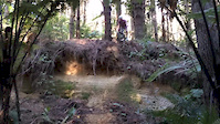
Photos of Taupo Mountain Bike
trail: Rotary Ride
10 |
Jul 1, 2022 @ 6:43pm
Jul 1, 2022
trail: W2K
23 |
Jan 8, 2022 @ 4:26pm
Jan 8, 2022
trail: W2K
132 |
Feb 13, 2019 @ 6:04pm
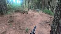
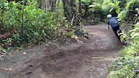
Feb 13, 2019Videos of Taupo Mountain Bike
trail: Scraggs Out
243 |
Jan 27, 2021
trail: Cole's Killer
3:14 |
551 |
Feb 3, 2020

trail: Redwoods
21:26 |
102 |
Mar 27, 2015
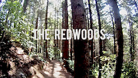
trail: Redwoods
2:10 |
88 |
Mar 27, 2015

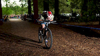
trail: Pinners
4:58 |
744 |
Feb 9, 2015
trail: Redwoods
1:09 |
152 |
Dec 28, 2014
trail: Redwoods
0:08 |
1193 |
Aug 8, 2014
trail: Redwoods
0:52 |
313 |
Aug 8, 2014
Recent Trail Reports
| status | trail | date | condition | info | user |
|---|---|---|---|---|---|
| Craters of the Moon Express Delivery | Jul 4, 2022 @ 1:27pm 2 days | Ideal | graeme-mtb | ||
| Hammer It | Jul 4, 2022 @ 1:27pm 2 days | Ideal | graeme-mtb | ||
| Spyce Girls | Jul 4, 2022 @ 1:27pm 2 days | Ideal | graeme-mtb | ||
| Zeezeetop | Jul 4, 2022 @ 1:27pm 2 days | Ideal | graeme-mtb | ||
| Dier Straights | Jul 4, 2022 @ 1:27pm 2 days | Ideal | graeme-mtb | ||
| Incline | Jul 4, 2022 @ 1:27pm 2 days | Ideal | graeme-mtb | ||
| Coaster | Jul 4, 2022 @ 1:27pm 2 days | Ideal | graeme-mtb | ||
| Nail It | Jul 4, 2022 @ 1:27pm 2 days | Ideal | graeme-mtb | ||
| Rotary Ride | Jun 27, 2022 @ 2:09pm Jun 27, 2022 | Ideal | graeme-mtb | ||
| Tongariro River Trail | Jun 15, 2022 @ 5:48pm Jun 15, 2022 | Ideal | SteveKVMYIL |
Activity Feed
| username | action | type | title | date | |
|---|---|---|---|---|---|
 | NathancmVYYb | wishlist | route | Huka Teaser 2018 | Jul 5, 2022 @ 2:22pm 13 hours |
 | graeme-mtb | add | report | Hammer It and 6 more | Jul 3, 2022 @ 10:32pm 2 days |
| graeme-mtb | add | report | Craters of the Moon Express Delivery | Jul 3, 2022 @ 10:32pm 2 days |
| dalekpredator | add | report | Jul 3, 2022 @ 2:42am Jul 3, 2022 | |
| NicholasMdEk3q | add | photo | in My City | Jul 1, 2022 @ 6:43pm Jul 1, 2022 |
Recent Comments
| username | type | title | comment | date | |
|---|---|---|---|---|---|
 | trail | Like a lot of Craters there is too much... | Jun 26, 2022 @ 3:58am Jun 26, 2022 | ||
 | trail | Good walk around the Taupo thermal landscape | Jun 25, 2022 @ 8:23pm Jun 25, 2022 | ||
| report | L | May 14, 2022 @ 3:49pm May 14, 2022 | ||
| trail | Realized this section about 3km-I had added... | May 12, 2022 @ 5:59pm May 12, 2022 | ||
| trail | Kinda boring but good for getting around the... | Apr 24, 2022 @ 7:53pm Apr 24, 2022 |
Local Badges
-

Big Ride 30k1,774 awarded -

10 Blue Trails323 awarded -

10 Green Trails355 awarded -

Completionist0 awarded -

Epic Ride 50k504 awarded -

Climbing 10k Badge72 awarded
Bike & Skill Parks
| name | type | city | rating |
|---|---|---|---|
| Taupo BMX Track | skill park | Taupo | |
| Taupo Pump Track | skill park | Taupo |
Local Trail Supporters
![Pack and Pedal Taupo]()
![BNZ]()
![Wairakei Resort]()
![Legend]()
- Placemakers Taupo
![PAK'nsave Taupo]()
![Matt Jensen Insurance Brokers]()
![Huka Cycles]()
![Vetplus]()
![Groundeffect]()
![Jensen Waymouth Lawyers]()
![Cheal Taupo]()
![Richard Chow Osteopathic Clinic]()
![The Property Store]()
- Taupo Landscapes
![Signon]()
- CSM Surveys
- Nigel and Carla Broadhurst
Activity Type Stats
| activitytype | trails | distance | descent | descent distance | total vertical | rating | global rank | state rank | photos | reports | routes | ridelogs |
|---|---|---|---|---|---|---|---|---|---|---|---|---|
| Mountain Bike | 78 | 149 miles | 21,755 ft | 59 miles | 2,753 ft | #159 | #9 | 387 | 940 | 11 | 15,309 | |
| E-Bike | 69 | 98 miles | 11,929 ft | 41 miles | 935 ft | #57 | #5 | 1 | 802 | 1 | 1,653 | |
| Hike | 34 | 104 miles | 14,810 ft | 41 miles | 2,753 ft | #494 | #13 | 836 | 188 | |||
| Trail Running | 33 | 97 miles | 14,098 ft | 38 miles | 2,753 ft | #509 | #15 | 828 | 218 |
- By canadaka
 Trailforks & contributors
 - Admins: ralley, BikeTaupõ
- #6666 - 19,493 views
- taupo activity log | embed map of Taupo mountain bike trails | taupo mountain biking points of interest
Downloading of trail gps tracks in kml & gpx formats is enabled for Taupo.
You must login to download files.