close
Trail Conditions
- Unknown
- Snow Groomed
- Snow Packed
- Snow Covered
- Snow Cover Inadequate
- Freeze/thaw Cycle
- Icy
- Prevalent Mud
- Wet
- Variable
- Ideal
- Dry
- Very Dry
Trail Flow (Ridden Direction)
Trailforks scans users ridelogs to determine the most popular direction each trail is ridden. A good flowing trail network will have most trails flowing in a single direction according to their intension.
The colour categories are based on what percentage of riders are riding a trail in its intended direction.
The colour categories are based on what percentage of riders are riding a trail in its intended direction.
- > 96%
- > 90%
- > 80%
- > 70%
- > 50%
- < 50%
- bi-directional trail
- no data
Trail Last Ridden
Trailforks scans ridelogs to determine the last time a trail was ridden.
- < 2 days
- < 1 week
- < 2 weeks
- < 1 month
- < 6 months
- > 6 months
Trail Ridden Direction
The intended direction a trail should be ridden.
- Downhill Only
- Downhill Primary
- Both Directions
- Uphill Primary
- Uphill Only
- One Direction
Contribute Details
Colors indicate trail is missing specified detail.
- Description
- Photos
- Description & Photos
- Videos
Trail Popularity ?
Trailforks scans ridelogs to determine which trails are ridden the most in the last 9 months.
Trails are compared with nearby trails in the same city region with a possible 25 colour shades.
Think of this as a heatmap, more rides = more kinetic energy = warmer colors.
- most popular
- popular
- less popular
- not popular
ATV/ORV/OHV Filter
Max Vehicle Width
inches
Radar Time
x
Activity Recordings
Trailforks users anonymized public ridelogs from the past 6 months.
- mountain biking recent
- mountain biking (>6 month)
- hiking (1 year)
- moto (1 year)
Activity Recordings
Trailforks users anonymized public skilogs from the past 12 months.
- Downhill Ski
- Backcountry Ski
- Nordic Ski
Jump Magnitude Heatmap
Heatmap of where riders jump on trails. Zoom in to see individual jumps, click circles to view jump details.
Trails Deemphasized
Trails are shown in grey.
Only show trails with NO bikes.
Save the current map location and zoom level as your default home location whenever this page is loaded.
SaveNestled in the foothills of the Beaufort Range beneath the shadow of the Comox Glacier, the historic Village of Cumberland invites you to come experience our rich history and our bright future The mix of mining and logging history has led to a vast network of old roads that are now intermixed with an ample amount of singletrack.
Cumberland has become a new mecca for riders on Vancouver Island and beyond. With the most varied selection of trails, easy access and a fabulous trail crew, it should become a regular destination for mountain bikers throughout BC and western Canada.
Be sure to visit a bike shop in Cumberland or the Comox Valley Visitor Centre to pickup one of the Cumberland trail maps!
Primary Trail Type: Cross-Country
Land Status: Managed by Local Riding Association
 google parking directions
 Access Info:
CRI gravel parking lot located at Dunsmuir Ave. and Sutton Rd.
Links
Activities Click to view
- Mountain Bike
194 trails
- Hike
187 trails
- Trail Running
187 trails
Region Details
- 46
- 1
- 8
- 85
- 37
- 12
Region Status
Caution as of Sep 11, 2021Local Trail Association
Stats
- Avg Trail Rating
- Trails (view details)
- 190
- Trails Mountain Bike
- 197
- Trails E-Bike
- 7
- Trails Hike
- 187
- Trails Trail Running
- 187
- Trails Dirtbike/Moto
- 1
- Trails ATV/ORV/OHV
- 1
- Total Distance
- 123 miles
- Total Descent
- 25,687 ft
- Total Vertical
- 1,841 ft
- Highest Trailhead
- 2,306 ft
- Reports
- 8,053
- Photos
- 2,041
- Ridden Counter
- 200,284
 Articles

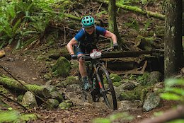
8 Days, 8 Life Lessons - BC Bike Race 2019
Jul 25, 2019 from pinkbike.com
A racer's perspective from the 2019 BC Bike Race and some advice if it's on your to-do list.
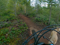
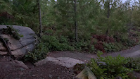
Popular Cumberland Forest Mountain Biking Trails
Cumberland Forest Mountain Bike Routes
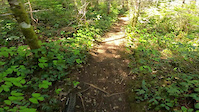
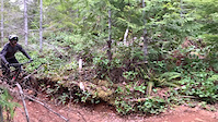
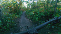
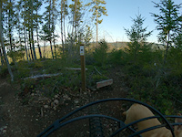
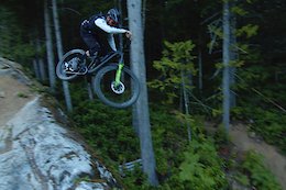
Photos of Cumberland Forest Mountain Bike
trail: Gravity
401 |
Jul 6, 2018 @ 5:19pm
Jul 6, 2018
trail: Gravity
260 |
Sep 1, 2017 @ 10:47pm
Sep 1, 2017
trail: Bear Buns
446 |
Jul 25, 2017 @ 4:07pm
Jul 25, 2017
trail: Upper Vanilla
321 |
Jun 23, 2017 @ 1:25pm
Jun 23, 2017
trail: Upper Vanilla
468 |
Jun 23, 2017 @ 1:25pm
Jun 23, 2017
trail: Upper Thirsty Beaver
548 | | 1 comments
May 7, 2017 @ 7:33pm
May 7, 2017
trail: Upper Thirsty Beaver
1,133 | | 1 comments
Jun 16, 2014 @ 4:06pm
Jun 16, 2014
trail: Tied Knot
704 |
Feb 28, 2010 @ 8:09pm
Feb 28, 2010Videos of Cumberland Forest Mountain Bike
trail: Iron Curtain
47 |
May 23, 2022
trail: DCDH
33 |
May 18, 2022
trail: 4 Pack
87 |
Nov 23, 2021

trail: Bonestorm
127 |
Jul 1, 2021
trail: Popper
|
Mar 10, 2021
trail: Knuckers
|
Mar 9, 2021

trail: Baker's Dozen
|
Jan 23, 2021
trail: Found Link
178 |
Jan 19, 2021
Current Trail Warnings
| status | trail | date | condition | user | info |
|---|---|---|---|---|---|
| 77 Sunset Strip | Jul 5, 2022 @ 12:04pm 15 hours | Dry | SurfingSARBoy | Tree down | |
| Teapot | Jul 3, 2022 @ 10:03am 3 days | Ideal | Bigbird427 | Didn't see a closed sign, others were in... | |
| That Dam Trail | Jul 3, 2022 @ 10:03am 3 days | Wet | Bigbird427 | Did not see a closed sign. running good. |
Recent Trail Reports
| status | trail | date | condition | info | user |
|---|---|---|---|---|---|
| Woodcutter | Jul 5, 2022 @ 5:36pm 9 hours | Ideal | rtwear | ||
| Short N Curly | Jul 3, 2022 @ 10:03am 3 days | Variable | Bigbird427 | ||
| Wookie Toothpicks | Jul 2, 2022 @ 11:12am Jul 2, 2022 | Ideal | cemoorelife TRAILFORKS | ||
| Upper Queso Grande | Jul 2, 2022 @ 11:12am Jul 2, 2022 | Ideal | cemoorelife TRAILFORKS | ||
| Lower Queso Grande | Jul 2, 2022 @ 11:12am Jul 2, 2022 | Ideal | cemoorelife TRAILFORKS | ||
| Access Out | Jul 2, 2022 @ 11:12am Jul 2, 2022 | Dry | cemoorelife TRAILFORKS | ||
| Garlic Bread | Jul 1, 2022 @ 2:23pm Jul 1, 2022 | Dry | theweev | ||
| Blockhead | Jul 1, 2022 @ 8:58am Jul 1, 2022 | Ideal | Bigbird427 | ||
| Old Bucket Access | Jul 1, 2022 @ 8:58am Jul 1, 2022 | Ideal | Bigbird427 | ||
| Lower Thirsty Beaver | Jul 1, 2022 @ 8:58am Jul 1, 2022 | Ideal | Bigbird427 |
Activity Feed
| username | action | type | title | date | |
|---|---|---|---|---|---|
 | cwatamaniuk | ridden | route | 2022 UROC Virtual Fiver #3 route | Jul 5, 2022 @ 7:56pm 7 hours |
 | rtwear | add | report | Woodcutter | Jul 5, 2022 @ 5:38pm 9 hours |
| cwatamaniuk | wishlist | route | 2022 UROC Virtual Fiver #3 route | Jul 5, 2022 @ 4:23pm 11 hours |
| tri193 | wishlist | route | Dodge City X 2022 Standard Bike Course and 1 more | Jul 5, 2022 @ 3:57pm 11 hours |
| brettwatson | ridden | trail | Upper Climax | Jul 5, 2022 @ 2:14pm 13 hours |
Recent Comments
| username | type | title | comment | date | |
|---|---|---|---|---|---|
 | trail | Should this not be labeled as Broadway? | Jul 3, 2022 @ 6:38pm 2 days | ||
| trail | Big step up, steep rock face into must catch u... | Jul 3, 2022 @ 8:12am 3 days | ||
| trail | Overall fun gnarly descent, didn’t notice... | Jul 3, 2022 @ 8:06am 3 days | ||
| trail | Fantastic true double black enduro line when... | Jul 3, 2022 @ 7:55am 3 days | ||
 | trail | Not the best trail in the area by a long... | Jul 2, 2022 @ 4:05pm Jul 2, 2022 |
Nearby Areas
| name | distance | ||||
|---|---|---|---|---|---|
| The Vortex | 9 | 26 | 8 | 4 km | |
| Forbidden Plateau | 9 | 14 | 47 | 3 | 4.8 km |
| Nymph Falls Park | 5 km | ||||
| Northeast Woods | 16 | 5 | 2 | 8.7 km | |
| Mount Washington | 2 | 11 | 7 | 3 | 14.9 km |
Local Badges
-

Completionist13 awarded
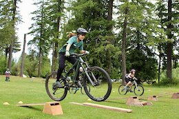
Bike & Skill Parks
| name | type | city | rating |
|---|---|---|---|
| Village Park Dirt Jump and Skate Park | skill park | Cumberland |
Local Trail Supporters
![]()
- River Rats
- UROC/Trail Harvest Crew/DMR/River Rats
- UROC/Trail Harvest Crew/DMR
- UROC/CS/DMR/River Rats
Pinkbike Articles
Jun 24, 2021
 Event Report: Connecting Sister Shredders - Cumberland, BC
Ride Like A Girl ambassador Emmy Lan organized a stoke-filled mountain bike for twenty young girls.
Jul 25, 2019
 8 Days, 8 Life Lessons - BC Bike Race 2019
A racer's perspective from the 2019 BC Bike Race and some advice if it's on your to-do list.
Oct 15, 2020
 Raw Video: Remy Metailler Sends Big Gaps in Squamish
Remy Metailler releases a raw version of his wild Squamish edit.
Activity Type Stats
| activitytype | trails | distance | descent | descent distance | total vertical | rating | global rank | state rank | photos | reports | routes | ridelogs |
|---|---|---|---|---|---|---|---|---|---|---|---|---|
| Mountain Bike | 194 | 123 miles | 25,653 ft | 58 miles | 1,841 ft | #5 | #3 | 2,034 | 8,046 | 60 | 82,601 | |
| E-Bike | 7 | 2 miles | 194 ft | 1 mile | 614 ft | 2 | 6,799 | 733 | ||||
| Hike | 187 | 117 miles | 22,520 ft | 53 miles | 1,841 ft | #2 | #2 | 7,955 | 2 | 1,088 | ||
| Trail Running | 187 | 117 miles | 22,520 ft | 53 miles | 1,841 ft | #2 | #2 | 5 | 7,955 | 5 | 3,508 | |
| Dirtbike/Moto | 1 | 3,750 ft | 52 ft | 1,844 ft | 56 ft | 3,669 | 26 | |||||
| ATV/ORV/OHV | 1 | 3,750 ft | 52 ft | 1,844 ft | 56 ft | 3,669 | 10 |
- By primodeelux
 & contributors
 - Admins: skifreak, DougalB, VoC, Forestfloor85, UROC, mrtcumberland, DougalB
- #382 - 133,900 views
- cumberland forest activity log | embed map of Cumberland Forest mountain bike trails | cumberland forest mountain biking points of interest
Downloading of trail gps tracks in kml & gpx formats is enabled for Cumberland Forest.
You must login to download files.