close
Trail Conditions
- Unknown
- Snow Groomed
- Snow Packed
- Snow Covered
- Snow Cover Inadequate
- Freeze/thaw Cycle
- Icy
- Prevalent Mud
- Wet
- Variable
- Ideal
- Dry
- Very Dry
Trail Flow (Ridden Direction)
Trailforks scans users ridelogs to determine the most popular direction each trail is ridden. A good flowing trail network will have most trails flowing in a single direction according to their intension.
The colour categories are based on what percentage of riders are riding a trail in its intended direction.
The colour categories are based on what percentage of riders are riding a trail in its intended direction.
- > 96%
- > 90%
- > 80%
- > 70%
- > 50%
- < 50%
- bi-directional trail
- no data
Trail Last Ridden
Trailforks scans ridelogs to determine the last time a trail was ridden.
- < 2 days
- < 1 week
- < 2 weeks
- < 1 month
- < 6 months
- > 6 months
Trail Ridden Direction
The intended direction a trail should be ridden.
- Downhill Only
- Downhill Primary
- Both Directions
- Uphill Primary
- Uphill Only
- One Direction
Contribute Details
Colors indicate trail is missing specified detail.
- Description
- Photos
- Description & Photos
- Videos
Trail Popularity ?
Trailforks scans ridelogs to determine which trails are ridden the most in the last 9 months.
Trails are compared with nearby trails in the same city region with a possible 25 colour shades.
Think of this as a heatmap, more rides = more kinetic energy = warmer colors.
- most popular
- popular
- less popular
- not popular
ATV/ORV/OHV Filter
Max Vehicle Width
inches
Radar Time
x
Activity Recordings
Trailforks users anonymized public ridelogs from the past 6 months.
- mountain biking recent
- mountain biking (>6 month)
- hiking (1 year)
- moto (1 year)
Activity Recordings
Trailforks users anonymized public skilogs from the past 12 months.
- Downhill Ski
- Backcountry Ski
- Nordic Ski
Jump Magnitude Heatmap
Heatmap of where riders jump on trails. Zoom in to see individual jumps, click circles to view jump details.
Trails Deemphasized
Trails are shown in grey.
Only show trails with NO bikes.
Save the current map location and zoom level as your default home location whenever this page is loaded.
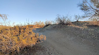
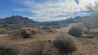
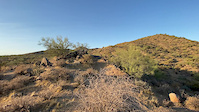
SaveXC & All-Mountain type trails in a stacked loop system on the Tonto National Forest.
Primary Trail Type: Cross-Country
Shuttleable: YES
Land Status: National Forest
Land Manager: Tonto National Forest
 google parking directions
 Activities Click to view
- Mountain Bike
86 trails
- Hike
82 trails
- Trail Running
82 trails
- Horse
9 trails
Region Details
- 1
- 22
- 34
- 23
- 5
- 1
Region Status
Open as of Dec 23, 2021Stats
- Avg Trail Rating
- Trails (view details)
- 86
- Trails Mountain Bike
- 86
- Trails Hike
- 82
- Trails Trail Running
- 82
- Trails Horse
- 9
- Total Distance
- 78 miles
- Total Descent
- 13,069 ft
- Total Vertical
- 1,344 ft
- Highest Trailhead
- 2,651 ft
- Reports
- 2,140
- Photos
- 821
- Ridden Counter
- 58,605
 Articles

Arizona's 5 Most Popular Trail Networks According to Trailforks Data
Oct 19, 2021 from pinkbike.com
The American Southwest is chock full of bucket list locales, and perhaps no single southwestern state is home to more of them than Arizona.
Popular Hawes Mountain Biking Trails
Hawes Mountain Bike Routes
| title | rating | distance |
|---|---|---|
| Hawes Sisters | 5 miles | |
| RMR loop | 9 miles | |
| Hawes Introduction | 18 miles | |
| Hawes Classic CCW | 8 miles | |
| The High Goats on Red Mountain | 15 miles | |
| West Side RMR | 11 miles | |
| Lunch Loop #2 | 7 miles | |
| Wild Horse Fun | 10 miles | |
| Lunch Lop #3 | 7 miles | |
| Lunch Loop #1 | 6 miles |
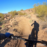
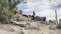
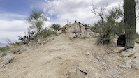
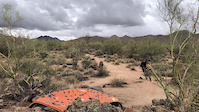
Photos of Hawes Mountain Bike
trail: L'Alpe d'Huez
112 |
Jan 14, 2021 @ 10:00am
Jan 14, 2021
trail: L'Alpe d'Huez
103 |
Jan 5, 2021 @ 8:16am
Jan 5, 2021
trail: Lower Hawes
345 |
Oct 17, 2019 @ 9:05pm
Oct 17, 2019
trail: Saddle
355 |
Oct 13, 2019 @ 7:30am
Oct 13, 2019
trail: Saddle
227 |
Oct 13, 2019 @ 7:27am
Oct 13, 2019
trail: Scorpion
118 |
Jan 27, 2019 @ 3:59pm
Jan 27, 2019
trail: Ridge
79 |
Nov 28, 2018 @ 12:00pm
Nov 28, 2018
trail: Wild Horse
347 |
Mar 3, 2015 @ 11:06am
Mar 3, 2015Videos of Hawes Mountain Bike
trail: Big Sister
187 |
Jan 3, 2022
trail: Sunset Ridge
|
Oct 26, 2021
trail: Sunset Ridge
|
Oct 26, 2021

trail: Red Mountain Rush
|
Oct 3, 2021
trail: Stinger Loop East
|
Apr 27, 2021
trail: TRW
112 |
Feb 19, 2021
trail: Pure O
423 |
Feb 19, 2021
trail: Pure O
0:07 |
|
Oct 4, 2020
Current Trail Warnings
| status | trail | date | condition | user | info |
|---|---|---|---|---|---|
| Boulderdash | Jun 8, 2022 @ 5:34am Jun 8, 2022 | Unknown | schillingsworth TRAILFORKS | Tool caches. |
Recent Trail Reports
| status | trail | date | condition | info | user |
|---|---|---|---|---|---|
| Stinger-Bush | Jul 5, 2022 @ 8:25am 19 hours | Dry | athene8 | ||
| Bush Lite Loop (East) | Jul 5, 2022 @ 8:25am 19 hours | Dry | athene8 | ||
| Bush Lite Loop (West) | Jul 5, 2022 @ 8:25am 19 hours | Dry | athene8 | ||
| Bush Lite West | Jul 5, 2022 @ 8:25am 19 hours | Dry | athene8 | ||
| Bush Lite East | Jul 5, 2022 @ 8:25am 19 hours | Dry | athene8 | ||
| Mid Hawes Alt | Jul 4, 2022 @ 5:36am 2 days | Ideal | carson-s-vanbeek | ||
| Magic Mountain | Jul 4, 2022 @ 5:36am 2 days | Ideal | carson-s-vanbeek | ||
| Lower Hawes | Jul 4, 2022 @ 5:36am 2 days | Ideal | carson-s-vanbeek | ||
| Saguaro | Jul 4, 2022 @ 5:36am 2 days | Dry | carson-s-vanbeek | ||
| Twisted Sister | Jun 30, 2022 @ 8:42am Jun 30, 2022 | Dry | athene8 |
Activity Feed
| username | action | type | title | date | |
|---|---|---|---|---|---|
 | athene8 | add | report | Stinger-Bush and 4 more | Jul 5, 2022 @ 11:14am 16 hours |
| RonaldKetelhutqTT | ridden | trail | Scorpion and 3 more | Jul 5, 2022 @ 6:51am 20 hours |
| SpankyBones | wishlist | trail | Red Mountain Rush | Jul 4, 2022 @ 9:12pm 1 day |
| Dhfalls | ridden | trail | Big Sister and 1 more | Jul 4, 2022 @ 5:26pm 1 day |
| carson-s-vanbeek | add | report | Mid Hawes Alt and 3 more | Jul 4, 2022 @ 10:57am 2 days |
Recent Comments
| username | type | title | comment | date | |
|---|---|---|---|---|---|
| trail | As of May 2022, a new sign at the bottom... | May 2, 2022 @ 11:56pm May 2, 2022 | ||
| trail | I have no idea what any of these comments are... | Apr 28, 2022 @ 8:59pm Apr 28, 2022 | ||
| trail | Unlike other nearby black diamonds, this is... | Apr 18, 2022 @ 11:58am Apr 18, 2022 | ||
 | trail | I don’t think climbing on this trail is a... | Apr 12, 2022 @ 9:38am Apr 12, 2022 | ||
| report | Aioli | Apr 10, 2022 @ 10:38am Apr 10, 2022 |
Nearby Areas
| name | distance | ||||
|---|---|---|---|---|---|
| Desert Trails Park | 2 | 4 | 1 | 3.3 km | |
| Desert Arroyo Park | 2 | 3.8 km | |||
| Usery Mountains | 20 | 9 | 9 | 3 | 4.4 km |
| Brown Mountain | 2 | 4.7 km | |||
| Tonto NF - Apache Junction | 1 | 1 | 6.9 km |
Local Badges
-

Hawes Dirty Dozen3 awarded -

Completionist0 awarded
Pinkbike Articles
Oct 19, 2021
 Arizona's 5 Most Popular Trail Networks According to Trailforks Data
The American Southwest is chock full of bucket list locales, and perhaps no single southwestern state is home to more of them than Arizona.
Oct 20, 2021
 The Most Popular Riding Areas in Arizona, Colorado, North Carolina, Oregon & Vermont According to Trailforks Data
We tasked Brice Shirbach with sifting through the data and intel on our sister site Trailforks to find out what trail networks are most popular...
May 15, 2020
 Photo Epic: #PanShotFriday - Crowd-Sourced Blur Love From The Week of May 15th
Blurry goodness to start your Friday off right.
Activity Type Stats
| activitytype | trails | distance | descent | descent distance | total vertical | rating | global rank | state rank | photos | reports | routes | ridelogs |
|---|---|---|---|---|---|---|---|---|---|---|---|---|
| Mountain Bike | 86 | 78 miles | 13,068 ft | 37 miles | 1,345 ft | #30 | #12 | 809 | 2,139 | 48 | 70,410 | |
| Hike | 82 | 77 miles | 12,808 ft | 36 miles | 1,345 ft | #17 | #9 | 12 | 2,137 | 1 | 1,477 | |
| Trail Running | 82 | 77 miles | 12,808 ft | 36 miles | 1,345 ft | #16 | #8 | 2,137 | 3 | 502 | ||
| Horse | 9 | 8 miles | 892 ft | 4 miles | 883 ft | #45 | #39 | 619 | 1 | 13 |
- By schillingsworth
 TRAILFORKS & contributors
 - Admins: apply
- #5403 - 52,677 views
- hawes activity log | embed map of Hawes mountain bike trails | hawes mountain biking points of interest
Downloading of trail gps tracks in kml & gpx formats is enabled for Hawes.
You must login to download files.