close
Trail Conditions
- Unknown
- Snow Groomed
- Snow Packed
- Snow Covered
- Snow Cover Inadequate
- Freeze/thaw Cycle
- Icy
- Prevalent Mud
- Wet
- Variable
- Ideal
- Dry
- Very Dry
Trail Flow (Ridden Direction)
Trailforks scans users ridelogs to determine the most popular direction each trail is ridden. A good flowing trail network will have most trails flowing in a single direction according to their intension.
The colour categories are based on what percentage of riders are riding a trail in its intended direction.
The colour categories are based on what percentage of riders are riding a trail in its intended direction.
- > 96%
- > 90%
- > 80%
- > 70%
- > 50%
- < 50%
- bi-directional trail
- no data
Trail Last Ridden
Trailforks scans ridelogs to determine the last time a trail was ridden.
- < 2 days
- < 1 week
- < 2 weeks
- < 1 month
- < 6 months
- > 6 months
Trail Ridden Direction
The intended direction a trail should be ridden.
- Downhill Only
- Downhill Primary
- Both Directions
- Uphill Primary
- Uphill Only
- One Direction
Contribute Details
Colors indicate trail is missing specified detail.
- Description
- Photos
- Description & Photos
- Videos
Trail Popularity ?
Trailforks scans ridelogs to determine which trails are ridden the most in the last 9 months.
Trails are compared with nearby trails in the same city region with a possible 25 colour shades.
Think of this as a heatmap, more rides = more kinetic energy = warmer colors.
- most popular
- popular
- less popular
- not popular
ATV/ORV/OHV Filter
Max Vehicle Width
inches
Radar Time
x
Activity Recordings
Trailforks users anonymized public ridelogs from the past 6 months.
- mountain biking recent
- mountain biking (>6 month)
- hiking (1 year)
- moto (1 year)
Activity Recordings
Trailforks users anonymized public skilogs from the past 12 months.
- Downhill Ski
- Backcountry Ski
- Nordic Ski
Jump Magnitude Heatmap
Heatmap of where riders jump on trails. Zoom in to see individual jumps, click circles to view jump details.
Trails Deemphasized
Trails are shown in grey.
Only show trails with NO bikes.
Save the current map location and zoom level as your default home location whenever this page is loaded.
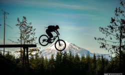
SavePhil’s Trail is a complex of intersecting trails of varying degrees of difficulty offering hundreds of miles of sweet singletrack. It is THE local’s choice for mountain biking. The trailhead is still just minutes from downtown Bend, but the opportunities for exploration are endless, as riders span out west toward Mt. Bachelor. The system reaches its apex at Swampy Sno-Park on the Cascade Lakes Highway. - See more at: http://www.visitbend.com/blog/2010/08/12/must-do-mountain-biking-phils-trail/#sthash.8NDG6r6M.dpuf
source: ...
Primary Trail Type: Cross-Country
Land Status: National Forest
 google parking directions
 Access Info:
Phil’s Trail trailhead is approximately three miles from downtown Bend. From Drake Park, travel west on Galveston Avenue (becomes Skyliners Drive) past Mt. Washington Drive until you reach a paved road on the left. Look for a sign with a biker icon. The trailhead is a half-mile further down this paved road.
Links
Region Supporters & Maintainers
![]()
Central Oregon Trail Alliance
since 1995Maintainer![]()
Central Oregon Trail AllianceBuilder
Activities Click to view
- Mountain Bike
100 trails
- E-Bike
1 trails
- Hike
98 trails
- Trail Running
98 trails
Region Details
- 21
- 3
- 31
- 31
- 10
- 2
Region Status
Open as of Apr 8, 2022Stats
- Avg Trail Rating
- Trails (view details)
- 98
- Trails Mountain Bike
- 100
- Trails E-Bike
- 1
- Trails Hike
- 98
- Trails Trail Running
- 98
- Trails Nordic Ski
- 2
- Total Distance
- 167 miles
- Total Descent
- 17,811 ft
- Total Vertical
- 3,370 ft
- Highest Trailhead
- 6,977 ft
- Reports
- 1,700
- Photos
- 600
- Ridden Counter
- 76,629
 Articles
Oregon's 5 Most Popular Trail Networks According to Trailforks Data
Oct 19, 2021 from pinkbike.com
Oregon is one of the most revered parts of the country amongst the mountain bike community, with riding opportunities that reflect the diverse...
Popular Phil's Mountain Biking Trails
Phil's Mountain Bike Routes
| title | rating | distance |
|---|---|---|
| Bens to pho | 9 miles | |
| Whoops Loop | 8 miles | |
| Quick "Best of Wanoga" rip | 10 miles | |
| Dirty Freehub: 4 Boys (Gravel Ride) | 46 miles | |
| Phil's Smorgasbord | 18 miles | |
| Ticket To Ride (Counter-Clockwise) | 6 miles | |
| Ben's - Whoops - Phil's | 15 miles | |
| Voodoo Loop | 8 miles | |
| Tiddlywinks (Upper & Lower) | 7 miles | |
| Dutchman to Bend (Flagline --> Phil's) | 23 miles |
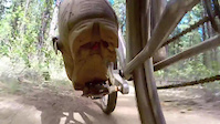
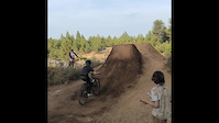
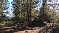
Photos of Phil's Mountain Bike
trail: Kent's Trail
165 |
Jun 1, 2019 @ 12:02am
Jun 1, 2019
trail: Kent's Trail
200 |
May 26, 2018 @ 2:11pm
May 26, 2018
trail: Phils Easy Pumptrack
298 |
Apr 26, 2018 @ 12:10am
Apr 26, 2018
trail: Marvin's Garden
131 |
Sep 26, 2017 @ 3:16pm
Sep 26, 2017
trail: Ben's Trail
287 |
Jul 23, 2017 @ 8:50am
Jul 23, 2017
trail: Mrazek
397 |
Jun 11, 2017 @ 7:52pm
Jun 11, 2017
trail: Mrazek
514 |
Jun 11, 2017 @ 7:52pm
Jun 11, 2017
trail: Phil's Trail
261 |
Nov 16, 2016 @ 4:38pm
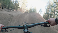
Nov 16, 2016Videos of Phil's Mountain Bike
trail: Phil's Trail
76 |
Dec 10, 2021
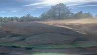
trail: The Lair
213 |
May 15, 2021
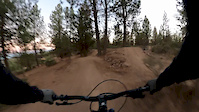
trail: The Lair
152 |
Feb 17, 2021
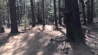
trail: The Lair
295 |
Jan 4, 2021

trail: The Lair
293 |
Nov 22, 2020
trail: The Lair
151 |
Nov 2, 2020
trail: The Lair
0:43 |
|
Oct 19, 2020
trail: Lower Whoops
0:10 |
299 |
May 7, 2020
Current Trail Warnings
| status | trail | date | condition | user | info |
|---|---|---|---|---|---|
| 310 Road (Whoops Climb) | Jun 24, 2022 @ 8:39pm Jun 24, 2022 | Dry | Gritzka1 | Strongly advise NOT using the road to... | |
| Middle Flagline | Jun 14, 2022 @ 9:00am Jun 14, 2022 | Variable | Alexbeard9 COTA | Trail closed until August 15 each summer... | |
| Storm King Trail | Jun 12, 2022 @ 11:17am Jun 12, 2022 | Ideal | swales | Riding well with a few puddles. BE AWARE... |
Recent Trail Reports
| status | trail | date | condition | info | user |
|---|---|---|---|---|---|
| COD RimRock Access | Jul 4, 2022 @ 2:47pm 2 days | Dry | mtnbkride | ||
| Marvin's Garden | Jul 4, 2022 @ 2:47pm 2 days | Dry | mtnbkride | ||
| Voodoo Child | Jul 4, 2022 @ 2:47pm 2 days | Dry | mtnbkride | ||
| LOGE Camp Skills Course | Jul 2, 2022 @ 9:34am Jul 2, 2022 | Dry | FBIIjL | ||
| Rim Rock Tunnel | Jul 1, 2022 @ 10:37am Jul 1, 2022 | Dry | mtnbkride | ||
| C.O.D. (Upper) | Jul 1, 2022 @ 10:37am Jul 1, 2022 | Dry | mtnbkride | ||
| North Fork (Tumalo Falls) | Jun 28, 2022 @ 12:37pm Jun 28, 2022 | Dry | CoreyMTBgo | ||
| Swampy/Dutchman | Jun 26, 2022 @ 4:49pm Jun 26, 2022 | Dry | wheelbreaker180 | ||
| Ticket to Ride | Jun 26, 2022 @ 1:08pm Jun 26, 2022 | Dry | Contactnicanderson | ||
| EXT | Jun 26, 2022 @ 7:52am Jun 26, 2022 | Ideal | sonofjohn |
Activity Feed
| username | action | type | title | date | |
|---|---|---|---|---|---|
 | myw | ridden | trail | South Fork Trail | Jul 5, 2022 @ 7:51pm 7 hours |
| sashpetrenko | wishlist | region | Phil's | Jul 5, 2022 @ 5:31pm 9 hours |
| TheGingerBear | wishlist | route | StormKing/Funner/TiddlyWinks/COD/Ticket2Ride | Jul 5, 2022 @ 2:54pm 12 hours |
 | Marshee | vote | trail | Upper Whoops Trail | Jul 5, 2022 @ 1:06pm 14 hours |
| Marshee | comment | trail | Upper Whoops Trail | Jul 5, 2022 @ 1:06pm 14 hours |
Recent Comments
| username | type | title | comment | date | |
|---|---|---|---|---|---|
| trail | Not as much going on as there is on the lower... | Jul 5, 2022 @ 1:06pm 14 hours | ||
 | report | S see see | Jul 2, 2022 @ 1:34pm Jul 2, 2022 | ||
| report | T. Tsqsqnzra.$—————exxxase | Jul 2, 2022 @ 1:33pm Jul 2, 2022 | ||
| trail | Pretty lame section of trails…no real uphill... | Jun 30, 2022 @ 3:22am Jun 30, 2022 | ||
| trail | If you ask me, this is the best trail in all... | Jun 27, 2022 @ 10:47am Jun 27, 2022 |
Nearby Areas
| name | distance | ||||
|---|---|---|---|---|---|
| Wanoga | 3 | 14 | 3 | 6.3 km | |
| Larkspur | 1 | 7 km | |||
| Swampy Sno-Park | 1 | 5 | 7.7 km | ||
| Horse Butte | 2 | 5 | 1 | 9.8 km | |
| Mt. Bachelor Bike Park | 2 | 15 | 7 | 1 | 13.2 km |
Local Badges
-

Completionist0 awarded
Bike & Skill Parks
| name | type | city | rating |
|---|---|---|---|
| The Lair | skill park | Bend |
Upcoming Local Events
Local Products
Pinkbike Articles
Oct 19, 2021
![Oregon's 5 Most Popular Trail Networks According to Trailforks Data]() Oregon's 5 Most Popular Trail Networks According to Trailforks Data
Oregon is one of the most revered parts of the country amongst the mountain bike community, with riding opportunities that reflect the diverse...
Aug 4, 2021
Oregon's 5 Most Popular Trail Networks According to Trailforks Data
Oregon is one of the most revered parts of the country amongst the mountain bike community, with riding opportunities that reflect the diverse...
Aug 4, 2021
![Video: Dusty Wygle Takes a Rental Bike for a Spin Around Bend, Oregon with Cam McCaul & Kyle Jameson]() Video: Dusty Wygle Takes a Rental Bike for a Spin Around Bend, Oregon with Cam McCaul & Kyle Jameson
"Get the tires off the ground?" "Oh yeah."
Jun 6, 2020
Video: Dusty Wygle Takes a Rental Bike for a Spin Around Bend, Oregon with Cam McCaul & Kyle Jameson
"Get the tires off the ground?" "Oh yeah."
Jun 6, 2020
![Video: Dirt Jump Session & Trail Bike Laps with Cam McCaul]() Video: Dirt Jump Session & Trail Bike Laps with Cam McCaul
Cam spends a full day riding with his Trail and Dirt Jump bike.
Video: Dirt Jump Session & Trail Bike Laps with Cam McCaul
Cam spends a full day riding with his Trail and Dirt Jump bike.
Local Products
Pinkbike Articles
Oct 19, 2021
 Oregon's 5 Most Popular Trail Networks According to Trailforks Data
Oregon is one of the most revered parts of the country amongst the mountain bike community, with riding opportunities that reflect the diverse...
Aug 4, 2021
 Video: Dusty Wygle Takes a Rental Bike for a Spin Around Bend, Oregon with Cam McCaul & Kyle Jameson
"Get the tires off the ground?" "Oh yeah."
Jun 6, 2020
 Video: Dirt Jump Session & Trail Bike Laps with Cam McCaul
Cam spends a full day riding with his Trail and Dirt Jump bike.
Activity Type Stats
| activitytype | trails | distance | descent | descent distance | total vertical | rating | global rank | state rank | photos | reports | routes | ridelogs |
|---|---|---|---|---|---|---|---|---|---|---|---|---|
| Mountain Bike | 100 | 167 miles | 17,812 ft | 84 miles | 3,369 ft | #34 | #15 | 593 | 1,660 | 58 | 48,727 | |
| E-Bike | 1 | 3 miles | 217 ft | 2 miles | 108 ft | #1,498 | #367 | 1,184 | 185 | |||
| Hike | 98 | 167 miles | 17,717 ft | 83 miles | 3,369 ft | #20 | #11 | 3 | 1,658 | 604 | ||
| Trail Running | 98 | 167 miles | 17,717 ft | 83 miles | 3,369 ft | #19 | #10 | 4 | 1,658 | 1,019 | ||
| Nordic Ski | 2 | 3 miles | 230 ft | 1 mile | 666 ft | 16 | 17 |
- By Bricklin69
 & contributors
 - Admins: COTA, COTA, TravisHolman, bendtrails, n-skinner, Alexbeard9, johannsdad, aiwetir, Wayfinder, sporty-nordy
- #6579 - 37,685 views
- phil's activity log | embed map of Phil's mountain bike trails | phil's mountain biking points of interest polygons
Downloading of trail gps tracks in kml & gpx formats is enabled for Phil's.
You must login to download files.