close
Trail Conditions
- Unknown
- Snow Groomed
- Snow Packed
- Snow Covered
- Snow Cover Inadequate
- Freeze/thaw Cycle
- Icy
- Prevalent Mud
- Wet
- Variable
- Ideal
- Dry
- Very Dry
Trail Flow (Ridden Direction)
Trailforks scans users ridelogs to determine the most popular direction each trail is ridden. A good flowing trail network will have most trails flowing in a single direction according to their intension.
The colour categories are based on what percentage of riders are riding a trail in its intended direction.
The colour categories are based on what percentage of riders are riding a trail in its intended direction.
- > 96%
- > 90%
- > 80%
- > 70%
- > 50%
- < 50%
- bi-directional trail
- no data
Trail Last Ridden
Trailforks scans ridelogs to determine the last time a trail was ridden.
- < 2 days
- < 1 week
- < 2 weeks
- < 1 month
- < 6 months
- > 6 months
Trail Ridden Direction
The intended direction a trail should be ridden.
- Downhill Only
- Downhill Primary
- Both Directions
- Uphill Primary
- Uphill Only
- One Direction
Contribute Details
Colors indicate trail is missing specified detail.
- Description
- Photos
- Description & Photos
- Videos
Trail Popularity ?
Trailforks scans ridelogs to determine which trails are ridden the most in the last 9 months.
Trails are compared with nearby trails in the same city region with a possible 25 colour shades.
Think of this as a heatmap, more rides = more kinetic energy = warmer colors.
- most popular
- popular
- less popular
- not popular
ATV/ORV/OHV Filter
Max Vehicle Width
inches
Radar Time
x
Activity Recordings
Trailforks users anonymized public ridelogs from the past 6 months.
- mountain biking recent
- mountain biking (>6 month)
- hiking (1 year)
- moto (1 year)
Activity Recordings
Trailforks users anonymized public skilogs from the past 12 months.
- Downhill Ski
- Backcountry Ski
- Nordic Ski
Jump Magnitude Heatmap
Heatmap of where riders jump on trails. Zoom in to see individual jumps, click circles to view jump details.
Trails Deemphasized
Trails are shown in grey.
Only show trails with NO bikes.
Save the current map location and zoom level as your default home location whenever this page is loaded.
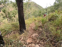
SaveTownsville's premier venue of public access XC and all mountain trails within 20 minutes of the CBD.
source: Rockwheelers Website
Primary Trail Type: Cross-Country
AKA: Douglas
Land Status: Managed by Local Riding Association
 google parking directions
 Access Info:
Head past the Hospital and University, southwest along Angus Smith Drive for a few kilometres. After the last cross street, Freshwater Drive, look for the main car park and trail head on you left.
Links
Activities Click to view
- Mountain Bike
65 trails
- E-Bike
62 trails
Region Details
- 1
- 16
- 26
- 17
- 3
- 2
Region Status
Caution as of May 18, 2022Local Trail Association
Stats
- Avg Trail Rating
- Trails (view details)
- 65
- Trails Mountain Bike
- 65
- Trails E-Bike
- 62
- Trails Hike
- 15
- Trails Trail Running
- 15
- Total Distance
- 26 miles
- Total Descent
- 7,550 ft
- Total Vertical
- 652 ft
- Highest Trailhead
- 745 ft
- Reports
- 5,133
- Photos
- 403
- Ridden Counter
- 16,180
Popular Douglas Mountain Bike Park Trails
Mountain Bike Routes
| title | rating | distance |
|---|---|---|
| 2018 XCM National Champs Course | 10 miles | |
| Bike Fix XC1 2022 | 2 miles | |
| Carpark To The Top | 3 miles | |
| Beginners Gateway to mountain biking | 3 miles | |
| Douglas Beginner Green Route | 8 miles | |
| Bike Fix XC3 2019 race | 4 miles | |
| Bike Fix XC6 2021 race | 3 miles | |
| Targa 2016 - Douglas Stage race | 8 miles | |
| race | 5 miles | |
| race | 5 miles |
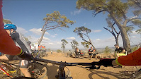
Photos of Douglas Mountain Bike Park Mountain Bike
trail: Up The Ante
17 |
Oct 26, 2021 @ 2:56pm
Oct 26, 2021
trail: Ridgeline Jumps
66 |
Sep 8, 2021 @ 4:19am
Sep 8, 2021
trail: Ridgeline Jumps
39 |
Sep 8, 2021 @ 4:18am
Sep 8, 2021
trail: Rock and Roll 2 and 3
90 |
Dec 30, 2020 @ 10:47pm
Dec 30, 2020
trail: Taipan
70 |
Nov 25, 2020 @ 4:27am
Nov 25, 2020
trail: Taipan
119 |
Jun 24, 2020 @ 3:19am
Jun 24, 2020
trail: Up The Backside
63 |
Jun 11, 2020 @ 2:04pm
Jun 11, 2020
trail: Up The Backside
33 |
Jun 11, 2020 @ 2:01pm
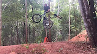
Jun 11, 2020Videos of Douglas Mountain Bike Park Mountain Bike

trail: Lower Wedgetail
0:16 |
230 |
Jun 1, 2019
trail: Lower Wedgetail
0:16 |
180 |
Jun 1, 2019

trail: Hammerhead (Upper)
0:16 |
126 |
Jun 1, 2019

trail: Whiptail
0:16 |
115 |
Jun 1, 2019
trail: Rock and Roll 2 and 3
0:59 |
214 |
Nov 10, 2018
trail: Sticks and Stones
0:36 |
724 |
Sep 19, 2018

trail: Rock and Roll 2 and 3
3:10 |
315 |
Feb 2, 2018

trail: Taipan
0:32 |
402 |
Aug 23, 2017
Recent Trail Reports
| status | trail | date | condition | info | user |
|---|---|---|---|---|---|
| Oh What A Feeling | Jun 19, 2022 @ 3:43am Jun 19, 2022 | Dry | |||
| Ridgeline (Gravity) | May 27, 2022 @ 1:54am May 27, 2022 | Variable | broso817 | ||
| Taipan | May 26, 2022 @ 4:53pm May 26, 2022 | Dry | M4tt12 | ||
| Hammerhead (Upper) | May 24, 2022 @ 6:36pm May 24, 2022 | Dry | LucianoM | ||
| Keelback (lower) | May 19, 2022 @ 5:55pm May 19, 2022 | Variable | Br3nd0n | ||
| Ring Bark Frog | May 18, 2022 @ 5:41pm May 18, 2022 | Variable | broso817 | ||
| RNR 3 A-Line | May 18, 2022 @ 3:05pm May 18, 2022 | Variable | broso817 | ||
| Rock and Roll 2 and 3 | May 18, 2022 @ 3:05pm May 18, 2022 | Variable | broso817 | ||
| Taipan B-LINE | May 18, 2022 @ 3:01pm May 18, 2022 | Unknown | broso817 | ||
| Parmi Exit | May 18, 2022 @ 2:58pm May 18, 2022 | Unknown | broso817 |
Activity Feed
| username | action | type | title | date | |
|---|---|---|---|---|---|
 | EthanKwa | wishlist | trail | Easy Street and 1 more | Jul 5, 2022 @ 9:51pm 5 hours |
| JohnEuJ3KN | ridden | trail | Ridgeline (Gravity) and 2 more | Jun 26, 2022 @ 5:45am Jun 26, 2022 |
 | Sonofhans | wishlist | region | Douglas Mountain Bike Park | Jun 18, 2022 @ 7:38pm Jun 18, 2022 |
| EthanKwa | wishlist | trail | Easy Street | Jun 14, 2022 @ 11:18pm Jun 14, 2022 |
| broso817 | ridden | poi | Drop in wood work | May 27, 2022 @ 1:54am May 27, 2022 |
Recent Comments
| username | type | title | comment | date | |
|---|---|---|---|---|---|
| trail | Good fast flow track. | Feb 14, 2022 @ 3:13am Feb 14, 2022 | ||
| trail | Good consistent climb. | Feb 14, 2022 @ 3:12am Feb 14, 2022 | ||
| trail | Nice ridgeline single track. | Feb 14, 2022 @ 3:11am Feb 14, 2022 | ||
| trail | Good consistent climb with some more... | Feb 14, 2022 @ 3:11am Feb 14, 2022 | ||
| report | Thankyou | Sep 14, 2021 @ 7:43pm Sep 14, 2021 |
Nearby Areas
| name | distance | ||||
|---|---|---|---|---|---|
| Ross River Dam | 11 | 3 | 5.4 km | ||
| Mount Stuart Downhill | 1 | 1 | 2 | 5.7 km | |
| Castle Hill | 1 | 1 | 6.4 km | ||
| Pinnacles | 7.3 km | ||||
| Cape Pallarenda | 4 | 9.5 km |
Local Badges
-

Completionist22 awarded
Bike & Skill Parks
| name | type | city | rating |
|---|---|---|---|
| Douglas Skills Park | skill park | Townsville |
Local Trail Supporters
![]()
- DH Crew
- Fazza
- Dave Bassingwait
Activity Type Stats
| activitytype | trails | distance | descent | descent distance | total vertical | rating | global rank | state rank | photos | reports | routes | ridelogs |
|---|---|---|---|---|---|---|---|---|---|---|---|---|
| Mountain Bike | 65 | 26 miles | 7,549 ft | 14 miles | 653 ft | #75 | #9 | 403 | 5,128 | 10 | 43,400 | |
| E-Bike | 62 | 25 miles | 7,418 ft | 13 miles | 653 ft | #31 | #6 | 4,822 | 2 | 1,853 | ||
| Hike | 15 | 7 miles | 2,425 ft | 3 miles | 610 ft | #46 | 3,888 | 135 | ||||
| Trail Running | 15 | 7 miles | 2,425 ft | 3 miles | 610 ft | #46 | 3,888 | 54 |
- By Rockwheelers TRMBC & contributors
- Admins: MTBA, Evocoop, rayland, TRMBC, Evocoop, broso817
- #9541 - 30,408 views
- douglas mountain bike park activity log | embed map of Douglas Mountain Bike Park mountain bike trails | douglas mountain bike park mountain biking points of interest polygons
Downloading of trail gps tracks in kml & gpx formats is enabled for Douglas Mountain Bike Park.
You must login to download files.