close
Trail Conditions
- Unknown
- Snow Groomed
- Snow Packed
- Snow Covered
- Snow Cover Inadequate
- Freeze/thaw Cycle
- Icy
- Prevalent Mud
- Wet
- Variable
- Ideal
- Dry
- Very Dry
Trail Flow (Ridden Direction)
Trailforks scans users ridelogs to determine the most popular direction each trail is ridden. A good flowing trail network will have most trails flowing in a single direction according to their intension.
The colour categories are based on what percentage of riders are riding a trail in its intended direction.
The colour categories are based on what percentage of riders are riding a trail in its intended direction.
- > 96%
- > 90%
- > 80%
- > 70%
- > 50%
- < 50%
- bi-directional trail
- no data
Trail Last Ridden
Trailforks scans ridelogs to determine the last time a trail was ridden.
- < 2 days
- < 1 week
- < 2 weeks
- < 1 month
- < 6 months
- > 6 months
Trail Ridden Direction
The intended direction a trail should be ridden.
- Downhill Only
- Downhill Primary
- Both Directions
- Uphill Primary
- Uphill Only
- One Direction
Contribute Details
Colors indicate trail is missing specified detail.
- Description
- Photos
- Description & Photos
- Videos
Trail Popularity ?
Trailforks scans ridelogs to determine which trails are ridden the most in the last 9 months.
Trails are compared with nearby trails in the same city region with a possible 25 colour shades.
Think of this as a heatmap, more rides = more kinetic energy = warmer colors.
- most popular
- popular
- less popular
- not popular
ATV/ORV/OHV Filter
Max Vehicle Width
inches
Radar Time
x
Activity Recordings
Trailforks users anonymized public ridelogs from the past 6 months.
- mountain biking recent
- mountain biking (>6 month)
- hiking (1 year)
- moto (1 year)
Activity Recordings
Trailforks users anonymized public skilogs from the past 12 months.
- Downhill Ski
- Backcountry Ski
- Nordic Ski
Jump Magnitude Heatmap
Heatmap of where riders jump on trails. Zoom in to see individual jumps, click circles to view jump details.
Trails Deemphasized
Trails are shown in grey.
Only show trails with NO bikes.
Save the current map location and zoom level as your default home location whenever this page is loaded.
SaveEnglish Version Below
Collserola consta de territorios de 9 municipios (Barcelona, Cerdanyola del Vallès, Esplugues de Llobregat, Molins de Rei, Montcada i Reixac, el Papiol, Sant Cugat del Vallès, Sant Feliu de Llobregat y Sant Just Desvern) - pero los limites entre los territorios no son visibles en Trailforks.
La Serra de Collserola , o simplemente Collserola, es una cadena montañosa y parque natural (flora, fauna y terreno protegidos) entre los ríos Besòs y Llobregat.
Hay más de 250 km de senderos para caminatas en todo Collserola, donde el ciclismo está oficialmente permitido.
Los trenes aptos para bicicletas en España significan que un viaje a través de Collserola no necesariamente tiene que ser una ruta circular, porque el transporte público se puede encontrar en todos los lados fuera de las montañas, e incluso en el medio (Vallvidrera / [L = https: //www.trailforks.com/trails/les-planes-173471/] Les Planes [/L] / La Floresta).
Más información: Las montañas de Collserola son parte de la Cordillera Costera Catalana, separan Barcelona de la llanura del Vallès y su pico más alto es el [L = https: //www.trailforks.com/trails/tibidabo/] Tibidabo [/ L], a 512 m. Otras cumbres principales son: Turó del Puig, Puig d'Olorda, Turó de Valldaura, Turó de la Magarola, Puig d'Ossa y Puig Madrona. Los valles de los ríos Llobregat y Besós, la llanura de Barcelona y la cuenca del Vallès, marcan los límites geográficos del macizo de Collserola.
El Parque Natural Collserola ha publicado reglas y letreros, que prohíben explícitamente las bicicletas de descenso, y prohíben andar en bicicleta en general cuando no se sigue la red de caminos que deben tener 3 metros de ancho o más, o sea, todas las traileras
También hay un límite de velocidad de 20 km / h, y las carreras están prohibidas, organizadas o espontaneas.
Estas reglas de uso excesivamente restrictivas están ahora bajo evaluación gracias al trabajo de la CSRC en colaboración con Federació Catalana de Ciclisme e IMBA-ES. Si quieres defender el uso de la BTT, no dudéis en unirte a ellos.
Los peatones siempre tienen prioridad Por favor, disminuye la velocidad a su alrededor, y siempre respeta el estado de la naturaleza en los bordes de las traileras.
Fuente: https://www.parcnaturalcollserola.cat/collserola-en-bici/
Esa misma página también muestra las rutas donde se permiten bicicletas.
También ten cuidado con los caballos durante el día y los jabalíes por la noche.
English Version
rating system used in Spain is the European variant, green blue red black, known in Trailforks as "UK", but also promoted officially by IMBA Spain: https://www.imba.com.es/images/imba/docs/trail_solutions_2018.pdf - page 22
The Serra de Collserola, or simply Collserola, is a mountain range and Natural Park (protected flora, fauna, and terrain) between the rivers Besòs and Llobregat.
There are more than 250 km of hike paths all across Collserola, where biking is officially allowed.
Bike-friendly trains in Spain mean that a trip through Collserola doesn't necessarily have to be a loop route, because public transport can be found on all sides outside of the mountains, and even right through the middle (Vallvidrera / Les Planes / La Floresta).
More info: The Collserola mountains is part of the Catalan Coastal Range, separate Barcelona from the Vallès plain and their tallest peak is the Tibidabo, at 512 m. Other main summits are: Turó del Puig, Puig d'Olorda, Turó de Valldaura, Turó de la Magarola, Puig d'Ossa, and Puig Madrona. The valleys of the Llobregat and Besós Rivers, the plain of Barcelona, and the Vallès basin, mark the geographical boundaries of the Collserola massif.
The Natural Park Collserola has published rules and posted signs, which prohibit Downhill bikes explicitly, and prohibit biking in general when not following the network of paths which must be 3 meters wide or more, that is, all single tracks .
There is also a 20 km/h speed limit, and racing is prohibited.
These overly restrictive rules are now under full consideration thanks to the work of CSRC , in Collaboration with the “Federacio Catalana de Ciclisme” and IMBA-ES. If you want to support local MTB at Collserola don’t hesitate in joining them.
Pedestrians ALWAYS have priority [/B}. Please slow down around them. Also please respect to the upmost extend the natural environment immediately around the trails.
Source: https://www.parcnaturalcollserola.cat/collserola-en-bici/
That same page also shows the paths where bicycles are allowed.
Also watch out for horses during the day, and boars at night.
source: Wikipedia
Primary Trail Type: Cross-Country
AKA: Serra de Collserola
Land Status: National Park
 google parking directions
 Disclaimer:
El Parque Natural Collserola ha publicado reglas y letreros, que prohíben explícitamente las bicicletas de descenso, y prohíben andar en bicicleta en general cuando no se sigue la red de caminos que deben tener 3 metros de ancho o más, o sea, todas las traileras
También hay un límite de velocidad de 20 km / h, y las carreras están prohibidas, organizadas o espontaneas.
The Natural Park Collserola has published rules and posted signs, which prohibit Downhill bikes explicitly, and prohibit biking in general when not following the network of paths which must be 3 meters wide or more, that is, all Single Tracks.
There is also a 20 km/h speed limit, and racing is prohibited.
Pedestrians have priority. Please slow down around them. Also watch out for horses during the day, and boars at night.
Source: https://www.parcnaturalcollserola.cat/collserola-en-bici/
That same page also shows the paths where bicycles are allowed.
Links
This region uses the Uk/Euro style trail grading system.
Activities Click to view
- Mountain Bike
923 trails
- E-Bike
923 trails
- Hike
931 trails
- Trail Running
913 trails
- Horse
86 trails
Region Details
- 313
- 207
- 258
- 110
- 32
- 3
Region Status
Open as of Jun 6, 2020Stats
- Avg Trail Rating
- Trails (view details)
- 943
- Trails Mountain Bike
- 923
- Trails E-Bike
- 923
- Trails Hike
- 931
- Trails Trail Running
- 913
- Trails Horse
- 86
- Total Distance
- 398 miles
- Total Descent
- 114,853 ft
- Total Vertical
- 1,585 ft
- Highest Trailhead
- 1,670 ft
- Reports
- 6,996
- Photos
- 617
- Ridden Counter
- 111,643
Popular Collserola Mountain Biking Trails
Collserola Mountain Bike Routes
| title | rating | distance |
|---|---|---|
| Poblenou - Montcada - Tibidabo | 37.4 km | |
| Intense Enduro, western Collserola, e-bike | 29.3 km | |
| XC Colleserola Loop | 28.0 km | |
| Tiets | 26.2 km | |
| Mtb Tibidabo | 30.0 km | |
| Acueducto Completa | 37.4 km | |
| Travessant Collserola per la Vall de Gausac | 27.8 km | |
| Vueltita Roja por Muralla China | 27.1 km | |
| Collserola Clasic Trails | 19.9 km | |
| 2019 Collserola 100 | 103.6 km |
Photos of Collserola Mountain Bike
trail: Muralla Xina connection
13 |
May 3, 2022 @ 1:32pm
May 3, 2022
trail: Sadako Vertical
5 |
Apr 30, 2022 @ 2:38am
Apr 30, 2022
trail: Sadako Vertical
9 |
Apr 30, 2022 @ 2:38am
Apr 30, 2022
trail: Pursuit Jump
5 |
Apr 28, 2022 @ 1:32pm
Apr 28, 2022
trail: Acceso Lago Can Borrell
4 |
Apr 28, 2022 @ 1:24pm
Apr 28, 2022
trail: Acceso Lago Can Borrell
14 |
Apr 28, 2022 @ 1:24pm
Apr 28, 2022
trail: Tibidabo
12 |
Apr 18, 2022 @ 9:52am
Apr 18, 2022Videos of Collserola Mountain Bike

trail: Pajaros
73 |
Jan 27, 2022
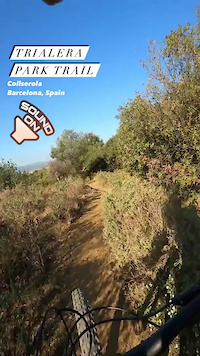
trail: Trialera Park
25 |
Jan 27, 2022
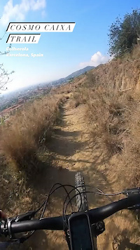
trail: Cosmo Caixa
35 |
Jan 27, 2022
trail: Pared P6 Extrema
30 |
Dec 27, 2021

31 |
Oct 25, 2021
trail: Karton Trail
75 |
Jun 23, 2021
trail: Kamikaze Can Catà
141 |
Jan 14, 2021

trail: Font Vella a Tres Fonts
24 |
Jan 14, 2021
Current Trail Warnings
| status | trail | date | condition | user | info |
|---|---|---|---|---|---|
| Oncle Benet | Jun 26, 2022 @ 9:31am Jun 26, 2022 | Dry | jum4l0 | Árbol caído en medio del camino que... | |
| Pla dels Maduixers | Jun 20, 2022 @ 9:15am Jun 20, 2022 | Dry | FrancescoGbb | Overgrown vegetation | |
| Torrent d´en Fotja | Jun 11, 2022 @ 2:44pm Jun 11, 2022 | Dry | Nagova87 | Casi impracticable. vegetación crecida,... |
Recent Trail Reports
| status | trail | date | condition | info | user |
|---|---|---|---|---|---|
| Jurassic Trail | Jul 4, 2022 @ 1:55am 2 days | Very Dry | XPUIG | ||
| Fast & Furious | Jul 4, 2022 @ 1:55am 2 days | Very Dry | XPUIG | ||
| Camí de Cal Roldan | Jul 2, 2022 @ 10:33pm Jul 2, 2022 | Dry | kai-bcn | ||
| Camí de Can Gelabert | Jul 2, 2022 @ 10:33pm Jul 2, 2022 | Dry | kai-bcn | ||
| Can Gelabert Off-Piste | Jul 2, 2022 @ 10:33pm Jul 2, 2022 | Dry | kai-bcn | ||
| Corriol de Can Solanes - Tiet Mèlich | Jul 2, 2022 @ 10:33pm Jul 2, 2022 | Dry | kai-bcn | ||
| Oncle Josep / Coll d'en Solanes a Pg. Muntanya | Jul 2, 2022 @ 10:33pm Jul 2, 2022 | Dry | kai-bcn | ||
| Corriol dels Ametllers | Jul 2, 2022 @ 10:33pm Jul 2, 2022 | Dry | kai-bcn | ||
| Font de Can Merlès | Jul 2, 2022 @ 10:33pm Jul 2, 2022 | Dry | kai-bcn | ||
| La Corta (entre Can Merlès y las Murallas) | Jul 2, 2022 @ 10:33pm Jul 2, 2022 | Dry | kai-bcn |
Activity Feed
| username | action | type | title | date | |
|---|---|---|---|---|---|
 | albpi | ridden | route | Acueducto Completa | Jul 5, 2022 @ 5:28am 21 hours |
| vnxkmc5l | wishlist | region | Collserola | Jul 5, 2022 @ 3:02am 24 hours |
 | Pillulako | wishlist | trail | GdC kilometrica - Hiperespacio | Jul 5, 2022 @ 2:11am 1 day |
| Anurag966 | wishlist | route | Vueltita Roja por Muralla China and 1 more | Jul 4, 2022 @ 2:04am 2 days |
| XPUIG | add | report | Jurassic Trail and 1 more | Jul 4, 2022 @ 1:56am 2 days |
Recent Comments
| username | type | title | comment | date | |
|---|---|---|---|---|---|
 | trail | Get your best XC friends slightly tipsy with... | Jun 27, 2022 @ 1:32pm Jun 27, 2022 | ||
| trail | Thank you for this message. I tried to clean... | Jun 11, 2022 @ 9:02am Jun 11, 2022 | ||
| trail | Zona privada, NO USAR | Jun 8, 2022 @ 3:52pm Jun 8, 2022 | ||
 | trail | Where the red trail goes on dragon khan there... | Jun 3, 2022 @ 7:24am Jun 3, 2022 | ||
 | trail | La cambio a roja. Si al final la haces me... | May 24, 2022 @ 10:50am May 24, 2022 |
Nearby Areas
| name | distance | ||||
|---|---|---|---|---|---|
| Els Tres Turons | 6 | 6 | 3.1 km | ||
| Montjuic | 20 | 15 | 5.6 km | ||
| Rubike Naturpark | 6.2 km | ||||
| Serra de Galliners | 10 | 9 | 6.6 km | ||
| El Remei Bikepark | 1 | 2 | 6.8 km |
Local Badges
-

Completionist0 awarded
Activity Type Stats
| activitytype | trails | distance | descent | descent distance | total vertical | rating | global rank | state rank | photos | reports | routes | ridelogs |
|---|---|---|---|---|---|---|---|---|---|---|---|---|
| Mountain Bike | 923 | 391 miles | 112,346 ft | 224 miles | 1,585 ft | #22 | #1 | 602 | 6,994 | 21 | 42,553 | |
| E-Bike | 923 | 391 miles | 112,346 ft | 224 miles | 1,585 ft | #11 | #1 | 1 | 6,587 | 11 | 3,012 | |
| Hike | 931 | 396 miles | 113,878 ft | 227 miles | 1,585 ft | #14 | #1 | 2 | 6,848 | 1 | 667 | |
| Trail Running | 913 | 392 miles | 111,841 ft | 225 miles | 1,585 ft | #13 | #1 | 12 | 6,789 | 2,662 | ||
| Horse | 86 | 56 miles | 7,625 ft | 23 miles | 1,362 ft | #510 | #6 | 437 |
- By JaumeAmoros & contributors
- Admins: kai-bcn
- #9809 - 38,057 views
- collserola activity log | embed map of Collserola mountain bike trails | collserola mountain biking points of interest polygons
Downloading of trail gps tracks in kml & gpx formats is enabled for Collserola.
You must login to download files.