close
Trail Conditions
- Unknown
- Snow Groomed
- Snow Packed
- Snow Covered
- Snow Cover Inadequate
- Freeze/thaw Cycle
- Icy
- Prevalent Mud
- Wet
- Variable
- Ideal
- Dry
- Very Dry
Trail Flow (Ridden Direction)
Trailforks scans users ridelogs to determine the most popular direction each trail is ridden. A good flowing trail network will have most trails flowing in a single direction according to their intension.
The colour categories are based on what percentage of riders are riding a trail in its intended direction.
The colour categories are based on what percentage of riders are riding a trail in its intended direction.
- > 96%
- > 90%
- > 80%
- > 70%
- > 50%
- < 50%
- bi-directional trail
- no data
Trail Last Ridden
Trailforks scans ridelogs to determine the last time a trail was ridden.
- < 2 days
- < 1 week
- < 2 weeks
- < 1 month
- < 6 months
- > 6 months
Trail Ridden Direction
The intended direction a trail should be ridden.
- Downhill Only
- Downhill Primary
- Both Directions
- Uphill Primary
- Uphill Only
- One Direction
Contribute Details
Colors indicate trail is missing specified detail.
- Description
- Photos
- Description & Photos
- Videos
Trail Popularity ?
Trailforks scans ridelogs to determine which trails are ridden the most in the last 9 months.
Trails are compared with nearby trails in the same city region with a possible 25 colour shades.
Think of this as a heatmap, more rides = more kinetic energy = warmer colors.
- most popular
- popular
- less popular
- not popular
ATV/ORV/OHV Filter
Max Vehicle Width
inches
Radar Time
x
Activity Recordings
Trailforks users anonymized public ridelogs from the past 6 months.
- mountain biking recent
- mountain biking (>6 month)
- hiking (1 year)
- moto (1 year)
Activity Recordings
Trailforks users anonymized public skilogs from the past 12 months.
- Downhill Ski
- Backcountry Ski
- Nordic Ski
Jump Magnitude Heatmap
Heatmap of where riders jump on trails. Zoom in to see individual jumps, click circles to view jump details.
Trails Deemphasized
Trails are shown in grey.
Only show trails with NO bikes.
Save the current map location and zoom level as your default home location whenever this page is loaded.
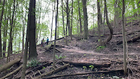
SaveLocated in the heart of Toronto, the Don Valley offers a wide assortment of trail opportunities. With trails ranging from wide-open single track, to flowy ravine-wall trails, to tight man-made TTFs, the Don has something for every level of mountain biker.
**Note: Some trails are rated with a higher degree of difficulty due to high exposure level/consequence-of-failure.**
**Note: Some trails are rated with a higher degree of difficulty due to high exposure level/consequence-of-failure.**
Primary Trail Type: Cross-Country
eBikes Allowed:
Yes
Land Status: City Managed
Land Manager: City of Toronto / Toronto Region Conservation Authority
 google parking directions
 Activities Click to view
- Mountain Bike
374 trails
- E-Bike
292 trails
- Hike
379 trails
- Trail Running
370 trails
Region Details
- 95
- 32
- 87
- 80
- 56
- 12
Region Status
Open as of Apr 5, 2021Local Trail Association
Stats
- Avg Trail Rating
- Trails (view details)
- 373
- Trails Mountain Bike
- 374
- Trails E-Bike
- 292
- Trails Hike
- 379
- Trails Trail Running
- 370
- Trails Horse
- 2
- Trails Snowshoe
- 238
- Trails Nordic Ski
- 50
- Total Distance
- 107 miles
- Total Descent
- 8,778 ft
- Total Vertical
- 431 ft
- Highest Trailhead
- 680 ft
- Reports
- 11,258
- Photos
- 1,010
- Ridden Counter
- 108,628
Popular Don Valley Mountain Biking Trails
Don Valley Mountain Bike Routes
| title | rating | distance |
|---|---|---|
| 100k In The Don (Almost) No Repeats | 59 miles | |
| CXCT (Cyclocross Central Toronto) | 14 miles | |
| Don Valley Big North Loop - Loblaws parking | 14 miles | |
| Beaver Flats | Motown | Kit Sink | Trash Panda | 11 miles | |
| Don Valley Comp Badge 80k Challenge | 51 miles | |
| Don Valley North Trails Loop | 6 miles | |
| Round the Valley Hard Ride | 18 miles | |
| Don Valley Big North Loop | 16 miles | |
| The Don to Highland Creek | 36 miles | |
| 55k of Fun In The Don | 35 miles |
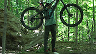
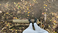
Photos of Don Valley Mountain Bike
trail: Climbmax
24 |
Jun 29, 2022 @ 7:54am
Jun 29, 2022
trail: Rail Siding
1 |
Jun 20, 2022 @ 11:28am
Jun 20, 2022
trail: Rail Siding
1 |
Jun 20, 2022 @ 11:28am
Jun 20, 2022
trail: Rail Siding
1 |
Jun 20, 2022 @ 11:28am
Jun 20, 2022
trail: Rail Siding
14 |
Jun 20, 2022 @ 11:28am
Jun 20, 2022
trail: ET Seton Park East
18 |
Jun 3, 2022 @ 7:08am
Jun 3, 2022
trail: The Flats
297 |
Jun 27, 2019 @ 8:44am
Jun 27, 2019
trail: The Flats
902 |
May 3, 2015 @ 5:19pm
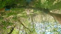
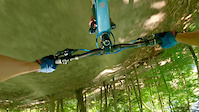
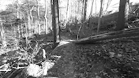
May 3, 2015Videos of Don Valley Mountain Bike
trail: Wilket Creek
9 |
Jun 24, 2022
trail: Donaconda
94 |
May 16, 2022

trail: Fruitloop
50 |
May 15, 2022

trail: Fruitloop
|
May 15, 2022
trail: Jump The Gundy
151 |
Mar 4, 2022
trail: Trash Panda
54 |
Jan 17, 2022
trail: Wilket Creek
146 |
Nov 1, 2021
trail: Climbmax
238 |
Oct 4, 2021
Current Trail Warnings
| status | trail | date | condition | user | info |
|---|---|---|---|---|---|
| Garb City | Jul 2, 2022 @ 1:07pm Jul 2, 2022 | Very Dry | jb-K | Major issue with the bridge. It is... | |
| Fiveplay | Jul 2, 2022 @ 12:27pm Jul 2, 2022 | Very Dry | natedagreat | Tree down on first climb | |
| Nipple Slip | Jun 26, 2022 @ 1:22pm Jun 26, 2022 | Very Dry | natedagreat |
Recent Trail Reports
| status | trail | date | condition | info | user |
|---|---|---|---|---|---|
| RollerFlowster | Jul 4, 2022 @ 6:18pm 1 day | Very Dry | Rbrown78nova | ||
| Short 'n Sweet | Jul 4, 2022 @ 5:41pm 1 day | Ideal | spyman1980 | ||
| Over The Rainbow | Jul 4, 2022 @ 12:32pm 2 days | Dry | stuvie | ||
| New Day Rising | Jul 4, 2022 @ 12:16pm 2 days | Dry | stuvie | ||
| Donaconda | Jul 3, 2022 @ 2:56pm 3 days | Dry | natedagreat | ||
| Beechwood Access Trail | Jul 3, 2022 @ 2:56pm 3 days | Dry | natedagreat | ||
| The Ridge | Jul 3, 2022 @ 2:56pm 3 days | Very Dry | natedagreat | ||
| E.T. Seton Access Road | Jul 3, 2022 @ 2:56pm 3 days | Dry | natedagreat | ||
| Motown | Jul 3, 2022 @ 2:56pm 3 days | Very Dry | natedagreat | ||
| Dr. Quads | Jul 3, 2022 @ 2:56pm 3 days | Very Dry | natedagreat |
Activity Feed
| username | action | type | title | date | |
|---|---|---|---|---|---|
 | zhabzadik | wishlist | route | 100k In The Don (Almost) No Repeats | Jul 5, 2022 @ 4:35am 22 hours |
 | Rbrown78nova | add | report | RollerFlowster | Jul 4, 2022 @ 6:18pm 1 day |
| spyman1980 | add | report | Short 'n Sweet | Jul 4, 2022 @ 5:53pm 1 day |
 | natedagreat | comment | report | New Day Rising | Jul 4, 2022 @ 3:30pm 1 day |
 | stuvie | comment | report | New Day Rising | Jul 4, 2022 @ 12:31pm 2 days |
Recent Comments
| username | type | title | comment | date | |
|---|---|---|---|---|---|
| report | Sweet! Thank you! | Jul 4, 2022 @ 3:30pm 1 day | ||
| report | hey Nate, I cleared up all the downed trees.... | Jul 4, 2022 @ 12:31pm 2 days | ||
 | trail | Tree down, requiring a full dismount before... | Jul 3, 2022 @ 5:12pm 2 days | ||
| trail | There has been some damage to the bridge. It... | Jul 2, 2022 @ 1:12pm Jul 2, 2022 | ||
| trail | Sky Pilot is the best option when the fences... | Jun 23, 2022 @ 7:33pm Jun 23, 2022 |
Nearby Areas
| name | distance | ||||
|---|---|---|---|---|---|
| Crothers Woods | 5 | 13 | 1.5 km | ||
| Don Valley Brick Works Park | 2.2 km | ||||
| Warden Woods | 8 | 5 | 4 | 5 | 2.7 km |
| David A. Balfour Ravine Park | 4 | 5 | 1 | 3 km | |
| The Quarry | 3.1 km |
Local Badges
-

Completionist5 awarded
Bike & Skill Parks
| name | type | city | rating |
|---|---|---|---|
| Crother's Woods Skill Park / Pump Track | skill park | Toronto |
Activity Type Stats
| activitytype | trails | distance | descent | descent distance | total vertical | rating | global rank | state rank | photos | reports | routes | ridelogs |
|---|---|---|---|---|---|---|---|---|---|---|---|---|
| Mountain Bike | 374 | 104 miles | 8,553 ft | 38 miles | 430 ft | #17 | #1 | 998 | 11,200 | 21 | 39,785 | |
| E-Bike | 292 | 89 miles | 7,080 ft | 33 miles | 295 ft | #9 | #1 | 10,538 | 8 | 98 | ||
| Hike | 379 | 106 miles | 8,665 ft | 38 miles | 430 ft | #10 | #1 | 15 | 11,110 | 4 | 1,236 | |
| Trail Running | 370 | 104 miles | 8,264 ft | 37 miles | 430 ft | #9 | #1 | 1 | 11,094 | 4 | 2,225 | |
| Horse | 2 | 2 miles | 56 ft | 2,864 ft | 85 ft | 1,424 | 1 | |||||
| Snowshoe | 238 | 73 miles | 5,364 ft | 26 miles | 295 ft | 224 | 15 | |||||
| Nordic Ski | 50 | 25 miles | 994 ft | 7 miles | 295 ft | 118 | 19 |
- By brenthillier
 NSMBA TRAILFORKS & contributors
 - Admins: Wyrmblight, TORONTO
- #3300 - 174,929 views
- don valley activity log | embed map of Don Valley mountain bike trails | don valley mountain biking points of interest polygons
-
- subscribe
- 3d map
Downloading of trail gps tracks in kml & gpx formats is enabled for Don Valley.
You must login to download files.