close
Trail Conditions
- Unknown
- Snow Groomed
- Snow Packed
- Snow Covered
- Snow Cover Inadequate
- Freeze/thaw Cycle
- Icy
- Prevalent Mud
- Wet
- Variable
- Ideal
- Dry
- Very Dry
Trail Flow (Ridden Direction)
Trailforks scans users ridelogs to determine the most popular direction each trail is ridden. A good flowing trail network will have most trails flowing in a single direction according to their intension.
The colour categories are based on what percentage of riders are riding a trail in its intended direction.
The colour categories are based on what percentage of riders are riding a trail in its intended direction.
- > 96%
- > 90%
- > 80%
- > 70%
- > 50%
- < 50%
- bi-directional trail
- no data
Trail Last Ridden
Trailforks scans ridelogs to determine the last time a trail was ridden.
- < 2 days
- < 1 week
- < 2 weeks
- < 1 month
- < 6 months
- > 6 months
Trail Ridden Direction
The intended direction a trail should be ridden.
- Downhill Only
- Downhill Primary
- Both Directions
- Uphill Primary
- Uphill Only
- One Direction
Contribute Details
Colors indicate trail is missing specified detail.
- Description
- Photos
- Description & Photos
- Videos
Trail Popularity ?
Trailforks scans ridelogs to determine which trails are ridden the most in the last 9 months.
Trails are compared with nearby trails in the same city region with a possible 25 colour shades.
Think of this as a heatmap, more rides = more kinetic energy = warmer colors.
- most popular
- popular
- less popular
- not popular
ATV/ORV/OHV Filter
Max Vehicle Width
inches
Radar Time
x
Activity Recordings
Trailforks users anonymized public ridelogs from the past 6 months.
- mountain biking recent
- mountain biking (>6 month)
- hiking (1 year)
- moto (1 year)
Activity Recordings
Trailforks users anonymized public skilogs from the past 12 months.
- Downhill Ski
- Backcountry Ski
- Nordic Ski
Jump Magnitude Heatmap
Heatmap of where riders jump on trails. Zoom in to see individual jumps, click circles to view jump details.
Trails Deemphasized
Trails are shown in grey.
Only show trails with NO bikes.
Save the current map location and zoom level as your default home location whenever this page is loaded.
Save
No description for Phoenix Mountain Preserve has been added yet!
Login or register to submit one.
 google parking directions
google parking directions Activities Click to view
- Mountain Bike
99 trails
- E-Bike
104 trails
- Hike
103 trails
- Trail Running
103 trails
Region Details
- 7
- 1
- 18
- 50
- 21
- 2
Region Status
Open as of Jun 8, 2022Stats
- Avg Trail Rating
- Trails (view details)
- 104
- Trails Mountain Bike
- 99
- Trails E-Bike
- 104
- Trails Hike
- 103
- Trails Trail Running
- 103
- Trails Horse
- 10
- Total Distance
- 93 miles
- Total Descent
- 12,508 ft
- Total Vertical
- 1,373 ft
- Highest Trailhead
- 2,588 ft
- Reports
- 1,276
- Photos
- 310
- Ridden Counter
- 35,786
Popular Phoenix Mountain Preserve Trails
Mountain Bike Routes
| title | rating | distance |
|---|---|---|
| Friday evening climbs | 8 miles | |
| East Valley Stroll | 8 miles | |
| UpHill Both Ways | 6 miles | |
| Trail 100 intermediate | 5 miles | |
| DAISY MOUNTAIN Lower | 5 miles | |
| 24 mile Phoenix Mountains Preserve Ride | popular ridelog | 24 miles |
| 4 mile Phoenix Mountains Preserve Ride | popular ridelog | 4 miles |
| 4 mile Phoenix Mountains Preserve Ride | popular ridelog | 4 miles |
| 6 mile Phoenix Mountains Preserve Ride | popular ridelog | 6 miles |
| 7 mile Phoenix Mountains Preserve Ride | popular ridelog | 7 miles |
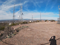
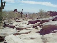
Photos of Phoenix Mountain Preserve Mountain Bike
Videos of Phoenix Mountain Preserve Mountain Bike
trail: Shaw Butte (306)
7:11 |
124 |
Jan 11, 2019
trail: Dreamy Draw (Connect)
2:16 |
79 |
Jul 23, 2018
trail: Rocky Road
0:13 |
495 |
Jun 7, 2014

trail: Irregular Link
10:39 |
70 |
Dec 13, 2021 , Phoenix

trail: 220 Conn
10:39 |
39 |
Dec 13, 2021 , Phoenix

trail: Christiansen (100)
10:39 |
46 |
Dec 13, 2021 , Phoenix

trail: Dreamy Draw (NW)
10:39 |
50 |
Dec 13, 2021 , Phoenix

trail: Chutes
10:39 |
65 |
Dec 13, 2021 , Phoenix
Recent Trail Reports
| status | trail | date | condition | info | user |
|---|---|---|---|---|---|
| Hairpin Alley | Jun 8, 2022 @ 9:30pm Jun 8, 2022 | Dry | redrum20 | ||
| Kata Klimb to Devil's Descent | Jun 5, 2022 @ 11:16am Jun 5, 2022 | Very Dry | 5SOuMNoT | ||
| Carolinement | May 29, 2022 @ 5:43am May 29, 2022 | Very Dry | Jibro | ||
| Off the Driveway | May 29, 2022 @ 5:43am May 29, 2022 | Very Dry | Jibro | ||
| Cheesecake | May 29, 2022 @ 5:43am May 29, 2022 | Very Dry | Jibro | ||
| CMC 100 Access | May 20, 2022 @ 6:08am May 20, 2022 | Dry | Adato | ||
| CMC (100/306) | May 20, 2022 @ 6:08am May 20, 2022 | Dry | Adato | ||
| Bypass | May 20, 2022 @ 6:08am May 20, 2022 | Dry | Adato | ||
| North Mountain Visitor Center | May 20, 2022 @ 6:08am May 20, 2022 | Dry | Adato | ||
| 306 Parallel | May 20, 2022 @ 6:08am May 20, 2022 | Dry | Adato |
Activity Feed
| username | action | type | title | date | |
|---|---|---|---|---|---|
 | JuanRochin1 | wishlist | trail | Charles M. Christiansen (100) | Jul 4, 2022 @ 9:43pm 1 day |
| azflyer21 | wishlist | trail | Zipper | Jun 29, 2022 @ 10:50am Jun 29, 2022 |
| Krazywake | vote | poi | Cheesegrater | Jun 29, 2022 @ 6:19am Jun 29, 2022 |
| Krazywake | ridden | poi | Cheesegrater | Jun 29, 2022 @ 6:19am Jun 29, 2022 |
| 5SOuMNoT | difficultyvote | trail | Heritage Run | Jun 26, 2022 @ 8:03pm Jun 26, 2022 |
Recent Comments
| username | type | title | comment | date | |
|---|---|---|---|---|---|
| trail | awesome mtb loop little drops some tight stuff... | May 24, 2022 @ 7:14pm May 24, 2022 | ||
| trail | Fun trail. Rocky and fast. Plenty of line... | Apr 15, 2022 @ 3:36am Apr 15, 2022 | ||
 | trail | First time doing the loop, rode CCW as... | Mar 20, 2022 @ 9:33pm Mar 20, 2022 | ||
| trail | Connector from the parking lot to the... | Mar 20, 2022 @ 8:54pm Mar 20, 2022 | ||
| trail | A nice green trail, most rocks can be avoided... | Mar 20, 2022 @ 8:48pm Mar 20, 2022 |
Nearby Areas
| name | distance | ||||
|---|---|---|---|---|---|
| Echo Canyon Recreation Area | 6.1 km | ||||
| Papago Park | 27 | 8 | 10.3 km | ||
| Rio Salado Habitat Restoration Area | 10.6 km | ||||
| Thunderbird | 3 | 7 | 4 | 2 | 11.7 km |
| Deem Hills | 1 | 5 | 1 | 12.5 km |
Local Badges
-

Completionist1 awarded
Activity Type Stats
| activitytype | trails | distance | descent | descent distance | total vertical | rating | global rank | state rank | photos | reports | routes | ridelogs |
|---|---|---|---|---|---|---|---|---|---|---|---|---|
| Mountain Bike | 99 | 90 miles | 11,673 ft | 32 miles | 1,175 ft | #64 | #25 | 287 | 1,265 | 5 | 35,579 | |
| E-Bike | 104 | 93 miles | 12,507 ft | 32 miles | 1,375 ft | #29 | #9 | 1,166 | 485 | |||
| Hike | 103 | 93 miles | 12,487 ft | 32 miles | 1,375 ft | #43 | #22 | 22 | 1,263 | 11 | 3,274 | |
| Trail Running | 103 | 93 miles | 12,487 ft | 32 miles | 1,375 ft | #42 | #21 | 1 | 1,261 | 1 | 1,036 | |
| Horse | 10 | 8 miles | 728 ft | 2 miles | 682 ft | 603 | 2 |
- By todd
 Trailforks & contributors
 - Admins: GROAZ, RangerSzopinski
- #4992 - 24,512 views
- phoenix mountain preserve activity log | embed map of Phoenix Mountain Preserve mountain bike trails | phoenix mountain preserve mountain biking points of interest
Downloading of trail gps tracks in kml & gpx formats is enabled for Phoenix Mountain Preserve.
You must login to download files.