We had intended to release a small update during the winter to add winter trail support, but it grew into a much larger update and was delayed. So, sorry to those that were waiting for the winter trails. The good news is there is a ton of other new features and refinements!
Get the Trailforks app here.
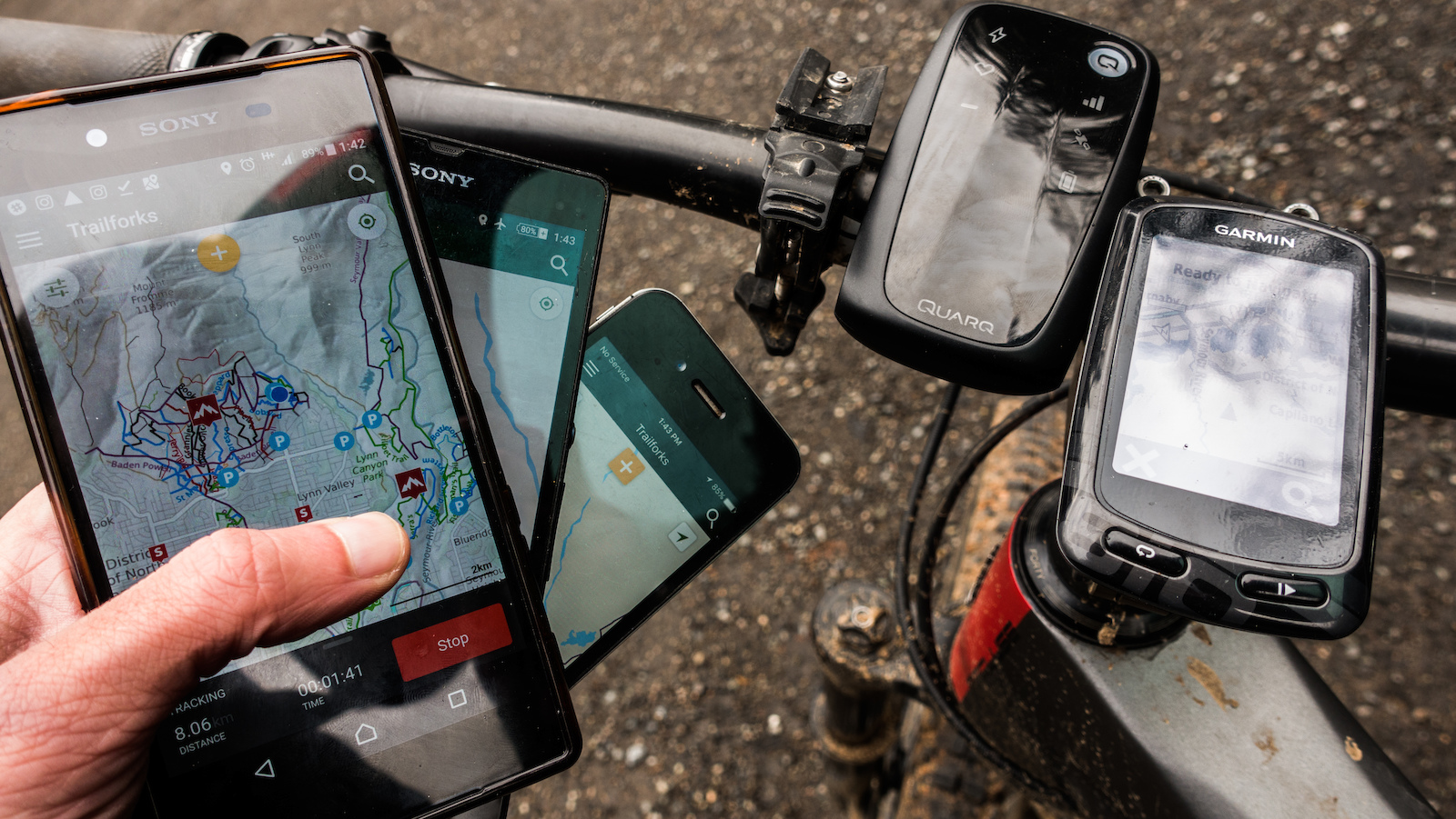
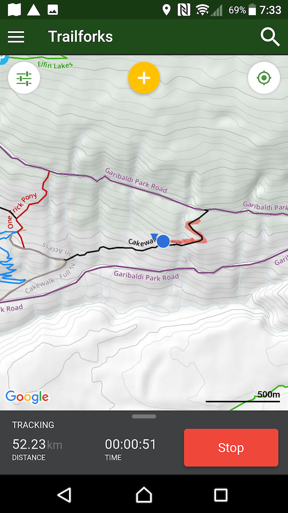
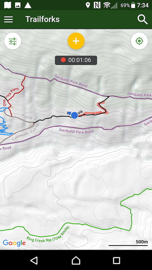
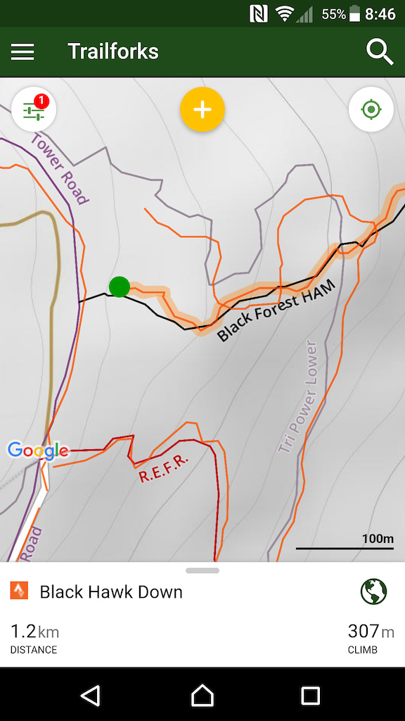
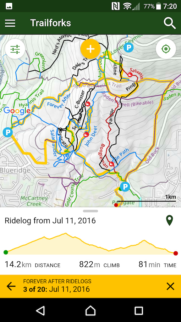
Experimental GPS Tracking!
This has long been our number one requested feature. We aren't ready to roll it out 100%, but this update contains an option within the app's GPS settings to enable experimental GPS tracking, so you can start using and testing it!
As a navigation app, it is really valuable being able to see where you've been on the trail map because it makes it easier to orientate yourself and find your route. The tracking feature is pretty simple, if you are a rider that likes to record all their fitness data with various devices, your best to stick with something like Strava. But if you just want to record your ride with a simple start/stop interface and provide trail usage data to the local trail associations, then this is for you. You can save your ride when you're done and upload it to Trailforks as a ridelog. If you have your Stava account connected to Trailforks you can sync this to your Strava account.
The tracking works in the background, so it will use more battery to get your location constantly when your screen is off or the Trailforks app is not the active app. Being super nerds we have taken extreme measures to make sure that Trailforks tracking is power efficient.
Please let us know how the tracking works or if you encounter issues.

Strava
You can now connect your Stava account to Trailforks from within the Trailforks app. So you can start syncing your Strava rides with Trailforks.
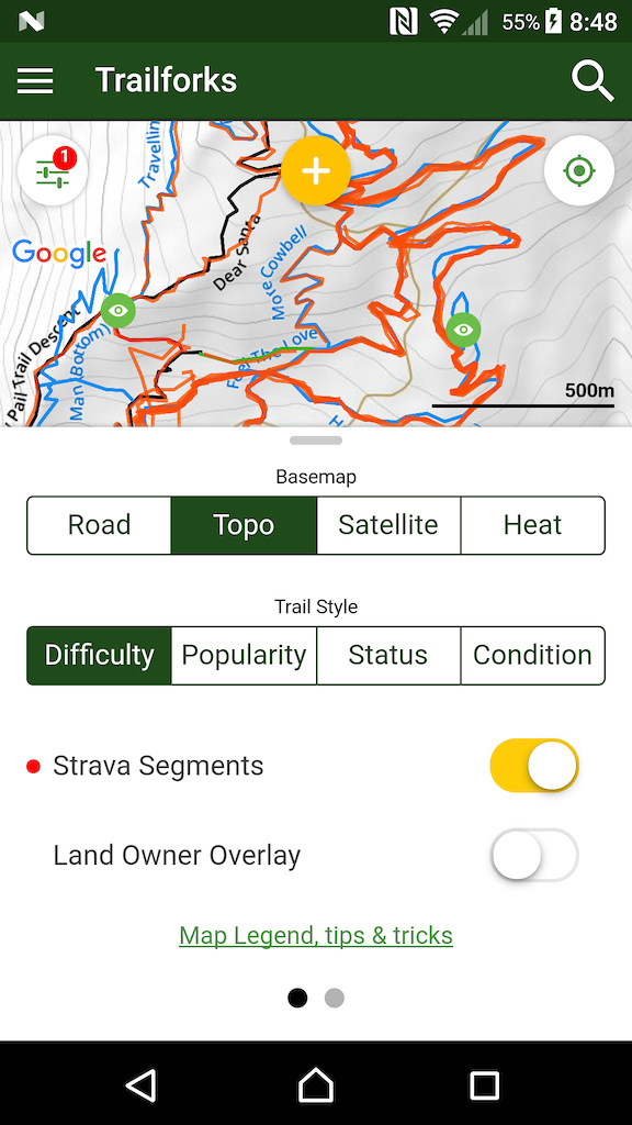
For those competitive Strava users, we have a super cool new feature for you! You can toggle on Strava segments to show on the map. Segments are often not right at the start and end of a trail, so being able to see the segment in relation to the overal trail network map can help you know where to start and end a run. You can click the segment on the map to load its details in the Strava app.
Please note you must zoom in close to the trails before the Strava segments load.
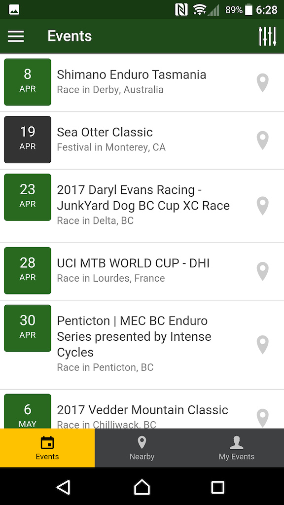
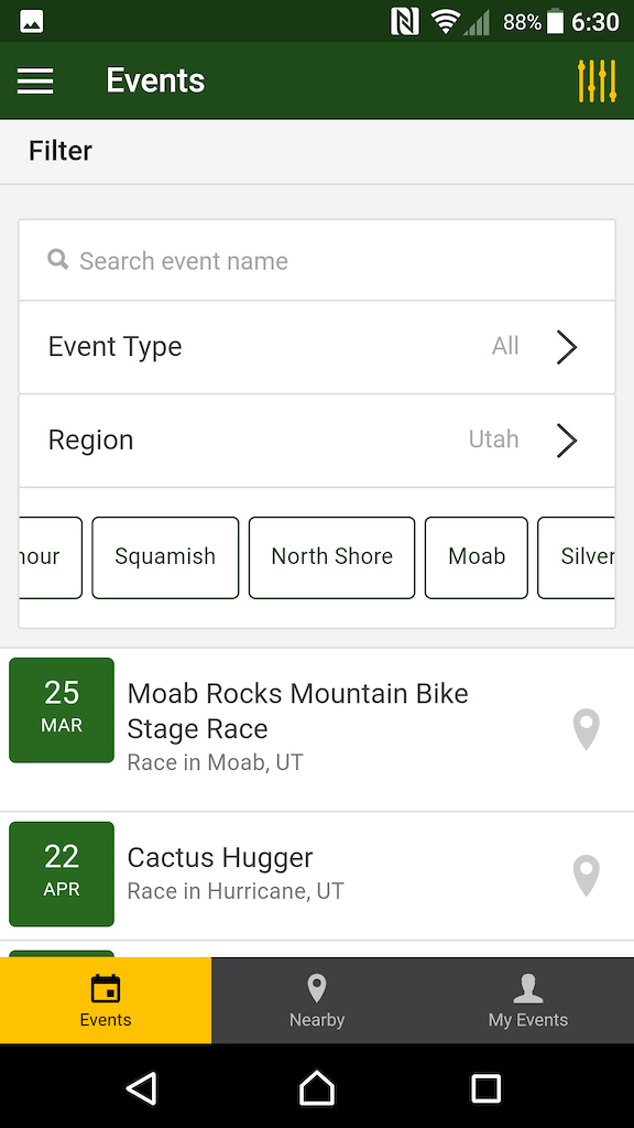
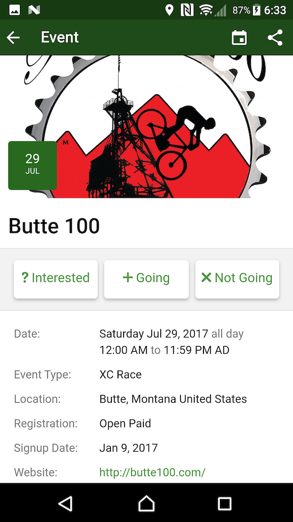
Events Section
The Trailforks website has been collecting mountain biking events such as races for several months now. We are building a global calendar of race events customized for your location. In this app update you can view the listing of events customized for your user, view nearby events or your personal events calendar. Routes can be attached to events, making it easier to find & follow the route for an upcoming race you want to get some practice riding on.
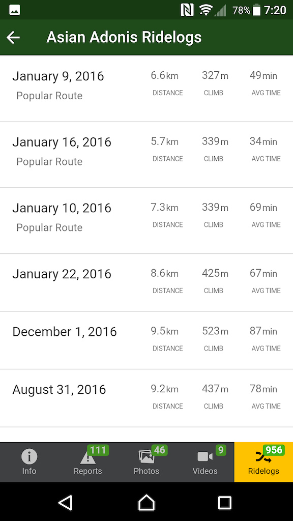
Popular Routes
Want to find out in what order to ride trails in a new riding area? When viewing a trail's ridelogs tab, we now sort the most popular routes to the top of the list. We recently scanned over 1 million user ridelogs to programmatically determine the most popular routes people ride in each riding area. You can simply look at any trail and in this way see what the most popular route/ride is that includes this trail. This is the best way to figure out how and what to ride when you are in a new area.
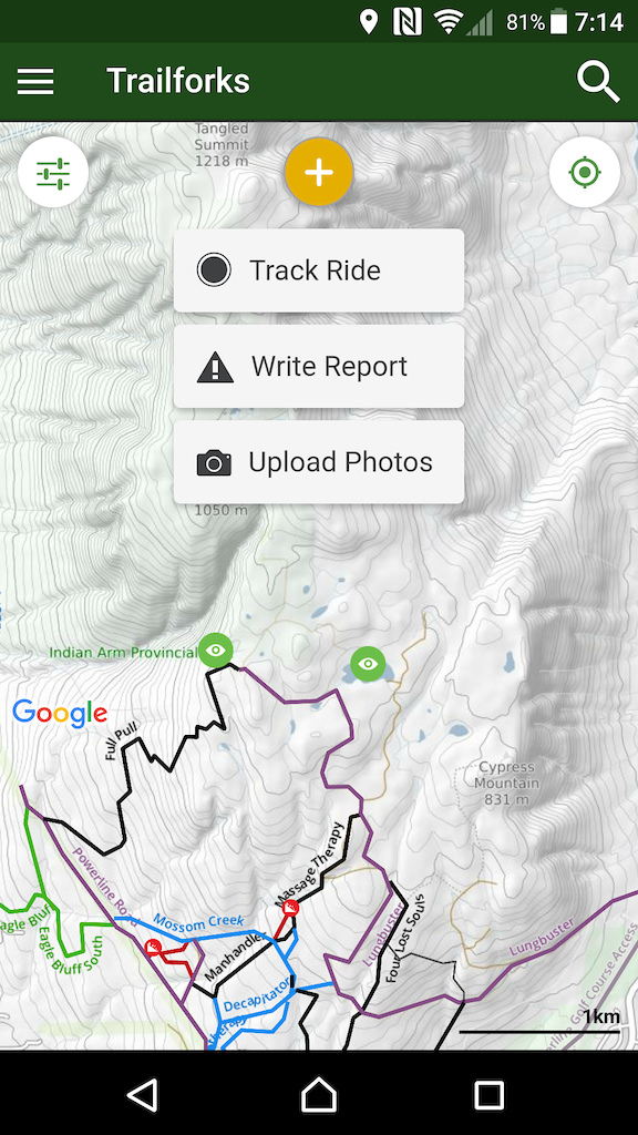
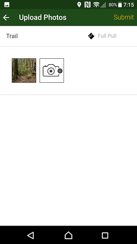
New Contribute Button
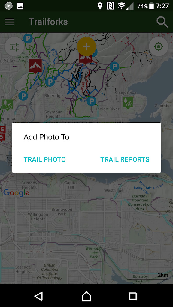
We've moved where you go to submit a trail report from the main menu to the new yellow contribute button at the top of the map. This button will host links to all the types of content you can "contribute" to Trailforks. We've had the option to upload photos to a trail without being tied to a report for awhile, but this feature was hard to find, it's easy to find in the new contribute menu.
This button has a handy time saving feature, if you first select a trail on the map so it's highlighted, then open the contribute menu to submit a report or a photo, it will pre-populate the trail with the one you had selected on the map!
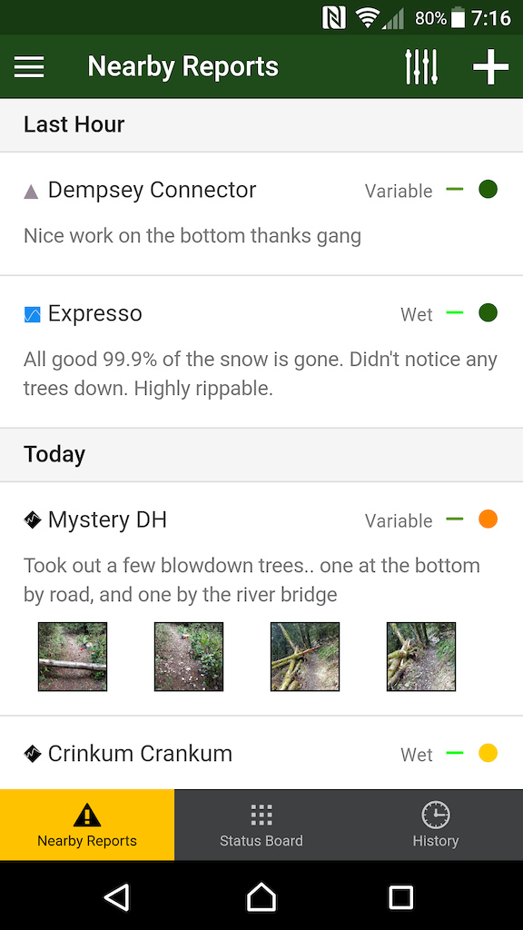
New Reports Section
Since the report form is now accessed via the Contribute button mentioned above, we've changed the functionality of the "Trail Reports" section accessed via the main menu. This section is now focusing on viewing reports, rather than creating them. The nearby reports is now front and center with a better design to show you all the info at a glance.
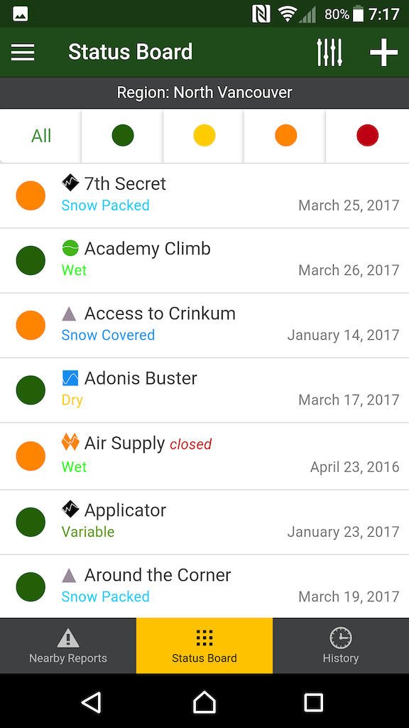
There is a new page called "Status Board" think of this like a status board at a ski mountain. It will list all the trails alphabetically listing each trails current status. You can quickly filter the list with the status buttons at the top.
Both these pages can be filtered, if you rather have them show reports & status for only a specific region you can do so. The region you select will also be saved each time you visit.
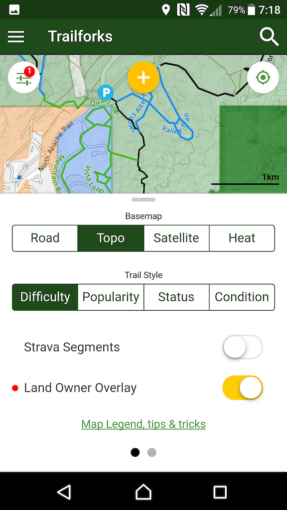
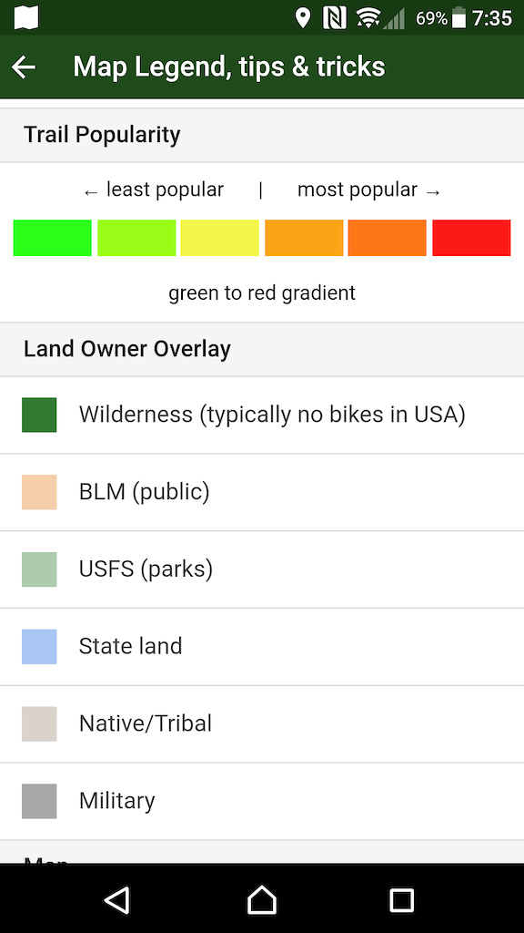
US Land Owner Map Layer
The landowner map overlay we created for the website is now available in the app!
Related to this the app will also show "planned trails" now. They will be thinner lines on the map. So region admins adding hidden planned trails can use the app in the field.
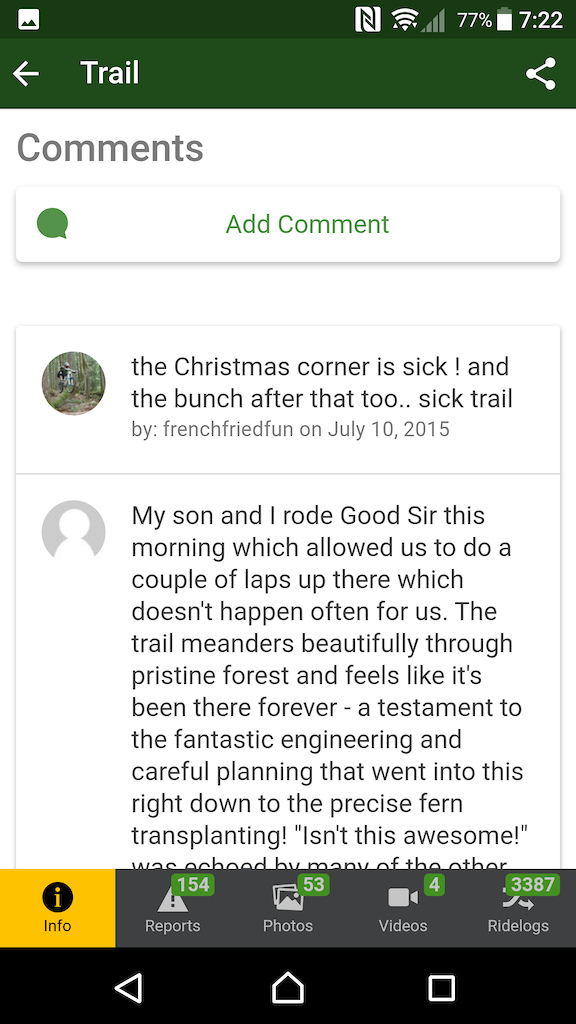
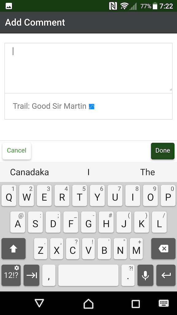
Comments
Comments can now be viewed and posted in the app for trails, routes, reports & events.
Sharing
Ridelog & rideplans now have a detail page in the app. When viewing a detail page for a route, ridelog or rideplan there is a share icon in the top right. Allowing you to share this route with a friend. This sharing will include a link when clicked, and if that friend has the Trailforks app installed it will open that route in the app. If they don't have the region installed where the route resides, no worries, the route will download in the background and be available to view.
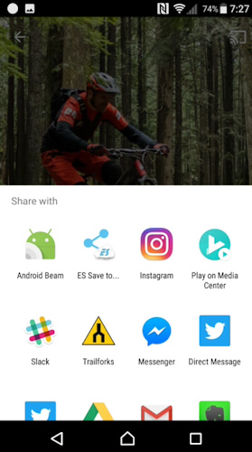
Android users can now share photos to the Trailforks app. Select a photo or photos with your favourite photo viewing app and Trailforks will be listed among the apps to share the photo with. When Trailforks launches it will prompt what you want to do with this photo.
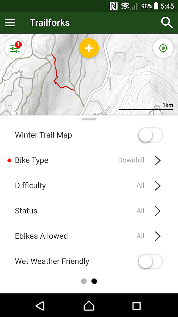
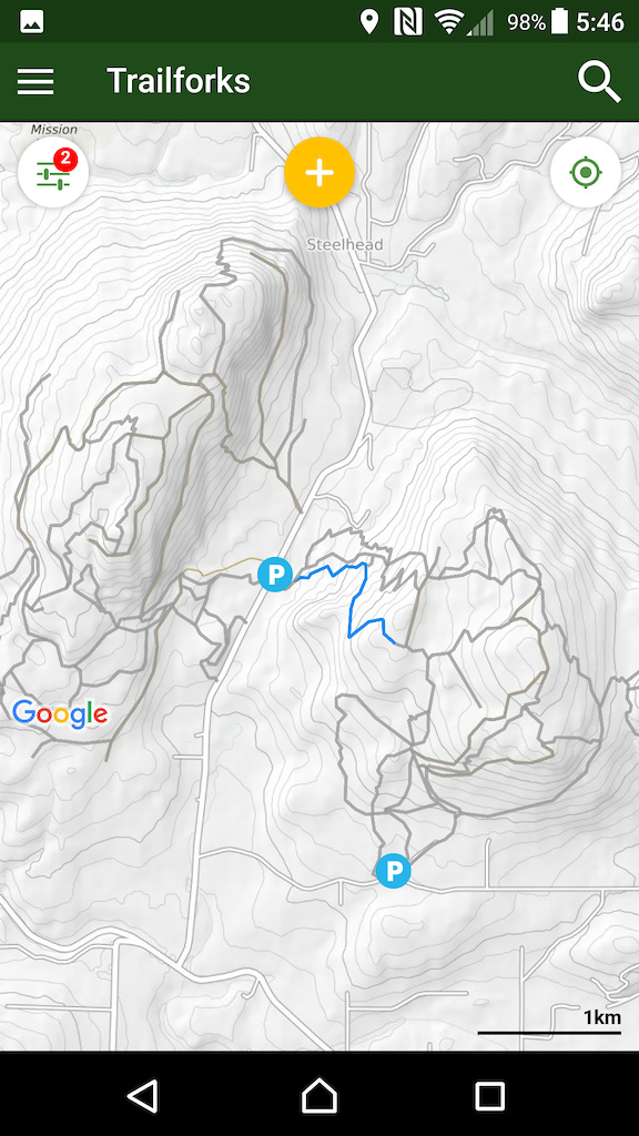
Map Trail Filtering
We've added the ability to filter the trails shown on the map using a new UI in the map settings panel. Trails matching the selected filters will be shown as normal, all other trails will be greyed out. This is especially useful for adaptive mountain bikers or eBike owners to see what trails they can or are allowed to ride on.
Trails can also be tagged as "wet weather friendly" to better educate riders which trails are suitable to be ridden in wet conditions.
The map settings panel is now paged, to accommodate these new map filters. Swipe left/right to switch panels. The map settings button will show a small red number indicating how many filters are enabled.
Many other sections of the app have more filtering as well, for example the trails wishlist can now be filtered to only show trails in a specific region.
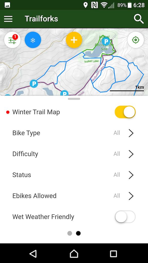
Winter Trail Map
Many riding areas around the world have separate trail networks in the winter, these winter trails often only exist in the winter and overlap summer trails. So a separate winter only map is needed.
The Trailforks website has been mapping winter trails for over a year now. So now you can toggle the app to show the winter trail map, to view these winter trail networks.
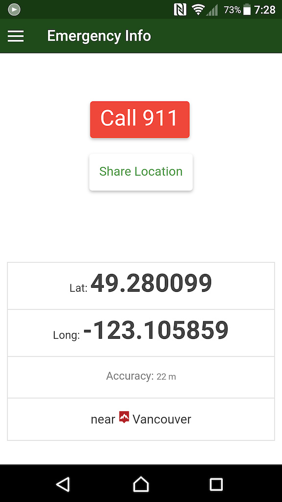
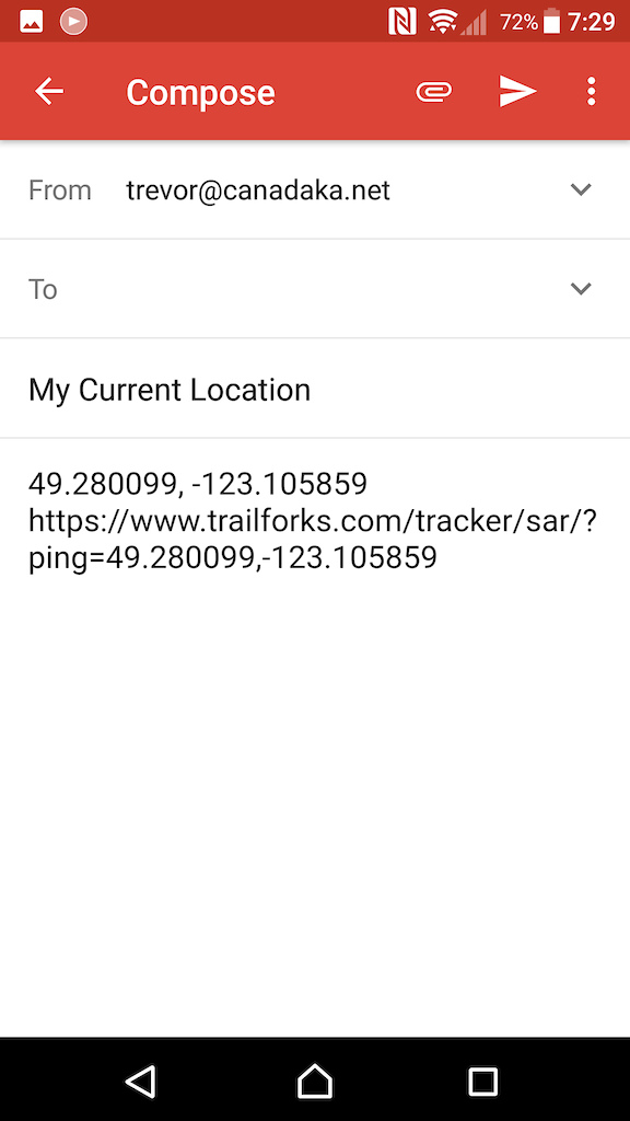
Share Location Link
The emergency page now has an additional button, which will share a message with the app of your choosing; for example, a TXT message. This message will include a link to a map showing your current location. You can use this to aid search & rescue or simply to let a friend know where you are on the trails.
Map Longpress Elevation
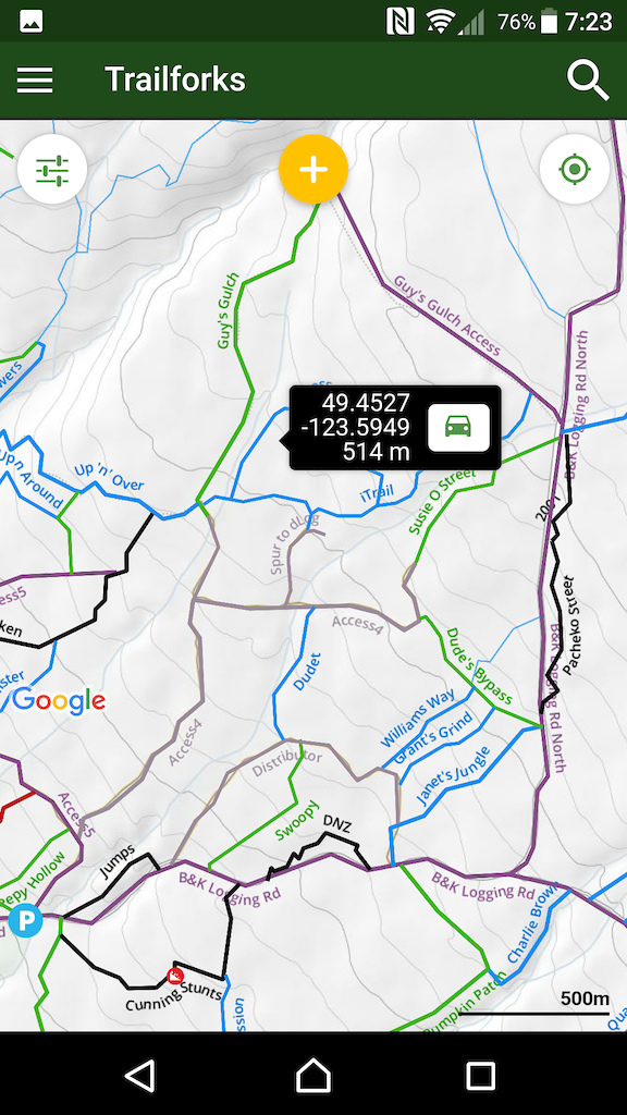
A small handy new feature, when you longpress on the map, a small bubble pops up like before with your lat/long. But now the elevation of that point is also included.
This feature only works if you have a data connection.
This feature only works if you have a data connection.
Other Changes
There are hundreds of other small refinements and fixes that we continue to make based on user feedback and our own usage. Here are a few.
- Users karma regions sycned in background
- Trail & region content counters synced in background
- Reports and photo uploads now have a background task
- When trail is selected on report form, the most recent report for that trail is shown at bottom for reference
- Clicking a report or event from a list and going back, will return you to that scroll spot on the list
- Region filter on routes page
- Fix iOS users reporting invisible text in report description field
- Fix photos are not rotated when taken vertically
- Improved legend page layout
- Improve list scroll speed
- iOS users can now copy and paste
- iOS users can choose Waze as directions app
- better handling of opening driving directions app
- More directory listing types shown on map, tour guides, shuttle companies,
- Allow bike park regions to have a custom emergency contact number
- Quick filter list of your faved regions
- List your faved regions in account page
- wishlist & faved buttons on regions
- 5-star rating for routes
- wishlist & ridden buttons on routes
- directions link on skillpark POI
- change trail & route start & end markers to be different shape for color blind users
If you’re enjoying the app, please take the time to leave us a review, it really helps us out!