close
Trail Conditions
- Unknown
- Snow Groomed
- Snow Packed
- Snow Covered
- Snow Cover Inadequate
- Freeze/thaw Cycle
- Icy
- Prevalent Mud
- Wet
- Variable
- Ideal
- Dry
- Very Dry
Trail Flow (Ridden Direction)
Trailforks scans users ridelogs to determine the most popular direction each trail is ridden. A good flowing trail network will have most trails flowing in a single direction according to their intension.
The colour categories are based on what percentage of riders are riding a trail in its intended direction.
The colour categories are based on what percentage of riders are riding a trail in its intended direction.
- > 96%
- > 90%
- > 80%
- > 70%
- > 50%
- < 50%
- bi-directional trail
- no data
Trail Last Ridden
Trailforks scans ridelogs to determine the last time a trail was ridden.
- < 2 days
- < 1 week
- < 2 weeks
- < 1 month
- < 6 months
- > 6 months
Trail Ridden Direction
The intended direction a trail should be ridden.
- Downhill Only
- Downhill Primary
- Both Directions
- Uphill Primary
- Uphill Only
- One Direction
Contribute Details
Colors indicate trail is missing specified detail.
- Description
- Photos
- Description & Photos
- Videos
Trail Popularity ?
Trailforks scans ridelogs to determine which trails are ridden the most in the last 9 months.
Trails are compared with nearby trails in the same city region with a possible 25 colour shades.
Think of this as a heatmap, more rides = more kinetic energy = warmer colors.
- most popular
- popular
- less popular
- not popular
ATV/ORV/OHV Filter
Max Vehicle Width
inches
Radar Time
x
Activity Recordings
Trailforks users anonymized public ridelogs from the past 6 months.
- mountain biking recent
- mountain biking (>6 month)
- hiking (1 year)
- moto (1 year)
Activity Recordings
Trailforks users anonymized public skilogs from the past 12 months.
- Downhill Ski
- Backcountry Ski
- Nordic Ski
Jump Magnitude Heatmap
Heatmap of where riders jump on trails. Zoom in to see individual jumps, click circles to view jump details.
Trails Deemphasized
Trails are shown in grey.
Only show trails with NO bikes.
Save the current map location and zoom level as your default home location whenever this page is loaded.
Save
No description for Brunei has been added yet!
Login or register to submit one.
Region Details
- 3
- 15
- 76
- 8
- 1
Stats
- Avg Trail Rating
- Trails (view details)
- 103
- Trails Mountain Bike
- 103
- Trails E-Bike
- 21
- Trails Hike
- 94
- Trails Trail Running
- 93
- Total Distance
- 52 miles
- Total Descent
- 9,029 ft
- Total Vertical
- 1,016 ft
- Highest Trailhead
- 1,056 ft
- Reports
- 68
- Photos
- 67
- Ridden Counter
- 1,558
Sub Regions
- Bandar Seri Begawan (69)
- Agro (4)
- Hutan Simpan Berakas (HSB) (20)
- Serubing Subok (4)
- Spg 67 Subok (11)
- Sungai Akar (11)
- UTB (20)
- Kuala Belait (9)
- Labi (2)
- Labi (1)
- Tutong (19)
- Bukit Ambok (0)
- Bukit Ambok (0)
- Bukit Panggal (4)
- Sungai Liang (11)
Popular Brunei Mountain Biking Trails
| status | title | difficulty | rating |
|---|---|---|---|
| Warmup climb to mushroom hut Hutan Simpan Berakas (HSB) | |||
| Climb to Duncan's Hole Hutan Simpan Berakas (HSB) | |||
| Kumanda Trail UTB | |||
| Amilee UTB | |||
| ELBN trail UTB | |||
| Sofa Trail UTB | |||
| Kingkong Trail UTB | |||
| Water Tank to Fathill Park UTB | |||
| Baie Tutong | |||
| DO Climb Tutong | |||
| Back to UTB UTB | |||
| Valley Trail UTB | |||
| River Crossing Hutan Simpan Berakas (HSB) | |||
| Ride to the Bike Wash Hutan Simpan Berakas (HSB) | |||
| Tower Trail Hutan Simpan Berakas (HSB) |
Brunei Mountain Bike Routes
| title | rating | distance |
|---|---|---|
| Podium to Mushroom Hut Descent to Tower Climb Start Hutan Simpan Berakas (HSB) | 2,995 ft | |
| Kaboon Kuala Belait | 3 miles | |
| Bukit Beruang Tutong | 6 miles | |
| Agro Bandar Seri Begawan | 10 miles | |
| Kaboon | 4 miles | |
| Manjab Tutong | 2 miles | |
| Selangan Labi | 20 miles | |
| Talun Tutong | 7 miles | |
| Bukit Panggal Tutong | 3 miles | |
| Lugu Lake Bandar Seri Begawan | 1 mile |
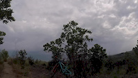
Photos of Brunei Mountain Bike
trail: Ego Trip
23 |
Sep 14, 2020 @ 10:00pm
Sep 14, 2020
trail: Ego Trip
19 |
Sep 14, 2020 @ 10:00pm
Sep 14, 2020
trail: Ego Trip
16 |
Sep 14, 2020 @ 10:00pm
Sep 14, 2020
trail: Ego Trip
20 |
Sep 14, 2020 @ 10:00pm
Sep 14, 2020
trail: Ego Trip
25 |
Sep 14, 2020 @ 10:00pm
Sep 14, 2020
trail: Rock Steady
10 |
Sep 14, 2020 @ 9:47pm
Sep 14, 2020
trail: Rock Steady
11 |
Sep 14, 2020 @ 9:47pm
Sep 14, 2020
trail: Rock Steady
11 |
Sep 14, 2020 @ 9:47pm
Sep 14, 2020Videos of Brunei Mountain Bike
1:20 |
71 |
Sep 21, 2018
trail: ELBN trail
1:38 |
42 |
Sep 19, 2018
Recent Trail Reports
| status | trail | date | condition | info | user |
|---|---|---|---|---|---|
| Higher Lover (Upper Section) Spg 67 Subok | Jun 26, 2022 @ 1:35am Jun 26, 2022 | Variable | picko990 KINGDOM | ||
| No Way Through Trail Spg 67 Subok | Jun 26, 2022 @ 1:35am Jun 26, 2022 | Ideal | picko990 KINGDOM | ||
| Bamboo Shoot Spg 67 Subok | Jun 26, 2022 @ 1:35am Jun 26, 2022 | Variable | picko990 KINGDOM | ||
| Connector Spg 67 Subok | Jun 26, 2022 @ 1:35am Jun 26, 2022 | Unknown | picko990 KINGDOM | ||
| Welcome to 67 Spg 67 Subok | Jun 26, 2022 @ 1:35am Jun 26, 2022 | Ideal | picko990 KINGDOM | ||
| Bukit Belanja descent Sungai Akar | Oct 30, 2021 @ 1:52am Oct 30, 2021 | Variable | Kairi | ||
| Selepas Tangki Tutong | Sep 10, 2021 @ 2:16am Sep 10, 2021 | Variable | Skid3155 | ||
| TCG Funduro SS1 @ Bukit Beruang Tutong | Jul 6, 2021 @ 1:46am Jul 6, 2021 | Wet | Skid3155 | ||
| Magic Carpet Spg 67 Subok | Apr 8, 2020 @ 5:47am Apr 8, 2020 | Ideal | picko990 KINGDOM | ||
| Mady Down Spg 67 Subok | Feb 7, 2020 @ 9:04pm Feb 7, 2020 | Dry | picko990 KINGDOM |
Recent Comments
| username | type | title | comment | date | |
|---|---|---|---|---|---|
 | trail | Skinny lines and sharp switchbacks. Rocks are... | Jul 10, 2020 @ 8:07am Jul 10, 2020 | ||
| report | all go! | Nov 4, 2019 @ 8:45pm Nov 4, 2019 | ||
| report | tree has been cleared. trail is in awesome... | Jun 14, 2018 @ 6:15pm Jun 14, 2018 | ||
| report | Bridges have now been fixed. Green light is... | Jan 17, 2018 @ 3:45pm Jan 17, 2018 |
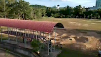
Bike & Skill Parks
| name | type | city | rating |
|---|---|---|---|
| Brunei Pump Track | skill park | Bandar Seri Begawan |
Activity Type Stats
| activitytype | trails | distance | descent | descent distance | total vertical | rating | global rank | state rank | photos | reports | routes | ridelogs |
|---|---|---|---|---|---|---|---|---|---|---|---|---|
| Mountain Bike | 103 | 52 miles | 9,029 ft | 25 miles | 1,017 ft | #48 | 67 | 68 | 19 | 4,923 | ||
| E-Bike | 21 | 13 miles | 2,602 ft | 7 miles | 440 ft | #62 | 42 | 1 | 27 | |||
| Hike | 94 | 48 miles | 7,900 ft | 22 miles | 1,017 ft | #52 | 65 | 644 | ||||
| Trail Running | 93 | 48 miles | 7,900 ft | 22 miles | 1,017 ft | #52 | 65 | 161 |
- By JohanAnnuar & contributors
- Admins: KINGDOM, YETI TRIBE BN
- #5325 - 9,353 views
- brunei activity log | embed map of Brunei mountain bike trails | brunei mountain biking points of interest
-
- subscribe
- 3d map
Downloading of trail gps tracks in kml & gpx formats is enabled for Brunei.
You must login to download files.