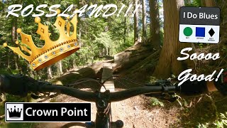
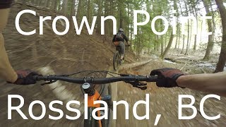
Crown Point (lower) Details
-
Activities
- Mountain Bike
- Hike
- Trail Running
-
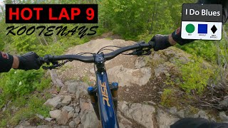
Riding AreaMalde Creek
Rossland, British Columbia -
Difficulty Rating
-
Trail TypeSingletrack
-
Bike TypeDH, AM
-
DirectionDownhill OnlyPopular direction shown
-
Physical RatingModerate
-
Dogs AllowedYes
-
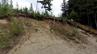
TTFs on TrailBridge, Drop, Jump, Rock Face, Skinny
-
Global Ranking#9514 in Mountain Biking
-
Local Popularity70 in Mountain Biking [+]
- 5 in Trail Running
- 5 in Hiking
-
OSM Way
Crown Point is favorite amongst Rossland riders, providing an advanced, freeriding trail with a hints of 'North Shore' style, amidst a lush, mountain forest. The ride entertains from start to finish with sections of fast, flowy singletrack, mixed with tight, techy sections, and many log rides, booters, bridges and the occasional rock garden. Originally built by local riders in the early 90's, Crown Point has withstood the persistent pressures of logging to retain its stunning, natural setting above the fast flowing, Tiger Creek. The ride itself is greatly diversified and caters to wide range of abilities, from advanced x-country riders to the downhill, shuttle crowd, who typically park a vehicle in Warfield. For others, the long pedal to and from town is easily justified, especially during the height of a dry, hot summer, when Crown Point will remain cool and tacky.
To reach the upper trailhead, proceed approx. 2 km up Malde Creek FSR to Birch Main FSR. Ride (gradual climb) almost 3 km to the end of Birch Main FSR where the singletrack commences. Crown Point begins with undulating traverse through open cut blocks, before a short descent to meet Branch 3000 (or 007) FSR. Turn right onto the road and pedal 400 m to where the main descent of Crown Point begins. Drop the seat and bomb down towards the tall, dark forest ahead. The trail stays close to a featured ridgeline at first and then falls imperceptibly towards the valley bottom, where it stays for the remainder of the ride. The trail is intersected half way with the crossing of Tiger Main FSR which is often a good place to regroup, before dropping across the high banks and featured benches above Tiger Creek, and finally ending in an open cut block above the Gas Line Rd.
Hints: For shuttle riders with a parked vehicle in Warfield, proceed across the Gas Line Rd, follow the dirt road on the west (left) side of Tiger Creek for 500m to Switchback trailheads. Turn right onto Lower Switchback trail which flows in fast, wide arcs down to the Railgrade trail. Turn right (straight) and descend towards to Warfield.
Riders returning to Rossland have several options. The quickest route, but least ascetic, is to pedal back along the Gas Line Rd to where it joins the Railgrade trail and continues into Lower Rossland. Its a 5 km, hilly return on logging roads back to Rossland. Another option is to cross the Gas Line Rd at the end of Crown Point, follow the dirt road on the west side of Tiger Creek for 500m to Switchback trailheads. Take the Upper Switchback trail which joins Railgrade further down the valley. Climb the Railgrade back (turn left) towards town which will curves slowly into Lower Rossland. On the Railgrade you will encounter the Rubberhead trailhead which provides further options into Lower Rossland.
Local Trail Association
-

-

-
Please consider joining or donating to the local trail association to supportdonate to earn trail karma!
trail development & maintenance.
Traditionally Indigenous Territory
More Stats for Crown Point (lower) mountain bike trail trail
-
Altitude change-1,123 ft
-
Altitude min2,735 ft
-
Altitude max3,858 ft
-
Altitude start3,858 ft
-
Altitude end2,735 ft
-
Grade-12.96%
-
Grade max-32.396%
-
Grade min16.258%
-
Distance climb150 ft
-
Distance down2 miles
-
Distance flat96 ft
-
Avg time00:19:43
-
Avg reverse time00:08:50
- view trail stats
- Unknown
- Snow Groomed
- Snow Packed
- Snow Covered
- Snow Cover Inadequate
- Freeze/thaw Cycle
- Icy
- Prevalent Mud
- Wet
- Variable
- Ideal
- Dry
- Very Dry
The colour categories are based on what percentage of riders are riding a trail in its intended direction.
- > 96%
- > 90%
- > 80%
- > 70%
- > 50%
- < 50%
- bi-directional trail
- no data
- < 2 days
- < 1 week
- < 2 weeks
- < 1 month
- < 6 months
- > 6 months
- Downhill Only
- Downhill Primary
- Both Directions
- Uphill Primary
- Uphill Only
- One Direction
- Description
- Photos
- Description & Photos
- Videos
- most popular
- popular
- less popular
- not popular
- mountain biking recent
- mountain biking (>6 month)
- hiking (1 year)
- moto (1 year)
- Downhill Ski
- Backcountry Ski
- Nordic Ski
Save the current map location and zoom level as your default home location whenever this page is loaded.
SaveCrown Point (lower) Trail Reports
Recent Ridelog Activity on Trail
Past Week
- 4 rides
- 17 miles avg distance
6 Months
- 75 rides
- 19 miles avg distance
All
- 840 rides
Photos
Routes with this trail
Trail Products
Videos
Nearby Trails
- Crown Point (upper) 4,393 ft
- Cherry Poppins 2 miles
- Whiskey 2 miles
- Whiskey On The Rocks 2 miles
- Birch Main 2 miles
- embed Crown Point (lower) trail on your website
- By canadaka
 Trailforks & contributors
 - #2148 - 4,249 views
- subscribe
- login to download gpx or kml files.