1,542 ft
Distance
-278 ft
Descent
00:06:38
Avg time
Supporters, Builders, Maintainers & Land Managers of Lower Ladies Trail
DiggerBuilder- Joe WoywitkaBuilder
- past supporters

Knolly Bikes
2015Sponsor
Lower Ladies Details
-
Activities
- Mountain Bike
- Hike
- Trail Running
-
Riding AreaMount Fromme
North Vancouver, British Columbia -
Difficulty Rating
-
Voted DifficultyDouble Black Diamond (3 votes)
-
Trail TypeSingletrack
-
Bike TypeDH
-
DirectionDownhill PrimaryPopular direction shown
-
Dogs AllowedYes
-
TTFs on TrailRock Face, Roller Coaster, Skinny
-
Global Ranking
-
Local Popularity70 in Mountain Biking [+]
- 50 in Trail Running
- 65 in Hiking
-
Land ManagerDistrict of North Vancouver
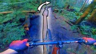
Technical trail containing many very steep natural and some man-made TTFs. Not a beginner trail, no easy options.
Access Info
Accessed off Baden Powell, exiting at Mountain Hwy.
Local Trail Association
-

-

-
Please consider joining or donating to the local trail association to supportdonate to earn trail karma!
trail development & maintenance.
Traditionally Indigenous Territory
More Stats for Lower Ladies mountain bike trail trail
-
Altitude change-278 ft
-
Altitude min1,030 ft
-
Altitude max1,308 ft
-
Altitude start1,308 ft
-
Altitude end1,030 ft
-
Grade-18%
-
Grade max-33.5%
-
Grade min-2.5%
-
Distance down1,542 ft
-
Avg time00:06:38
-
Avg reverse time00:11:24
- view trail stats
close
Trail Conditions
- Unknown
- Snow Groomed
- Snow Packed
- Snow Covered
- Snow Cover Inadequate
- Freeze/thaw Cycle
- Icy
- Prevalent Mud
- Wet
- Variable
- Ideal
- Dry
- Very Dry
Trail Flow (Ridden Direction)
Trailforks scans users ridelogs to determine the most popular direction each trail is ridden. A good flowing trail network will have most trails flowing in a single direction according to their intension.
The colour categories are based on what percentage of riders are riding a trail in its intended direction.
The colour categories are based on what percentage of riders are riding a trail in its intended direction.
- > 96%
- > 90%
- > 80%
- > 70%
- > 50%
- < 50%
- bi-directional trail
- no data
Trail Last Ridden
Trailforks scans ridelogs to determine the last time a trail was ridden.
- < 2 days
- < 1 week
- < 2 weeks
- < 1 month
- < 6 months
- > 6 months
Trail Ridden Direction
The intended direction a trail should be ridden.
- Downhill Only
- Downhill Primary
- Both Directions
- Uphill Primary
- Uphill Only
- One Direction
Contribute Details
Colors indicate trail is missing specified detail.
- Description
- Photos
- Description & Photos
- Videos
Trail Popularity ?
Trailforks scans ridelogs to determine which trails are ridden the most in the last 9 months.
Trails are compared with nearby trails in the same city region with a possible 25 colour shades.
Think of this as a heatmap, more rides = more kinetic energy = warmer colors.
- most popular
- popular
- less popular
- not popular
ATV/ORV/OHV Filter
Max Vehicle Width
inches
Radar Time
x
Activity Recordings
Trailforks users anonymized public ridelogs from the past 6 months.
- mountain biking recent
- mountain biking (>6 month)
- hiking (1 year)
- moto (1 year)
Activity Recordings
Trailforks users anonymized public skilogs from the past 12 months.
- Downhill Ski
- Backcountry Ski
- Nordic Ski
Jump Magnitude Heatmap
Heatmap of where riders jump on trails. Zoom in to see individual jumps, click circles to view jump details.
Trails Deemphasized
Trails are shown in grey.
Only show trails with NO bikes.
Save the current map location and zoom level as your default home location whenever this page is loaded.
Save
Directions to lower-ladies trailhead
(49.353660, -123.041120)
update trails status or condition
Lower Ladies Trail Reports
view all reports »
Recent Ridelog Activity on Trail
Past Week
- 7 rides
- 6 miles avg distance
6 Months
- 189 rides
- 8 miles avg distance
All
- 2,543 rides
Photos
more »
Trail Lists
-
Go to loop on Fromme
7 trails
-
Fromme Mountain
58 trails
-
Mount Fromme
22 trails
-
BC Trip
10 trails
Routes with this trail
more »
Trail Products
-
+ 1
martinblostein
 (Sep 7, 2020 at 12:33)
One of the coolest trails in the world imo
[Reply]
 SteffenMasaites
Hard tail was extra extra fun.. rattle rattle all the way down
[Reply]

pnadeaux
(Jul 19, 2016 at 12:50)
A true north shore trail. No joke.
Has some really teeth shattering natural sections.
Try it on a hardtail for extra fun.
[Reply]
Has some really teeth shattering natural sections.
Try it on a hardtail for extra fun.

Videos
more »


Nearby Trails
- Ladies Only Exit 932 ft
- Big Stupid 932 ft
- The Skull 958 ft
- The Big Stupid 1,148 ft
- Mountain Highway 1,657 ft
- embed Lower Ladies trail on your website
- By canadaka Trailforks & contributors
- #179 - 11,748 views
- subscribe
- login to download gpx or kml files.