close
Trail Conditions
- Unknown
- Snow Groomed
- Snow Packed
- Snow Covered
- Snow Cover Inadequate
- Freeze/thaw Cycle
- Icy
- Prevalent Mud
- Wet
- Variable
- Ideal
- Dry
- Very Dry
Trail Flow (Ridden Direction)
Trailforks scans users ridelogs to determine the most popular direction each trail is ridden. A good flowing trail network will have most trails flowing in a single direction according to their intension.
The colour categories are based on what percentage of riders are riding a trail in its intended direction.
The colour categories are based on what percentage of riders are riding a trail in its intended direction.
- > 96%
- > 90%
- > 80%
- > 70%
- > 50%
- < 50%
- bi-directional trail
- no data
Trail Last Ridden
Trailforks scans ridelogs to determine the last time a trail was ridden.
- < 2 days
- < 1 week
- < 2 weeks
- < 1 month
- < 6 months
- > 6 months
Trail Ridden Direction
The intended direction a trail should be ridden.
- Downhill Only
- Downhill Primary
- Both Directions
- Uphill Primary
- Uphill Only
- One Direction
Contribute Details
Colors indicate trail is missing specified detail.
- Description
- Photos
- Description & Photos
- Videos
Trail Popularity ?
Trailforks scans ridelogs to determine which trails are ridden the most in the last 9 months.
Trails are compared with nearby trails in the same city region with a possible 25 colour shades.
Think of this as a heatmap, more rides = more kinetic energy = warmer colors.
- most popular
- popular
- less popular
- not popular
ATV/ORV/OHV Filter
Max Vehicle Width
inches
Radar Time
x
Activity Recordings
Trailforks users anonymized public ridelogs from the past 6 months.
- mountain biking recent
- mountain biking (>6 month)
- hiking (1 year)
- moto (1 year)
Activity Recordings
Trailforks users anonymized public skilogs from the past 12 months.
- Downhill Ski
- Backcountry Ski
- Nordic Ski
Jump Magnitude Heatmap
Heatmap of where riders jump on trails. Zoom in to see individual jumps, click circles to view jump details.
Trails Deemphasized
Trails are shown in grey.
Only show trails with NO bikes.
Save the current map location and zoom level as your default home location whenever this page is loaded.
SaveA Trailforks weboldalhoz és az alkalmazáshoz készült pár magyarnyelvű leírás. Ezeket itt találjátok:
https://docs.google.com/document/d/1SO0rHsjFuo57xPHVFhWAp3QY7fBPpCL45MGodZMMq-Y/edit?usp=sharing
(Minden dokumentumhoz hozzá lehet szólni, ha pontatlanságot találtok benne, akkor jelezzétek)
https://docs.google.com/document/d/1SO0rHsjFuo57xPHVFhWAp3QY7fBPpCL45MGodZMMq-Y/edit?usp=sharing
(Minden dokumentumhoz hozzá lehet szólni, ha pontatlanságot találtok benne, akkor jelezzétek)
This region uses the Uk/Euro style trail grading system.
Region Details
- 74
- 83
- 161
- 16
- 4
- 1
Stats
- Avg Trail Rating
- Trails (view details)
- 384
- Trails Mountain Bike
- 383
- Trails E-Bike
- 131
- Trails Hike
- 244
- Trails Trail Running
- 244
- Trails Horse
- 18
- Trails Dirtbike/Moto
- 15
- Trails Observed Trials
- 9
- Trails Snowshoe
- 9
- Trails Downhill Ski
- 9
- Trails Backcountry Ski
- 8
- Trails Nordic Ski
- 9
- Total Distance
- 341 miles
- Total Descent
- 99,193 ft
- Total Vertical
- 2,729 ft
- Highest Trailhead
- 3,058 ft
- Reports
- 1,041
- Photos
- 1,031
- Ridden Counter
- 5,092
 Articles
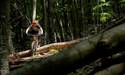
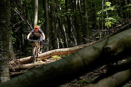
Michal Prokop Explores the Riding in Hungary's National Park
Jul 20, 2019 from pinkbike.com
Hungary might not have the biggest mountains, but there are several places well suited to bigger travel bikes.
Popular Trail Networks
view all areas »Sub Regions
- Dunántúli-dombság (53)
- Hosszúhetény (5)
- Kaposvár (9)
- Komló (5)
- 7domb Bringapark (5)
- Pécs (30)
- Mecsek (28)
- Szászvár (1)
- Szekszárd (4)
- Dunántúli-középhegység (192)
- Balatonfüred (21)
- Balaton-felvidék (21)
- Budapest (82)
- Bro'Hill Freeride Park (2)
- Budai-hegység (70)
- Háromhegyek (9)
- Kamaraerdő (1)
- Csór (1)
- Eplény (1)
- Érd (1)
- Iszkaszentgyörgy (1)
- Kazincbarcika (2)
- Nagykovácsi (1)
- Pákozd (13)
- Pilisborosjenő (1)
- Pilisszentkereszt (3)
- Pilisvörösvár (17)
- Pilis (17)
- Székesfehérvár (1)
- Tata (4)
- Tatabánya (21)
- Gerecse (20)
- Törökbálint (4)
- Anna-hegy (4)
- Várpalota (23)
- Keleti-Bakony (23)
- Veszprém (1)
- Visegrád (4)
- Zirc (1)
- Bakony (1)
- Balatonfüred (21)
- Északi-középhegység (54)
- Eger (18)
- Bükk (18)
- Esztergom (1)
- Gödöllö (5)
- Gödöllõi-dombság (5)
- Gyöngyös (3)
- Mátra (3)
- Gyöngyössolymos (2)
- Isaszeg (3)
- Jobbágyi (1)
- Mátrafüred (1)
- Miskolc (12)
- Almás Bike Park (1)
- Komlóstető-Tapolca (10)
- Pásztó (1)
- Cserhát (1)
- Salgótarján (5)
- Karancs-Medves (5)
- Vác (4)
- Kosdi-dombság (3)
- Börzsöny (6)
- Eger (18)
- Nyugat-magyarországi-peremvidék (83)
- Fertőrákos (2)
- Kőszeg (32)
- Kőszegi-hegység (32)
- Sopron (43)
- Soproni-hegység (42)
- Szentgotthárd (5)
- Zalaegerszeg (1)
- Pilis (1)
- Tardonai-dombság (2)
- Vasi-Hegyhát (5)
- Velencei-hegység (12)
- Visegrádi-hegység (4)
- Zselic (6)
Popular Hungary Mountain Biking Trails
| status | title | difficulty | rating |
|---|---|---|---|
| Contest Budai-hegység | |||
| Csikicsuki Budai-hegység | |||
| Yoko HHH Budai-hegység | |||
| Normafa - Libegő access road Budai-hegység | |||
| Mária-hegy - Határnyereg downhill Budai-hegység | |||
| János-hegyi kilátó Budai-hegység | |||
| Kiserdő 2 Budai-hegység | |||
| Kápolna downhill Budai-hegység | |||
| Desszert Budai-hegység | |||
| Libegő - Szépjuhászné downhill Budai-hegység | |||
| No Comment Budai-hegység | |||
| Fogaskerekű - Normafa access road Budai-hegység | |||
| Hárshegyi körút - Stop Shop downhill Budai-hegység | |||
| Katlan Budai-hegység | |||
| Budaörs Budai-hegység |
Hungary Mountain Bike Routes
| title | rating | distance |
|---|---|---|
| MTB40 | 25 miles | |
| 03 Gerecse | 3 miles | |
| 29-560-pstkereszt Budapest | 18 miles | |
| Piliscsaba Pilisvorosvar labirintus loop Pilis | 5 miles | |
| Bükk-kör | 24 miles | |
| Börzsöny kör Vác | 31 miles | |
| PBJ - Hosszúhegy - PBJ Pilisborosjenő | 15 miles | |
| Piliscsaba to Budapest mountain bike. Nagykovácsi | 23 miles | |
| Várpalota_Singletrack_Up&Down Várpalota | 5 miles | |
| Galyatető-gyöngyössolymos Enduro Trail Matra | 8 miles |
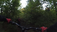
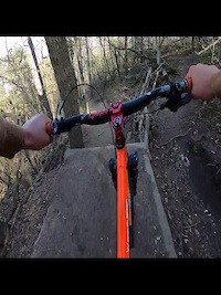
Photos of Hungary Mountain Bike
Videos of Hungary Mountain Bike
trail: Kanada easy line
53 |
Feb 7, 2022

trail: Felező
95 |
Jan 4, 2022
trail: Kanada easy line
75 |
Nov 28, 2021
trail: Bro Hill
45 |
Oct 30, 2021
trail: Yoko HHH
98 |
Oct 16, 2021

trail: Express
74 |
Oct 11, 2021
trail: Lonkahegy DH 2021
|
Aug 11, 2021
trail: János-hegyi kilátó
246 |
Jul 13, 2021
Recent Trail Reports
| status | trail | date | condition | info | user |
|---|---|---|---|---|---|
| Desszert Budai-hegység | Jul 5, 2022 @ 10:02am 16 hours | Ideal | bigburrito | ||
| Kápolna downhill Budai-hegység | Jul 5, 2022 @ 10:01am 16 hours | Variable | bigburrito | ||
| No Comment Budai-hegység | Jul 5, 2022 @ 9:59am 16 hours | Variable | bigburrito | ||
| Köves Háromhegyek | Jul 3, 2022 @ 12:25pm 3 days | Dry | bigburrito | ||
| Péter-hegy DH Háromhegyek | Jul 3, 2022 @ 12:25pm 3 days | Dry | bigburrito | ||
| Felező Háromhegyek | Jul 3, 2022 @ 12:25pm 3 days | Dry | bigburrito | ||
| Péter-hegy Budai-hegység | Jul 3, 2022 @ 12:25pm 3 days | Dry | bigburrito | ||
| Fütyülős Háromhegyek | Jul 3, 2022 @ 12:25pm 3 days | Dry | bigburrito | ||
| HHH DH Budai-hegység | Jul 2, 2022 @ 8:20am Jul 2, 2022 | Dry | nyirinor | ||
| Transfer to Nagy-Kevély peak Pilis | Jul 2, 2022 @ 12:44am Jul 2, 2022 | Dry | kelemenlajos |
Recent Comments
| username | type | title | comment | date | |
|---|---|---|---|---|---|
 | report | Lopva helyett kopva, bocsesz :D | Jun 6, 2022 @ 12:01pm Jun 6, 2022 | ||
 | report | Sajnos az ugratókat lerombolták, építeni... | Apr 22, 2022 @ 11:22am Apr 22, 2022 | ||
| trail | Nagy fa letores erkezoje nem mukodik ✋ | Apr 10, 2022 @ 12:53pm Apr 10, 2022 | ||
| trail | Inkabb koran reggel hasznald, mert akkor... | Apr 9, 2022 @ 1:16pm Apr 9, 2022 | ||
| report | Köszi a munkátokat! | Apr 7, 2022 @ 8:40am Apr 7, 2022 |
Bike & Skill Parks
| name | type | city | rating |
|---|---|---|---|
| Alsóerdei Bringapark | skill park | Zalaegerszeg | |
| Balatonalmádi pumpapálya | skill park | Balatonalmádi | |
| Békéscsaba BMX freestyle | skill park | Békéscsaba | |
| Békéscsaba Pump Track | skill park | Békéscsaba | |
| Budafok pumpapálya | skill park | Budapest |
Pinkbike Articles
Jul 20, 2019
 Michal Prokop Explores the Riding in Hungary's National Park
Hungary might not have the biggest mountains, but there are several places well suited to bigger travel bikes.
Nov 17, 2017
 The History of the First BMX Cross Track in Hungary
This is one BMX track with a lot of history and now it's getting a second chance in life.
Activity Type Stats
| activitytype | trails | distance | descent | descent distance | total vertical | rating | global rank | state rank | photos | reports | routes | ridelogs |
|---|---|---|---|---|---|---|---|---|---|---|---|---|
| Mountain Bike | 383 | 338 miles | 97,474 ft | 213 miles | 2,730 ft | #40 | 1,031 | 1,041 | 21 | 33,945 | ||
| E-Bike | 131 | 99 miles | 25,305 ft | 57 miles | 1,985 ft | #55 | 812 | 4 | 1,385 | |||
| Hike | 244 | 250 miles | 61,053 ft | 153 miles | 2,651 ft | #39 | 945 | 1 | 1,057 | |||
| Trail Running | 244 | 249 miles | 59,767 ft | 152 miles | 2,651 ft | #41 | 944 | 1 | 161 | |||
| Horse | 18 | 14 miles | 2,149 ft | 6 miles | 1,434 ft | #36 | 117 | |||||
| Dirtbike/Moto | 15 | 10 miles | 2,467 ft | 6 miles | 1,355 ft | #44 | 117 | 2 | ||||
| Observed Trials | 9 | 4 miles | 1,079 ft | 2 miles | 1,355 ft | |||||||
| Snowshoe | 9 | 4 miles | 1,224 ft | 2 miles | 1,076 ft | 1 | ||||||
| Downhill Ski | 9 | 4 miles | 1,224 ft | 2 miles | 1,076 ft | 43 | ||||||
| Backcountry Ski | 8 | 4 miles | 1,076 ft | 2 miles | 1,024 ft | 2 | ||||||
| Nordic Ski | 9 | 4 miles | 1,224 ft | 2 miles | 1,076 ft | 13 |
- By canadaka
 Trailforks & contributors
 - Admins: kelemenlajos
- #3211 - 34,832 views
- hungary activity log | embed map of Hungary mountain bike trails | hungary mountain biking points of interest
-
- subscribe
- 3d map
Downloading of trail gps tracks in kml & gpx formats is enabled for Hungary.
You must login to download files.