close
Trail Conditions
- Unknown
- Snow Groomed
- Snow Packed
- Snow Covered
- Snow Cover Inadequate
- Freeze/thaw Cycle
- Icy
- Prevalent Mud
- Wet
- Variable
- Ideal
- Dry
- Very Dry
Trail Flow (Ridden Direction)
Trailforks scans users ridelogs to determine the most popular direction each trail is ridden. A good flowing trail network will have most trails flowing in a single direction according to their intension.
The colour categories are based on what percentage of riders are riding a trail in its intended direction.
The colour categories are based on what percentage of riders are riding a trail in its intended direction.
- > 96%
- > 90%
- > 80%
- > 70%
- > 50%
- < 50%
- bi-directional trail
- no data
Trail Last Ridden
Trailforks scans ridelogs to determine the last time a trail was ridden.
- < 2 days
- < 1 week
- < 2 weeks
- < 1 month
- < 6 months
- > 6 months
Trail Ridden Direction
The intended direction a trail should be ridden.
- Downhill Only
- Downhill Primary
- Both Directions
- Uphill Primary
- Uphill Only
- One Direction
Contribute Details
Colors indicate trail is missing specified detail.
- Description
- Photos
- Description & Photos
- Videos
Trail Popularity ?
Trailforks scans ridelogs to determine which trails are ridden the most in the last 9 months.
Trails are compared with nearby trails in the same city region with a possible 25 colour shades.
Think of this as a heatmap, more rides = more kinetic energy = warmer colors.
- most popular
- popular
- less popular
- not popular
ATV/ORV/OHV Filter
Max Vehicle Width
inches
Radar Time
x
Activity Recordings
Trailforks users anonymized public ridelogs from the past 6 months.
- mountain biking recent
- mountain biking (>6 month)
- hiking (1 year)
- moto (1 year)
Activity Recordings
Trailforks users anonymized public skilogs from the past 12 months.
- Downhill Ski
- Backcountry Ski
- Nordic Ski
Jump Magnitude Heatmap
Heatmap of where riders jump on trails. Zoom in to see individual jumps, click circles to view jump details.
Trails Deemphasized
Trails are shown in grey.
Only show trails with NO bikes.
Save the current map location and zoom level as your default home location whenever this page is loaded.
Save
No description for Morocco has been added yet!
Login or register to submit one.
Region Details
- 3
- 1
- 1
Stats
- Trails (view details)
- 5
- Trails Mountain Bike
- 5
- Trails E-Bike
- 1
- Trails Hike
- 5
- Trails Trail Running
- 5
- Total Distance
- 19 miles
- Total Descent
- 3,649 ft
- Total Vertical
- 5,598 ft
- Highest Trailhead
- 6,053 ft
- Reports
- 1
- Ridden Counter
- 3
 Articles
7 Things to Know When You're Planning a Trip to Morocco
Apr 7, 2019 from pinkbike.com
Don't expect luxury, know how to repair your bike, and more tips to enjoy your time in Morocco.
Sub Regions
- Casablanca (4)
- Marrakech (1)
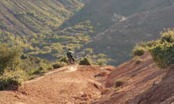
Popular Morocco Mountain Biking Trails
| status | title | difficulty | rating |
|---|---|---|---|
| Sharp Rock Trail Marrakech | |||
| Sanhok Casablanca | |||
| The Pig Ride Casablanca | |||
| XC ride Casablanca | |||
| wall side Casablanca |
Morocco Mountain Bike Routes
| title | rating | distance |
|---|---|---|
| Tag4b Morocco | 16 miles |
Recent Trail Reports
no previous reports, add one now!
Recent Comments
| username | type | title | comment | date | |
|---|---|---|---|---|---|
 | trail | One of my favourite natural downhill trails... | Aug 30, 2021 @ 8:11am Aug 30, 2021 |
Activity Type Stats
| activitytype | trails | distance | descent | descent distance | total vertical | rating | global rank | state rank | photos | reports | routes | ridelogs |
|---|---|---|---|---|---|---|---|---|---|---|---|---|
| Mountain Bike | 5 | 19 miles | 3,648 ft | 13 miles | 5,597 ft | #121 | 1 | 1 | 1,189 | |||
| E-Bike | 1 | 6 miles | 3,310 ft | 5 miles | 3,077 ft | #99 | 1 | 13 | ||||
| Hike | 5 | 19 miles | 3,648 ft | 13 miles | 5,597 ft | #117 | 1 | 160 | ||||
| Trail Running | 5 | 19 miles | 3,648 ft | 13 miles | 5,597 ft | #117 | 1 | 1 |
- By canadaka
 Trailforks & contributors
 - Admins: apply
- #3245 - 5,119 views
- morocco activity log | embed map of Morocco mountain bike trails |
-
- subscribe
- 3d map
Downloading of trail gps tracks in kml & gpx formats is enabled for Morocco.
You must login to download files.