close
Trail Conditions
- Unknown
- Snow Groomed
- Snow Packed
- Snow Covered
- Snow Cover Inadequate
- Freeze/thaw Cycle
- Icy
- Prevalent Mud
- Wet
- Variable
- Ideal
- Dry
- Very Dry
Trail Flow (Ridden Direction)
Trailforks scans users ridelogs to determine the most popular direction each trail is ridden. A good flowing trail network will have most trails flowing in a single direction according to their intension.
The colour categories are based on what percentage of riders are riding a trail in its intended direction.
The colour categories are based on what percentage of riders are riding a trail in its intended direction.
- > 96%
- > 90%
- > 80%
- > 70%
- > 50%
- < 50%
- bi-directional trail
- no data
Trail Last Ridden
Trailforks scans ridelogs to determine the last time a trail was ridden.
- < 2 days
- < 1 week
- < 2 weeks
- < 1 month
- < 6 months
- > 6 months
Trail Ridden Direction
The intended direction a trail should be ridden.
- Downhill Only
- Downhill Primary
- Both Directions
- Uphill Primary
- Uphill Only
- One Direction
Contribute Details
Colors indicate trail is missing specified detail.
- Description
- Photos
- Description & Photos
- Videos
Trail Popularity ?
Trailforks scans ridelogs to determine which trails are ridden the most in the last 9 months.
Trails are compared with nearby trails in the same city region with a possible 25 colour shades.
Think of this as a heatmap, more rides = more kinetic energy = warmer colors.
- most popular
- popular
- less popular
- not popular
ATV/ORV/OHV Filter
Max Vehicle Width
inches
Radar Time
x
Activity Recordings
Trailforks users anonymized public ridelogs from the past 6 months.
- mountain biking recent
- mountain biking (>6 month)
- hiking (1 year)
- moto (1 year)
Activity Recordings
Trailforks users anonymized public skilogs from the past 12 months.
- Downhill Ski
- Backcountry Ski
- Nordic Ski
Jump Magnitude Heatmap
Heatmap of where riders jump on trails. Zoom in to see individual jumps, click circles to view jump details.
Trails Deemphasized
Trails are shown in grey.
Only show trails with NO bikes.
Save the current map location and zoom level as your default home location whenever this page is loaded.
Save
No description for Nicaragua has been added yet!
Login or register to submit one.
Region Details
- 20
- 15
- 21
- 3
Local Trail Association
Stats
- Avg Trail Rating
- Trails (view details)
- 59
- Trails Mountain Bike
- 59
- Trails E-Bike
- 58
- Trails Hike
- 57
- Trails Trail Running
- 57
- Trails Horse
- 10
- Trails Dirtbike/Moto
- 2
- Total Distance
- 107 miles
- Total Descent Distance
- 51 miles
- Total Descent
- 12,874 ft
- Total Vertical
- 2,212 ft
- Highest Trailhead
- 2,233 ft
- Reports
- 98
- Photos
- 53
- Ridden Counter
- 220
Sub Regions
- Occidente (2)
- Rivas (55)
- Tola (55)
- Hacienda Iguana (3)
- Rancho Santana (53)
- Tola (55)
- Chichigalpa (2)
- Masaya (1)
- Tipitapa (1)
Popular Nicaragua Mountain Biking Trails
| status | title | difficulty | rating |
|---|---|---|---|
| Tortuga Run Rancho Santana | |||
| Tres Rios Rancho Santana | |||
| Nacho's Connector Rancho Santana | |||
| Nacho Rancho Santana | |||
| Cola Rip Rancho Santana | |||
| Pájaro Muerto Rancho Santana | |||
| Señor Currey Rancho Santana | |||
| Monkey Trail Rancho Santana | |||
| Machete Rancho Santana | |||
| Piso de Playa Rancho Santana | |||
| The Bertberry Express Rancho Santana | |||
| Welcome Center Trail Rancho Santana | |||
| Serpento Rancho Santana | |||
| Stable Trail Rancho Santana | |||
| Root Ridge Alternate Rancho Santana |
Nicaragua Mountain Bike Routes
| title | rating | distance |
|---|---|---|
| Rancho Quick Blue Route Via Main Road Rancho Santana | 4 miles | |
| Rancho Quick Blue Route Via Trails Rancho Santana | 4 miles | |
| Quick Intermediate Route Rancho Santana | 4 miles | |
| School Rancho Santana | 2 miles | |
| Root Ridge, Machete, Bertberry, and Señor Currey Rancho Santana | 8 miles | |
| Rancho Long Blue Route Via Trails Rancho Santana | 10 miles | |
| Gigante to San Juan Tola | 22 miles | |
| Magma Trail Managua | 7 miles | |
| Conectando Caminos Chichigalpa | 28 miles |
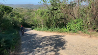
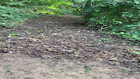
Photos of Nicaragua Mountain Bike
trail: Road to Los Perros
31 |
Feb 5, 2021 @ 5:50pm
Feb 5, 2021
trail: Bella Vista Road
39 |
Feb 5, 2021 @ 5:46pm
Feb 5, 2021
trail: Machete
39 |
Jan 15, 2021 @ 9:27am
Jan 15, 2021
trail: Machete
38 |
Jan 15, 2021 @ 9:27am
Jan 15, 2021
trail: Machete
36 |
Jan 15, 2021 @ 9:27am
Jan 15, 2021
trail: Machete
30 |
Jan 15, 2021 @ 9:27am
Jan 15, 2021
trail: Machete
32 |
Jan 15, 2021 @ 9:27am
Jan 15, 2021
trail: Welcome Center Trail
36 |
Jan 11, 2021 @ 7:14am
Jan 11, 2021Videos of Nicaragua Mountain Bike
trail: Bella Vista Road
26 |
Feb 5, 2021
trail: Machete
|
Jan 13, 2021
Recent Trail Reports
| status | trail | date | condition | info | user |
|---|---|---|---|---|---|
| Root Ridge Alternate Rancho Santana | Jan 30, 2022 @ 7:06am Jan 30, 2022 | Dry | Hryciuk | ||
| Nacho Rancho Santana | Jan 3, 2022 @ 7:19am Jan 3, 2022 | Dry | Hryciuk | ||
| Nacho's Connector Rancho Santana | Jan 3, 2022 @ 7:19am Jan 3, 2022 | Dry | Hryciuk | ||
| Tres Rios Rancho Santana | Jan 3, 2022 @ 7:19am Jan 3, 2022 | Dry | Hryciuk | ||
| Tortuga Run Rancho Santana | Jan 3, 2022 @ 7:19am Jan 3, 2022 | Variable | Hryciuk | ||
| Escondida Connector Rancho Santana | Dec 5, 2021 @ 7:40am Dec 5, 2021 | Dry | Hryciuk | ||
| Quinn's Paradise Rancho Santana | Dec 5, 2021 @ 7:40am Dec 5, 2021 | Variable | Hryciuk | ||
| Monkey Trail Rancho Santana | Dec 2, 2021 @ 6:35am Dec 2, 2021 | Variable | Hryciuk | ||
| La Tienda Connector Rancho Santana | Dec 2, 2021 @ 6:35am Dec 2, 2021 | Dry | Hryciuk | ||
| Welcome Center Trail Rancho Santana | Dec 1, 2021 @ 7:10pm Dec 1, 2021 | Dry | james529529 ECMBA |
Recent Comments
| username | type | title | comment | date | |
|---|---|---|---|---|---|
 | report | Yep | Mar 24, 2022 @ 10:12am Mar 24, 2022 | ||
 | report | Has this been cleared now? | Mar 24, 2022 @ 9:45am Mar 24, 2022 | ||
 | trail | Access limited to guests of Rancho Santana Resort | Mar 20, 2022 @ 2:36pm Mar 20, 2022 | ||
| trail | Super soft dirt, acts like deep sand. You’re... | Feb 26, 2022 @ 12:59pm Feb 26, 2022 | ||
| trail | Great place to start a nice downhill flow all... | Jan 12, 2021 @ 9:47am Jan 12, 2021 |
Activity Type Stats
| activitytype | trails | distance | descent | descent distance | total vertical | rating | global rank | state rank | photos | reports | routes | ridelogs |
|---|---|---|---|---|---|---|---|---|---|---|---|---|
| Mountain Bike | 59 | 107 miles | 12,874 ft | 51 miles | 2,211 ft | #101 | 53 | 98 | 9 | 563 | ||
| E-Bike | 58 | 107 miles | 12,874 ft | 51 miles | 2,211 ft | #77 | 98 | 7 | 22 | |||
| Hike | 57 | 95 miles | 11,857 ft | 45 miles | 2,211 ft | #92 | 97 | 5 | 78 | |||
| Trail Running | 57 | 95 miles | 11,857 ft | 45 miles | 2,211 ft | #92 | 97 | 5 | 22 | |||
| Horse | 10 | 20 miles | 1,811 ft | 7 miles | 919 ft | #46 | 2 | |||||
| Dirtbike/Moto | 2 | 9 miles | 1,017 ft | 3 miles | 889 ft | #11 |
- By BGiroux
 & contributors
 - Admins: ECMBA
- #21455 - 2,545 views
- nicaragua activity log | embed map of Nicaragua mountain bike trails |
-
- subscribe
- 3d map
Downloading of trail gps tracks in kml & gpx formats is enabled for Nicaragua.
You must login to download files.