close
Trail Conditions
- Unknown
- Snow Groomed
- Snow Packed
- Snow Covered
- Snow Cover Inadequate
- Freeze/thaw Cycle
- Icy
- Prevalent Mud
- Wet
- Variable
- Ideal
- Dry
- Very Dry
Trail Flow (Ridden Direction)
Trailforks scans users ridelogs to determine the most popular direction each trail is ridden. A good flowing trail network will have most trails flowing in a single direction according to their intension.
The colour categories are based on what percentage of riders are riding a trail in its intended direction.
The colour categories are based on what percentage of riders are riding a trail in its intended direction.
- > 96%
- > 90%
- > 80%
- > 70%
- > 50%
- < 50%
- bi-directional trail
- no data
Trail Last Ridden
Trailforks scans ridelogs to determine the last time a trail was ridden.
- < 2 days
- < 1 week
- < 2 weeks
- < 1 month
- < 6 months
- > 6 months
Trail Ridden Direction
The intended direction a trail should be ridden.
- Downhill Only
- Downhill Primary
- Both Directions
- Uphill Primary
- Uphill Only
- One Direction
Contribute Details
Colors indicate trail is missing specified detail.
- Description
- Photos
- Description & Photos
- Videos
Trail Popularity ?
Trailforks scans ridelogs to determine which trails are ridden the most in the last 9 months.
Trails are compared with nearby trails in the same city region with a possible 25 colour shades.
Think of this as a heatmap, more rides = more kinetic energy = warmer colors.
- most popular
- popular
- less popular
- not popular
ATV/ORV/OHV Filter
Max Vehicle Width
inches
Radar Time
x
Activity Recordings
Trailforks users anonymized public ridelogs from the past 6 months.
- mountain biking recent
- mountain biking (>6 month)
- hiking (1 year)
- moto (1 year)
Activity Recordings
Trailforks users anonymized public skilogs from the past 12 months.
- Downhill Ski
- Backcountry Ski
- Nordic Ski
Jump Magnitude Heatmap
Heatmap of where riders jump on trails. Zoom in to see individual jumps, click circles to view jump details.
Trails Deemphasized
Trails are shown in grey.
Only show trails with NO bikes.
Save the current map location and zoom level as your default home location whenever this page is loaded.
SaveAberdeen is a city in northeast Scotland. It is Scotland's third most populous city, one of Scotland's 32 local government council areas and the United Kingdom's 39th most populous built-up area.
source: Wikipedia
This region uses the Uk/Euro style trail grading system.
Activities Click to view
- Mountain Bike
242 trails
- E-Bike
232 trails
- Hike
246 trails
- Trail Running
246 trails
Region Details
- 135
- 21
- 31
- 48
- 6
- 1
Region Status
Open as of Jun 26, 2022Stats
- Avg Trail Rating
- Trails (view details)
- 256
- Trails Mountain Bike
- 242
- Trails E-Bike
- 232
- Trails Hike
- 246
- Trails Trail Running
- 246
- Trails Horse
- 77
- Total Distance
- 98 miles
- Total Descent
- 12,960 ft
- Total Vertical
- 843 ft
- Highest Trailhead
- 866 ft
- Reports
- 1,221
- Photos
- 84
- Ridden Counter
- 21,946
Sub Regions
-
Countesswells
- 6
- 13
- 15
- 4
-
Cults Woods
-
Doonies Hill
-
Foggieton Woods
-
Hazlehead Park
-
Kincord Hill Nature Reserve
-
Kirkhill Forest
- 2
- 6
- 31
- 2
- 1
-
Tollohill Wood
- 1
- 3
-
Tyrebagger
- 3
- 8
- 2
Popular Aberdeen Mountain Biking Trails
Aberdeen Mountain Bike Routes
| title | rating | distance |
|---|---|---|
| Kingshill MTB Lap | 2 miles | |
| Deeside Way - Aberdeen to Drumoak | 11 miles | |
| Route130 | 26 miles | |
| Route131 | 35 miles |
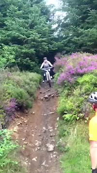
Photos of Aberdeen Mountain Bike
trail: Trail
27 |
May 25, 2022 @ 12:12pm
May 25, 2022
trail: Brimmond Singletrack climb
23 |
Aug 23, 2021 @ 8:08am
Aug 23, 2021
trail: Twister
76 |
Sep 29, 2020 @ 11:14am
Sep 29, 2020
trail: Boneshaker
74 |
Sep 29, 2020 @ 11:10am
Sep 29, 2020
trail: Boneshaker
58 |
Sep 29, 2020 @ 11:10am
Sep 29, 2020
trail: Quarry in-direct
37 |
Sep 29, 2020 @ 11:06am
Sep 29, 2020
trail: Quarry in-direct
45 |
Sep 29, 2020 @ 11:06am
Sep 29, 2020
trail: Cove Cliff Drop
45 |
Aug 25, 2020 @ 6:12am
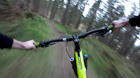
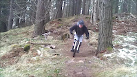
Aug 25, 2020Videos of Aberdeen Mountain Bike
trail: Kirkhill Fun Park
0:39 |
785 |
Jul 11, 2016
trail: Berm Baby Bump
0:43 |
786 |
Apr 1, 2014
trail: Berm Baby Bump
0:49 |
849 |
Mar 26, 2013
trail: Fast Forwarder
66 |
Jun 23, 2021 , Aberdeen

trail: Flee the Tower
0:50 |
137 |
May 18, 2021 , Aberdeen

trail: Kirkhill Fun Park
1:35 |
241 |
May 12, 2021 , Aberdeen

trail: Twister
1:37 |
167 |
Mar 15, 2021 , Aberdeen
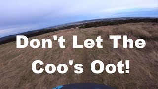
trail: Don't Let The Coo's Oot !!
2:32 |
263 |
Jun 20, 2020 , Aberdeen
Current Trail Warnings
| status | trail | date | condition | user | info |
|---|---|---|---|---|---|
| Marcus Flint | Jun 12, 2022 @ 1:56pm Jun 12, 2022 | Dry | Mmf |
Recent Trail Reports
| status | trail | date | condition | info | user |
|---|---|---|---|---|---|
| lastminute.com | Jun 26, 2022 @ 10:51am Jun 26, 2022 | Dry | Mmf | ||
| Fast Forwarder | Jun 26, 2022 @ 10:50am Jun 26, 2022 | Dry | Mmf | ||
| Descenderoo | Jun 26, 2022 @ 10:50am Jun 26, 2022 | Dry | Mmf | ||
| Sweet and Sour | Jun 26, 2022 @ 10:48am Jun 26, 2022 | Dry | Mmf | ||
| Flee the Tower | Jun 26, 2022 @ 10:48am Jun 26, 2022 | Dry | Mmf | ||
| Fallen Tree | Jun 25, 2022 @ 12:28am Jun 25, 2022 | Dry | Ronan605 | ||
| Trail | Jun 12, 2022 @ 1:55pm Jun 12, 2022 | Ideal | Mmf | ||
| Side-tracked | Jun 12, 2022 @ 1:54pm Jun 12, 2022 | Dry | Mmf | ||
| Tower Descent | Jun 12, 2022 @ 1:53pm Jun 12, 2022 | Dry | Mmf | ||
| Trail | Jun 5, 2022 @ 6:46am Jun 5, 2022 | Dry | karloveloce |
Activity Feed
| username | action | type | title | date | |
|---|---|---|---|---|---|
 | mungomcleish | add | karma | Aberdeen | Jul 5, 2022 @ 5:32am 22 hours |
 | clarkyboy86 | add | karma | Aberdeen | Jun 30, 2022 @ 3:29am Jun 30, 2022 |
| Mmf | add | report | Flee the Tower and 4 more | Jun 26, 2022 @ 10:48am Jun 26, 2022 |
| Ronan605 | add | report | Fallen Tree | Jun 25, 2022 @ 12:28am Jun 25, 2022 |
| Ronan605 | vote | trail | Fallen Tree | Jun 25, 2022 @ 12:27am Jun 25, 2022 |
Recent Comments
| username | type | title | comment | date | |
|---|---|---|---|---|---|
 | trail | Definitely isn't closed. No issues at all and... | May 17, 2022 @ 2:45pm May 17, 2022 | ||
| trail | Not sure why is stated the trial is closed. It... | Apr 19, 2022 @ 8:28am Apr 19, 2022 | ||
| report | It selected wrong part of trail, should be the... | Mar 28, 2022 @ 3:26pm Mar 28, 2022 | ||
| trail | Blocked by fallen tree - 5/12/21 | Dec 5, 2021 @ 1:46pm Dec 5, 2021 | ||
| trail | Wish I read the previous comment | Sep 16, 2021 @ 5:48am Sep 16, 2021 |
Local Badges
-

Big Ride 30k3,010 awarded -

Completionist1 awarded -

10 Blue Trails138 awarded -

Epic Ride 50k1,193 awarded -
Completionist8 awarded -

Epic Ride Climb 2k19 awarded
Bike & Skill Parks
| name | type | city | rating |
|---|---|---|---|
| Cults Bike Loop | skill park | Aberdeen | |
| Transition Pumptrack | skill park | Aberdeen |
Activity Type Stats
| activitytype | trails | distance | descent | descent distance | total vertical | rating | global rank | state rank | photos | reports | routes | ridelogs |
|---|---|---|---|---|---|---|---|---|---|---|---|---|
| Mountain Bike | 242 | 95 miles | 12,897 ft | 47 miles | 843 ft | #442 | #28 | 83 | 1,221 | 4 | 23,999 | |
| E-Bike | 232 | 89 miles | 11,503 ft | 44 miles | 843 ft | #127 | #15 | 1 | 1,082 | 3 | 1,107 | |
| Hike | 246 | 95 miles | 12,162 ft | 46 miles | 843 ft | #390 | #11 | 1,175 | 2 | 526 | ||
| Trail Running | 246 | 95 miles | 12,162 ft | 46 miles | 843 ft | #392 | #11 | 1,175 | 2 | 1,129 | ||
| Horse | 77 | 28 miles | 2,093 ft | 13 miles | 643 ft | 282 |
- By alii
 & contributors
 - Admins: gav-s, Gravitate, ATA, eastfyfes
- #6972 - 6,804 views
- aberdeen activity log | embed map of Aberdeen mountain bike trails | aberdeen mountain biking points of interest
Downloading of trail gps tracks in kml & gpx formats is enabled for Aberdeen.
You must login to download files.