close
Trail Conditions
- Unknown
- Snow Groomed
- Snow Packed
- Snow Covered
- Snow Cover Inadequate
- Freeze/thaw Cycle
- Icy
- Prevalent Mud
- Wet
- Variable
- Ideal
- Dry
- Very Dry
Trail Flow (Ridden Direction)
Trailforks scans users ridelogs to determine the most popular direction each trail is ridden. A good flowing trail network will have most trails flowing in a single direction according to their intension.
The colour categories are based on what percentage of riders are riding a trail in its intended direction.
The colour categories are based on what percentage of riders are riding a trail in its intended direction.
- > 96%
- > 90%
- > 80%
- > 70%
- > 50%
- < 50%
- bi-directional trail
- no data
Trail Last Ridden
Trailforks scans ridelogs to determine the last time a trail was ridden.
- < 2 days
- < 1 week
- < 2 weeks
- < 1 month
- < 6 months
- > 6 months
Trail Ridden Direction
The intended direction a trail should be ridden.
- Downhill Only
- Downhill Primary
- Both Directions
- Uphill Primary
- Uphill Only
- One Direction
Contribute Details
Colors indicate trail is missing specified detail.
- Description
- Photos
- Description & Photos
- Videos
Trail Popularity ?
Trailforks scans ridelogs to determine which trails are ridden the most in the last 9 months.
Trails are compared with nearby trails in the same city region with a possible 25 colour shades.
Think of this as a heatmap, more rides = more kinetic energy = warmer colors.
- most popular
- popular
- less popular
- not popular
ATV/ORV/OHV Filter
Max Vehicle Width
inches
Radar Time
x
Activity Recordings
Trailforks users anonymized public ridelogs from the past 6 months.
- mountain biking recent
- mountain biking (>6 month)
- hiking (1 year)
- moto (1 year)
Activity Recordings
Trailforks users anonymized public skilogs from the past 12 months.
- Downhill Ski
- Backcountry Ski
- Nordic Ski
Jump Magnitude Heatmap
Heatmap of where riders jump on trails. Zoom in to see individual jumps, click circles to view jump details.
Trails Deemphasized
Trails are shown in grey.
Only show trails with NO bikes.
Save the current map location and zoom level as your default home location whenever this page is loaded.
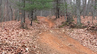
SaveBent Creek is an experimental forest managed by the US Forest Service for foresty and biology. It is home to an extensive network of short trails ranging from rolling to rocky. Most all trails are beginner and intermediate level. The higher up the ridge you climb, the more technical features available like Greens Lick and lower Sidehill.
Primary Trail Type: Cross-Country
Land Status: National Forest
 google parking directions
Links
Activities Click to view
- Mountain Bike
52 trails
- Hike
60 trails
- Trail Running
60 trails
- Horse
9 trails
Region Details
- 17
- 18
- 15
- 2
Region Status
Open as of Mar 17, 2022Stats
- Avg Trail Rating
- Trails (view details)
- 60
- Trails Mountain Bike
- 52
- Trails Hike
- 60
- Trails Trail Running
- 60
- Trails Horse
- 9
- Total Distance
- 74 miles
- Total Descent
- 11,500 ft
- Total Vertical
- 3,266 ft
- Highest Trailhead
- 5,276 ft
- Reports
- 1,201
- Photos
- 125
- Ridden Counter
- 38,727
Popular Bent Creek Experimental Forest Trails
Mountain Bike Routes
| title | rating | distance |
|---|---|---|
| Bent Creek North | 14 miles | |
| Freehub Magazine: Bent Creek Loop | 9 miles | |
| Bent creek Black Trails | 15 miles | |
| Deer Lake Lodge & Ledford Branch Road Loop | 3 miles | |
| Crazy Eights | 10 miles | |
| Northern Boundary Loop | 13 miles | |
| Bent Creek Regular Gravel Route | 13 miles | |
| Bent Creek Easy Shorty | 5 miles | |
| Bent Creek Up & Easy Circuit | 8 miles | |
| Bent Creek to Trace Ridge | 17 miles |
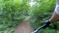
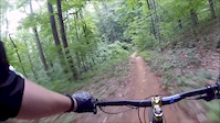
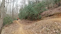
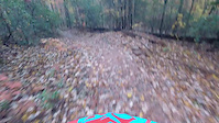
Photos of Bent Creek Experimental Forest Mountain Bike
trail: Ledford Branch Road
12 |
May 17, 2022 @ 2:26pm
May 17, 2022
trail: Ledford Branch Road
9 |
May 17, 2022 @ 2:26pm
May 17, 2022
trail: Ledford Branch Road
7 |
May 17, 2022 @ 2:26pm
May 17, 2022
trail: Green's Lick
72 |
Oct 9, 2021 @ 1:10pm
Oct 9, 2021
trail: Explorer loop Descent
32 |
Sep 25, 2021 @ 6:00am
Sep 25, 2021
trail: Green's Lick
112 |
Aug 10, 2021 @ 5:46pm
Aug 10, 2021
trail: Green's Lick
2,455 | | 5 comments
Sep 30, 2019 @ 12:43am
Sep 30, 2019Videos of Bent Creek Experimental Forest Mountain Bike
trail: Green's Lick
0:26 |
264 |
Apr 12, 2020
trail: Green's Lick
0:45 |
162 |
Jun 1, 2019
trail: Green's Lick
0:07 |
263 |
Apr 16, 2019
trail: Ingles Field Gap
11:39 |
100 |
Nov 8, 2018
trail: Ingles Field Gap
0:16 |
218 |
Dec 22, 2017
trail: Green's Lick
4:04 |
508 |
Sep 9, 2014
trail: Sidehill
7:06 |
449 |
Nov 11, 2011
trail: Ingles Field Gap
7:31 |
651 |
Jul 10, 2011
Recent Trail Reports
| status | trail | date | condition | info | user |
|---|---|---|---|---|---|
| Ingles Field Gap | Jun 28, 2022 @ 6:23am Jun 28, 2022 | Ideal | es223 | ||
| Wolf Branch | Jun 28, 2022 @ 6:23am Jun 28, 2022 | Ideal | es223 | ||
| Deer Lake Road | Jun 28, 2022 @ 6:23am Jun 28, 2022 | Ideal | es223 | ||
| Deer Lake Lodge | Jun 27, 2022 @ 2:37pm Jun 27, 2022 | Ideal | Uta2000 | ||
| Pine Tree Loop | Jun 19, 2022 @ 10:19am Jun 19, 2022 | Dry | Shortbus901 | ||
| Campground Connector | Jun 18, 2022 @ 7:05am Jun 18, 2022 | Ideal | RoachRoach | ||
| Green's Lick | Jun 18, 2022 @ 5:36am Jun 18, 2022 | Ideal | direwolfnca | ||
| Rice Pinnacle Road | Jun 9, 2022 @ 5:54pm Jun 9, 2022 | Ideal | Amosyoder283 | ||
| Little Hickory Top | Jun 9, 2022 @ 5:53pm Jun 9, 2022 | Ideal | Amosyoder283 | ||
| Northern Boundary Road 485 | Jun 9, 2022 @ 5:51pm Jun 9, 2022 | Ideal | Amosyoder283 |
Activity Feed
| username | action | type | title | date | |
|---|---|---|---|---|---|
 | 14mhaddick | wishlist | region | Bent Creek Experimental Forest | Jul 5, 2022 @ 4:41pm 11 hours |
 | ahmed-a | wishlist | route | Bent creek Black Trails and 3 more | Jul 5, 2022 @ 11:51am 16 hours |
 | Hwpennell | wishlist | route | Freehub Magazine: Bent Creek Loop | Jul 4, 2022 @ 2:08pm 2 days |
| Eltacojr | add | karma | Bent Creek Experimental Forest and 1 more | Jul 4, 2022 @ 5:05am 2 days |
 | jmrider0717 | wishlist | region | Bent Creek Experimental Forest | Jul 1, 2022 @ 7:29am Jul 1, 2022 |
Recent Comments
| username | type | title | comment | date | |
|---|---|---|---|---|---|
| trail | Great trail, super popular and is barely a... | Jun 27, 2022 @ 10:05am Jun 27, 2022 | ||
| trail | Several trees down across trail on 4-2-2022 | Apr 3, 2022 @ 5:50am Apr 3, 2022 | ||
 | report | Nest still there. Trees cleared | Sep 6, 2021 @ 8:37pm Sep 6, 2021 | ||
| trail | More of a blue trail with quite a bit of... | Aug 24, 2021 @ 6:21am Aug 24, 2021 | ||
| trail | Definitely way better going in reverse | May 17, 2021 @ 7:32am May 17, 2021 |
Nearby Areas
| name | distance | ||||
|---|---|---|---|---|---|
| Alex's Forest | 2.3 km | ||||
| North Mills River | 1 | 11 | 4 | 4.2 km | |
| Biltmore Estate | 6 | 3 | 6.2 km | ||
| The Riveter | 6.6 km | ||||
| Kolo Bike Park | 9 | 8 | 2 | 1 | 8.3 km |
Local Badges
-

Completionist 20220 awarded -

10 Blue Trails492 awarded -

10 Green Trails372 awarded -

Completionist - Life Time1 awarded -

Top 10 Trails109 awarded
Activity Type Stats
| activitytype | trails | distance | descent | descent distance | total vertical | rating | global rank | state rank | photos | reports | routes | ridelogs |
|---|---|---|---|---|---|---|---|---|---|---|---|---|
| Mountain Bike | 52 | 56 miles | 6,220 ft | 23 miles | 1,555 ft | #131 | #53 | 111 | 1,200 | 17 | 26,805 | |
| Hike | 60 | 74 miles | 11,499 ft | 33 miles | 3,264 ft | #86 | #43 | 12 | 1,201 | 3 | 449 | |
| Trail Running | 60 | 74 miles | 11,499 ft | 33 miles | 3,264 ft | #85 | #42 | 1 | 1,201 | 5 | 878 | |
| Horse | 9 | 14 miles | 1,302 ft | 5 miles | 1,407 ft | #26 | #24 | 493 | 2 |
- By caleb93
 & contributors
 - Admins: TTB, danielsapp, Pisgah, CMC
- #4412 - 19,548 views
- bent creek experimental forest activity log | embed map of Bent Creek Experimental Forest mountain bike trails | bent creek experimental forest mountain biking points of interest
Downloading of trail gps tracks in kml & gpx formats is enabled for Bent Creek Experimental Forest.
You must login to download files.