close
Trail Conditions
- Unknown
- Snow Groomed
- Snow Packed
- Snow Covered
- Snow Cover Inadequate
- Freeze/thaw Cycle
- Icy
- Prevalent Mud
- Wet
- Variable
- Ideal
- Dry
- Very Dry
Trail Flow (Ridden Direction)
Trailforks scans users ridelogs to determine the most popular direction each trail is ridden. A good flowing trail network will have most trails flowing in a single direction according to their intension.
The colour categories are based on what percentage of riders are riding a trail in its intended direction.
The colour categories are based on what percentage of riders are riding a trail in its intended direction.
- > 96%
- > 90%
- > 80%
- > 70%
- > 50%
- < 50%
- bi-directional trail
- no data
Trail Last Ridden
Trailforks scans ridelogs to determine the last time a trail was ridden.
- < 2 days
- < 1 week
- < 2 weeks
- < 1 month
- < 6 months
- > 6 months
Trail Ridden Direction
The intended direction a trail should be ridden.
- Downhill Only
- Downhill Primary
- Both Directions
- Uphill Primary
- Uphill Only
- One Direction
Contribute Details
Colors indicate trail is missing specified detail.
- Description
- Photos
- Description & Photos
- Videos
Trail Popularity ?
Trailforks scans ridelogs to determine which trails are ridden the most in the last 9 months.
Trails are compared with nearby trails in the same city region with a possible 25 colour shades.
Think of this as a heatmap, more rides = more kinetic energy = warmer colors.
- most popular
- popular
- less popular
- not popular
ATV/ORV/OHV Filter
Max Vehicle Width
inches
Radar Time
x
Activity Recordings
Trailforks users anonymized public ridelogs from the past 6 months.
- mountain biking recent
- mountain biking (>6 month)
- hiking (1 year)
- moto (1 year)
Activity Recordings
Trailforks users anonymized public skilogs from the past 12 months.
- Downhill Ski
- Backcountry Ski
- Nordic Ski
Jump Magnitude Heatmap
Heatmap of where riders jump on trails. Zoom in to see individual jumps, click circles to view jump details.
Trails Deemphasized
Trails are shown in grey.
Only show trails with NO bikes.
Save the current map location and zoom level as your default home location whenever this page is loaded.
SaveThe Franklin Falls Dam federal flood control llands are located on both sides of the Pemigewasset River between Bristol and Franklin, NH. The property consists of more than 2,500 wooded acres and spans five towns. It is managed by the US Army Corps of Engineers. The mountain bike trail system is centered near the Franklin Falls Dam administrative offices on highway 127, three miles south of I-93 off exit 22. The system currently consists of approximately 10 miles of multi-use trail, built by mountain bikers for mountain bikers.
Much of the terrain is very “un-New England like” with very few rocks. As a result Franklin Falls is known for its flowing, buff single track. It is great venue for group rides with mixed skill levels. Experts can enjoy high speed tree-slaloming, while novices can enjoy the trails at a more relaxed pace without getting in over their heads in difficulty level. Even your roadie friends can have fun here Some of the fastest flow can be found on trails that include Moose Gully, Pine Snake, Bee, Lost Wall Rusty Bucket, and Stump. Trails on the slightly tighter side include Rogue, Caddywhompus, and Cellar Hole. The newest trail, Sniper is a nice combination of flow and undulating terrain. For advanced riders looking for a more technical challenge, Salmon Brook Trail offers steeper pitches, tight switchbacks, narrow benches, bridges, and rock gardens. It rides best when entering at its intersection with the Rusty Bucket Trail.
The signature trail at Franklin Falls is Mighty Chicken. It is sure to put a smile on your face. Mighty Chicken is a gravity trail, built in a natural half-pipe created by the walls of Chicken Ravine. The trail surfs up and down the ravine walls then finishes out over a series of drops and berms. It continues to be tuned to increase the yeehaw! index.
The trail system is open year round, and is a great choice for early spring riding when other trail systems are closed for mud season. Sandy sub-soil keeps the area extremely well drained so mud is virtually non-existent.
Central NH NEMBA considers Franklin Falls its home base, but also maintains Ahern Park in Laconia, and led by Jesse McGowan is developing a new trail system, Page Hill, in the town of Hill, NH. The Page Hill trail system development is a partnership with Lakes Region Conservation Trust.
Primary Trail Type: Cross-Country
 google parking directions
 Region Supporters & Maintainers
![]()
Central New Hampshire NEMBAMaintainer
Activities Click to view
- Mountain Bike
27 trails
- Hike
27 trails
- Trail Running
27 trails
Region Details
- 9
- 15
- 2
- 1
Region Status
Open as of Apr 23, 2022Stats
- Avg Trail Rating
- Trails (view details)
- 28
- Trails Mountain Bike
- 27
- Trails Hike
- 27
- Trails Trail Running
- 27
- Trails Snowshoe
- 1
- Total Distance
- 13 miles
- Total Descent
- 2,243 ft
- Total Vertical
- 198 ft
- Highest Trailhead
- 514 ft
- Reports
- 417
- Photos
- 43
- Ridden Counter
- 10,616
Popular Franklin Falls Dam Mountain Biking Trails
Franklin Falls Dam Mountain Bike Routes
| title | rating | distance |
|---|---|---|
| Shenanigans | 9 miles | |
| Freeztivus Long Route | 8 miles |
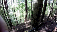
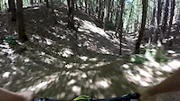
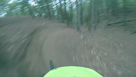
Photos of Franklin Falls Dam Mountain Bike
trail: Rogue
32 |
Feb 21, 2021 @ 2:48pm
Feb 21, 2021
trail: Caddywhompus
18 |
Jan 16, 2021 @ 8:43am
Jan 16, 2021
trail: Lost Wall
20 |
Dec 4, 2020 @ 9:46am
Dec 4, 2020
trail: Rusty Bucket
56 |
Aug 24, 2020 @ 9:49am
Aug 24, 2020
trail: Sniper
59 |
Jul 29, 2020 @ 7:49am
Jul 29, 2020
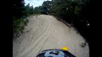
trail: Salmon Brook
104 |
Nov 10, 2019 @ 4:43am
Nov 10, 2019
trail: Caddywhompus
69 |
Jun 2, 2019 @ 4:34pm
Jun 2, 2019
trail: Caddywhompus
68 |
Jun 2, 2019 @ 3:46pm
Jun 2, 2019Videos of Franklin Falls Dam Mountain Bike
trail: Salmon Brook
3:37 |
325 |
Jul 6, 2017
trail: Chicken Ravine
1:18 |
185 |
Jul 5, 2017
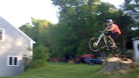
trail: Mighty Chicken
2:31 |
378 |
Dec 22, 2014
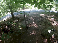
trail: Stump
0:10 |
210 |
Jun 25, 2014
trail: Stump
0:08 |
243 |
Jun 25, 2014
trail: Stump
0:22 |
591 |
Oct 6, 2013
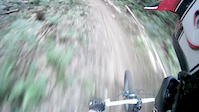
trail: Chicken Ravine
1:00 |
159 |
Jul 27, 2013
trail: Stump
1:13 |
494 |
Aug 23, 2012
Recent Trail Reports
| status | trail | date | condition | info | user |
|---|---|---|---|---|---|
| Old Bench | Jul 3, 2022 @ 2:08pm 3 days | Dry | jsargevt | ||
| Sniper | Jun 19, 2022 @ 11:30am Jun 19, 2022 | Dry | BodinOSe6BJ | ||
| Access Trail | Jun 5, 2022 @ 1:29pm Jun 5, 2022 | Ideal | mcninja97 | ||
| Whaleback | Jun 5, 2022 @ 1:29pm Jun 5, 2022 | Ideal | mcninja97 | ||
| Chicken Ravine | Jun 5, 2022 @ 1:29pm Jun 5, 2022 | Ideal | mcninja97 | ||
| Mighty Chicken | Jun 5, 2022 @ 1:29pm Jun 5, 2022 | Ideal | mcninja97 | ||
| Caddywhompus | Jun 5, 2022 @ 1:29pm Jun 5, 2022 | Ideal | mcninja97 | ||
| Middle Trail | Jun 5, 2022 @ 1:29pm Jun 5, 2022 | Ideal | mcninja97 | ||
| Stump | May 27, 2022 @ 3:53pm May 27, 2022 | Ideal | jsargevt | ||
| Lost Wall | May 27, 2022 @ 3:51pm May 27, 2022 | Dry | jsargevt |
Activity Feed
| username | action | type | title | date | |
|---|---|---|---|---|---|
 | Captainbri | add | karma | Franklin Falls Dam | Jul 3, 2022 @ 2:10pm 3 days |
| jsargevt | add | report | Old Bench | Jul 3, 2022 @ 2:08pm 3 days |
| darwee | wishlist | route | Shenanigans | Jun 22, 2022 @ 7:36am Jun 22, 2022 |
| BodinOSe6BJ | add | report | Sniper | Jun 19, 2022 @ 11:30am Jun 19, 2022 |
 | mtnfun2 | add | report | Old Bench | Jun 11, 2022 @ 2:31pm Jun 11, 2022 |
Recent Comments
| username | type | title | comment | date | |
|---|---|---|---|---|---|
| trail | Fun trail, nice challenging decent. | Jun 22, 2020 @ 6:38pm Jun 22, 2020 | ||
| trail | It may be the best trail at Franklin Falls. | Jun 22, 2020 @ 6:37pm Jun 22, 2020 |
Nearby Areas
| name | distance | ||||
|---|---|---|---|---|---|
| Veterans Memorial Recreation Ski Area | 2 | 2.9 km | |||
| Spaulding Woods | 5 | 6 | 5 km | ||
| Page Hill | 3 | 6 | 2 | 6.2 km | |
| Highland Mtn | 7 km | ||||
| Highland XC Trails | 4 | 2 | 7 | 7.2 km |
Local Badges
-

Completionist56 awarded
Local Trail Supporters
- Central NH NEMBA
Activity Type Stats
| activitytype | trails | distance | descent | descent distance | total vertical | rating | global rank | state rank | photos | reports | routes | ridelogs |
|---|---|---|---|---|---|---|---|---|---|---|---|---|
| Mountain Bike | 27 | 12 miles | 2,119 ft | 5 miles | 194 ft | #524 | #268 | 43 | 417 | 2 | 3,752 | |
| Hike | 27 | 13 miles | 2,139 ft | 5 miles | 197 ft | #392 | #242 | 412 | 28 | |||
| Trail Running | 27 | 13 miles | 2,139 ft | 5 miles | 197 ft | #391 | #240 | 412 | 19 | |||
| Snowshoe | 1 | 4,587 ft | 33 ft | 1,296 ft | 66 ft |
- By markholloway
 Trailforks & contributors
 - Admins: TILTON, CNH NEMBA, CNH NEMBA, FranklinFalls
- #24743 - 4,657 views
- franklin falls dam activity log | embed map of Franklin Falls Dam mountain bike trails | franklin falls dam mountain biking points of interest
Downloading of trail gps tracks in kml & gpx formats is enabled for Franklin Falls Dam.
You must login to download files.