close
Trail Conditions
- Unknown
- Snow Groomed
- Snow Packed
- Snow Covered
- Snow Cover Inadequate
- Freeze/thaw Cycle
- Icy
- Prevalent Mud
- Wet
- Variable
- Ideal
- Dry
- Very Dry
Trail Flow (Ridden Direction)
Trailforks scans users ridelogs to determine the most popular direction each trail is ridden. A good flowing trail network will have most trails flowing in a single direction according to their intension.
The colour categories are based on what percentage of riders are riding a trail in its intended direction.
The colour categories are based on what percentage of riders are riding a trail in its intended direction.
- > 96%
- > 90%
- > 80%
- > 70%
- > 50%
- < 50%
- bi-directional trail
- no data
Trail Last Ridden
Trailforks scans ridelogs to determine the last time a trail was ridden.
- < 2 days
- < 1 week
- < 2 weeks
- < 1 month
- < 6 months
- > 6 months
Trail Ridden Direction
The intended direction a trail should be ridden.
- Downhill Only
- Downhill Primary
- Both Directions
- Uphill Primary
- Uphill Only
- One Direction
Contribute Details
Colors indicate trail is missing specified detail.
- Description
- Photos
- Description & Photos
- Videos
Trail Popularity ?
Trailforks scans ridelogs to determine which trails are ridden the most in the last 9 months.
Trails are compared with nearby trails in the same city region with a possible 25 colour shades.
Think of this as a heatmap, more rides = more kinetic energy = warmer colors.
- most popular
- popular
- less popular
- not popular
ATV/ORV/OHV Filter
Max Vehicle Width
inches
Radar Time
x
Activity Recordings
Trailforks users anonymized public ridelogs from the past 6 months.
- mountain biking recent
- mountain biking (>6 month)
- hiking (1 year)
- moto (1 year)
Activity Recordings
Trailforks users anonymized public skilogs from the past 12 months.
- Downhill Ski
- Backcountry Ski
- Nordic Ski
Jump Magnitude Heatmap
Heatmap of where riders jump on trails. Zoom in to see individual jumps, click circles to view jump details.
Trails Deemphasized
Trails are shown in grey.
Only show trails with NO bikes.
Save the current map location and zoom level as your default home location whenever this page is loaded.
Save
No description for Valemount has been added yet!
Login or register to submit one.
Links
Region Supporters & Maintainers
![]()
Love ValemountSponsor
Activities Click to view
- Mountain Bike
159 trails
- E-Bike
46 trails
- Hike
139 trails
- Trail Running
138 trails
Region Details
- 63
- 2
- 33
- 35
- 18
- 8
Region Status
Closed as of Nov 9, 2021Stats
- Avg Trail Rating
- Trails (view details)
- 170
- Trails Mountain Bike
- 159
- Trails E-Bike
- 46
- Trails Hike
- 139
- Trails Trail Running
- 138
- Trails Horse
- 1
- Trails Dirtbike/Moto
- 2
- Trails Observed Trials
- 1
- Trails ATV/ORV/OHV
- 2
- Trails Snowmobile
- 2
- Trails Snowshoe
- 2
- Trails Backcountry Ski
- 2
- Trails Nordic Ski
- 4
- Total Distance
- 486 miles
- Total Descent
- 54,177 ft
- Total Vertical
- 6,279 ft
- Highest Trailhead
- 8,654 ft
- Reports
- 940
- Photos
- 583
- Ridden Counter
- 14,551
 Articles
Video: Building a Bike Park from Scratch in Valemount, BC
Sep 11, 2020 from pinkbike.com
From a couple trails to a full on bike park.
Sub Regions
-
Mount Robson Provincial Park
- 3
- 1
-
Valemount and Area
- 2
- 9
- 9
- 5
- 7
-
Valemount Bike Park
- 23
- 20
- 10
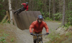
Popular Valemount Mountain Biking Trails
Valemount Mountain Bike Routes
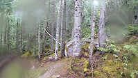
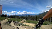
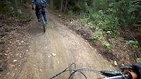
Photos of Valemount Mountain Bike
trail: Truck Yeah Full
2 |
Jul 2, 2022 @ 12:44pm
Jul 2, 2022
trail: Truck Yeah Full
7 |
Jul 2, 2022 @ 12:44pm
Jul 2, 2022
trail: Plaid Shirt
4 |
Jun 26, 2022 @ 5:08pm
Jun 26, 2022
trail: Plaid Shirt
3 |
Jun 26, 2022 @ 5:08pm
Jun 26, 2022
trail: Plaid Shirt
4 |
Jun 26, 2022 @ 5:08pm
Jun 26, 2022
trail: Plaid Shirt
8 |
Jun 26, 2022 @ 5:08pm
Jun 26, 2022
trail: Provincial Trail Descent
65 |
Aug 12, 2016 @ 11:09pm
Aug 12, 2016
trail: Provincial Trail Descent
44 |
Aug 12, 2016 @ 11:08pm
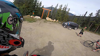
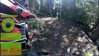
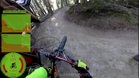
Aug 12, 2016Videos of Valemount Mountain Bike
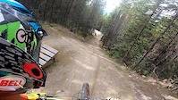
trail: Tinfoil Hat DH
84 |
Jun 21, 2021
trail: High Roller
7:04 |
361 |
Sep 9, 2019
trail: Moby Dick
4:34 |
91 |
Sep 9, 2019
trail: Stinger
5:51 |
583 |
Jun 16, 2019
trail: Moby Dick
2:57 |
312 |
Jun 10, 2018
trail: Bacon by NDIT
11:49 |
397 |
Sep 7, 2017
trail: Tinfoil Hat DH
5:57 |
321 |
Sep 6, 2017
trail: Turducken
11:20 |
542 |
Sep 6, 2017
Recent Trail Reports
| status | trail | date | condition | info | user |
|---|---|---|---|---|---|
| CBT Munday Grind | Jul 2, 2022 @ 10:29am Jul 2, 2022 | Ideal | riddell30 | ||
| Tinfoil Hat DH | Jul 2, 2022 @ 10:29am Jul 2, 2022 | Variable | riddell30 | ||
| Truck Yeah Full | Jul 2, 2022 @ 10:29am Jul 2, 2022 | Ideal | riddell30 | ||
| Moby Dick | Jul 2, 2022 @ 10:29am Jul 2, 2022 | Dry | riddell30 | ||
| High Roller | Jul 2, 2022 @ 10:29am Jul 2, 2022 | Ideal | riddell30 | ||
| Turducken | Jul 2, 2022 @ 10:29am Jul 2, 2022 | Ideal | riddell30 | ||
| Bacon by NDIT | Jul 2, 2022 @ 10:29am Jul 2, 2022 | Ideal | riddell30 | ||
| The Craig | Jul 2, 2022 @ 10:29am Jul 2, 2022 | Variable | riddell30 | ||
| Stinger | Jul 2, 2022 @ 10:29am Jul 2, 2022 | Ideal | riddell30 | ||
| Connect the Dots | Jul 2, 2022 @ 10:29am Jul 2, 2022 | Ideal | riddell30 |
Activity Feed
| username | action | type | title | date | |
|---|---|---|---|---|---|
 | cgjyd | wishlist | trail | Turducken and 2 more | Jul 4, 2022 @ 6:53pm 1 day |
| Nomadicdazza | vote | trail | Tinfoil Hat Alternate (Turducken Connector) | Jul 4, 2022 @ 10:27am 2 days |
| MicaMTN44 | wishlist | region | Valemount | Jul 2, 2022 @ 9:35pm Jul 2, 2022 |
| tirli | wishlist | trail | The Craig | Jul 2, 2022 @ 9:35pm Jul 2, 2022 |
| riddell30 | add | report | CBT Munday Grind and 11 more | Jul 2, 2022 @ 4:25pm Jul 2, 2022 |
Recent Comments
| username | type | title | comment | date | |
|---|---|---|---|---|---|
| report | Rode it twice Saturday May 21 and it was perfect | May 24, 2022 @ 4:07pm May 24, 2022 | ||
| trail | Please DO NOT use as a return to staging area.... | May 24, 2022 @ 8:56am May 24, 2022 | ||
 | trail | Opps this was meant for my hike the day prior... | Sep 1, 2021 @ 9:08pm Sep 1, 2021 | ||
| trail | There is another trail that leads off to... | Sep 1, 2021 @ 8:55pm Sep 1, 2021 | ||
| report | Correct. No longer exists. | Jul 10, 2021 @ 6:21pm Jul 10, 2021 |
Local Badges
-

Epic Ride Climb 2k152 awarded -

Completionist0 awarded -

10 Green Trails128 awarded -
Completionist0 awarded -

Climbing 100k Badge0 awarded -

Climbing 10k Badge26 awarded
Bike & Skill Parks
| name | type | city | rating |
|---|---|---|---|
| Valemount Bike Park | bike park | Valemount | |
| Staging Area Pump Track | skill park | Valemount |
Activity Type Stats
| activitytype | trails | distance | descent | descent distance | total vertical | rating | global rank | state rank | photos | reports | routes | ridelogs |
|---|---|---|---|---|---|---|---|---|---|---|---|---|
| Mountain Bike | 159 | 451 miles | 52,362 ft | 176 miles | 6,280 ft | #410 | #41 | 562 | 935 | 13 | 6,349 | |
| E-Bike | 46 | 131 miles | 14,154 ft | 45 miles | 6,181 ft | #237 | #30 | 758 | 53 | |||
| Hike | 139 | 458 miles | 44,383 ft | 167 miles | 6,280 ft | #841 | #53 | 21 | 793 | 519 | ||
| Trail Running | 138 | 448 miles | 43,904 ft | 165 miles | 6,280 ft | #845 | #53 | 793 | 46 | |||
| Horse | 1 | 3 miles | 581 ft | 2 miles | 469 ft | 218 | ||||||
| Dirtbike/Moto | 2 | 15 miles | 13 ft | 3,074 ft | 5,620 ft | 218 | 7 | |||||
| Observed Trials | 1 | 4 miles | 10 ft | 449 ft | 2,356 ft | |||||||
| ATV/ORV/OHV | 2 | 15 miles | 13 ft | 3,074 ft | 5,620 ft | 218 | 11 | |||||
| Snowmobile | 2 | 15 miles | 13 ft | 3,074 ft | 5,620 ft | 5 | 15 | |||||
| Snowshoe | 2 | 5 miles | 13 ft | 640 ft | 2,356 ft | 5 | 22 | |||||
| Backcountry Ski | 2 | 3 miles | 351 ft | 4,062 ft | 1,837 ft | 5 | 69 | |||||
| Nordic Ski | 4 | 5 miles | 489 ft | 2 miles | 112 ft | 5 | 21 |
- By brenthillier
 NSMBA TRAILFORKS & contributors
 - Admins: BCBR, TrailsBC, BCORMA, DSBC, wheelmaniac3, bcpunk, VARDA, NBC, PGBRS, aleksa
- #3402 - 18,813 views
- valemount activity log | embed map of Valemount mountain bike trails | valemount mountain biking points of interest polygons
Downloading of trail gps tracks in kml & gpx formats is enabled for Valemount.
You must login to download files.