close
Trail Conditions
- Unknown
- Snow Groomed
- Snow Packed
- Snow Covered
- Snow Cover Inadequate
- Freeze/thaw Cycle
- Icy
- Prevalent Mud
- Wet
- Variable
- Ideal
- Dry
- Very Dry
Trail Flow (Ridden Direction)
Trailforks scans users ridelogs to determine the most popular direction each trail is ridden. A good flowing trail network will have most trails flowing in a single direction according to their intension.
The colour categories are based on what percentage of riders are riding a trail in its intended direction.
The colour categories are based on what percentage of riders are riding a trail in its intended direction.
- > 96%
- > 90%
- > 80%
- > 70%
- > 50%
- < 50%
- bi-directional trail
- no data
Trail Last Ridden
Trailforks scans ridelogs to determine the last time a trail was ridden.
- < 2 days
- < 1 week
- < 2 weeks
- < 1 month
- < 6 months
- > 6 months
Trail Ridden Direction
The intended direction a trail should be ridden.
- Downhill Only
- Downhill Primary
- Both Directions
- Uphill Primary
- Uphill Only
- One Direction
Contribute Details
Colors indicate trail is missing specified detail.
- Description
- Photos
- Description & Photos
- Videos
Trail Popularity ?
Trailforks scans ridelogs to determine which trails are ridden the most in the last 9 months.
Trails are compared with nearby trails in the same city region with a possible 25 colour shades.
Think of this as a heatmap, more rides = more kinetic energy = warmer colors.
- most popular
- popular
- less popular
- not popular
ATV/ORV/OHV Filter
Max Vehicle Width
inches
Radar Time
x
Activity Recordings
Trailforks users anonymized public ridelogs from the past 6 months.
- mountain biking recent
- mountain biking (>6 month)
- hiking (1 year)
- moto (1 year)
Activity Recordings
Trailforks users anonymized public skilogs from the past 12 months.
- Downhill Ski
- Backcountry Ski
- Nordic Ski
Jump Magnitude Heatmap
Heatmap of where riders jump on trails. Zoom in to see individual jumps, click circles to view jump details.
Trails Deemphasized
Trails are shown in grey.
Only show trails with NO bikes.
Save the current map location and zoom level as your default home location whenever this page is loaded.
SavePurpose built mountain biking trail system in the Coos County Forest. Trails for all levels of riders from family friendly/beginner areas at The Snag to advanced jump lines and Double Black hand-built fall-line trails. This system is constantly expanding so be sure to keep coming back for more
Grants, funding, and support provided by Wild Rivers Coast Alliance, Coos County, Travel Oregon, Wild Rivers Coast Mountain Biking Association, and Travel Southern Oregon Coast.
Enjoy the trails? Our trails are 100% maintained through our local mountain bike club: Wild Rivers Coast MTB Association. Please donate via the Trail Karma button on this page.
Primary Trail Type: Cross-Country
Shuttleable: YES
AKA: Whiskey Run
Land Status: Community Forest
Land Manager: Coos County Forest
 google parking directions
 Access Info:
Whiskey Run Road off West Beaver Hill has 3 parking areas- 1 at the furthest south trails at The Snag; a large double lot in the middle with pit toilets, picnic tables, bike corral, bike repair station, and benches; The Upper Parking Area is accessed off W. Beaver Hill Road, at a gravel access road and provides top to bottom options for shuttling.
Disclaimer:
Lock your vehicles and take all valuables with you. Please report any suspicious behavior by calling the Coos County Sheriff's Office: (541) 396-7800. Absolutely NO HORSES ALLOWED!
Region Supporters & Maintainers
![]()
Wild Rivers Coast Mountain Bicycling Association
2016 - 2022Maintainer
Activities Click to view
- Mountain Bike
63 trails
- E-Bike
6 trails
- Hike
43 trails
- Trail Running
44 trails
Region Details
- 8
- 3
- 20
- 18
- 12
- 2
Region Status
Caution as of Apr 19, 2022Stats
- Avg Trail Rating
- Trails (view details)
- 64
- Trails Mountain Bike
- 63
- Trails E-Bike
- 6
- Trails Hike
- 43
- Trails Trail Running
- 44
- Total Distance
- 37 miles
- Total Descent
- 7,293 ft
- Total Vertical
- 586 ft
- Highest Trailhead
- 586 ft
- Reports
- 1,782
- Photos
- 134
- Ridden Counter
- 12,338
Popular Whiskey Run Trails Mountain Biking Trails
Whiskey Run Trails Mountain Bike Routes
| title | rating | distance |
|---|---|---|
| Cross-country Loop | 13 miles | |
| Intermediate Ride- Opt. 2 | 11 miles | |
| Trail Builder's Choice | 20 miles | |
| Whiskey Sampler Classic (Phase 1) | 7 miles | |
| East Bound & Down | 9 miles | |
| Full Flight 3 | 13 miles | |
| Full Flight Classic (Phase 1) | 12 miles | |
| Easy Kids Out & Back-1 | 2 miles | |
| Intermediate Ride | 11 miles | |
| Tour Of The Trails-Blue | 16 miles |
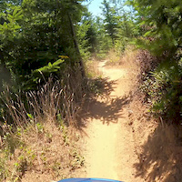
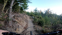
Photos of Whiskey Run Trails Mountain Bike
trail: Hangover
29 |
Apr 12, 2022 @ 5:37pm
Apr 12, 2022
trail: Hangover
46 |
Apr 12, 2022 @ 5:37pm
Apr 12, 2022
trail: Hangover
32 |
Apr 12, 2022 @ 5:37pm
Apr 12, 2022
trail: Hangover
42 |
Apr 12, 2022 @ 5:37pm
Apr 12, 2022
trail: Hangover
34 |
Apr 12, 2022 @ 5:37pm
Apr 12, 2022
trail: Hangover
52 |
Apr 12, 2022 @ 5:37pm
Apr 12, 2022
trail: Hangover
27 |
Apr 12, 2022 @ 5:37pm
Apr 12, 2022
trail: Sir Lance-A-Lot
164 |
Jun 6, 2021 @ 11:27am
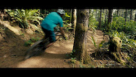
Jun 6, 2021Videos of Whiskey Run Trails Mountain Bike
trail: Hey Bub
1:00 |
197 |
Aug 2, 2020
trail: Joe Ben & Jerry's
0:23 |
528 |
Aug 29, 2019
trail: Hollerback Trail
3:03 |
8815 |
Jun 6, 2019

trail: Dirty Dishes
15:55 |
68 |
Mar 30, 2022 , Coos Bay

trail: Hollerback Trail
15:55 |
70 |
Mar 30, 2022 , Coos Bay

5:20 |
60 |
Mar 24, 2022

trail: Bam-Ba-Lam
2:55 |
154 |
Jan 11, 2022 , Coos Bay

trail: Old Bones
4:44 |
89 |
Jan 4, 2022 , Coos Bay
Current Trail Warnings
| status | trail | date | condition | user | info |
|---|---|---|---|---|---|
| Outlaw | Jul 2, 2022 @ 2:07pm Jul 2, 2022 | Ideal | nwta-ted | Love it! |
Recent Trail Reports
| status | trail | date | condition | info | user |
|---|---|---|---|---|---|
| White Lightning | Jul 3, 2022 @ 2:38pm 3 days | Very Dry | DogsBoy | ||
| Upper Captain Blacklock | Jul 3, 2022 @ 2:38pm 3 days | Very Dry | DogsBoy | ||
| Lower Captain Blacklock | Jul 3, 2022 @ 2:38pm 3 days | Very Dry | DogsBoy | ||
| Sir Lance-A-Lot | Jul 3, 2022 @ 2:38pm 3 days | Very Dry | DogsBoy | ||
| Boots with the Fir | Jul 3, 2022 @ 2:38pm 3 days | Very Dry | DogsBoy | ||
| Dirty Dishes | Jul 3, 2022 @ 2:38pm 3 days | Very Dry | DogsBoy | ||
| Meadow Skipper | Jul 3, 2022 @ 2:38pm 3 days | Very Dry | DogsBoy | ||
| Upper Copperhead Road | Jul 3, 2022 @ 2:38pm 3 days | Very Dry | DogsBoy | ||
| Wing and a Prayer | Jul 3, 2022 @ 2:38pm 3 days | Very Dry | DogsBoy | ||
| Landing Pad Road | Jul 3, 2022 @ 2:07pm 3 days | Dry | nhlpat |
Activity Feed
| username | action | type | title | date | |
|---|---|---|---|---|---|
 | dgangemi | wishlist | route | Whiskey Chaser 2021 and 1 more | Jul 5, 2022 @ 11:55am 16 hours |
| DogsBoy | add | report | White Lightning and 8 more | Jul 4, 2022 @ 9:34am 2 days |
| coedaly | vote | trail | Baloni Sandwich | Jul 3, 2022 @ 9:54pm 2 days |
| nhlpat | add | report | Bourbon Street and 9 more | Jul 3, 2022 @ 2:03pm 3 days |
 | nwta-ted | add | report | Hollerback Connector and 18 more | Jul 3, 2022 @ 11:20am 3 days |
Recent Comments
| username | type | title | comment | date | |
|---|---|---|---|---|---|
 | report | We understand the desire to park up there, but... | Jun 15, 2022 @ 7:51pm Jun 15, 2022 | ||
 | report | This should be allowed. It would make a lot of... | Jun 12, 2022 @ 6:58pm Jun 12, 2022 | ||
| report | Please do not ride for a couple days. Let the... | Jun 12, 2022 @ 5:49pm Jun 12, 2022 | ||
| report | Thanks Karl | May 27, 2022 @ 7:47pm May 27, 2022 | ||
| report | Thanks Karl | May 27, 2022 @ 7:47pm May 27, 2022 |
Nearby Areas
| name | distance | ||||
|---|---|---|---|---|---|
| Winchester Trails | 4 | 16 | 3 | 1 | 2.5 km |
| Bullards Beach State Park | 5.3 km | ||||
| Oregon Dunes National Recreation Area | 4 | 9 | 15.4 km | ||
| New River Nature Center | 16.4 km | ||||
| Floras Lake State Park | 4 | 1 | 26.1 km |
Local Badges
-

Completionist14 awarded
Local Trail Supporters
![]()
- Jerry Gross
![]()
Activity Type Stats
| activitytype | trails | distance | descent | descent distance | total vertical | rating | global rank | state rank | photos | reports | routes | ridelogs |
|---|---|---|---|---|---|---|---|---|---|---|---|---|
| Mountain Bike | 63 | 31 miles | 7,280 ft | 17 miles | 518 ft | #436 | #224 | 133 | 1,781 | 28 | 4,067 | |
| E-Bike | 6 | 5 miles | 1,293 ft | 3 miles | 453 ft | #1,304 | 1,085 | 6 | 50 | |||
| Hike | 43 | 27 miles | 3,632 ft | 11 miles | 587 ft | #491 | #300 | 1,487 | 27 | |||
| Trail Running | 44 | 28 miles | 3,648 ft | 12 miles | 587 ft | #494 | #299 | 1,487 | 1 | 64 |
- By whiskeyqueen
 WRCMBA & contributors
 - Admins: WRCMBA
- #21273 - 31,612 views
- whiskey run trails activity log | embed map of Whiskey Run Trails mountain bike trails | whiskey run trails mountain biking points of interest
Downloading of trail gps tracks in kml & gpx formats is enabled for Whiskey Run Trails.
You must login to download files.