close
Trail Conditions
- Unknown
- Snow Groomed
- Snow Packed
- Snow Covered
- Snow Cover Inadequate
- Freeze/thaw Cycle
- Icy
- Prevalent Mud
- Wet
- Variable
- Ideal
- Dry
- Very Dry
Trail Flow (Ridden Direction)
Trailforks scans users ridelogs to determine the most popular direction each trail is ridden. A good flowing trail network will have most trails flowing in a single direction according to their intension.
The colour categories are based on what percentage of riders are riding a trail in its intended direction.
The colour categories are based on what percentage of riders are riding a trail in its intended direction.
- > 96%
- > 90%
- > 80%
- > 70%
- > 50%
- < 50%
- bi-directional trail
- no data
Trail Last Ridden
Trailforks scans ridelogs to determine the last time a trail was ridden.
- < 2 days
- < 1 week
- < 2 weeks
- < 1 month
- < 6 months
- > 6 months
Trail Ridden Direction
The intended direction a trail should be ridden.
- Downhill Only
- Downhill Primary
- Both Directions
- Uphill Primary
- Uphill Only
- One Direction
Contribute Details
Colors indicate trail is missing specified detail.
- Description
- Photos
- Description & Photos
- Videos
Trail Popularity ?
Trailforks scans ridelogs to determine which trails are ridden the most in the last 9 months.
Trails are compared with nearby trails in the same city region with a possible 25 colour shades.
Think of this as a heatmap, more rides = more kinetic energy = warmer colors.
- most popular
- popular
- less popular
- not popular
ATV/ORV/OHV Filter
Max Vehicle Width
inches
Radar Time
x
Activity Recordings
Trailforks users anonymized public ridelogs from the past 6 months.
- mountain biking recent
- mountain biking (>6 month)
- hiking (1 year)
- moto (1 year)
Activity Recordings
Trailforks users anonymized public skilogs from the past 12 months.
- Downhill Ski
- Backcountry Ski
- Nordic Ski
Jump Magnitude Heatmap
Heatmap of where riders jump on trails. Zoom in to see individual jumps, click circles to view jump details.
Trails Deemphasized
Trails are shown in grey.
Only show trails with NO bikes.
Save the current map location and zoom level as your default home location whenever this page is loaded.
Save
No description for Grand Valley Canyons has been added yet!
Login or register to submit one.
Activities Click to view
- Mountain Bike
319 trails
- E-Bike
111 trails
- Hike
375 trails
- Trail Running
371 trails
- Horse
30 trails
- Dirtbike/Moto
44 trails
- Observed Trials
2 trails
- ATV/ORV/OHV
27 trails
- Downhill Ski
39 trails
Stats
- Avg Trail Rating
- Trails (view details)
- 428
- Trails Mountain Bike
- 319
- Trails E-Bike
- 111
- Trails Hike
- 375
- Trails Trail Running
- 371
- Trails Horse
- 30
- Trails Dirtbike/Moto
- 44
- Trails Observed Trials
- 2
- Trails ATV/ORV/OHV
- 27
- Trails Snowmobile
- 1
- Trails Snowshoe
- 1
- Trails Downhill Ski
- 39
- Trails Backcountry Ski
- 1
- Total Distance
- 704 miles
- Total Descent
- 125,467 ft
- Total Vertical
- 6,544 ft
- Highest Trailhead
- 10,884 ft
- Reports
- 2,392
- Photos
- 1,208
- Ridden Counter
- 113,692
 Articles
Colorado's 5 Most Popular Trail Networks According to Trailforks Data
Oct 20, 2021 from pinkbike.com
Colorado is the eighth most expansive of the 50 states by area and is home to 53 different mountain peaks in excess of 14,000 feet above sea level.
Preview: Colorado's New Palisade Plunge Trail
Feb 1, 2021 from betamtb.com
Palisade Colorado has built the newest epic mountain bike descent. Palidase Plunge drops 6,000 feet from Grand Mesa to the Colorado River.
Video: Dust and Snow on Classic Colorado Trails
Mar 4, 2020 from pinkbike.com
Revel Bikes riders Mason Bond and Brady Tweedy take on some Fruita trails in the snow to test out the new RW30 wheelset.
Sub Regions
- Cedaredge (22)
- Flowing Park (15)
- Powderhorn Mountain Resort (12)
- Fruita (126)
- 18 Road (39)
- Highline Lake State Park (8)
- Kokopelli Loops (38)
- Rabbit Valley (29)
- Grand Junction (151)
- Gunnison River Bluffs (4)
- Lunch Loops (62)
- Redlands (38)
- Third Flats (28)
- Turkey Flats (8)
- Loma (1)
- Palisade (20)
- Grand Mesa (8)
- McInnis Canyon National Conservation Area (0)
Popular Grand Valley Canyons Mountain Biking Trails
| status | title | difficulty | rating |
|---|---|---|---|
| Horsethief Bench Kokopelli Loops | |||
| PBR 18 Road | |||
| Horsethief Drop Kokopelli Loops | |||
| Joes Ridge 18 Road | |||
| Marys Cutoff Kokopelli Loops | |||
| Mojoe 18 Road | |||
| Zippity Do Dah 18 Road | |||
| Zippity 18 Road | |||
| Marys Kokopelli Loops | |||
| Prime Cut 18 Road | |||
| Curts Lane Lunch Loops | |||
| Curts Lane (S) Lunch Loops | |||
| Rustlers Loop Kokopelli Loops | |||
| Curt's Down Lunch Loops | |||
| Marys Kokopelli Loops |
Grand Valley Canyons Mountain Bike Routes
| title | rating | distance |
|---|---|---|
| Kokopelli (More Singletrack Route) Kokopelli Loops | 138 miles | |
| Horsethief For Lunch Kokopelli Loops | 7 miles | |
| Roam Fest Fruita 18 Rd Joe's Ridge 18 Road | 5 miles | |
| The Best of Kokopelli Trail System Kokopelli Loops | 22 miles | |
| Fruita Ultimate Flow at 18 Road 18 Road | 18 miles | |
| Roam Fest Fruita 18 Rd PBR 18 Road | 4 miles | |
| Zion Curtain + Western Rim Loop Rabbit Valley | 32 miles | |
| Roam Fest Fruita Koko Horsethief Kokopelli Loops | 9 miles | |
| Roam Fest Fruita LL Lite Lunch Lunch Loops | 5 miles | |
| Roam Fest Fruita 18 Rd Zippity 18 Road | 7 miles |
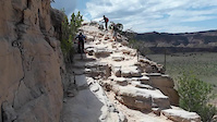
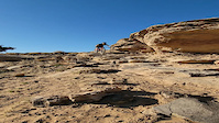
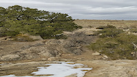
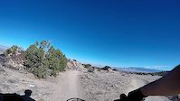
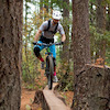
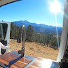
Photos of Grand Valley Canyons Mountain Bike
trail: Joes Ridge
190 |
May 29, 2020 @ 6:17pm
May 29, 2020
trail: Joes Ridge
269 |
Jun 6, 2019 @ 4:39pm
Jun 6, 2019
trail: Moore Fun
478 |
Apr 4, 2017 @ 8:56am
Apr 4, 2017
trail: Moore Fun
510 |
Dec 15, 2015 @ 6:59pm
Dec 15, 2015
trail: Mojoe
661 |
May 13, 2015 @ 7:12pm
May 13, 2015
trail: Andys Loop
513 |
Apr 15, 2015 @ 6:18pm
Apr 15, 2015
trail: Mojoe
312 |
Dec 6, 2014 @ 11:35am
Dec 6, 2014
trail: Andys Loop
342 |
Dec 6, 2014 @ 11:32am
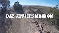
Dec 6, 2014Videos of Grand Valley Canyons Mountain Bike
trail: Horsethief Bench
5 |
May 26, 2022
trail: Horsethief Bench
193 |
Dec 26, 2021

trail: Zippity Do Dah
77 |
Sep 17, 2021

trail: 18 Road
38 |
May 24, 2021
trail: Joes Ridge
44 |
Apr 24, 2021
trail: Time Machine
183 |
Apr 14, 2021
trail: Holy Cross
119 |
Jan 22, 2021
trail: Pucker Up
123 |
Nov 21, 2020
Current Trail Warnings
| status | trail | date | condition | user | info |
|---|---|---|---|---|---|
| Haypress Turkey Flats | Jun 12, 2022 @ 8:07am Jun 12, 2022 | Prevalent Mud | randyfay | This was still too muddy, and there are... |
Recent Trail Reports
| status | trail | date | condition | info | user |
|---|---|---|---|---|---|
| Tabeguache Lunch Loops | Jul 5, 2022 @ 8:58am 19 hours | Dry | javadown1969 | ||
| Gunny Loop Lunch Loops | Jul 5, 2022 @ 8:58am 19 hours | Ideal | javadown1969 | ||
| Bunker Lunch Loops | Jul 5, 2022 @ 8:58am 19 hours | Ideal | javadown1969 | ||
| Miramonte Conn Lunch Loops | Jul 5, 2022 @ 8:58am 19 hours | Dry | javadown1969 | ||
| Leftover Lane Lunch Loops | Jul 5, 2022 @ 8:58am 19 hours | Ideal | javadown1969 | ||
| Time Machine Lunch Loops | Jul 5, 2022 @ 8:58am 19 hours | Ideal | javadown1969 | ||
| Curt's Up Lunch Loops | Jul 5, 2022 @ 8:58am 19 hours | Dry | javadown1969 | ||
| Curts Lane (S) Lunch Loops | Jul 5, 2022 @ 8:58am 19 hours | Ideal | javadown1969 | ||
| Bentonite Lunch Loops | Jul 5, 2022 @ 8:58am 19 hours | Ideal | javadown1969 | ||
| Palisade Plunge Palisade | Jul 4, 2022 @ 8:24am 2 days | Dry | ertoo |
Activity Feed
| username | action | type | title | date | |
|---|---|---|---|---|---|
 | Cpttimerestraint | wishlist | route | Roam Fest Fruita Koko Horsethief and 1 more | Jul 5, 2022 @ 9:38pm 6 hours |
 | warpdoc | wishlist | trail | The Ribbon | Jul 5, 2022 @ 5:41pm 10 hours |
| Pedro01 | wishlist | region | Lunch Loops | Jul 5, 2022 @ 3:04pm 13 hours |
 | javadown1969 | add | report | Tabeguache and 8 more | Jul 5, 2022 @ 1:54pm 14 hours |
 | cjbear | wishlist | route | LUNCH LOOPS FROM MONUMENT PARKING and 1 more | Jul 5, 2022 @ 11:21am 16 hours |
Recent Comments
| username | type | title | comment | date | |
|---|---|---|---|---|---|
 | trail | Did it once, don't need to do it again... The... | Jun 13, 2022 @ 5:46pm Jun 13, 2022 | ||
| trail | This first 11.8 miles of the trail is simple... | Jun 13, 2022 @ 8:09am Jun 13, 2022 | ||
| trail | Kutc | Jun 5, 2022 @ 8:32am Jun 5, 2022 | ||
| trail | Fun downhill with some... | May 31, 2022 @ 8:59pm May 31, 2022 | ||
| trail | Not so much a trail but more a somewhat... | May 26, 2022 @ 7:35am May 26, 2022 |
Local Badges
-

Big Ride 30k3,362 awarded -

10 Blue Trails1,041 awarded -
Big Ride 30k2,600 awarded -

Epic Ride 50k719 awarded -

10 Black Trails346 awarded -
10 Blue Trails574 awarded
Bike & Skill Parks
| name | type | city | rating |
|---|---|---|---|
| Powderhorn Mountain Resort | bike park | Cedaredge | |
| Fruita Jump Park | skill park | Fruita | |
| Lunch Loops Jump Park | skill park | Grand Junction |
Upcoming Local Events
Local Products
Local Products
Activity Type Stats
| activitytype | trails | distance | descent | descent distance | total vertical | rating | global rank | state rank | photos | reports | routes | ridelogs |
|---|---|---|---|---|---|---|---|---|---|---|---|---|
| Mountain Bike | 319 | 572 miles | 80,482 ft | 247 miles | 6,453 ft | 1,187 | 2,377 | 67 | 67,568 | |||
| E-Bike | 111 | 221 miles | 24,501 ft | 90 miles | 5,692 ft | 12 | 1,960 | 10 | 637 | |||
| Hike | 375 | 663 miles | 93,589 ft | 282 miles | 6,545 ft | 5 | 2,332 | 34 | 2,465 | |||
| Trail Running | 371 | 655 miles | 92,943 ft | 280 miles | 6,545 ft | 2,332 | 34 | 1,428 | ||||
| Horse | 30 | 104 miles | 15,400 ft | 56 miles | 6,230 ft | 819 | 4 | 11 | ||||
| Dirtbike/Moto | 44 | 126 miles | 18,373 ft | 60 miles | 5,643 ft | 1 | 826 | 7 | 83 | |||
| Observed Trials | 2 | 11 miles | 1,736 ft | 7 miles | 1,302 ft | 13 | 7 | |||||
| ATV/ORV/OHV | 27 | 65 miles | 10,558 ft | 36 miles | 4,905 ft | 815 | 1 | 11 | ||||
| Snowmobile | 1 | 1 mile | 289 ft | 1 mile | 279 ft | |||||||
| Snowshoe | 1 | 1 mile | 289 ft | 1 mile | 279 ft | 32 | ||||||
| Downhill Ski | 39 | 22 miles | 23,455 ft | 22 miles | 1,598 ft | 35 | 483 | |||||
| Backcountry Ski | 1 | 1 mile | 289 ft | 1 mile | 279 ft | 127 |
- By brenthillier
 NSMBA TRAILFORKS & contributors
 - Admins: jpmcghee, msmcfate, cmcquade, COPMOBA, GVTA, grandvalleydave
- #8987 - 4,148 views
- grand valley canyons activity log | embed map of Grand Valley Canyons mountain bike trails | grand valley canyons mountain biking points of interest
Downloading of trail gps tracks in kml & gpx formats is enabled for Grand Valley Canyons.
You must login to download files.