close
Trail Conditions
- Unknown
- Snow Groomed
- Snow Packed
- Snow Covered
- Snow Cover Inadequate
- Freeze/thaw Cycle
- Icy
- Prevalent Mud
- Wet
- Variable
- Ideal
- Dry
- Very Dry
Trail Flow (Ridden Direction)
Trailforks scans users ridelogs to determine the most popular direction each trail is ridden. A good flowing trail network will have most trails flowing in a single direction according to their intension.
The colour categories are based on what percentage of riders are riding a trail in its intended direction.
The colour categories are based on what percentage of riders are riding a trail in its intended direction.
- > 96%
- > 90%
- > 80%
- > 70%
- > 50%
- < 50%
- bi-directional trail
- no data
Trail Last Ridden
Trailforks scans ridelogs to determine the last time a trail was ridden.
- < 2 days
- < 1 week
- < 2 weeks
- < 1 month
- < 6 months
- > 6 months
Trail Ridden Direction
The intended direction a trail should be ridden.
- Downhill Only
- Downhill Primary
- Both Directions
- Uphill Primary
- Uphill Only
- One Direction
Contribute Details
Colors indicate trail is missing specified detail.
- Description
- Photos
- Description & Photos
- Videos
Trail Popularity ?
Trailforks scans ridelogs to determine which trails are ridden the most in the last 9 months.
Trails are compared with nearby trails in the same city region with a possible 25 colour shades.
Think of this as a heatmap, more rides = more kinetic energy = warmer colors.
- most popular
- popular
- less popular
- not popular
ATV/ORV/OHV Filter
Max Vehicle Width
inches
Radar Time
x
Activity Recordings
Trailforks users anonymized public ridelogs from the past 6 months.
- mountain biking recent
- mountain biking (>6 month)
- hiking (1 year)
- moto (1 year)
Activity Recordings
Trailforks users anonymized public skilogs from the past 12 months.
- Downhill Ski
- Backcountry Ski
- Nordic Ski
Jump Magnitude Heatmap
Heatmap of where riders jump on trails. Zoom in to see individual jumps, click circles to view jump details.
Trails Deemphasized
Trails are shown in grey.
Only show trails with NO bikes.
Save the current map location and zoom level as your default home location whenever this page is loaded.
SaveThe primary gateway to Rothrock State Forest from State College
Primary Trail Type: Cross-Country
Land Status: State Forest
 google parking directions
 Access Info:
Galbraith Gap parking lot off Bear Meadows Rd just past Tussey Mountain Ski area
Links
Activities Click to view
- Mountain Bike
58 trails
- E-Bike
0 trails
- Hike
59 trails
- Trail Running
59 trails
Region Details
- 10
- 1
- 11
- 15
- 13
- 8
Region Status
Caution as of Mar 3, 2022Stats
- Avg Trail Rating
- Trails (view details)
- 60
- Trails Mountain Bike
- 58
- Trails Hike
- 59
- Trails Trail Running
- 59
- Trails Horse
- 11
- Trails Snowmobile
- 3
- Trails Snowshoe
- 20
- Trails Downhill Ski
- 1
- Trails Backcountry Ski
- 9
- Trails Nordic Ski
- 1
- Total Distance
- 100 miles
- Total Descent
- 16,703 ft
- Total Vertical
- 1,467 ft
- Highest Trailhead
- 2,416 ft
- Reports
- 1,829
- Photos
- 386
- Ridden Counter
- 8,091
Popular Galbraith Gap Mountain Biking Trails
Galbraith Gap Mountain Bike Routes
| title | rating | distance |
|---|---|---|
| Cooper's Quick Loop | 11 miles | |
| Beer Tap - Ridge Loop | 12 miles | |
| Rothrock TrailMix (IMBA Epic) | 35 miles | |
| Bald Knob & the Laurels Loop | 13 miles | |
| NMBA Beginner Coopers 01 | 11 miles | |
| 2 Gaps 2 Ridges | 34 miles | |
| Galbraith Gravel 50 | 47 miles | |
| NMBA Galbraith Gap Beginner 02 | 15 miles | |
| NMBA - Tussey Ridge Loop | 10 miles | |
| Penn Roosevelt 21 | 21 miles |
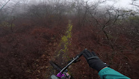
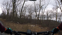
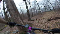
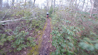
Photos of Galbraith Gap Mountain Bike
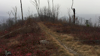
trail: Charcoal Flats
20 |
Mar 21, 2022 @ 5:40am
Mar 21, 2022
trail: Mountain Mist Trail - East
15 |
Mar 17, 2022 @ 2:23pm
Mar 17, 2022
trail: Wampler Rd
14 |
Mar 4, 2022 @ 8:14am
Mar 4, 2022
trail: Little Shingletown Trail
6 |
Mar 4, 2022 @ 8:00am
Mar 4, 2022
trail: Bear Gap Rd
8 |
Mar 4, 2022 @ 7:57am
Mar 4, 2022
trail: Tussey Mountain Trail
172 |
Apr 21, 2019 @ 5:34pm
Apr 21, 2019
trail: Tussey Mountain Trail
801 |
Apr 14, 2016 @ 8:35am
Apr 14, 2016Videos of Galbraith Gap Mountain Bike
trail: Greenshoot Trail
56 |
Jan 6, 2021
trail: Shingletown Gap Trail
45 |
Jan 6, 2021
trail: Sand Spring Trail - South
32 |
Jan 6, 2021
trail: Spruce Gap
62 |
Jan 5, 2021
trail: Tussey Mountain Trail
0:24 |
182 |
Nov 28, 2016
trail: Galbraith Gap Trail
3:40 |
16040 |
Oct 11, 2016
trail: Three Bridges Trail
4:31 |
342 |
Apr 8, 2014

trail: Spur
0:11 |
114 |
Jul 13, 2011
Recent Trail Reports
| status | trail | date | condition | info | user |
|---|---|---|---|---|---|
| Lonberger Path | Jun 22, 2022 @ 6:50am Jun 22, 2022 | Wet | ayeho | ||
| Wildcat Gap Trail | Jun 21, 2022 @ 3:30pm Jun 21, 2022 | Dry | ihertzler | ||
| Tussey Mountain Trail | Jun 21, 2022 @ 3:28pm Jun 21, 2022 | Dry | ihertzler | ||
| Dylan's Path | Jun 21, 2022 @ 3:26pm Jun 21, 2022 | Dry | ihertzler | ||
| Long Mountain Trail | Jun 20, 2022 @ 9:28am Jun 20, 2022 | Variable | ihertzler | ||
| Old Laurel Run Trail | Jun 20, 2022 @ 9:26am Jun 20, 2022 | Ideal | ihertzler | ||
| Black Gum Trail | Jun 20, 2022 @ 8:28am Jun 20, 2022 | Ideal | LINDAMARSHALLsfa | ||
| Tussey Mountain Extension Trail (upper) | Jun 18, 2022 @ 6:53am Jun 18, 2022 | Dry | ayeho | ||
| Sand Spring Trail - Mid | Jun 15, 2022 @ 3:02pm Jun 15, 2022 | Variable | ihertzler | ||
| Gettis Ridge Rd | Jun 14, 2022 @ 1:07pm Jun 14, 2022 | Dry | AdamWilusz |
Activity Feed
| username | action | type | title | date | |
|---|---|---|---|---|---|
 | Stirfrycook | wishlist | route | NMBA Beginner Coopers 01 | Jul 2, 2022 @ 5:19pm Jul 2, 2022 |
| biking29 | add | karma | Galbraith Gap | Jun 29, 2022 @ 7:20pm Jun 29, 2022 |
| ayeho | add | report | Lonberger Path and 2 more | Jun 23, 2022 @ 6:48am Jun 23, 2022 |
 | ihertzler | add | report | Dylan's Path and 2 more | Jun 21, 2022 @ 3:26pm Jun 21, 2022 |
 | Charlie116 | wishlist | route | Cooper's Quick Loop | Jun 20, 2022 @ 10:33am Jun 20, 2022 |
Recent Comments
| username | type | title | comment | date | |
|---|---|---|---|---|---|
| trail | Pretty steep loose trail harder than many... | May 7, 2022 @ 8:46am May 7, 2022 | ||
| trail | Absolutely not a double black. Rocks are not... | Nov 7, 2021 @ 3:46pm Nov 7, 2021 | ||
| report | Yes, that is now gone. | Oct 20, 2021 @ 8:31am Oct 20, 2021 | ||
 | report | Was that the sharp left log drop? | Oct 20, 2021 @ 6:20am Oct 20, 2021 | ||
| report | Ground bees have been taken care of | Jul 21, 2021 @ 10:04am Jul 21, 2021 |
Nearby Areas
| name | distance | ||||
|---|---|---|---|---|---|
| Greenwood Furnace State Park | 3 | 9 | 4 | 3 | 3.6 km |
| Coopers Gap | 3 | 8 | 12 | 1 | 4.2 km |
| Harvest Fields Community Trails | 6 | 1 | 4.7 km | ||
| Colyer Lake | 4 | 3 | 1 | 5.1 km | |
| Musser Gap | 2 | 2 | 1 | 5.8 km |
Local Badges
-

Completionist0 awarded
Upcoming Local Events
Local Mountain Biking Directory
-
Nittany Mountain Bike Association
![Nittany Mountain Bike Association]()
-
Happy Valley Woemen's Cycling
![Happy Valley Woemen's Cycling]()
-
Freeze Thaw Cycles
![Freeze Thaw Cycles]() Bike Shop
Bike Shop
-
The Bicycle Shop
![The Bicycle Shop]() Bike Shop
Bike Shop
-
Eddie's Bicycles And Sport Equipment
![Eddie's Bicycles And Sport Equipment]() Bike Shop
Bike Shop
Local Products
Local Trail Supporters
![]()
- http://www.dcnr.state.pa.us/forestry/stateforests/rothrock/index.htm
- http://nittanymba.org/
Local Mountain Biking Directory
-
Nittany Mountain Bike Association
![Nittany Mountain Bike Association]()
-
Happy Valley Woemen's Cycling
![Happy Valley Woemen's Cycling]()
-
Freeze Thaw CyclesBike Shop
![Freeze Thaw Cycles]()
-
The Bicycle ShopBike Shop
![The Bicycle Shop]()
-
Eddie's Bicycles And Sport EquipmentBike Shop
![Eddie's Bicycles And Sport Equipment]()
Local Products
Local Trail Supporters
![]()
- http://www.dcnr.state.pa.us/forestry/stateforests/rothrock/index.htm
- http://nittanymba.org/
Activity Type Stats
| activitytype | trails | distance | descent | descent distance | total vertical | rating | global rank | state rank | photos | reports | routes | ridelogs |
|---|---|---|---|---|---|---|---|---|---|---|---|---|
| Mountain Bike | 58 | 99 miles | 16,171 ft | 51 miles | 1,467 ft | #749 | #385 | 384 | 1,752 | 32 | 4,219 | |
| Hike | 59 | 100 miles | 16,558 ft | 51 miles | 1,467 ft | #534 | #324 | 2 | 1,753 | 1 | 125 | |
| Trail Running | 59 | 100 miles | 16,558 ft | 51 miles | 1,467 ft | #536 | #322 | 1,753 | 1 | 181 | ||
| Horse | 11 | 38 miles | 4,573 ft | 20 miles | 1,457 ft | 1,003 | ||||||
| Snowmobile | 3 | 22 miles | 1,722 ft | 11 miles | 1,414 ft | 1 | ||||||
| Snowshoe | 20 | 21 miles | 3,369 ft | 10 miles | 1,286 ft | 92 | ||||||
| Downhill Ski | 1 | 2,316 ft | 354 ft | 2,316 ft | 354 ft | |||||||
| Backcountry Ski | 9 | 17 miles | 1,512 ft | 6 miles | 1,421 ft | 17 | 3 | |||||
| Nordic Ski | 1 | 2,316 ft | 354 ft | 2,316 ft | 354 ft |
- By Saclydesdale
 NMBA & contributors
 - Admins: NMBA
- #6335 - 11,722 views
- galbraith gap activity log | embed map of Galbraith Gap mountain bike trails | galbraith gap mountain biking points of interest
Downloading of trail gps tracks in kml & gpx formats is enabled for Galbraith Gap.
You must login to download files.