close
Trail Conditions
- Unknown
- Snow Groomed
- Snow Packed
- Snow Covered
- Snow Cover Inadequate
- Freeze/thaw Cycle
- Icy
- Prevalent Mud
- Wet
- Variable
- Ideal
- Dry
- Very Dry
Trail Flow (Ridden Direction)
Trailforks scans users ridelogs to determine the most popular direction each trail is ridden. A good flowing trail network will have most trails flowing in a single direction according to their intension.
The colour categories are based on what percentage of riders are riding a trail in its intended direction.
The colour categories are based on what percentage of riders are riding a trail in its intended direction.
- > 96%
- > 90%
- > 80%
- > 70%
- > 50%
- < 50%
- bi-directional trail
- no data
Trail Last Ridden
Trailforks scans ridelogs to determine the last time a trail was ridden.
- < 2 days
- < 1 week
- < 2 weeks
- < 1 month
- < 6 months
- > 6 months
Trail Ridden Direction
The intended direction a trail should be ridden.
- Downhill Only
- Downhill Primary
- Both Directions
- Uphill Primary
- Uphill Only
- One Direction
Contribute Details
Colors indicate trail is missing specified detail.
- Description
- Photos
- Description & Photos
- Videos
Trail Popularity ?
Trailforks scans ridelogs to determine which trails are ridden the most in the last 9 months.
Trails are compared with nearby trails in the same city region with a possible 25 colour shades.
Think of this as a heatmap, more rides = more kinetic energy = warmer colors.
- most popular
- popular
- less popular
- not popular
ATV/ORV/OHV Filter
Max Vehicle Width
inches
Radar Time
x
Activity Recordings
Trailforks users anonymized public ridelogs from the past 6 months.
- mountain biking recent
- mountain biking (>6 month)
- hiking (1 year)
- moto (1 year)
Activity Recordings
Trailforks users anonymized public skilogs from the past 12 months.
- Downhill Ski
- Backcountry Ski
- Nordic Ski
Jump Magnitude Heatmap
Heatmap of where riders jump on trails. Zoom in to see individual jumps, click circles to view jump details.
Trails Deemphasized
Trails are shown in grey.
Only show trails with NO bikes.
Save the current map location and zoom level as your default home location whenever this page is loaded.
SaveConsisting of many expansive and diverse trails, Blackstrap Hill Preserve and its adjacent networks are popular among local riders. The bulk of the trails in the area are located between Blackstrap Road and the Turnpike. This area encompasses the trails with features that aggressive riders will enjoy: Berms, flowy turns, drops and optional doubles can be found here. Across Blackstrap Rd, there is some very loamy, flowy, and fun singletrack continuing into the North Falmouth Community Forest. The network also continues across the turnpike where some flatter cross country trails can be found. The map from the Falmouth Land Trust Website is not fully inclusive of all of these trails, but using the Strava segment explorer will help you discover the bulk of the unmapped trails. Definitely a place to check out if you are into more aggressive all-mountain style riding, but also worth the trip for the cross country trails that are mixed in throughout.
Access and parking information information from Falmouth Land Trust website:
From the south: a parking area is located on the east side of Blackstrap Road, 1/4 mile north of Mountain Road. A kiosk with a trail map is down the hill from the parking area.
From the north: an access road off Hurricane Road, just west of the Maine Turnpike bridge, leads to a parking area and information kiosk.
From the west: a trailhead is located just north of the intersection of Babbidge Road and Blackstrap Road. Park along the road near the trailhead. The property can also be accessed from the utility corridor just north of the intersection of Blackstrap Road and Mast Road.
Hiking, snowmobiling, mountain biking, snowshoeing, cross-country skiing, hunting, fishing, nature study, and horseback riding are all allowed. Motorized vehicles are prohibited, except snowmobiles on marked trails. Trails are not handicapped accessible.
source: ...
Primary Trail Type: All-Mountain & Downhill
Land Status: Community Forest
Land Manager: Falmouth Land Trust
 google parking directions
Links
Files
- Blackstrap_Large_Map.pdf (4.78 MB)
Activities Click to view
- Mountain Bike
37 trails
- Hike
35 trails
- Trail Running
35 trails
- Horse
0 trails
- Snowmobile
3 trails
- Snowshoe
0 trails
- Nordic Ski
0 trails
Region Details
- 5
- 5
- 24
- 3
Region Status
Open as of May 2, 2022Stats
- Avg Trail Rating
- Trails (view details)
- 37
- Trails Mountain Bike
- 37
- Trails E-Bike
- 1
- Trails Hike
- 35
- Trails Trail Running
- 35
- Trails Snowmobile
- 3
- Total Distance
- 24 miles
- Total Descent
- 3,845 ft
- Total Vertical
- 401 ft
- Highest Trailhead
- 474 ft
- Reports
- 388
- Photos
- 80
- Ridden Counter
- 13,349
Popular Blackstrap Hill Preserve Mountain Biking Trails
Blackstrap Hill Preserve Mountain Bike Routes
| title | rating | distance |
|---|---|---|
| Blackstrap Virtual XC MTB Race | 4 miles | |
| 15 mile Blackstrap Hill Preserve Ride | popular ridelog | 15 miles |
| 12 mile Blackstrap Hill Preserve All-Mountain Ride | popular ridelog | 12 miles |
| 13 mile Blackstrap Hill Preserve Cross-country Ride | popular ridelog | 13 miles |
| 11 mile Blackstrap Hill Preserve All-Mountain Ride | popular ridelog | 11 miles |
| 6 mile Blackstrap Hill Preserve Ride | popular ridelog | 6 miles |
| 12 mile Blackstrap Hill Preserve Ride | popular ridelog | 12 miles |
| 6 mile Blackstrap Hill Preserve All-Mountain Ride | popular ridelog | 6 miles |
| 4 mile Blackstrap Hill Preserve Ride | popular ridelog | 4 miles |
| 7 mile Blackstrap Hill Preserve Ride | popular ridelog | 7 miles |
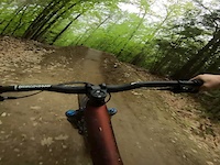
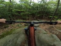
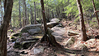
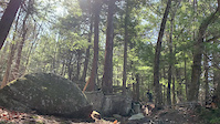
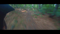
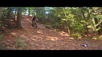
Photos of Blackstrap Hill Preserve Mountain Bike
trail: Powelines
65 |
Jun 8, 2021 @ 5:04am
Jun 8, 2021
trail: Lookout
41 |
Jan 23, 2021 @ 12:46pm
Jan 23, 2021
trail: Bustamove
119 |
Jan 23, 2021 @ 12:42pm
Jan 23, 2021
trail: Cakewalk
41 |
Jan 23, 2021 @ 12:35pm
Jan 23, 2021
trail: Poplar Ridge Trail
23 |
Jan 23, 2021 @ 12:35pm
Jan 23, 2021
trail: Poplar Ridge Trail
19 |
Jan 23, 2021 @ 12:33pm
Jan 23, 2021
trail: Poplar Ridge Trail
52 |
Jan 23, 2021 @ 12:32pm
Jan 23, 2021
trail: Flow Creek
64 |
Nov 11, 2020 @ 6:37am
Nov 11, 2020Videos of Blackstrap Hill Preserve Mountain Bike
trail: Bustamove
54 |
May 23, 2022
trail: Rocky Ridge (NEMBA Trail)
67 |
May 20, 2022
trail: Rocky Ridge (NEMBA Trail)
347 |
Mar 23, 2021
trail: Rocky Ridge (NEMBA Trail)
291 |
Mar 23, 2021

trail: Blackstrap River Trail
1:15 |
458 |
Sep 14, 2014
trail: Blackstrap River Trail
3:32 |
416 |
Aug 13, 2014
trail: Blackstrap River Trail
1:50 |
421 |
Aug 12, 2014
trail: Blackstrap River Trail
4:41 |
323 |
Jun 13, 2014
Recent Trail Reports
| status | trail | date | condition | info | user |
|---|---|---|---|---|---|
| Rocky Ridge (NEMBA Trail) | Jun 13, 2022 @ 7:23pm Jun 13, 2022 | Variable | JoshuaLangworthy07 | ||
| Powelines | Jun 13, 2022 @ 7:23pm Jun 13, 2022 | Variable | JoshuaLangworthy07 | ||
| Saw Whet | Jun 13, 2022 @ 7:23pm Jun 13, 2022 | Variable | JoshuaLangworthy07 | ||
| Green Line Summit | Jun 13, 2022 @ 7:23pm Jun 13, 2022 | Variable | JoshuaLangworthy07 | ||
| Bobcat Trail | Jun 13, 2022 @ 7:23pm Jun 13, 2022 | Variable | JoshuaLangworthy07 | ||
| Yellow Line Connect | Jun 13, 2022 @ 7:23pm Jun 13, 2022 | Variable | JoshuaLangworthy07 | ||
| Snowmobile | Jun 13, 2022 @ 7:23pm Jun 13, 2022 | Variable | JoshuaLangworthy07 | ||
| Rocky Raven Connect | Jun 13, 2022 @ 7:23pm Jun 13, 2022 | Variable | JoshuaLangworthy07 | ||
| Red | Jun 13, 2022 @ 7:23pm Jun 13, 2022 | Variable | JoshuaLangworthy07 | ||
| Red Trail & Green Line | Jun 13, 2022 @ 7:23pm Jun 13, 2022 | Variable | JoshuaLangworthy07 |
Activity Feed
| username | action | type | title | date | |
|---|---|---|---|---|---|
 | zKKrkN | wishlist | region | Blackstrap Hill Preserve | Jul 5, 2022 @ 8:07am 20 hours |
| BrennenMoquiniXx | ridden | trail | Flow Creek and 3 more | Jul 4, 2022 @ 5:31pm 1 day |
| ILikeSubarus | wishlist | region | Blackstrap Hill Preserve | Jul 4, 2022 @ 2:10pm 2 days |
| negruel | wishlist | trail | Bustamove and 2 more | Jul 3, 2022 @ 1:46pm 3 days |
| negruel | wishlist | region | Blackstrap Hill Preserve | Jul 3, 2022 @ 1:46pm 3 days |
Recent Comments
| username | type | title | comment | date | |
|---|---|---|---|---|---|
| trail | Awesome step down and step up at the bottom | Jun 10, 2021 @ 12:45pm Jun 10, 2021 | ||
| trail | Idk if this is even a legit trail anymore.... | Jun 10, 2021 @ 12:40pm Jun 10, 2021 | ||
| trail | The first couple hundred feet are pretty cool... | Jun 10, 2021 @ 12:35pm Jun 10, 2021 | ||
| trail | Some cool terrain but definitely punishes... | Jun 10, 2021 @ 12:31pm Jun 10, 2021 | ||
| report | Yes, most trails in the region close for... | Mar 29, 2021 @ 11:22am Mar 29, 2021 |
Nearby Areas
| name | distance | ||||
|---|---|---|---|---|---|
| Hadlock Community Forest | 5 | 10 | 1.9 km | ||
| Lowell Preserve | 3 | 12 | 2.2 km | ||
| Rines Forest | 2 | 7 | 2.7 km | ||
| Hardy Road Conservation Area | 3 | 2.8 km | |||
| Falmouth Community Park | 4 | 4 | 2.8 km |
Local Badges
-

Completionist0 awarded
Activity Type Stats
| activitytype | trails | distance | descent | descent distance | total vertical | rating | global rank | state rank | photos | reports | routes | ridelogs |
|---|---|---|---|---|---|---|---|---|---|---|---|---|
| Mountain Bike | 37 | 24 miles | 3,845 ft | 12 miles | 400 ft | #373 | #186 | 80 | 388 | 1 | 8,567 | |
| E-Bike | 1 | 4,232 ft | 79 ft | 1,086 ft | 177 ft | 335 | 104 | |||||
| Hike | 35 | 23 miles | 3,517 ft | 11 miles | 400 ft | #306 | #184 | 377 | 100 | |||
| Trail Running | 35 | 23 miles | 3,517 ft | 11 miles | 400 ft | #308 | #183 | 377 | 74 | |||
| Snowmobile | 3 | 2 miles | 259 ft | 4,226 ft | 331 ft | #43 | #20 | 8 |
- By GoRideYoBike
 & contributors
 - Admins: GPNEMBA
- #5666 - 18,149 views
- blackstrap hill preserve activity log | embed map of Blackstrap Hill Preserve mountain bike trails | blackstrap hill preserve mountain biking points of interest
Downloading of trail gps tracks in kml & gpx formats is enabled for Blackstrap Hill Preserve.
You must login to download files.