close
Trail Conditions
- Unknown
- Snow Groomed
- Snow Packed
- Snow Covered
- Snow Cover Inadequate
- Freeze/thaw Cycle
- Icy
- Prevalent Mud
- Wet
- Variable
- Ideal
- Dry
- Very Dry
Trail Flow (Ridden Direction)
Trailforks scans users ridelogs to determine the most popular direction each trail is ridden. A good flowing trail network will have most trails flowing in a single direction according to their intension.
The colour categories are based on what percentage of riders are riding a trail in its intended direction.
The colour categories are based on what percentage of riders are riding a trail in its intended direction.
- > 96%
- > 90%
- > 80%
- > 70%
- > 50%
- < 50%
- bi-directional trail
- no data
Trail Last Ridden
Trailforks scans ridelogs to determine the last time a trail was ridden.
- < 2 days
- < 1 week
- < 2 weeks
- < 1 month
- < 6 months
- > 6 months
Trail Ridden Direction
The intended direction a trail should be ridden.
- Downhill Only
- Downhill Primary
- Both Directions
- Uphill Primary
- Uphill Only
- One Direction
Contribute Details
Colors indicate trail is missing specified detail.
- Description
- Photos
- Description & Photos
- Videos
Trail Popularity ?
Trailforks scans ridelogs to determine which trails are ridden the most in the last 9 months.
Trails are compared with nearby trails in the same city region with a possible 25 colour shades.
Think of this as a heatmap, more rides = more kinetic energy = warmer colors.
- most popular
- popular
- less popular
- not popular
ATV/ORV/OHV Filter
Max Vehicle Width
inches
Radar Time
x
Activity Recordings
Trailforks users anonymized public ridelogs from the past 6 months.
- mountain biking recent
- mountain biking (>6 month)
- hiking (1 year)
- moto (1 year)
Activity Recordings
Trailforks users anonymized public skilogs from the past 12 months.
- Downhill Ski
- Backcountry Ski
- Nordic Ski
Jump Magnitude Heatmap
Heatmap of where riders jump on trails. Zoom in to see individual jumps, click circles to view jump details.
Trails Deemphasized
Trails are shown in grey.
Only show trails with NO bikes.
Save the current map location and zoom level as your default home location whenever this page is loaded.
Save
No description for Stresa has been added yet!
Login or register to submit one.
Activities Click to view
- Mountain Bike
32 trails
- E-Bike
27 trails
- Hike
27 trails
- Trail Running
27 trails
Region Details
- 1
- 6
- 13
- 8
- 2
- 2
Region Status
Open as of Jan 27, 2022Local Trail Association
Stats
- Avg Trail Rating
- Trails (view details)
- 32
- Trails Mountain Bike
- 32
- Trails E-Bike
- 27
- Trails Hike
- 27
- Trails Trail Running
- 27
- Total Distance
- 41 miles
- Total Descent
- 14,364 ft
- Total Vertical
- 3,882 ft
- Highest Trailhead
- 4,530 ft
- Reports
- 215
- Photos
- 105
- Ridden Counter
- 930
Sub Regions
-
CIPS AltoVergante
- 6
- 7
- 8
- 1
Popular Stresa Mountain Biking Trails
Stresa Mountain Bike Routes
| title | rating | distance |
|---|---|---|
| LA GT - LA GRAVEL sulla ciclovia DEL TOCE on GPSies.com race | 63 miles | |
| 2 miles |
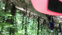
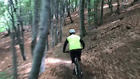
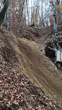
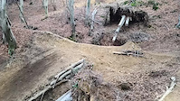
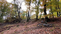
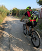
Photos of Stresa Mountain Bike
trail: Biscia line
83 |
Apr 8, 2021 @ 12:33am
Apr 8, 2021
trail: Biscia line
76 |
Apr 8, 2021 @ 12:32am
Apr 8, 2021
trail: Trail della Canà
25 |
Jan 26, 2021 @ 6:50am
Jan 26, 2021
trail: Trail della Canà
23 |
Jan 26, 2021 @ 6:49am
Jan 26, 2021
trail: Trail della Canà
42 |
Jan 26, 2021 @ 6:49am
Jan 26, 2021
trail: Biscia line
87 |
Nov 12, 2020 @ 11:39am
Nov 12, 2020Videos of Stresa Mountain Bike
trail: Alpe Marta's Trail
|
May 22, 2022
trail: Alpe Marta's Trail
|
May 22, 2022
trail: Biscia line
261 |
Nov 9, 2020
trail: Biscia line
281 |
Nov 9, 2020
trail: Biscia line
227 |
Oct 25, 2020

trail: Biscia line
226 |
Oct 25, 2020
Recent Trail Reports
| status | trail | date | condition | info | user |
|---|---|---|---|---|---|
| Coiromonte Dorsale/Gignese | Jun 19, 2022 @ 5:43am Jun 19, 2022 | Dry | alex73mtb | ||
| Sparta trail | Jun 6, 2022 @ 11:47am Jun 6, 2022 | Ideal | marambo | ||
| Secondino trail | May 30, 2022 @ 12:15pm May 30, 2022 | Wet | AsdCIPS | ||
| Vedabia trail | May 22, 2022 @ 7:07am May 22, 2022 | Ideal | tosiroberto | ||
| Obelisco DH | May 22, 2022 @ 7:07am May 22, 2022 | Ideal | tosiroberto | ||
| From Levo To Stresa | May 22, 2022 @ 7:07am May 22, 2022 | Dry | tosiroberto | ||
| Cappella Monte Croce-Santa Crisitina | May 22, 2022 @ 2:11am May 22, 2022 | Ideal | marambo | ||
| Alpe Marta's Trail | May 22, 2022 @ 1:36am May 22, 2022 | Ideal | marambo | ||
| Stropino-Stresa | May 20, 2022 @ 10:14pm May 20, 2022 | Ideal | lozioo LDC | ||
| Biscia line | May 15, 2022 @ 5:19am May 15, 2022 | Ideal | tosiroberto |
Activity Feed
| username | action | type | title | date | |
|---|---|---|---|---|---|
 | alex73mtb | add | report | Coiromonte Dorsale/Gignese | Jun 19, 2022 @ 5:43am Jun 19, 2022 |
 | moritzdisch | ridden | trail | Biscia line | Jun 12, 2022 @ 10:34am Jun 12, 2022 |
 | marambo | add | report | Sparta trail | Jun 6, 2022 @ 11:48am Jun 6, 2022 |
| marambo | add | trail | Carpugnino-Motosega trail | Jun 5, 2022 @ 3:34am Jun 5, 2022 |
| AsdCIPS | add | report | Secondino trail | May 30, 2022 @ 12:15pm May 30, 2022 |
Recent Comments
| username | type | title | comment | date | |
|---|---|---|---|---|---|
| report | Chiedo venia per l’ortografia... | Nov 22, 2021 @ 4:47am Nov 22, 2021 | ||
| report | Grazie Marambo per la segbalazione, se non ho... | Nov 22, 2021 @ 4:46am Nov 22, 2021 | ||
| report | il report precedente lo dava arancione (forse... | Nov 22, 2021 @ 2:54am Nov 22, 2021 | ||
| report | Grazie della info!! | Nov 17, 2021 @ 4:59am Nov 17, 2021 | ||
| report | E da soffiare ci sono un sacco di foglie quasi... | Nov 14, 2021 @ 8:36am Nov 14, 2021 |
Local Badges
-

Climbing 10k Badge10 awarded -

Epic Ride 50k134 awarded -

10 Green Trails7 awarded -

Mountain Biking 100k Badge0 awarded -

Top 10 Trails0 awarded -

Epic Mountain Bike Climb 2k32 awarded
Activity Type Stats
| activitytype | trails | distance | descent | descent distance | total vertical | rating | global rank | state rank | photos | reports | routes | ridelogs |
|---|---|---|---|---|---|---|---|---|---|---|---|---|
| Mountain Bike | 32 | 41 miles | 14,364 ft | 24 miles | 3,881 ft | #5,260 | #412 | 102 | 215 | 2 | 1,298 | |
| E-Bike | 27 | 37 miles | 12,349 ft | 22 miles | 3,881 ft | #2,161 | #255 | 3 | 206 | 124 | ||
| Hike | 27 | 36 miles | 11,804 ft | 21 miles | 3,881 ft | #4,327 | #323 | 204 | 29 | |||
| Trail Running | 27 | 36 miles | 11,804 ft | 21 miles | 3,881 ft | #4,320 | #324 | 204 | 124 |
- By AsdCIPS & contributors
- Admins: silviu86, marambo
- #22074 - 3,035 views
- stresa activity log | embed map of Stresa mountain bike trails | stresa mountain biking points of interest
Downloading of trail gps tracks in kml & gpx formats is enabled for Stresa.
You must login to download files.