We've been hard at work in 2018 improving Trailforks with new features and refinements along with fixing many bugs. Over 900 GIT code commits for the website and 250 for the mobile app.
While we spend a lot of development time fixing bugs, tweaking backend systems to be more efficient, changing queries to be faster, and other boring stuff. But we have also added a lot of new features this year! Fall and winter is typically when we tackle the big development tasks, so you can look forward to more updates coming this year and before spring 2019.
Here is a list of some of the changes we've made in 2018:
Website
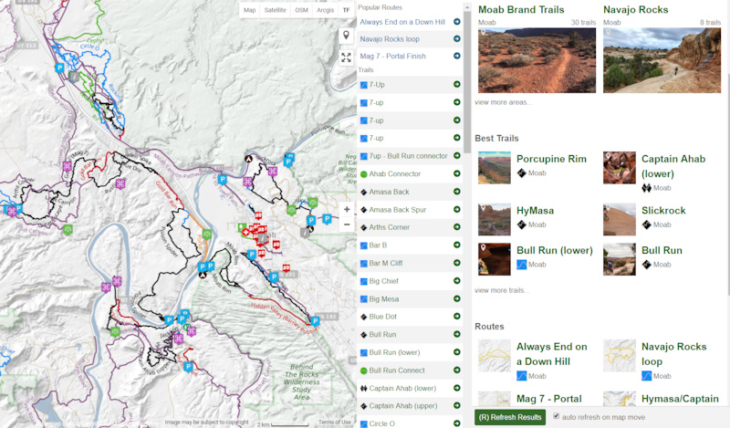
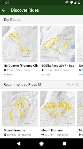
• Re-make of the "Browse By Map" page, shows top content in the map view on the right. Including top routes and recommended rides. (example)
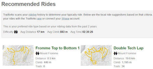
• Recommended Rides engine, uses your Ridelog history to recommend rides you might like based on your riding patterns. (example)
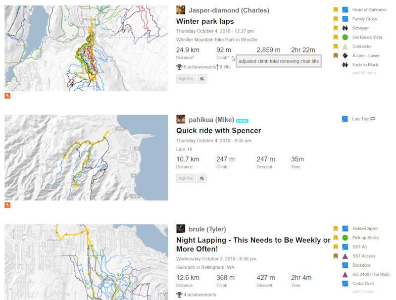
• New Ridelog feed page, showing details about your friends rides.
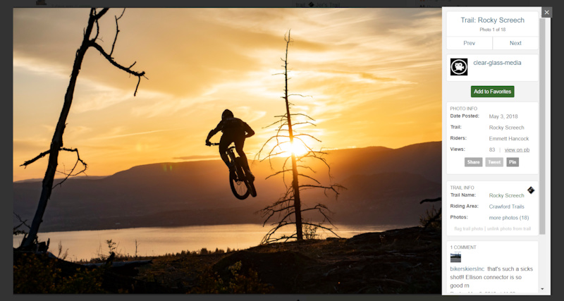
• View photos on Trailforks with the new photo viewer popup.
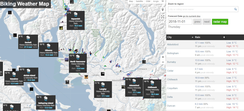
• Riding area weather forecast map. Includes webcams, radar and links to weather services.
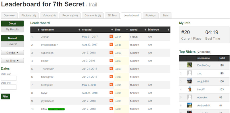
• Fix trail leaderboards and achievements. (example)
• Auto Disable leaderboards for trails 200 in length.
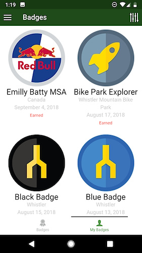
• Trailforks contests & badges to unlock via Ridelogs.

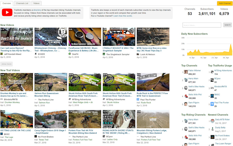
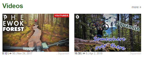
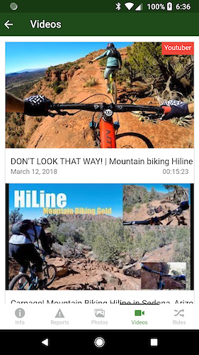
• Youtube channel directory.
• YouTube videos promoted to top of lists.
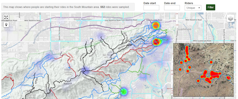
• Ride Start Heatmap tool for region admins.
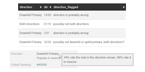
• Determine trail direction from users ridelogs. Show percentage of riders going in each direction. Flag trails for admins with wrong direction. (example)
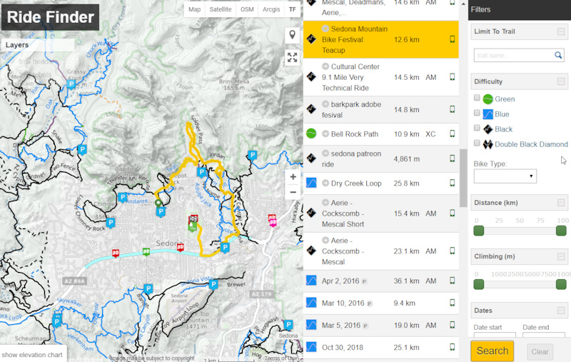
• Ride Finder. Provides a fast visual way to discover & filter rides in an area of the map.
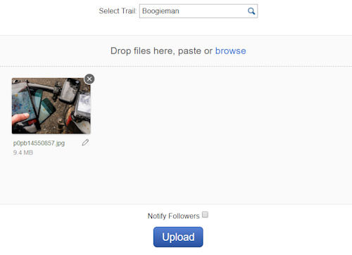
• New modern photo & video upload pages, no more flash!
• Landowners map layer powered by a Google Fusion table.
• Show riding area and descent total in synced Strava activity descriptions.
• Change how filtering trails on map works. Instead of hiding trails, trails are greyed out.
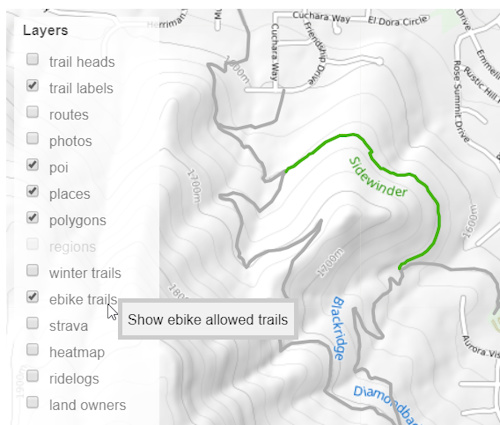
• Ebike map filter. ebike landing page.
• Display region ebike policy.
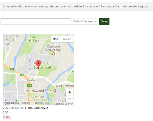
• Personal privacy zone option on Ridelogs.
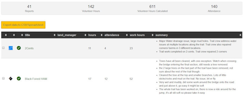
• Trail work report tool with chart and export to spreadsheet.
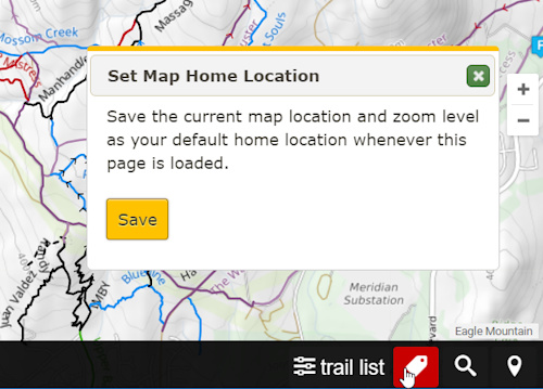
• Add a save home to fullscreen map and trail search.
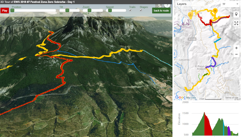
• Ridelog 3D tour.
• Show sections on route 3D tour. Fix playback speed.
• Custom ridelog preview images with trail & topo map in background. Used for friend feed and when you share a ridelog on social media.
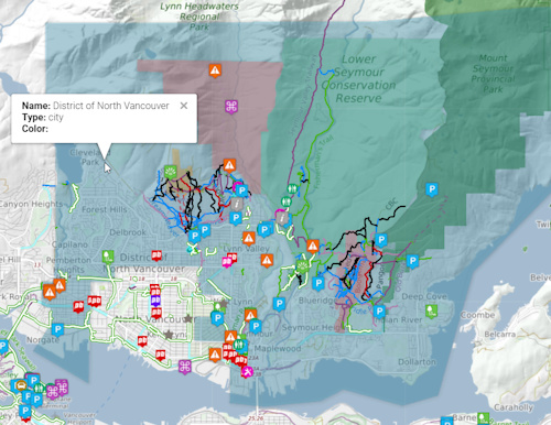
• Show different sized region markers on map based on popularity. Some are removed at zoom levels all together.
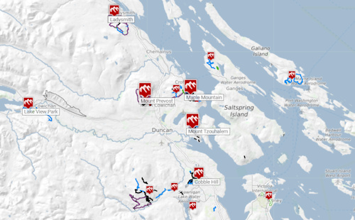
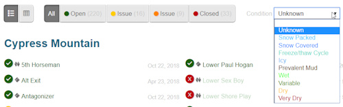
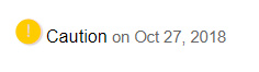
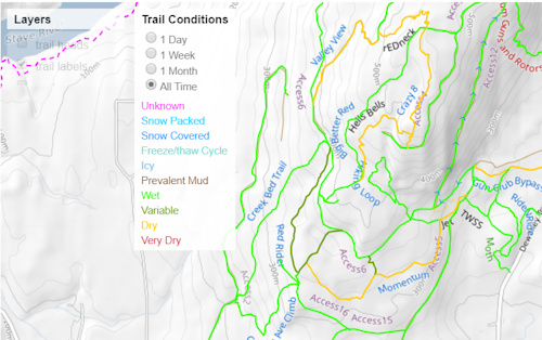
• Add condition select to region status page. (example)
• Regional status. An average of all the status reports from the trails in the region.
• Admin option to manually control/toggle the region status of riding areas in your region.
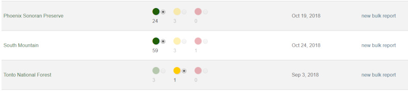
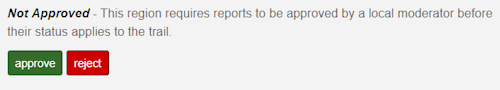
• Per-region option to enable trail status approval from reports.
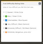
• Trail difficulty rating by users.
• Filter conditions map by update Time/Date.
PLUS:
• Group labels beside usernames clickable, shows group details.
• US State Epics & Trailforks Gold route lists.
• Trail Work Photo Feed.
• Trail Challenge tool.
• Option to delete Trailforks account and all data.
• Ridelog matching on routes. Route leaderboards.
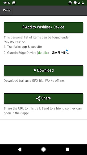
• Info on downloading a trail or route to Garmin Edge app.
• Better sorting of photos on trail & region pages to show better photos first.
• Route global ranking score. (example)
• "My Routes" page to view & manage routes sycned to the app.
• Download Garmin.FIT course files for trails & routes.
• Add GPX downloads for individual route sections. (example)
• Region list widget. Region status widget.
• Region popularity ranking. (example)
• Update ridelog title and privacy if updated on Strava.
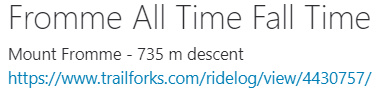
• Statistics page showing each trails checkin counts per year. (example)
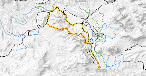
• Trails snap to ground on 3D maps. (example)
• Aggregate Trailforks Report Notification Emails.
• Print Map Tool, winter & planned trail filters.
• Ridelog stat for avg rides per year by locals and visitors.
• View users who have ridden unique trails in a region. (example)
• Show Current region name in corner of map.
• Improved Ridelog trail matching. Total rewrite of this code, more accurate now and better handles riding the same trail multiple times and different directions.
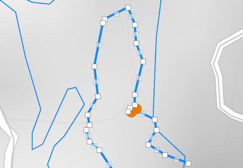
• Click ridelog matched trails distance to view the matched segment on the map.
• Detect chairlifts taken in a Ridelog. Show all the chairlift laps with timing. Show shuttle and lifts on elevation chart.
• Subtract distance and climb of chairlifts from Ridelog totals.
• View total lifts taken in a year on friends leaderboard page.
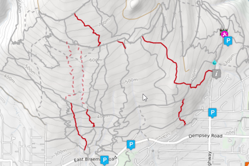
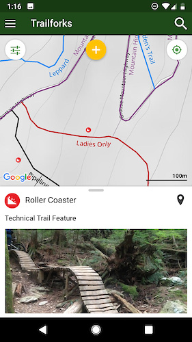
• Page listing a regions TTFs. (example)
Mobile App
• POI detail page, POI photo, add report to POI.
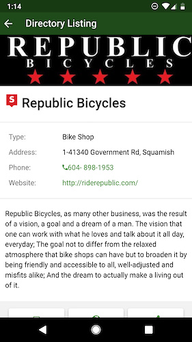
• Bike shop details page.
• Save trail or route as GPX file.
• Badge lists.
• View recommend rides on Discover page. Recommended based on your Ridelog history.
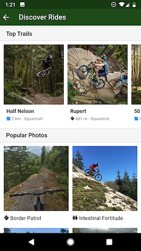
• Discover rides page improvements. Better trail images, don't refresh on small map changes.
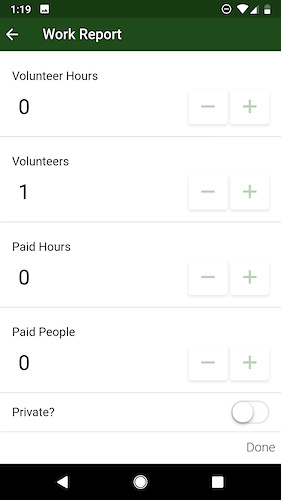
• Track paid hours on work reports.
• Youtuber videos promoted to start of trail videos.
PLUS:
• Major overhaul to GPS tracking feature.
• Save to Garmin button on trails and routes.
• Push notification support added.
• Contests listing page and popup.
• Delete ridelog with left swipe.
• Create new account from within app.
• Trail preferred direction detail.
• Connect Strava account within the app.
• Longpress trail titles or descriptions to translate or copy text.
• Photos retain GPS EXIF data.
• Cache last known location for emergency page.
• New fancier app information website.
• Auto-resume ride recording if app or phone crashes on Android.
• Delete reports from upload queue, swipe left.
Website Contributing Content
• Detect trails with overlapping GPS points, flag for moderators.
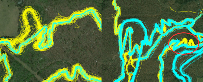
• 2 coloured ridelog heatmap, showing more recent rides in cyan.
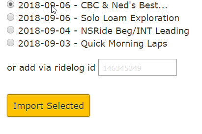
• Add trail from cropping a Ridelog.
PLUS:
• Option to delete bounding polygon on region edit page.
• Override trail association on routes.
• Bikepacking option on routes.
• Closed & archive option for skillpark.
• Allow trails to be excluded from a region trail inventory statistics.
• Add Gravel Grinder Event Race Type.
• Private trail reports.
• Reports can track volunteer hours and staff hours separate.
• POI 'aMTB Accessible' option.
• POI 'Mandatory' option.
• Add POI location from uploaded photo with GPS exif data.
• Manual input of report & POI GPS location.
• Per Trail manual override for trail association associated.
• Winter date range field on regions.
• Check when adding trail to see if its far away from its assigned region.
• Detect trails that overlap fully or partially other trails, flag for moderators.
• Trail cover photo voting tool.
• Send event author email 2 weeks prior if race event has no route attached.
• Clear trail 'wrong direction' flag.
• Route 'race date' field if not linked to an event.
• Upload a photo with location data and identify trail the photo was taken on.
• Add supported routes to supporter page.
• Make contribute forms more mobile friendly.
• Per-trail trail association setting.
• Allow admins to leave a note on unconfirmed trails.
Website Backend
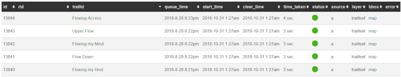
• Queue system for trail label tile updates with logging.
• Function to manual refresh of map tiles in an area.
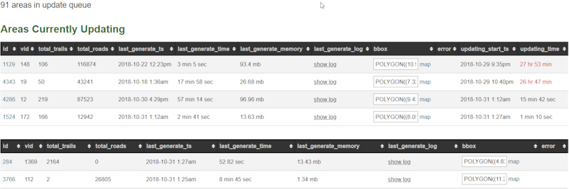
• Major improvements to routing network update queue system.
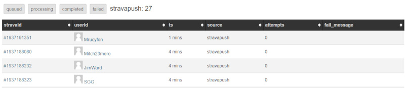
• Get users Strava activities by PUSH API. Better Strava import queue system.
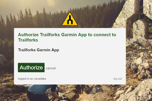
• API OAuth2 login.
PLUS:
• In-house elevation service (still not in use for most things).
• Calculate a ridelog & routes 'trail popularity score'. Used for helping suggest rides.
• Ridelog data now stored as compressed JSON files rather than in database.
And many more small things including numerous bug fixes. Many reported by users via our support forums or email.
Follow us on Facebook and Instagram to keep updated on new features.