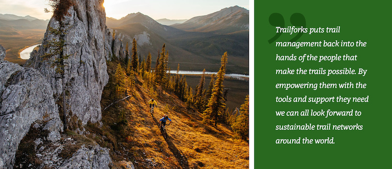
Many riders have heard about Trailforks by now and often think of it as the trail map app on your phone. But Trailforks is much more than just an app. One of the founding goals was to build a trail management system with features to empower local trail associations with data, planning & advocacy tools.
Trailforks has a large list of tools that have been created with these goals in mind, including many related to our robust trail reporting or ride log trail usage statistics systems. But here are 5 lesser-known advanced features.
Land Owner Overlays
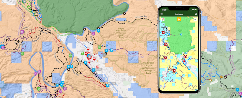
Working with Land Managers is always the first step to any trail work or maintenance, but it can sometimes be hard to understand where those boundaries are. Trailforks makes that easy. Whether you're in the field on the app or at home on the website, you can toggle on the Land Manager boundaries. Some of the Land Managers included are: the Forest Service, BLM, National Parks, Military, Indigenous Areas and any Congressional designated Wilderness Areas.
Tip: Want to camp for free? Trailforks now shows you exactly where the BLM land is.
BLM – Bureau of Land Management. Dispersed camping is allowed on most BLM land for up to 14 days. Even if land is leased or has mining claims, you may camp there unless posted otherwise by BLM management.
 | Recently I was on a trip near Joshua Tree Park in California and all the spots in the park were full. I pulled out the Trailforks App, turned on land owner overlay, and followed a dirt road on BLM land to an amazing mountain top camping spot, within a mile of the park boundary. Amazing! |
Heatmap Past/Current
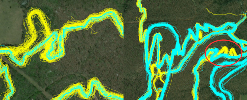
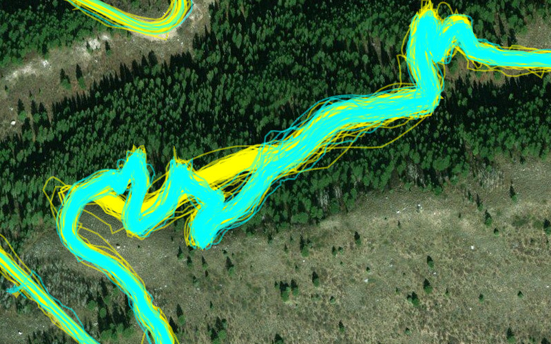
Notice in this photo marked in red shows that past tracks (yellow) follow switch backs, but all more current tracks (cyan) are now re-routed and running straight.
Many are familiar with the Trailforks heatmap and how it can be used to edit trail GPS tracks through its "ride lines" view. But we've been working hard at improving this feature. While editing a trail, you now have the option to view the historic ride lines (yellow) and the ride lines from the most current 6 months (cyan). This displays any new trends for riders as well as any new reroutes on older trails.
Example of an awesome reroute put in to fix that brutal climb at the start of Mill Creek. A favorite both up and down, now provides a much better climbing experience to access "The Ghee"
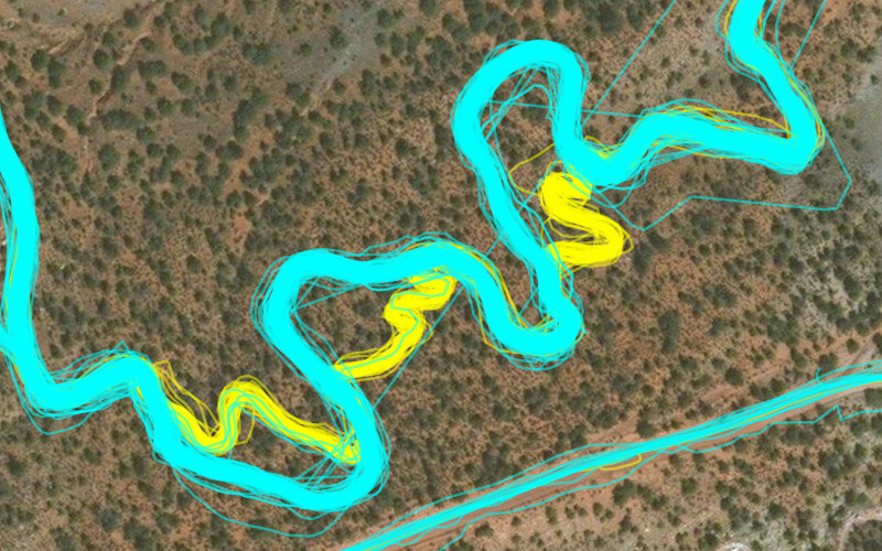
This is Wire Mesa where Jake Weber did some reroutes to open sight lines and widen some tight corners to create better flow. Thanks Jake!
Using the ride lines, you can edit trails' GPS tracks to be more accurate and trace where people actually ride.
Detect the following conditions easily:
• Trail re-routes
• New trails
• Old unused trails
• Improve trail GPS accuracy
Ride Start Heatmap
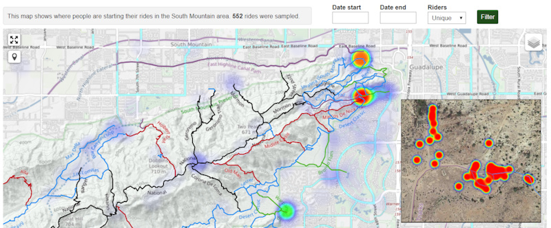
Trailforks has created a new heatmap that only shows the spot where riders have hit record on their GPS or Smartphone. The Ride Start Heatmap is great to see which parking lots are being used. Using the heatmap. you can identify potential conflict areas early on, perhaps identifying the need for new parking lots, trailheads or climbing trails. For extra privacy reasons, we do not make this feature publicly available. You will need to be given admin permissions for your region to access it via the admin page.

Auto-direction
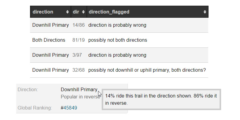
Using the user-contributed ride logs, Trailforks can now display the preferred direction of a trail. This is great to see how riders are using your network, and help trail organizations better understand which trails are used for climbing and which are used for descending.
Print Map
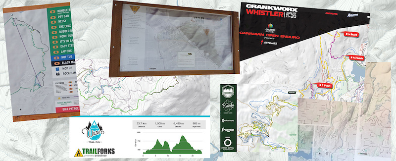
Trailforks might be a great map app, but that doesn't mean we don't see the value in a good old-fashioned paper map. Now Trailforks makes that easier. If you need a map for an event, a new trail proposal or a full-size map for a trailhead kiosk, the Trailforks Print Map Tool is a one-stop shop for all the information you need. Export high-resolution vector files of a map area for print.
MENTIONS: @trailforks