Providing users with the ability to easily create printable trail maps has been a goal of ours since we first started developing the custom topographic basemap. Using the new Trailforks Print Maps Interface, users are able to select various map layers and produce large scale maps in both screen and printer friendly output formats: JPG, PNG, GeoTiff, and PDF.
This new feature was designed to create quality looking maps with as few steps as possible. We want trail associations to concentrate on building awesome trails, and less time worrying about making maps. Using this interface it is simple to create trailhead kiosks, signs, posters, fliers, books, fold-able maps, or even static images of virtually any size. Depending on your background, interests, and experience, map making can be a fun and exciting part of trail building. That said, in our experience, trail builders, event organizers, even municipal park and recreation staff often struggle with making trail maps. More often than not we find that trail builders would rather be out in the forest with their chainsaw rather than sitting stagnant in front of a screen. Most consider map making a necessary evil, something that is a lot of work and expense up front and is then immediately out-of-date before the final map even makes it to the plotter.
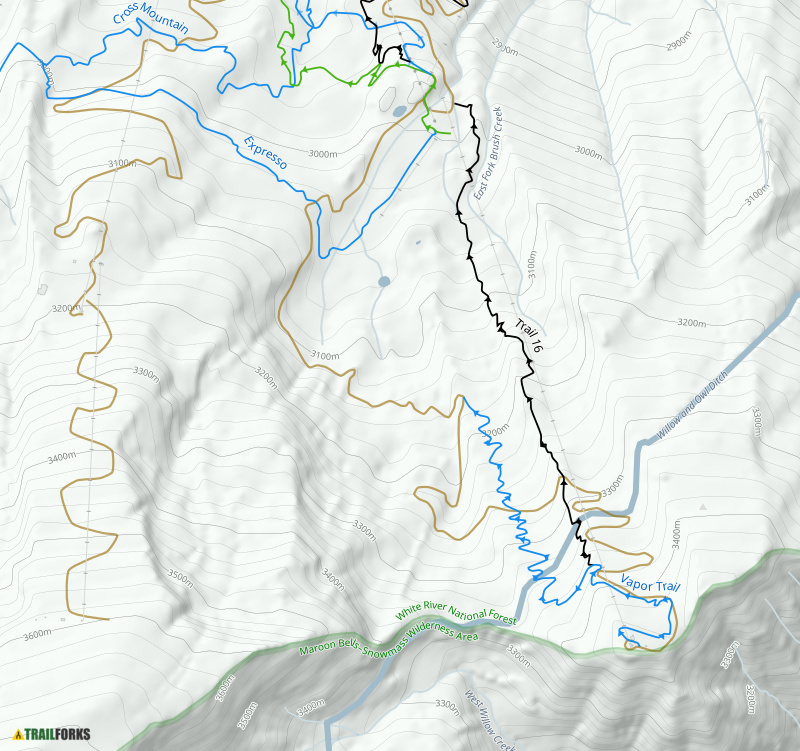
This past month I was riding Snowmass Bike Park in the Roaring Fork area of Colorado and due to construction most of Vapor Trail was closed. I only had enough time for 2 more runs before the top lift closed. Luckily my first run was the new Trail 16, which was old school rocky and rowdy fun. My second run was a complete waste. I wanted to ride all of Vapor Trail but was almost immediately dumped out to a dirt road where I lost a ton of elevation, only to find myself climbing back on the Expresso Trail. I created this sample flier size map showing the temporary closure of Vapor Trail. This map took about 3 minutes to create. Had this been on display, I would have done another run of Trail 16 before going back to ride Valhalla for the rest of the day.
I love beautiful maps created by graphics professionals, I believe they can be like works of art. But what I love more, is having a trail map that is updated with all the latest trails. The difficulty in keeping paper maps up-to-date is all of the post production details. So when your local trail association decides to add in a new trail that extends way outside your map, now the entire thing has to be re-arranged, imported into an editor, and then everything else must be shifted. In recent years, with the evolution of trail building, trail systems are changing quickly. Old rutted trails are being rerouted and engineered for sustainability. We may not all agree with each trail that gets "improved", but the fact remains that it is happening. Here in the states there has been an explosion in youth riders in large part thanks to High School Race Programs like NICA and the need for trails to practice on. To a trail builder the progress appears to be slow and labor intensive, but from a map making (and updating) perspective, it can feel like trails are change at lightening pace.
The primary goal of this interface is to get as close as we can to a professional looking print product with as minimal work and map making experience as possible. If you or someone in your trail organization is a savvy graphics person and wants to add all the post production logos, text, local sponsors, etc., this interface can provide most the heavy lifting by providing all the details of the map, with the added benefit of quick and easy updates using Trailforks to maintain your trail database. If you don't have GIS staff or cannot afford a professional map making contractor, this new feature will give you the power to create an intuitive and easy to read trail map in a few minutes that you can readily distribute.
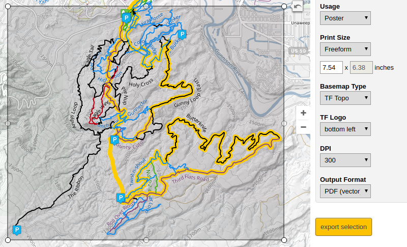
In order to do a real live test of the poster theme, I used the Trailforks Print Map Interface to create a full background Kiosk Map for the City of Pleasant Grove, Utah. By choosing the PDF Vector format, I was able to load the output file into Adobe Illustrator and add a key, logos, basic trail rules and other required verbiage. And because the PDF is editable, within Illustrator I could make a few quick trail label adjustments and paste the text bubbles on top of the main map.

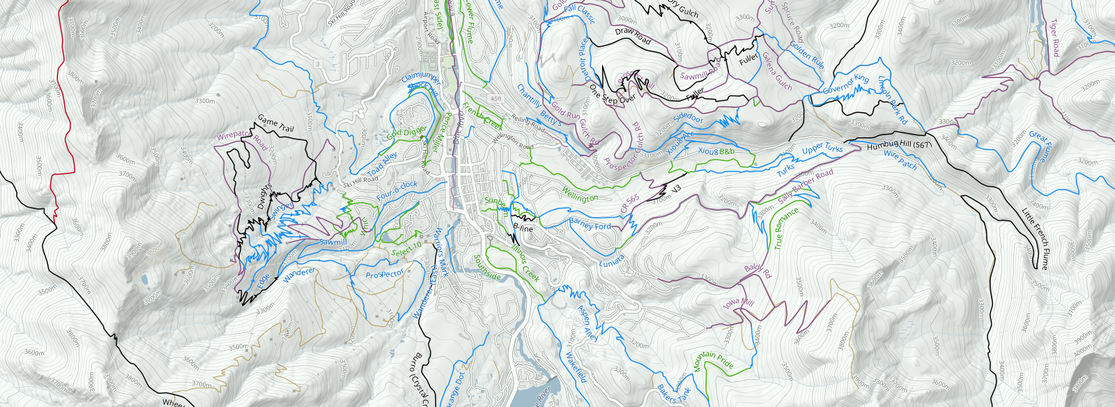
The current Trailforks Basemap consists of multiple layer groups, which can be selected to include in a map. We group the layers for simplicity. For example, in the map above the city wanted to display the US Forestry border, but because the zoom level was so low, elevation contour labels were unnecessary. In the layer options I simply selected "Landcover" and disabled "Contour Labels". The entire trail system is directional, so I selected to show primary direction of travel as well. Click, click, boom, instant printable trail map.
This new feature is only made possible because we are hosting our own custom basemap. When we initially announced that we were providing our own topographic background, we were asked why we did not use an off-the-shelf map product, and at the time we were a bit light on the details. Comments with regards to licensing and usage were centered around using an external map tile service online, which for all intents and purposes would have probably been a non-issue. It was the ability to freely output large static maps and then pass that ability on to our users in a distribution free environment that concerned us. Also, to make this new feature possible required full control of the map rendering pipeline, so that we could create maps of any size and output into vector formats with the ability to filter and change the map theme. In the end, the goal was to put that power into the hands of Trailforks users.
Here are the layer groups we decided to start with:
All Layers Together

To better illustrate the layers, we displayed each layer as they build on each other, but technically you can choose any layer combinations you want. For instance, maybe you just want the contour lines by themselves to use as a background for your website, business card or as part of a team jersey. If you select not to have the terrain background, our theme generator will change the background to be fully transparent so that if you generate a PNG file, you can use your output as an overlay image. If you generate the contour lines into a PDF, each contour line is a vector and can be readily used by a printer to create smooth lines.
EVENTS AND ROUTES
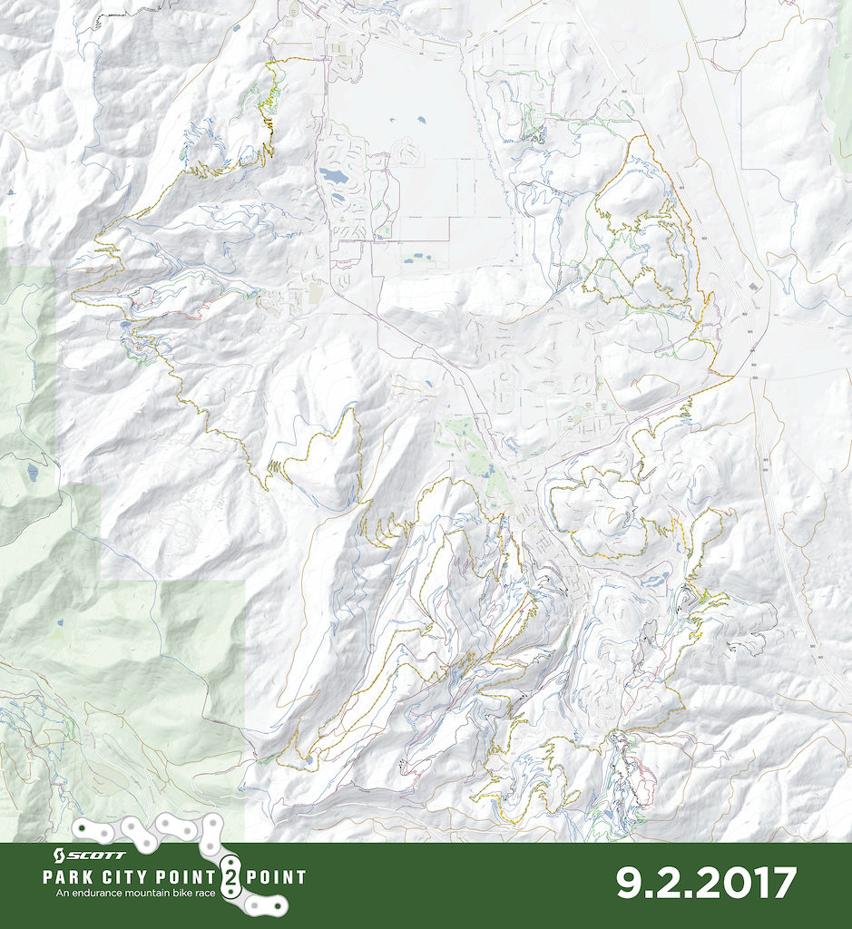
Event organizers, ride planners and tour guides have already started using this feature to create posters and fliers for their organized events. A popular race in Park City named the "Park City Point 2 Point", recently used the Trailforks Print Map Interface to create a poster of the race course. This poster was presented to riders during the race review meeting and the course was available for pre-riding through use of the Trailforks Mobile App.
Park City Point 2 Point Event Poster
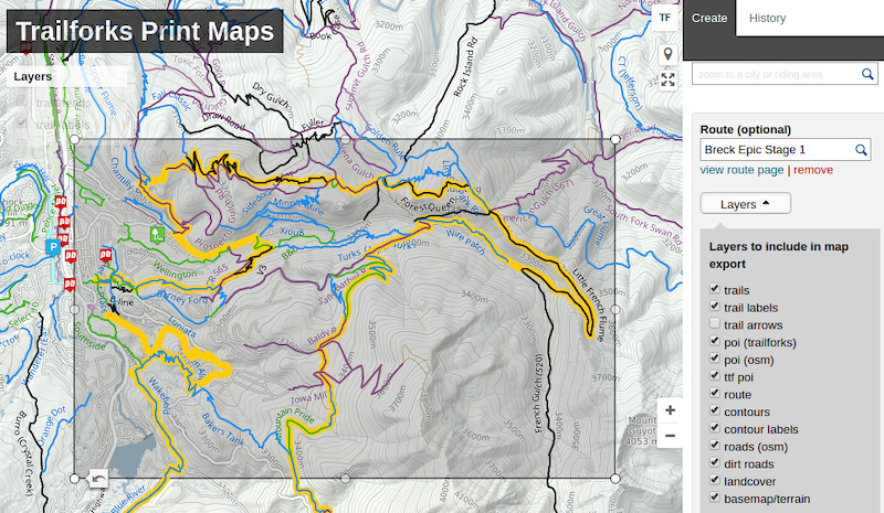
To create an event map like this, the map creation interface can pull in a previously created route and overlay it with directional arrows. Here is an example of the Breckenridge map above with Stage 1 of the Breck Epic course. This map contains most of the layer groups except I chose to leave off the landcover and trail arrows for a cleaner map that better emphasizes the race course.
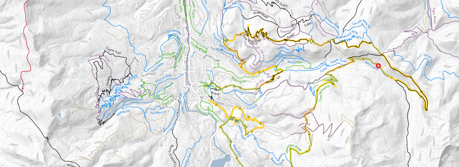
If you look closely, you will see an aid station icon displayed on the map as well. If you are creating your own race course and need to add any "course specific" points of interest (POI), those will also be pulled into the generated map. For the map above I turned off all the standard points of interest (POI) to better emphasize the race specific aid stations and water stops. The POI markers you add to your ride route do not appear on the standard map, so you are free to add points that only exist on race day and include them in your print media. The points of interest you choose are not limited to event style points. For example, you can remove all the standard points like public parking, but add your own parking POI as part of your route. This will help direct your racers to park at event designated parking locations, or even allow you to add temporary parking that only exists on race day.
TRAIL PLANNING
Another power feature of this tool comes in the form of trail planning and maintenance. Today users can add and mark new trails as "Planned" from within Trailforks. Planned trails can be made public or hidden from view. When generating a map which is to be used for planning purposes, the planned trails are displayed in a thinner line so as not to be mistaken for completed and established trails.
This feature enables trail planners to take their map with them out on the trail and verify the path of a new trail. Not all new trails are built in locations with excellent cell reception. When designing trails or reviewing trail plans, having the contour lines with elevation and gradients is often important. For this reason, Trailforks area administrators can output of their planning map into the GeoTiff format. With a GeoTiff, you can load your entire map including the background terrain, land cover, buildings, roads, basically everything in the basemap can be seen on location for trail maintenance, review and planning purposes.
CREATING PRINTABLE MAPS
Designing maps for print is more difficult than it may appear on the surface. Creating a static snapshot image (JPG, PNG) of a map is easy because you can apply the same theme as all dimensions may be expressed in terms of pixels. When you move to physical printing sizes several new variables come into play. Things like typical viewing distance (usage), can drastically effect the theme at all zoom levels. Take for example two output map usages: a foldable map and a poster map. If you completely unfold a map, it is typically about the same size as a poster, but the viewing distance is more often up close. Riders out on a trail will either partially unfold the map or unfold it and squint at it only a few inches from their nose. Whereas a poster is viewed from one or more meters away, while the paper size remains the same.
The next problem is the advent of retina displays and other high resolution technologies that have pushed the average pixel width to microscopic sizes. It is now impossible to assume a standard pixel width as it translates to the real world (printed paper). The concept of Dots Per Inch (DPI) becomes an abstract sizing estimate rather than a precise print resolution. We have done many print samples, and tried to find a happy medium using various common print dimensions and free-form (user defined) output sizes. As more organizations find ways to leverage this feature, we continue to welcome feedback and fine tune our usage themes.
All of the data for each layer group is extracted directly from our databases at time of generation. We pull data from our trail database, routing database, global contour line database, and OpenStreetmap data. After the user selects each layer we dynamically filter the theme and recombine it into a new custom theme before piping it to the print renderer. In other words, we do not generate each layer separately and combine graphically. The reason we create a new theme on the fly, is that it creates a better looking and more up-to-date map. If you generate each layer individually, the map creation algorithms will not know about the other layers and there will be more inadvertent overlapping of lines and labels. In addition to this graphical detail we must change the SQL query to our database based upon user selections, route inclusion, and to query the database to only include POI markers that belong to the user’s selected route.
As a final touch, we give the trails just a touch of natural curve to soften the edges. The underlying trail data in Trailforks is never simplified and our GPS coordinate values are never rounded. We use the full precision and every point provided by user submissions. If a user desires maximum trail accuracy they often meticulously trace a trail path using our ride log averages. We don't want to delete all that work, and prefer accurate data. For maximum print quality, we advise users to make sure all the trails in the area they are going to print have been checked in our editor for overlaps, validate all the connections between trails, and re-align trails using our ridelog averages. This will create both a more beautiful and accurate map.
EXAMPLES
The printmap tool has outputted 2,237 files totalling 11.7 GB in file size.
Photo gallery of more print map examples
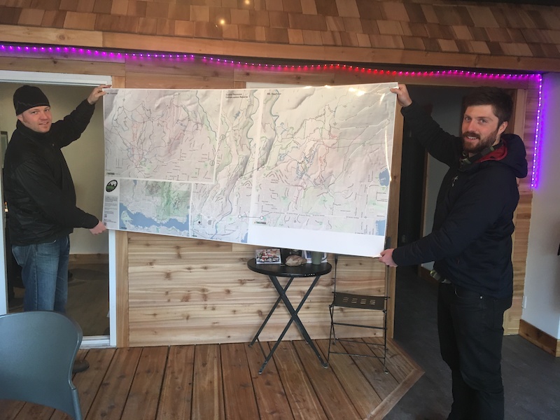
Endless Biking office poster
Trailforks New Printable Maps User Interface
This new feature was designed to create quality looking maps with as few steps as possible. We want trail associations to concentrate on building awesome trails, and less time worrying about making maps. Using this interface it is simple to create trailhead kiosks, signs, posters, fliers, books, fold-able maps, or even static images of virtually any size. Depending on your background, interests, and experience, map making can be a fun and exciting part of trail building. That said, in our experience, trail builders, event organizers, even municipal park and recreation staff often struggle with making trail maps. More often than not we find that trail builders would rather be out in the forest with their chainsaw rather than sitting stagnant in front of a screen. Most consider map making a necessary evil, something that is a lot of work and expense up front and is then immediately out-of-date before the final map even makes it to the plotter.
This past month I was riding Snowmass Bike Park in the Roaring Fork area of Colorado and due to construction most of Vapor Trail was closed. I only had enough time for 2 more runs before the top lift closed. Luckily my first run was the new Trail 16, which was old school rocky and rowdy fun. My second run was a complete waste. I wanted to ride all of Vapor Trail but was almost immediately dumped out to a dirt road where I lost a ton of elevation, only to find myself climbing back on the Expresso Trail. I created this sample flier size map showing the temporary closure of Vapor Trail. This map took about 3 minutes to create. Had this been on display, I would have done another run of Trail 16 before going back to ride Valhalla for the rest of the day.
I love beautiful maps created by graphics professionals, I believe they can be like works of art. But what I love more, is having a trail map that is updated with all the latest trails. The difficulty in keeping paper maps up-to-date is all of the post production details. So when your local trail association decides to add in a new trail that extends way outside your map, now the entire thing has to be re-arranged, imported into an editor, and then everything else must be shifted. In recent years, with the evolution of trail building, trail systems are changing quickly. Old rutted trails are being rerouted and engineered for sustainability. We may not all agree with each trail that gets "improved", but the fact remains that it is happening. Here in the states there has been an explosion in youth riders in large part thanks to High School Race Programs like NICA and the need for trails to practice on. To a trail builder the progress appears to be slow and labor intensive, but from a map making (and updating) perspective, it can feel like trails are change at lightening pace.
The primary goal of this interface is to get as close as we can to a professional looking print product with as minimal work and map making experience as possible. If you or someone in your trail organization is a savvy graphics person and wants to add all the post production logos, text, local sponsors, etc., this interface can provide most the heavy lifting by providing all the details of the map, with the added benefit of quick and easy updates using Trailforks to maintain your trail database. If you don't have GIS staff or cannot afford a professional map making contractor, this new feature will give you the power to create an intuitive and easy to read trail map in a few minutes that you can readily distribute.
Preset or custom output sizes and formats
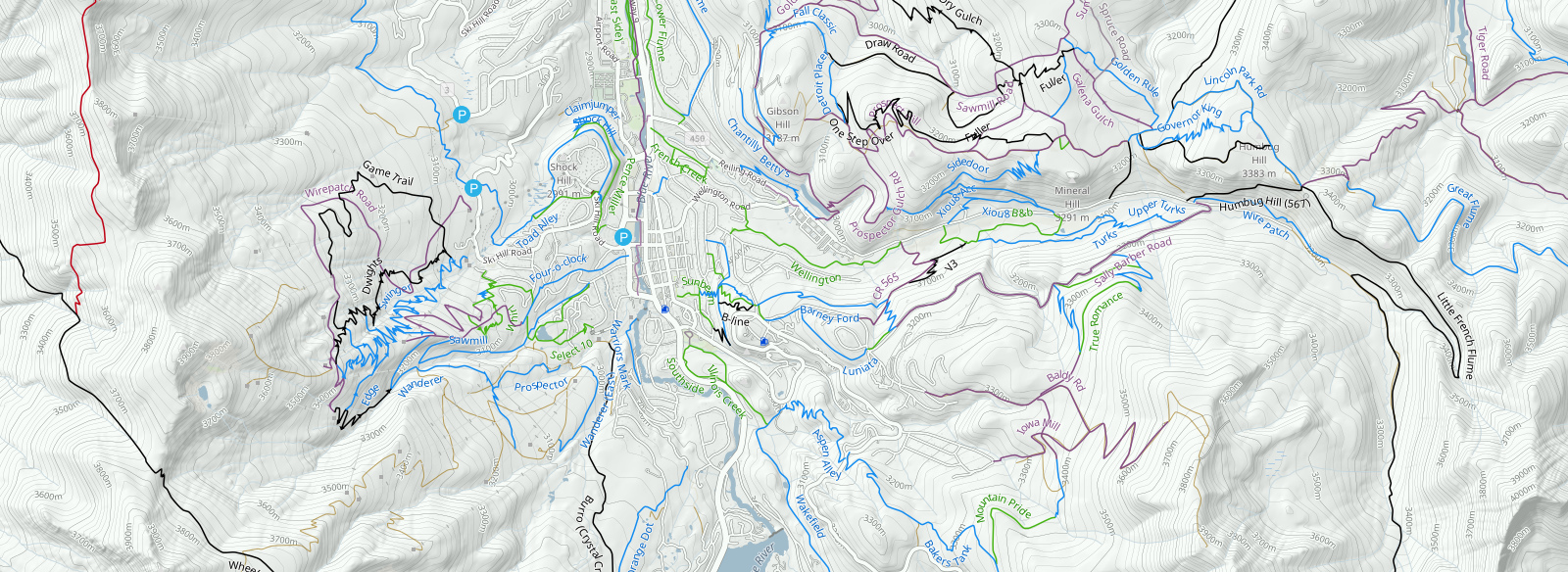
In order to do a real live test of the poster theme, I used the Trailforks Print Map Interface to create a full background Kiosk Map for the City of Pleasant Grove, Utah. By choosing the PDF Vector format, I was able to load the output file into Adobe Illustrator and add a key, logos, basic trail rules and other required verbiage. And because the PDF is editable, within Illustrator I could make a few quick trail label adjustments and paste the text bubbles on top of the main map.
Kiosk Map using the Trailforks Printmap PDF Output
The current Trailforks Basemap consists of multiple layer groups, which can be selected to include in a map. We group the layers for simplicity. For example, in the map above the city wanted to display the US Forestry border, but because the zoom level was so low, elevation contour labels were unnecessary. In the layer options I simply selected "Landcover" and disabled "Contour Labels". The entire trail system is directional, so I selected to show primary direction of travel as well. Click, click, boom, instant printable trail map.
This new feature is only made possible because we are hosting our own custom basemap. When we initially announced that we were providing our own topographic background, we were asked why we did not use an off-the-shelf map product, and at the time we were a bit light on the details. Comments with regards to licensing and usage were centered around using an external map tile service online, which for all intents and purposes would have probably been a non-issue. It was the ability to freely output large static maps and then pass that ability on to our users in a distribution free environment that concerned us. Also, to make this new feature possible required full control of the map rendering pipeline, so that we could create maps of any size and output into vector formats with the ability to filter and change the map theme. In the end, the goal was to put that power into the hands of Trailforks users.
Here are the layer groups we decided to start with:
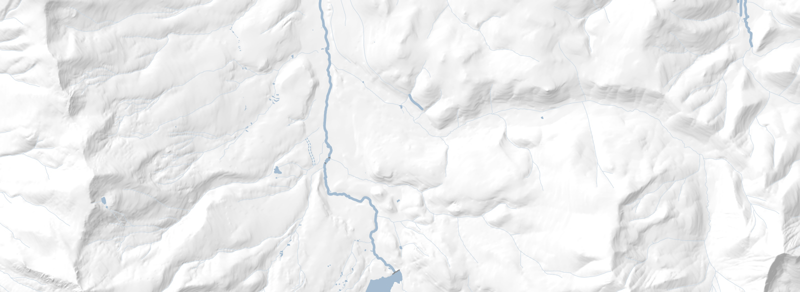
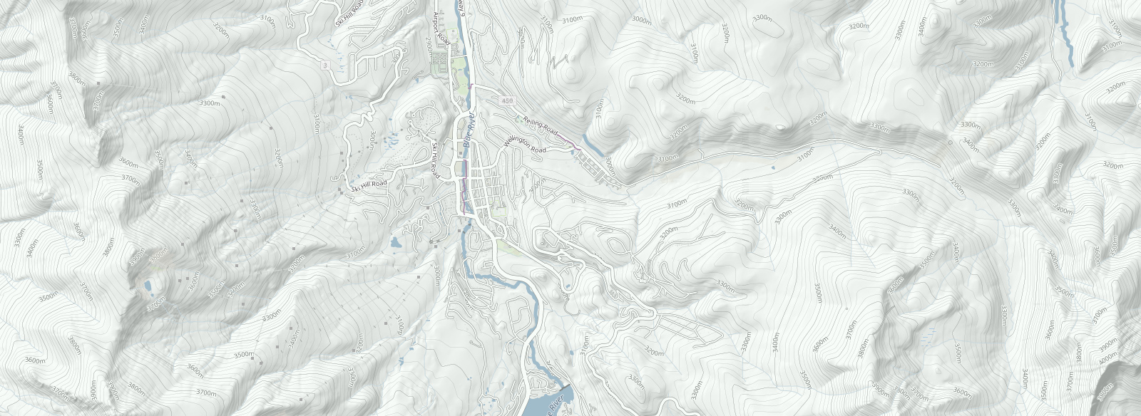
Terrain
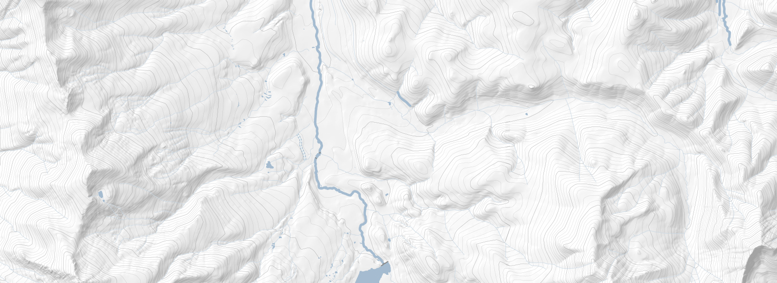
Terrain - Contours
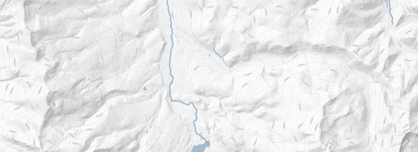
Terrain - Contours - Elevation
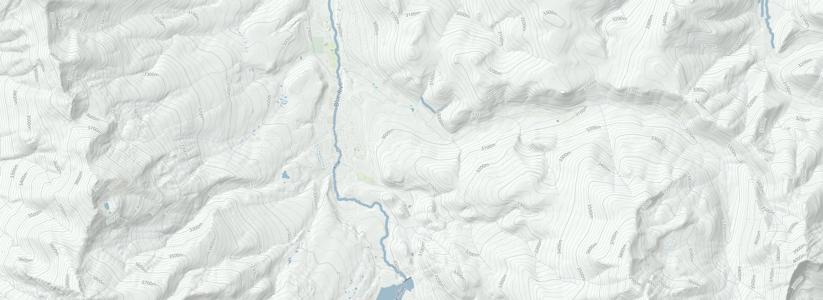
Terrain - Contours - Elevation - Landcover
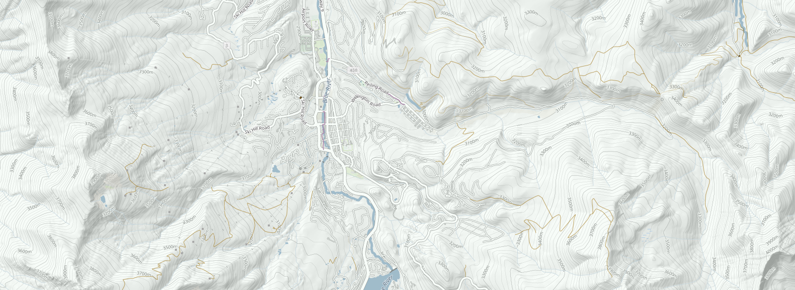
Terrain - Contours - Elevation - Landcover - Roads
Terrain - Contours - Elevation - Landcover - Roads - Dirt Roads
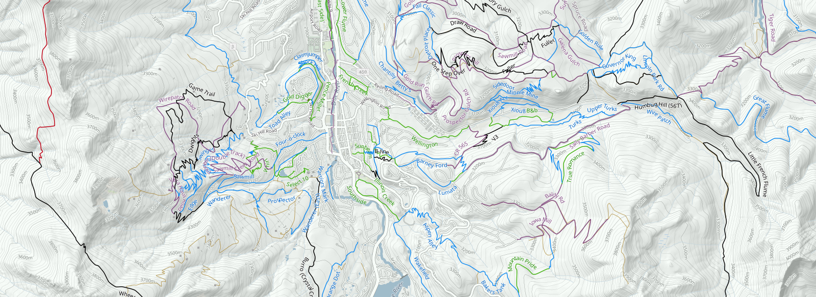
Terrain - Contours - Elevation - Landcover - Roads - Dirt Roads - Trails
Terrain - Contours - Elevation - Landcover - Roads - Dirt Roads - Trails - Trail Labels
Terrain - Contours - Elevation - Landcover - Roads - Dirt Roads - Trails - Names - Arrows
Terrain - Contours - Elevation - Landcover - Roads - Dirt Roads - Trails - Names - Arrows- POIs
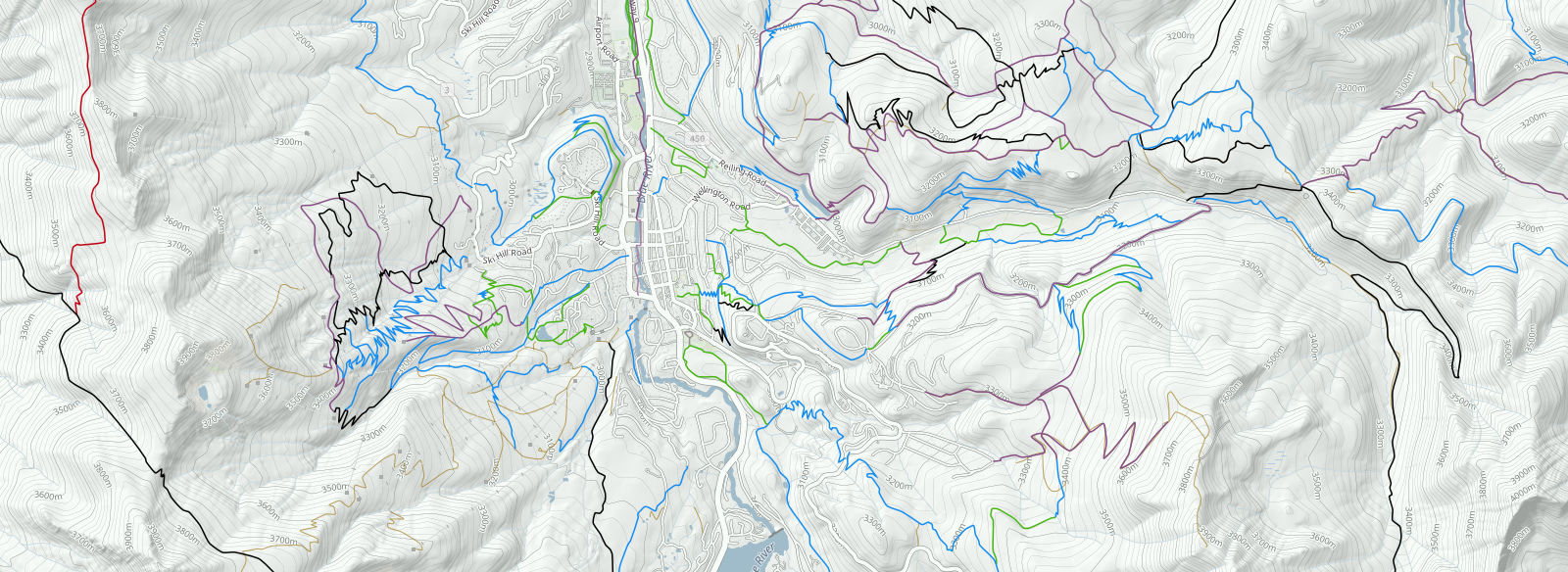
All Layers Together
0% Loaded
1/11
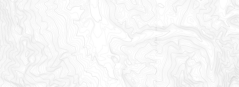
To better illustrate the layers, we displayed each layer as they build on each other, but technically you can choose any layer combinations you want. For instance, maybe you just want the contour lines by themselves to use as a background for your website, business card or as part of a team jersey. If you select not to have the terrain background, our theme generator will change the background to be fully transparent so that if you generate a PNG file, you can use your output as an overlay image. If you generate the contour lines into a PDF, each contour line is a vector and can be readily used by a printer to create smooth lines.
Only Contour Lines Layer
EVENTS AND ROUTES
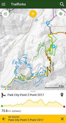
Event organizers, ride planners and tour guides have already started using this feature to create posters and fliers for their organized events. A popular race in Park City named the "Park City Point 2 Point", recently used the Trailforks Print Map Interface to create a poster of the race course. This poster was presented to riders during the race review meeting and the course was available for pre-riding through use of the Trailforks Mobile App.
Providing racers with a simple to follow map that displays a race course in the context of a complex trail system is key to putting on a quality event and arming your riders with everything they need to know to safely navigate your event.
Traiforks provides the complete event mapping package:
1. Events can be loaded into Trailforks for both pre-ride preparation and used on Race day while out on the course
2. Event Specific POI (Aid Stations, Event Parking, Warnings, etc.) can be assigned to individual ride plans
3. Standard Flyers can be printed using the new Print Map Interface.
4. Flyers can be generated in JPG format ideal for attaching to an email and sending out to event attendees and posting via social media. This also provides a simple way to warn trail users that may not be taking part in the event.
4. Event Poster for the day of the event
Park City Point 2 Point Event Poster
To create an event map like this, the map creation interface can pull in a previously created route and overlay it with directional arrows. Here is an example of the Breckenridge map above with Stage 1 of the Breck Epic course. This map contains most of the layer groups except I chose to leave off the landcover and trail arrows for a cleaner map that better emphasizes the race course.
Breck Epic Stage 1 with Aid Stations
If you look closely, you will see an aid station icon displayed on the map as well. If you are creating your own race course and need to add any "course specific" points of interest (POI), those will also be pulled into the generated map. For the map above I turned off all the standard points of interest (POI) to better emphasize the race specific aid stations and water stops. The POI markers you add to your ride route do not appear on the standard map, so you are free to add points that only exist on race day and include them in your print media. The points of interest you choose are not limited to event style points. For example, you can remove all the standard points like public parking, but add your own parking POI as part of your route. This will help direct your racers to park at event designated parking locations, or even allow you to add temporary parking that only exists on race day.
TRAIL PLANNING
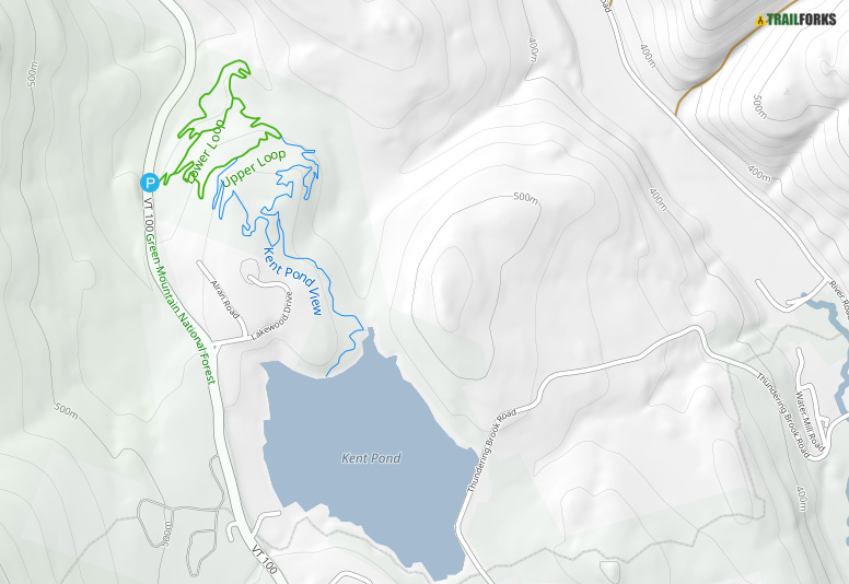
Another power feature of this tool comes in the form of trail planning and maintenance. Today users can add and mark new trails as "Planned" from within Trailforks. Planned trails can be made public or hidden from view. When generating a map which is to be used for planning purposes, the planned trails are displayed in a thinner line so as not to be mistaken for completed and established trails.
Planned Trail Kent Pond View
This feature enables trail planners to take their map with them out on the trail and verify the path of a new trail. Not all new trails are built in locations with excellent cell reception. When designing trails or reviewing trail plans, having the contour lines with elevation and gradients is often important. For this reason, Trailforks area administrators can output of their planning map into the GeoTiff format. With a GeoTiff, you can load your entire map including the background terrain, land cover, buildings, roads, basically everything in the basemap can be seen on location for trail maintenance, review and planning purposes.
CREATING PRINTABLE MAPS
Designing maps for print is more difficult than it may appear on the surface. Creating a static snapshot image (JPG, PNG) of a map is easy because you can apply the same theme as all dimensions may be expressed in terms of pixels. When you move to physical printing sizes several new variables come into play. Things like typical viewing distance (usage), can drastically effect the theme at all zoom levels. Take for example two output map usages: a foldable map and a poster map. If you completely unfold a map, it is typically about the same size as a poster, but the viewing distance is more often up close. Riders out on a trail will either partially unfold the map or unfold it and squint at it only a few inches from their nose. Whereas a poster is viewed from one or more meters away, while the paper size remains the same.
The next problem is the advent of retina displays and other high resolution technologies that have pushed the average pixel width to microscopic sizes. It is now impossible to assume a standard pixel width as it translates to the real world (printed paper). The concept of Dots Per Inch (DPI) becomes an abstract sizing estimate rather than a precise print resolution. We have done many print samples, and tried to find a happy medium using various common print dimensions and free-form (user defined) output sizes. As more organizations find ways to leverage this feature, we continue to welcome feedback and fine tune our usage themes.
All of the data for each layer group is extracted directly from our databases at time of generation. We pull data from our trail database, routing database, global contour line database, and OpenStreetmap data. After the user selects each layer we dynamically filter the theme and recombine it into a new custom theme before piping it to the print renderer. In other words, we do not generate each layer separately and combine graphically. The reason we create a new theme on the fly, is that it creates a better looking and more up-to-date map. If you generate each layer individually, the map creation algorithms will not know about the other layers and there will be more inadvertent overlapping of lines and labels. In addition to this graphical detail we must change the SQL query to our database based upon user selections, route inclusion, and to query the database to only include POI markers that belong to the user’s selected route.
As a final touch, we give the trails just a touch of natural curve to soften the edges. The underlying trail data in Trailforks is never simplified and our GPS coordinate values are never rounded. We use the full precision and every point provided by user submissions. If a user desires maximum trail accuracy they often meticulously trace a trail path using our ride log averages. We don't want to delete all that work, and prefer accurate data. For maximum print quality, we advise users to make sure all the trails in the area they are going to print have been checked in our editor for overlaps, validate all the connections between trails, and re-align trails using our ridelog averages. This will create both a more beautiful and accurate map.
EXAMPLES
The printmap tool has outputted 2,237 files totalling 11.7 GB in file size.
0% Loaded
1/9
Photo gallery of more print map examples