1.3 miles
Distance
7 ft
Climb
-537 ft
Descent
00:05:35
Avg time
Crank It Up - Lower Details
-
Activities
- Mountain Bike
-
Riding AreaWhistler Mountain Bike Park
Whistler, British Columbia -
AKALower Crank It Up
-
Difficulty Rating
-
Trail TypeMachine Groomed
-
Bike TypeDH, AM, Adaptive MTB
-
DirectionDownhill OnlyPopular direction shown
-
SeasonMay - October
-
TTFs on TrailBridge, Jump, Wallride
-
Global Ranking#8 in Mountain Biking
-
Local Popularity95 in Mountain Biking
-
Land Manager
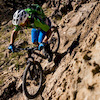
Long freeride trail in the Fitzsimmons area of the Bike Park. Rated between Heart of Darkness and Playground on Whistler's freeride progression chart, in the top half of the blues. Heavily used flowy, bermy trail. Big air or roll over – your speed will determine which.
Access Info
Continuation from Upper Crank It Up. Can also be accessed from Upper Joyride (double black technical).
Bike Park
Traditionally Indigenous Territory
More Stats for Crank It Up - Lower mountain bike trail trail
-
Altitude change-531 ft
-
Altitude min2,493 ft
-
Altitude max3,024 ft
-
Altitude start3,024 ft
-
Altitude end2,493 ft
-
Grade-8%
-
Grade max-51.4%
-
Grade min5.4%
-
Distance climb318 ft
-
Distance down1 mile
-
Avg time00:05:35
-
Avg reverse time00:03:48
- view trail stats
close
Trail Conditions
- Unknown
- Snow Groomed
- Snow Packed
- Snow Covered
- Snow Cover Inadequate
- Freeze/thaw Cycle
- Icy
- Prevalent Mud
- Wet
- Variable
- Ideal
- Dry
- Very Dry
Trail Flow (Ridden Direction)
Trailforks scans users ridelogs to determine the most popular direction each trail is ridden. A good flowing trail network will have most trails flowing in a single direction according to their intension.
The colour categories are based on what percentage of riders are riding a trail in its intended direction.
The colour categories are based on what percentage of riders are riding a trail in its intended direction.
- > 96%
- > 90%
- > 80%
- > 70%
- > 50%
- < 50%
- bi-directional trail
- no data
Trail Last Ridden
Trailforks scans ridelogs to determine the last time a trail was ridden.
- < 2 days
- < 1 week
- < 2 weeks
- < 1 month
- < 6 months
- > 6 months
Trail Ridden Direction
The intended direction a trail should be ridden.
- Downhill Only
- Downhill Primary
- Both Directions
- Uphill Primary
- Uphill Only
- One Direction
Contribute Details
Colors indicate trail is missing specified detail.
- Description
- Photos
- Description & Photos
- Videos
Trail Popularity ?
Trailforks scans ridelogs to determine which trails are ridden the most in the last 9 months.
Trails are compared with nearby trails in the same city region with a possible 25 colour shades.
Think of this as a heatmap, more rides = more kinetic energy = warmer colors.
- most popular
- popular
- less popular
- not popular
ATV/ORV/OHV Filter
Max Vehicle Width
inches
Radar Time
x
Activity Recordings
Trailforks users anonymized public ridelogs from the past 6 months.
- mountain biking recent
- mountain biking (>6 month)
- hiking (1 year)
- moto (1 year)
Activity Recordings
Trailforks users anonymized public skilogs from the past 12 months.
- Downhill Ski
- Backcountry Ski
- Nordic Ski
Jump Magnitude Heatmap
Heatmap of where riders jump on trails. Zoom in to see individual jumps, click circles to view jump details.
Trails Deemphasized
Trails are shown in grey.
Only show trails with NO bikes.
Save the current map location and zoom level as your default home location whenever this page is loaded.
Save
Directions to crank-it-up-lower trailhead
(50.103560, -122.950640)
update trails status or condition
Crank It Up - Lower Trail Reports
view all reports »
Recent Ridelog Activity on Trail
Past Week
- 230 rides
- 21 miles avg distance
6 Months
- 1,579 rides
- 22 miles avg distance
All
- 15,371 rides
Technical Trail Features (TTF)
- Ladder Bridge over Crank
 Roller Coaster
Photos
more »
Trail Lists
-
Whistler ToDo-FreeRide
17 trails
-
Whistler Bike Park Freeride Trails
33 trails
-
Favourite MTB Trails
3 trails
Routes with this trail
more »
Trail Products
 grandvalleydave
Videos
more »


Nearby Trails
- Old Oly Connector 0 ft
- Lower Joyride 784 ft
- Detroit Rock City 988 ft
- Canadian Open Course - Upper 988 ft
- Whistler Downhill - Lower 1,079 ft
Whistler Mountain Bike Park
- embed Crank It Up - Lower trail on your website
- By Tekmisfit & contributors
- #2477 - 10,948 views
- subscribe
- login to download gpx or kml files.