close
Trail Conditions
- Unknown
- Snow Groomed
- Snow Packed
- Snow Covered
- Snow Cover Inadequate
- Freeze/thaw Cycle
- Icy
- Prevalent Mud
- Wet
- Variable
- Ideal
- Dry
- Very Dry
Trail Flow (Ridden Direction)
Trailforks scans users ridelogs to determine the most popular direction each trail is ridden. A good flowing trail network will have most trails flowing in a single direction according to their intension.
The colour categories are based on what percentage of riders are riding a trail in its intended direction.
The colour categories are based on what percentage of riders are riding a trail in its intended direction.
- > 96%
- > 90%
- > 80%
- > 70%
- > 50%
- < 50%
- bi-directional trail
- no data
Trail Last Ridden
Trailforks scans ridelogs to determine the last time a trail was ridden.
- < 2 days
- < 1 week
- < 2 weeks
- < 1 month
- < 6 months
- > 6 months
Trail Ridden Direction
The intended direction a trail should be ridden.
- Downhill Only
- Downhill Primary
- Both Directions
- Uphill Primary
- Uphill Only
- One Direction
Contribute Details
Colors indicate trail is missing specified detail.
- Description
- Photos
- Description & Photos
- Videos
Trail Popularity ?
Trailforks scans ridelogs to determine which trails are ridden the most in the last 9 months.
Trails are compared with nearby trails in the same city region with a possible 25 colour shades.
Think of this as a heatmap, more rides = more kinetic energy = warmer colors.
- most popular
- popular
- less popular
- not popular
ATV/ORV/OHV Filter
Max Vehicle Width
inches
Radar Time
x
Activity Recordings
Trailforks users anonymized public ridelogs from the past 6 months.
- mountain biking recent
- mountain biking (>6 month)
- hiking (1 year)
- moto (1 year)
Activity Recordings
Trailforks users anonymized public skilogs from the past 12 months.
- Downhill Ski
- Backcountry Ski
- Nordic Ski
Jump Magnitude Heatmap
Heatmap of where riders jump on trails. Zoom in to see individual jumps, click circles to view jump details.
Trails Deemphasized
Trails are shown in grey.
Only show trails with NO bikes.
Save the current map location and zoom level as your default home location whenever this page is loaded.
Save
No description for Green Valley has been added yet!
Login or register to submit one.
 google parking directions
Primary Trail Type: Cross-Country
google parking directions Activities Click to view
- Mountain Bike
98 trails
- E-Bike
22 trails
- Hike
95 trails
- Trail Running
95 trails
- Dirtbike/Moto
3 trails
- ATV/ORV/OHV
3 trails
Region Details
- 26
- 12
- 44
- 12
- 4
Region Status
Open as of 19 hoursStats
- Avg Trail Rating
- Trails (view details)
- 99
- Trails Mountain Bike
- 98
- Trails E-Bike
- 22
- Trails Hike
- 95
- Trails Trail Running
- 95
- Trails Dirtbike/Moto
- 3
- Trails ATV/ORV/OHV
- 3
- Total Distance
- 80 miles
- Total Descent
- 9,729 ft
- Total Vertical
- 2,191 ft
- Highest Trailhead
- 4,748 ft
- Reports
- 988
- Photos
- 332
- Ridden Counter
- 56,172
Popular Green Valley Mountain Biking Trails
Green Valley Mountain Bike Routes
| title | rating | distance |
|---|---|---|
| Bearclaw Loop | 11 miles | |
| Bearclaw Loop | 11 miles | |
| Zen Loop | 6 miles | |
| Bearclaw/Stucki/Rattlesnake/Bearclaw | 13 miles | |
| Bearclaw Hot Laps | 5 miles | |
| Zen Loop to barrel | 11 miles | |
| Brad's Route | 43 miles | |
| 2021 ICUP Red Rock Rampage | 7 miles | |
| St George Day 1 | 15 miles | |
| St. G Perimeter | 20 miles |
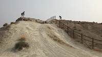
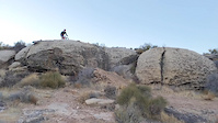
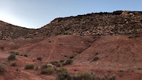
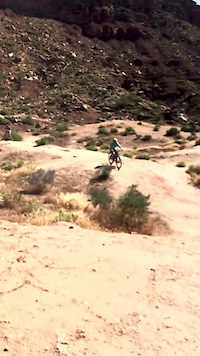
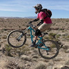
Photos of Green Valley Mountain Bike
trail: Barrel Connector
84 |
Mar 9, 2020 @ 10:58am
Mar 9, 2020
trail: Barrel Connector
109 |
Mar 9, 2020 @ 10:44am
Mar 9, 2020
trail: Bearclaw Poppy
317 |
Sep 18, 2019 @ 3:03pm
Sep 18, 2019
trail: Barrel
1,855 |
Feb 26, 2018 @ 7:56am
Feb 26, 2018
trail: Bearclaw Poppy (down)
245 |
Nov 24, 2017 @ 8:04pm
Nov 24, 2017
trail: Barrel
1,138 |
Apr 19, 2017 @ 10:38pm
Apr 19, 2017
trail: Barrel
1,101 |
Oct 19, 2016 @ 8:50pm
Oct 19, 2016
trail: Bearclaw Poppy
1,270 |
Apr 6, 2016 @ 6:34am
Apr 6, 2016Videos of Green Valley Mountain Bike

trail: Barrel
3 |
Mar 29, 2022

trail: Barrel
13 |
Mar 29, 2022

trail: Barrel
16 |
Mar 29, 2022
trail: Bearclaw Poppy (down)
154 |
Sep 4, 2021
trail: Barrel Jump
97 |
Apr 26, 2021
trail: Barrel
325 |
Dec 20, 2020
trail: Bearclaw Poppy (down)
0:20 |
198 |
Jul 28, 2020
trail: Bearclaw Poppy
0:06 |
250 |
Jul 24, 2020
Recent Trail Reports
| status | trail | date | condition | info | user |
|---|---|---|---|---|---|
| Snakepit Rim | Jun 25, 2022 @ 10:41am Jun 25, 2022 | Dry | gnarlysipes | ||
| Connector | Jun 25, 2022 @ 10:41am Jun 25, 2022 | Dry | gnarlysipes | ||
| Bearclaw Poppy (up) | Jun 25, 2022 @ 10:41am Jun 25, 2022 | Dry | gnarlysipes | ||
| Bearclaw Poppy (down) | Jun 25, 2022 @ 10:41am Jun 25, 2022 | Dry | gnarlysipes | ||
| Bearclaw Poppi | Jun 25, 2022 @ 10:41am Jun 25, 2022 | Dry | gnarlysipes | ||
| Bearclaw Poppy | Jun 25, 2022 @ 10:41am Jun 25, 2022 | Dry | gnarlysipes | ||
| Bearclaw Trailhead | Jun 25, 2022 @ 10:41am Jun 25, 2022 | Dry | gnarlysipes | ||
| Zen-Out | Jun 24, 2022 @ 5:46am Jun 24, 2022 | Dry | MJT109 | ||
| Zen Alt Line | Jun 24, 2022 @ 5:46am Jun 24, 2022 | Dry | MJT109 | ||
| Stucki Alt | Jun 15, 2022 @ 7:01am Jun 15, 2022 | Very Dry | Aaron7347 |
Activity Feed
| username | action | type | title | date | |
|---|---|---|---|---|---|
 | 22gb9044 | add | report | Jul 5, 2022 @ 8:40am 19 hours | |
| Cromriell | add | photo | in My City and 1 more | Jul 2, 2022 @ 9:26pm Jul 2, 2022 |
| alphaartis | wishlist | route | Zen Loop to barrel | Jul 2, 2022 @ 8:47pm Jul 2, 2022 |
 | KDUBBY | wishlist | route | Zen Loop | Jul 2, 2022 @ 8:39am Jul 2, 2022 |
| Cromriell | add | photo | in My City | Jul 1, 2022 @ 7:53pm Jul 1, 2022 |
Recent Comments
| username | type | title | comment | date | |
|---|---|---|---|---|---|
| trail | The whole area needs cleaned up. Designate one... | Apr 23, 2022 @ 9:45pm Apr 23, 2022 | ||
| trail | Lots of work recently on this trail and the... | Apr 23, 2022 @ 7:58pm Apr 23, 2022 | ||
 | trail | Actually felt like a pretty short trail so it... | Apr 14, 2022 @ 8:03am Apr 14, 2022 | ||
| trail | This was a very fun ride it is now one of my... | Apr 10, 2022 @ 3:10pm Apr 10, 2022 | ||
 | trail | Another unpopular opinion here, this trail is... | Mar 18, 2022 @ 11:37am Mar 18, 2022 |
Nearby Areas
| name | distance | ||||
|---|---|---|---|---|---|
| Santa Clara River Reserve | 4 | 21 | 8 | 3 km | |
| Snow Canyon State Park | 2 | 10 | 4 | 1 | 4.6 km |
| Kayenta Pickleball | 9 | 6.4 km | |||
| Desert Canyons | 9 | 6 | 6 | 1 | 8.7 km |
| Rhythm & Blues | 4 | 9 | 6 | 1 | 14.5 km |
Local Badges
-

Completionist0 awarded
Local Products
Activity Type Stats
| activitytype | trails | distance | descent | descent distance | total vertical | rating | global rank | state rank | photos | reports | routes | ridelogs |
|---|---|---|---|---|---|---|---|---|---|---|---|---|
| Mountain Bike | 98 | 79 miles | 9,567 ft | 37 miles | 2,192 ft | #60 | #24 | 332 | 988 | 21 | 23,917 | |
| E-Bike | 22 | 33 miles | 4,098 ft | 16 miles | 2,188 ft | #124 | #40 | 848 | 2 | 704 | ||
| Hike | 95 | 74 miles | 9,416 ft | 37 miles | 2,192 ft | #39 | #21 | 982 | 117 | |||
| Trail Running | 95 | 74 miles | 9,416 ft | 37 miles | 2,192 ft | #38 | #20 | 982 | 156 | |||
| Dirtbike/Moto | 3 | 16 miles | 2,943 ft | 10 miles | 2,188 ft | #374 | 340 | 3 | ||||
| ATV/ORV/OHV | 3 | 16 miles | 2,943 ft | 10 miles | 2,188 ft | #351 | 340 | 4 |
- By canadaka
 Trailforks & contributors
 - Admins: UtahJohn, jpmcghee, jasonmalczyk, TASU
- #11987 - 15,598 views
- green valley activity log | embed map of Green Valley mountain bike trails | green valley mountain biking points of interest polygons
Downloading of trail gps tracks in kml & gpx formats is enabled for Green Valley.
You must login to download files.