1,534 ft
Distance
4 ft
Climb
-324 ft
Descent
00:04:02
Avg time
Supporters, Builders, Maintainers & Land Managers of Upper Joyride Trail

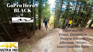
Joyride Bike Parks
since 1997Builder
Upper Joyride Details
-
Activities
- Mountain Bike
-
Riding AreaWhistler Mountain Bike Park
Whistler, British Columbia -
Difficulty Rating
-
Trail TypeSingletrack
-
Bike TypeDH, AM, XC, DJ, RD, Fat, Adaptive MTB
-
DirectionDownhill OnlyPopular direction shown
-
Physical RatingModerate
-
SeasonMay - Oct
-
TTFs on TrailRock Face
-
Global Ranking#222 in Mountain Biking
-
Local Popularity55 in Mountain Biking
-
Land Manager
No description for Upper Joyride trail has been added yet! Submit one here.
Upper Joyride is a highly rated 468 m moderately popular double black diamond singletrack scenic trail located near Whistler British Columbia. This mountain bike only trail can be used downhill only and has a moderate overall physical rating. On average it takes 4 minutes to complete this trail.
Access Info
Top of Fitzsimmons chairlift (to the left)
Bike Park
Traditionally Indigenous Territory
More Stats for Upper Joyride mountain bike trail trail
-
Altitude change-320 ft
-
Altitude min3,000 ft
-
Altitude max3,325 ft
-
Altitude start3,325 ft
-
Altitude end3,005 ft
-
Grade-20.847%
-
Grade max-107.402%
-
Grade min4.503%
-
Distance climb141 ft
-
Distance down1,058 ft
-
Distance flat302 ft
-
Avg time00:04:02
-
Avg reverse time00:22:22
- view trail stats
close
Trail Conditions
- Unknown
- Snow Groomed
- Snow Packed
- Snow Covered
- Snow Cover Inadequate
- Freeze/thaw Cycle
- Icy
- Prevalent Mud
- Wet
- Variable
- Ideal
- Dry
- Very Dry
Trail Flow (Ridden Direction)
Trailforks scans users ridelogs to determine the most popular direction each trail is ridden. A good flowing trail network will have most trails flowing in a single direction according to their intension.
The colour categories are based on what percentage of riders are riding a trail in its intended direction.
The colour categories are based on what percentage of riders are riding a trail in its intended direction.
- > 96%
- > 90%
- > 80%
- > 70%
- > 50%
- < 50%
- bi-directional trail
- no data
Trail Last Ridden
Trailforks scans ridelogs to determine the last time a trail was ridden.
- < 2 days
- < 1 week
- < 2 weeks
- < 1 month
- < 6 months
- > 6 months
Trail Ridden Direction
The intended direction a trail should be ridden.
- Downhill Only
- Downhill Primary
- Both Directions
- Uphill Primary
- Uphill Only
- One Direction
Contribute Details
Colors indicate trail is missing specified detail.
- Description
- Photos
- Description & Photos
- Videos
Trail Popularity ?
Trailforks scans ridelogs to determine which trails are ridden the most in the last 9 months.
Trails are compared with nearby trails in the same city region with a possible 25 colour shades.
Think of this as a heatmap, more rides = more kinetic energy = warmer colors.
- most popular
- popular
- less popular
- not popular
ATV/ORV/OHV Filter
Max Vehicle Width
inches
Radar Time
x
Activity Recordings
Trailforks users anonymized public ridelogs from the past 6 months.
- mountain biking recent
- mountain biking (>6 month)
- hiking (1 year)
- moto (1 year)
Activity Recordings
Trailforks users anonymized public skilogs from the past 12 months.
- Downhill Ski
- Backcountry Ski
- Nordic Ski
Jump Magnitude Heatmap
Heatmap of where riders jump on trails. Zoom in to see individual jumps, click circles to view jump details.
Trails Deemphasized
Trails are shown in grey.
Only show trails with NO bikes.
Save the current map location and zoom level as your default home location whenever this page is loaded.
Save
Directions to upper-joyride trailhead
(50.100520, -122.951420)
update trails status or condition
Upper Joyride Trail Reports
view all reports »
Recent Ridelog Activity on Trail
Past Week
- 47 rides
- 23 miles avg distance
6 Months
- 447 rides
- 23 miles avg distance
All
- 7,491 rides
Technical Trail Features (TTF)
- Ximenes
 Rock Face
Photos
more »
Trail Lists
-
Whistler Bike Park Tech Trails
51 trails
Routes with this trail
Trail Products
 canadaka
Videos
more »


Nearby Trails
- Ninja Cougar 299 ft
- Funshine Rolly Drops 344 ft
- Out Of Sight 505 ft
- B-line - Upper 620 ft
- Whistler Downhill - Upper 630 ft
Whistler Mountain Bike Park
- embed Upper Joyride trail on your website
- By mabes1 & contributors
- #5685 - 7,346 views
- subscribe
- login to download gpx or kml files.