1.7 miles
Distance
21 ft
Climb
-419 ft
Descent
00:10:13
Avg time
Supporters, Builders, Maintainers & Land Managers of PBR Trail

Singletrack TrailsBuilder
BLMLand Manager
PBR Details
-
Activities
- Mountain Bike
- E-Bike
- Hike
- Trail Running
-
Riding Area18 Road
Fruita, Colorado -
Difficulty Rating
-
Voted DifficultyBlue (3 votes)
-
Trail TypeSingletrack
-
Bike TypeDH, AM, XC, Fat, Adaptive MTB
-
DirectionDownhill OnlyPopular direction shown
-
Dogs AllowedYes
-
eBike AllowedYes up to Class 1
-
Global Ranking
-
Local Popularity100 in Mountain Biking [+]
- 100 in E-Biking
- 60 in Trail Running
- 90 in Hiking
AKA: Pumps, Bumps and Rollers
Lots of little jumps, some doubles, and some tabletops. Banked and bermed turns. Downhill only. A good intermediate trail where everything can be rolled without issue.
Adaptive Bike Info
aMTB 2 Rating: Obstacles exist. You may or may not be able to ride this solo. Support rider recommended.
A couple narrow off-camber sections
Local Trail Association
-

-
Please consider joining or donating to the local trail association to supportdonate to earn trail karma!
trail development & maintenance.
Traditionally Indigenous Territory
More Stats for PBR mountain bike trail trail
-
Altitude change-397 ft
-
Altitude min5,125 ft
-
Altitude max5,544 ft
-
Altitude start5,522 ft
-
Altitude end5,125 ft
-
Grade-4.4%
-
Grade max-17%
-
Grade min7.9%
-
Distance climb617 ft
-
Distance down2 miles
-
Distance flat338 ft
-
Avg time00:10:13
-
Avg reverse time00:18:39
- view trail stats
close
Trail Conditions
- Unknown
- Snow Groomed
- Snow Packed
- Snow Covered
- Snow Cover Inadequate
- Freeze/thaw Cycle
- Icy
- Prevalent Mud
- Wet
- Variable
- Ideal
- Dry
- Very Dry
Trail Flow (Ridden Direction)
Trailforks scans users ridelogs to determine the most popular direction each trail is ridden. A good flowing trail network will have most trails flowing in a single direction according to their intension.
The colour categories are based on what percentage of riders are riding a trail in its intended direction.
The colour categories are based on what percentage of riders are riding a trail in its intended direction.
- > 96%
- > 90%
- > 80%
- > 70%
- > 50%
- < 50%
- bi-directional trail
- no data
Trail Last Ridden
Trailforks scans ridelogs to determine the last time a trail was ridden.
- < 2 days
- < 1 week
- < 2 weeks
- < 1 month
- < 6 months
- > 6 months
Trail Ridden Direction
The intended direction a trail should be ridden.
- Downhill Only
- Downhill Primary
- Both Directions
- Uphill Primary
- Uphill Only
- One Direction
Contribute Details
Colors indicate trail is missing specified detail.
- Description
- Photos
- Description & Photos
- Videos
Trail Popularity ?
Trailforks scans ridelogs to determine which trails are ridden the most in the last 9 months.
Trails are compared with nearby trails in the same city region with a possible 25 colour shades.
Think of this as a heatmap, more rides = more kinetic energy = warmer colors.
- most popular
- popular
- less popular
- not popular
ATV/ORV/OHV Filter
Max Vehicle Width
inches
Radar Time
x
Activity Recordings
Trailforks users anonymized public ridelogs from the past 6 months.
- mountain biking recent
- mountain biking (>6 month)
- hiking (1 year)
- moto (1 year)
Activity Recordings
Trailforks users anonymized public skilogs from the past 12 months.
- Downhill Ski
- Backcountry Ski
- Nordic Ski
Jump Magnitude Heatmap
Heatmap of where riders jump on trails. Zoom in to see individual jumps, click circles to view jump details.
Trails Deemphasized
Trails are shown in grey.
Only show trails with NO bikes.
Save the current map location and zoom level as your default home location whenever this page is loaded.
Save
Directions to pbr-12264 trailhead
(39.334220, -108.694650)
update trails status or condition
PBR Trail Reports
view all reports »
Recent Ridelog Activity on Trail
Past Week
- 14 rides
- 9 miles avg distance
6 Months
- 1,166 rides
- 11 miles avg distance
All
- 7,679 rides
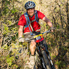
Photos
more »
Trail Lists
-
STT 18 Road
3 trails
Routes with this trail
more »
-
+ 0
misterjohn123
 (Dec 12, 2021 at 11:15)
first half is super fun, enough steepness to keep your speed and tons of rollers and small doubles. great for practicing due to low. second half felt a little slower and fewer features, still awesome
[Reply]
 mkb5150
no way this is black diamond. Intermediate if you keep raging speed and pop off everything, but dial the speed back a little and it's closer to a green...
[Reply]
Videos
more »


Nearby Trails
- Chutes Ladders 7 ft
- Kessel Run 2,664 ft
- Frontside 2,844 ft
- Joes Ridge 4,393 ft
- Sarlacc 1 mile
- embed PBR trail on your website
- By todd Trailforks & contributors
- #12264 - 11,824 views
- subscribe
- login to download gpx or kml files.