close
Trail Conditions
- Unknown
- Snow Groomed
- Snow Packed
- Snow Covered
- Snow Cover Inadequate
- Freeze/thaw Cycle
- Icy
- Prevalent Mud
- Wet
- Variable
- Ideal
- Dry
- Very Dry
Trail Flow (Ridden Direction)
Trailforks scans users ridelogs to determine the most popular direction each trail is ridden. A good flowing trail network will have most trails flowing in a single direction according to their intension.
The colour categories are based on what percentage of riders are riding a trail in its intended direction.
The colour categories are based on what percentage of riders are riding a trail in its intended direction.
- > 96%
- > 90%
- > 80%
- > 70%
- > 50%
- < 50%
- bi-directional trail
- no data
Trail Last Ridden
Trailforks scans ridelogs to determine the last time a trail was ridden.
- < 2 days
- < 1 week
- < 2 weeks
- < 1 month
- < 6 months
- > 6 months
Trail Ridden Direction
The intended direction a trail should be ridden.
- Downhill Only
- Downhill Primary
- Both Directions
- Uphill Primary
- Uphill Only
- One Direction
Contribute Details
Colors indicate trail is missing specified detail.
- Description
- Photos
- Description & Photos
- Videos
Trail Popularity ?
Trailforks scans ridelogs to determine which trails are ridden the most in the last 9 months.
Trails are compared with nearby trails in the same city region with a possible 25 colour shades.
Think of this as a heatmap, more rides = more kinetic energy = warmer colors.
- most popular
- popular
- less popular
- not popular
ATV/ORV/OHV Filter
Max Vehicle Width
inches
Radar Time
x
Activity Recordings
Trailforks users anonymized public ridelogs from the past 6 months.
- mountain biking recent
- mountain biking (>6 month)
- hiking (1 year)
- moto (1 year)
Activity Recordings
Trailforks users anonymized public skilogs from the past 12 months.
- Downhill Ski
- Backcountry Ski
- Nordic Ski
Jump Magnitude Heatmap
Heatmap of where riders jump on trails. Zoom in to see individual jumps, click circles to view jump details.
Trails Deemphasized
Trails are shown in grey.
Only show trails with NO bikes.
Save the current map location and zoom level as your default home location whenever this page is loaded.
SaveDaisy Hill is one of South East Queensland's most popular MTB parks. The conservation park has been set aside to preserve threatened flora and fauna including the koala, but also caters for MTB riders and other recreational users. The park has many trails most of which are relatively easy and hence, caters beginners through to more accomplished riders. A few trails are more challenging than others, and there is number of technical features should riders want to test their abilities.
Primary Trail Type: Cross-Country
eBikes Allowed:
Yes
Land Status: Conservation Reserve
 google parking directions
 Access Info:
The Daisy Hill complex can be accessed via one of three entrances. The main entrance is at the end of Daisy Hill Rd and parking is available immediately at the entrance and also adjacent to the lower day-use area (picnic area).
Another popular entrance point is via Underwood Park (at the end of Underwood Rd). Riders can park at the duck pond and enter the park at a number of points. There is also parking and access at the northern end of the park at Ford Rd, which is popular for those coming from the Redlands area.
Another popular entrance point is via Underwood Park (at the end of Underwood Rd). Riders can park at the duck pond and enter the park at a number of points. There is also parking and access at the northern end of the park at Ford Rd, which is popular for those coming from the Redlands area.
Links
Activities Click to view
- Mountain Bike
53 trails
- E-Bike
53 trails
- Hike
45 trails
- Trail Running
45 trails
- Horse
6 trails
Region Details
- 27
- 1
- 5
- 19
- 1
Region Status
Caution as of Feb 14, 2020Stats
- Avg Trail Rating
- Trails (view details)
- 54
- Trails Mountain Bike
- 53
- Trails E-Bike
- 53
- Trails Hike
- 45
- Trails Trail Running
- 45
- Trails Horse
- 6
- Total Distance
- 36 miles
- Total Descent
- 4,415 ft
- Total Vertical
- 369 ft
- Highest Trailhead
- 456 ft
- Reports
- 1,911
- Photos
- 180
- Ridden Counter
- 49,012
Popular Daisy Hill Mountain Biking Trails
Daisy Hill Mountain Bike Routes
| title | rating | distance |
|---|---|---|
| Daisy Hill Sampler | 6 miles | |
| Daisy Hill 2 Hr Loop | 10 miles | |
| Shimano MTB GP 2022 - Logan - QLD | 6 miles | |
| Getting down and dirty at Daisy Hill | 17 miles | |
| Extended Daisy-Funderwood loop | 18 miles | |
| Epic Training 21km Loop | 13 miles | |
| 27km Daisy Hill Loop + Nirvana | 17 miles | |
| Daisy big loop | 25 miles | |
| RCMC Beginner Daisy Loop | 9 miles | |
| That's betterer. | 14 miles |
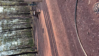
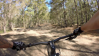
Photos of Daisy Hill Mountain Bike
trail: Wiry Panic
2 |
Jun 24, 2022 @ 3:38pm
Jun 24, 2022
trail: Wiry Panic
1 |
Jun 24, 2022 @ 3:37pm
Jun 24, 2022
trail: Wiry Panic
18 |
Jun 24, 2022 @ 3:36pm
Jun 24, 2022
trail: Nirvana
17 |
May 9, 2022 @ 1:31pm
May 9, 2022
trail: Nirvana
17 |
May 9, 2022 @ 1:31pm
May 9, 2022
trail: Nirvana
15 |
May 9, 2022 @ 1:31pm
May 9, 2022
trail: Nirvana
11 |
May 9, 2022 @ 1:31pm
May 9, 2022
trail: Nirvana
11 |
May 9, 2022 @ 1:31pm
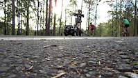
May 9, 2022Videos of Daisy Hill Mountain Bike

trail: Glossy Black
101 |
Aug 24, 2021

trail: Lace Monitor
5:16 |
297 |
Sep 26, 2020

trail: Wiry Panic
6:06 |
261 |
Sep 13, 2020

trail: Nirvana
6:10 |
369 |
Sep 12, 2020
trail: Jumping Ant
4:10 |
|
Dec 31, 2019
trail: Lace Monitor
7:09 |
734 |
Jul 15, 2017

trail: Lace Monitor
3:46 |
295 |
Jun 27, 2017
trail: Possum Box
3:16 |
533 |
Oct 3, 2016
Recent Trail Reports
| status | trail | date | condition | info | user |
|---|---|---|---|---|---|
| Access Trail | Jun 21, 2022 @ 2:27am Jun 21, 2022 | Ideal | FrancisnTVlys | ||
| Mad Max 1 | Jun 21, 2022 @ 2:27am Jun 21, 2022 | Ideal | FrancisnTVlys | ||
| Mad Max Jump Line | Jun 21, 2022 @ 2:27am Jun 21, 2022 | Ideal | FrancisnTVlys | ||
| Western Firebreak | Jun 21, 2022 @ 2:14am Jun 21, 2022 | Wet | FrancisnTVlys | ||
| Stringybark Break | Jun 17, 2022 @ 7:14pm Jun 17, 2022 | Dry | Mikaelolin | ||
| Jumping Ant | Jun 17, 2022 @ 6:38pm Jun 17, 2022 | Ideal | ScottKnowles | ||
| Mad Max 2 | Jun 17, 2022 @ 6:38pm Jun 17, 2022 | Ideal | ScottKnowles | ||
| Chocolate Buddha | Jun 17, 2022 @ 6:38pm Jun 17, 2022 | Ideal | ScottKnowles | ||
| Second Cummin | Jun 17, 2022 @ 6:38pm Jun 17, 2022 | Variable | ScottKnowles | ||
| Possum Box | Jun 17, 2022 @ 6:38pm Jun 17, 2022 | Ideal | ScottKnowles |
Activity Feed
| username | action | type | title | date | |
|---|---|---|---|---|---|
 | Chimonty | wishlist | route | Daisy Hill 2 Hr Loop | Jun 28, 2022 @ 2:16am Jun 28, 2022 |
| Aethiru | ridden | trail | Rifle Range Break | Jun 25, 2022 @ 6:37pm Jun 25, 2022 |
 | hamsuz | wishlist | route | Shimano MTB GP 2022 - Logan - QLD | Jun 25, 2022 @ 5:06pm Jun 25, 2022 |
| peterrabbit1 | wishlist | trail | Lace Monitor | Jun 24, 2022 @ 10:46pm Jun 24, 2022 |
| peterrabbit1 | wishlist | route | Daisy Hill Sampler | Jun 24, 2022 @ 10:40pm Jun 24, 2022 |
Recent Comments
| username | type | title | comment | date | |
|---|---|---|---|---|---|
| trail | Last 3 jumps are massive!!! | Apr 11, 2022 @ 11:57pm Apr 11, 2022 | ||
| trail | The start of the trail, from Basket Fern... | Dec 11, 2021 @ 4:03pm Dec 11, 2021 | ||
| trail | The track is closed to riders and walkers. | Dec 11, 2021 @ 4:01pm Dec 11, 2021 | ||
| report | An HR Ed b see g BBM re heater keep y he | Oct 23, 2021 @ 12:12am Oct 23, 2021 | ||
| report | Great, slightly damp in a couple of spots | Oct 19, 2021 @ 1:22am Oct 19, 2021 |
Nearby Areas
| name | distance | ||||
|---|---|---|---|---|---|
| Underwood Park | 3 | 3 | 1 | 1.8 km | |
| Cornubia Forest Park | 6 | 9 | 1 | 3.2 km | |
| Emu Street Bushland Refuge | 3.5 km | ||||
| Mount Cotton | 1 | 3.7 km | |||
| Eastern Escarpment Conservation Area | 4 | 9 | 2 | 4 km |
Local Badges
-

Completionist7 awarded
Local Products
Activity Type Stats
| activitytype | trails | distance | descent | descent distance | total vertical | rating | global rank | state rank | photos | reports | routes | ridelogs |
|---|---|---|---|---|---|---|---|---|---|---|---|---|
| Mountain Bike | 53 | 35 miles | 4,367 ft | 16 miles | 367 ft | #50 | #2 | 161 | 1,900 | 17 | 30,830 | |
| E-Bike | 53 | 35 miles | 4,367 ft | 16 miles | 367 ft | #23 | #1 | 10 | 1,692 | 6 | 2,457 | |
| Hike | 45 | 31 miles | 3,602 ft | 13 miles | 367 ft | #75 | #3 | 8 | 1,827 | 199 | ||
| Trail Running | 45 | 31 miles | 3,602 ft | 13 miles | 367 ft | #75 | #3 | 1 | 1,830 | 361 | ||
| Horse | 6 | 6 miles | 653 ft | 3 miles | 184 ft | #17 | #1 | 570 | 2 |
- By Jedo & contributors
- Admins: MTBA, RATSCC, LCTCA, Sneaky-Pete, mattmitchell, BORRA
- #12174 - 62,873 views
- daisy hill activity log | embed map of Daisy Hill mountain bike trails | daisy hill mountain biking points of interest
Downloading of trail gps tracks in kml & gpx formats is enabled for Daisy Hill.
You must login to download files.