4,705 ft
Distance
3 ft
Climb
-222 ft
Descent
00:06:01
Avg time
Cliff's Corners Details
-
Activities
- Mountain Bike
- E-Bike
- Observed Trials
-
Riding AreaAlice Lake & Highlands
Squamish, British Columbia -
Difficulty Rating
-
Trail TypeMixed
-
Bike TypeAM, XC, Adaptive MTB
-
DirectionBoth DirectionsPopular direction shown
-
Dogs AllowedYes
-
eBike AllowedYes up to Class 1
-
TTFs on TrailBerm, Bridge
-
Global Ranking
-
Local Popularity95 in Mountain Biking [+]
- 90 in E-Biking
- 5 in Observed Trials
Great trail for working on cornering skills.
Local Trail Association
-

-

-
Please consider joining or donating to the local trail association to supportdonate to earn trail karma!
trail development & maintenance.
Traditionally Indigenous Territory
More Stats for Cliff's Corners mountain bike trail trail
-
Altitude change-219 ft
-
Altitude min901 ft
-
Altitude max1,120 ft
-
Altitude start1,120 ft
-
Altitude end901 ft
-
Grade-4.665%
-
Grade max-13.295%
-
Grade min1.276%
-
Distance climb163 ft
-
Distance down3,452 ft
-
Distance flat1,090 ft
-
Avg time00:06:01
-
Avg reverse time00:11:21
- view trail stats
close
Trail Conditions
- Unknown
- Snow Groomed
- Snow Packed
- Snow Covered
- Snow Cover Inadequate
- Freeze/thaw Cycle
- Icy
- Prevalent Mud
- Wet
- Variable
- Ideal
- Dry
- Very Dry
Trail Flow (Ridden Direction)
Trailforks scans users ridelogs to determine the most popular direction each trail is ridden. A good flowing trail network will have most trails flowing in a single direction according to their intension.
The colour categories are based on what percentage of riders are riding a trail in its intended direction.
The colour categories are based on what percentage of riders are riding a trail in its intended direction.
- > 96%
- > 90%
- > 80%
- > 70%
- > 50%
- < 50%
- bi-directional trail
- no data
Trail Last Ridden
Trailforks scans ridelogs to determine the last time a trail was ridden.
- < 2 days
- < 1 week
- < 2 weeks
- < 1 month
- < 6 months
- > 6 months
Trail Ridden Direction
The intended direction a trail should be ridden.
- Downhill Only
- Downhill Primary
- Both Directions
- Uphill Primary
- Uphill Only
- One Direction
Contribute Details
Colors indicate trail is missing specified detail.
- Description
- Photos
- Description & Photos
- Videos
Trail Popularity ?
Trailforks scans ridelogs to determine which trails are ridden the most in the last 9 months.
Trails are compared with nearby trails in the same city region with a possible 25 colour shades.
Think of this as a heatmap, more rides = more kinetic energy = warmer colors.
- most popular
- popular
- less popular
- not popular
ATV/ORV/OHV Filter
Max Vehicle Width
inches
Radar Time
x
Activity Recordings
Trailforks users anonymized public ridelogs from the past 6 months.
- mountain biking recent
- mountain biking (>6 month)
- hiking (1 year)
- moto (1 year)
Activity Recordings
Trailforks users anonymized public skilogs from the past 12 months.
- Downhill Ski
- Backcountry Ski
- Nordic Ski
Jump Magnitude Heatmap
Heatmap of where riders jump on trails. Zoom in to see individual jumps, click circles to view jump details.
Trails Deemphasized
Trails are shown in grey.
Only show trails with NO bikes.
Save the current map location and zoom level as your default home location whenever this page is loaded.
Save
Directions to cliff-s-corners-3525 trailhead
(49.781410, -123.101600)
update trails status or condition
Cliff's Corners Trail Reports
view all reports »
Recent Ridelog Activity on Trail
Past Week
- 35 rides
- 15 miles avg distance
6 Months
- 674 rides
- 13 miles avg distance
All
- 8,093 rides
 canadaka
Videos
more »
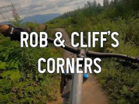
6:48 |
153 |
Jul 8, 2021 , Squamish
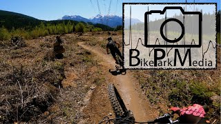
3:51 |
459 |
May 13, 2020 , Squamish

7:22 |
436 |
May 17, 2019 , Squamish
Nearby Trails
- Alice Lake Access 207 ft
- Northside Connector 207 ft
- Edith Lake Access 2,723 ft
- North Edith 3,176 ft
- Ed's Access 3,209 ft
Alice Lake & Highlands
- embed Cliff's Corners trail on your website
- By canadaka
 Trailforks & contributors
 - #3525 - 8,223 views
- subscribe
- login to download gpx or kml files.