3.9 miles
Distance
1,237 ft
Climb
-4 ft
Descent
00:52:53
Avg time
Armstrong Details
-
Activities
- Mountain Bike
- Hike
- Trail Running
-
Riding AreaPark City Mountain Resort
Park City, Utah -
Difficulty Rating
-
Voted DifficultyBlue (1 vote)
-
Trail TypeSingletrack
-
Bike TypeAM, XC, Adaptive MTB
-
DirectionUphill OnlyPopular direction shown
-
Climb DifficultyBlue
-
Physical RatingModerate
-
Dogs AllowedYes
-
Global Ranking
-
Local Popularity100 in Mountain Biking [+]
- 85 in Trail Running
- 80 in Hiking
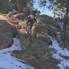
Uphill only for cyclists. This is a great way to access Mid Mountain and Pinecone. As far as climbing trails go, this one is a good steady grade, but does have a few minor technical areas. When the trail was first built, it was pretty smooth, but through time some more jagged rocks have worn through. When doing looping routes from PCMR, I like to do this climb first, while I am fresh and leave the smoother climbing trails for later.
Adaptive Bike Info
aMTB 2 Rating: Obstacles exist. You may or may not be able to ride this solo. Support rider recommended.
Local Trail Association
-

-
Please consider joining or donating to the local trail association to supportdonate to earn trail karma!
trail development & maintenance.
Traditionally Indigenous Territory
More Stats for Armstrong bike trail trail
-
Altitude change1,233 ft
-
Altitude min6,984 ft
-
Altitude max8,217 ft
-
Altitude start6,984 ft
-
Altitude end8,219 ft
-
Grade6%
-
Grade max-2.5%
-
Grade min41.9%
-
Distance climb4 miles
-
Distance down197 ft
-
Distance flat945 ft
-
Avg time00:52:53
-
Avg reverse time00:34:47
- view trail stats
close
Trail Conditions
- Unknown
- Snow Groomed
- Snow Packed
- Snow Covered
- Snow Cover Inadequate
- Freeze/thaw Cycle
- Icy
- Prevalent Mud
- Wet
- Variable
- Ideal
- Dry
- Very Dry
Trail Flow (Ridden Direction)
Trailforks scans users ridelogs to determine the most popular direction each trail is ridden. A good flowing trail network will have most trails flowing in a single direction according to their intension.
The colour categories are based on what percentage of riders are riding a trail in its intended direction.
The colour categories are based on what percentage of riders are riding a trail in its intended direction.
- > 96%
- > 90%
- > 80%
- > 70%
- > 50%
- < 50%
- bi-directional trail
- no data
Trail Last Ridden
Trailforks scans ridelogs to determine the last time a trail was ridden.
- < 2 days
- < 1 week
- < 2 weeks
- < 1 month
- < 6 months
- > 6 months
Trail Ridden Direction
The intended direction a trail should be ridden.
- Downhill Only
- Downhill Primary
- Both Directions
- Uphill Primary
- Uphill Only
- One Direction
Contribute Details
Colors indicate trail is missing specified detail.
- Description
- Photos
- Description & Photos
- Videos
Trail Popularity ?
Trailforks scans ridelogs to determine which trails are ridden the most in the last 9 months.
Trails are compared with nearby trails in the same city region with a possible 25 colour shades.
Think of this as a heatmap, more rides = more kinetic energy = warmer colors.
- most popular
- popular
- less popular
- not popular
ATV/ORV/OHV Filter
Max Vehicle Width
inches
Radar Time
x
Activity Recordings
Trailforks users anonymized public ridelogs from the past 6 months.
- mountain biking recent
- mountain biking (>6 month)
- hiking (1 year)
- moto (1 year)
Activity Recordings
Trailforks users anonymized public skilogs from the past 12 months.
- Downhill Ski
- Backcountry Ski
- Nordic Ski
Jump Magnitude Heatmap
Heatmap of where riders jump on trails. Zoom in to see individual jumps, click circles to view jump details.
Trails Deemphasized
Trails are shown in grey.
Only show trails with NO bikes.
Save the current map location and zoom level as your default home location whenever this page is loaded.
Save
Directions to armstrong trailhead
(40.656350, -111.515380)
update trails status or condition
Armstrong Trail Reports
view all reports »
Recent Ridelog Activity on Trail
Past Week
- 147 rides
- 19 miles avg distance
6 Months
- 813 rides
- 16 miles avg distance
All
- 9,619 rides
Photos
more »
Routes with this trail
more »
Trail Products
-
+ 0
EMG1992
(Aug 18, 2021 at 15:52)
Great way to access Mid-Mountain. Beautiful climb
[Reply]
cdeutsch
(Jul 14, 2020 at 6:16)
These reviews must be based on age of the reviewer...I’m 74 and it’s a HARD slog for me!
[Reply]
JacquiShort
(Jun 4, 2020 at 21:22)
This is an awesome trail with stunning views. Uphill but mellow grade and nothing technical.
[Reply]
CBizek
 (Aug 24, 2019 at 17:11)
This is a good challenging uphill without being overly brutal. Great way to access many other trails and it is nice that its shaded most of the way.
[Reply]
jdpierce
(Jul 10, 2019 at 19:08)
As straight up climbs go, this one is as nice as you’ll find. The grade isn’t bad and mostly shade, but if you’re coming from sea level, you’re probably going to sucking air all the way up. Stay hydrated too.
[Reply]
 hi-dr-nick
Wouldn’t call a slog, it’s pretty gradual and smooth. Easy climbing.
[Reply]

Videos
more »

4:41 |
461 |
Feb 17, 2020 , Park City
Nearby Trails
- Silver Star Lift 1,063 ft
- Eagle Lift 2,956 ft
- 3 Kings Lift 3,061 ft
- Jenni`s (lower) 3,533 ft
- Silver Spur 3,596 ft
Park City Mountain Resort
- embed Armstrong trail on your website
- By todd Trailforks & contributors
- #11473 - 20,813 views
- subscribe
- login to download gpx or kml files.