3,226 ft
Distance
7 ft
Climb
-159 ft
Descent
00:05:02
Avg time
Rob's Corners Details
-
Activities
- Mountain Bike
- E-Bike
-
Riding AreaAlice Lake & Highlands
Squamish, British Columbia -
Difficulty Rating
-
Trail TypeSingletrack
-
Bike TypeAM, XC, Adaptive MTB
-
DirectionDownhill OnlyPopular direction shown
-
Physical RatingModerate
-
Dogs AllowedYes
-
eBike AllowedYes up to Class 1
-
TTFs on TrailBerm
-
Ride in RainYes
-
Global Ranking
-
Local Popularity95 in Mountain Biking [+]
- 90 in E-Biking
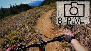
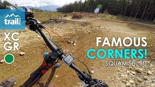
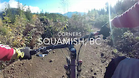
Flowy berm trail that rewards you for carrying your speed as the grade is not steep.
Original trail, Rob's Corners, was hand-built (singletrack) in 1997. Rebuilt in a "ham-fisted" manner in spring 2014 for the Test of Metal.
Access Info
Access from above Alice Lake near Ed's Bypass. Can access by parking at end of Perth Road, then riding up Mashiter trail past Tracks From Hell, up past Cliff's Corners and then enter Ham-Fisted to the left at top of dirt road.
Local Trail Association
-

-

-
Please consider joining or donating to the local trail association to supportdonate to earn trail karma!
trail development & maintenance.
Traditionally Indigenous Territory
More Stats for Rob's Corners mountain bike trail trail
-
Altitude change-152 ft
-
Altitude min1,121 ft
-
Altitude max1,280 ft
-
Altitude start1,273 ft
-
Altitude end1,121 ft
-
Grade-4.718%
-
Grade max-16.338%
-
Grade min5.88%
-
Distance climb295 ft
-
Distance down2,541 ft
-
Distance flat390 ft
-
Avg time00:05:02
-
Avg reverse time00:08:02
- view trail stats
close
Trail Conditions
- Unknown
- Snow Groomed
- Snow Packed
- Snow Covered
- Snow Cover Inadequate
- Freeze/thaw Cycle
- Icy
- Prevalent Mud
- Wet
- Variable
- Ideal
- Dry
- Very Dry
Trail Flow (Ridden Direction)
Trailforks scans users ridelogs to determine the most popular direction each trail is ridden. A good flowing trail network will have most trails flowing in a single direction according to their intension.
The colour categories are based on what percentage of riders are riding a trail in its intended direction.
The colour categories are based on what percentage of riders are riding a trail in its intended direction.
- > 96%
- > 90%
- > 80%
- > 70%
- > 50%
- < 50%
- bi-directional trail
- no data
Trail Last Ridden
Trailforks scans ridelogs to determine the last time a trail was ridden.
- < 2 days
- < 1 week
- < 2 weeks
- < 1 month
- < 6 months
- > 6 months
Trail Ridden Direction
The intended direction a trail should be ridden.
- Downhill Only
- Downhill Primary
- Both Directions
- Uphill Primary
- Uphill Only
- One Direction
Contribute Details
Colors indicate trail is missing specified detail.
- Description
- Photos
- Description & Photos
- Videos
Trail Popularity ?
Trailforks scans ridelogs to determine which trails are ridden the most in the last 9 months.
Trails are compared with nearby trails in the same city region with a possible 25 colour shades.
Think of this as a heatmap, more rides = more kinetic energy = warmer colors.
- most popular
- popular
- less popular
- not popular
ATV/ORV/OHV Filter
Max Vehicle Width
inches
Radar Time
x
Activity Recordings
Trailforks users anonymized public ridelogs from the past 6 months.
- mountain biking recent
- mountain biking (>6 month)
- hiking (1 year)
- moto (1 year)
Activity Recordings
Trailforks users anonymized public skilogs from the past 12 months.
- Downhill Ski
- Backcountry Ski
- Nordic Ski
Jump Magnitude Heatmap
Heatmap of where riders jump on trails. Zoom in to see individual jumps, click circles to view jump details.
Trails Deemphasized
Trails are shown in grey.
Only show trails with NO bikes.
Save the current map location and zoom level as your default home location whenever this page is loaded.
Save
Directions to rob-s-corners-3524 trailhead
(49.788760, -123.101110)
update trails status or condition
Rob's Corners Trail Reports
view all reports »
Recent Ridelog Activity on Trail
Past Week
- 34 rides
- 15 miles avg distance
6 Months
- 511 rides
- 13 miles avg distance
All
- 7,602 rides
Videos
more »
2:20 |
746 |
May 9, 2020 , Squamish
youtuber
![Never ending MTB Corners! || Squamish, BC |...]()
7:22 |
757 |
May 17, 2019 , Squamish

1217 |
Jun 9, 2014 , Squamish
3:40 |
594 |
Dec 21, 2014 , Squamish
Nearby Trails
- Upstream 108 ft
- Man Boobs 180 ft
- Connector Road 1,220 ft
- Ed's Bypass 2,178 ft
- Slippery Salmon 2,238 ft
Alice Lake & Highlands
- embed Rob's Corners trail on your website
- By canadaka
 Trailforks & contributors
 - #3524 - 9,696 views
- subscribe
- login to download gpx or kml files.