close
Trail Conditions
- Unknown
- Snow Groomed
- Snow Packed
- Snow Covered
- Snow Cover Inadequate
- Freeze/thaw Cycle
- Icy
- Prevalent Mud
- Wet
- Variable
- Ideal
- Dry
- Very Dry
Trail Flow (Ridden Direction)
Trailforks scans users ridelogs to determine the most popular direction each trail is ridden. A good flowing trail network will have most trails flowing in a single direction according to their intension.
The colour categories are based on what percentage of riders are riding a trail in its intended direction.
The colour categories are based on what percentage of riders are riding a trail in its intended direction.
- > 96%
- > 90%
- > 80%
- > 70%
- > 50%
- < 50%
- bi-directional trail
- no data
Trail Last Ridden
Trailforks scans ridelogs to determine the last time a trail was ridden.
- < 2 days
- < 1 week
- < 2 weeks
- < 1 month
- < 6 months
- > 6 months
Trail Ridden Direction
The intended direction a trail should be ridden.
- Downhill Only
- Downhill Primary
- Both Directions
- Uphill Primary
- Uphill Only
- One Direction
Contribute Details
Colors indicate trail is missing specified detail.
- Description
- Photos
- Description & Photos
- Videos
Trail Popularity ?
Trailforks scans ridelogs to determine which trails are ridden the most in the last 9 months.
Trails are compared with nearby trails in the same city region with a possible 25 colour shades.
Think of this as a heatmap, more rides = more kinetic energy = warmer colors.
- most popular
- popular
- less popular
- not popular
ATV/ORV/OHV Filter
Max Vehicle Width
inches
Radar Time
x
Activity Recordings
Trailforks users anonymized public ridelogs from the past 6 months.
- mountain biking recent
- mountain biking (>6 month)
- hiking (1 year)
- moto (1 year)
Activity Recordings
Trailforks users anonymized public skilogs from the past 12 months.
- Downhill Ski
- Backcountry Ski
- Nordic Ski
Jump Magnitude Heatmap
Heatmap of where riders jump on trails. Zoom in to see individual jumps, click circles to view jump details.
Trails Deemphasized
Trails are shown in grey.
Only show trails with NO bikes.
Save the current map location and zoom level as your default home location whenever this page is loaded.
Save
No description for Slaughter Pen Trails has been added yet!
Login or register to submit one.
 google parking directions
google parking directions Activities Click to view
- Mountain Bike
85 trails
- E-Bike
80 trails
- Hike
77 trails
- Trail Running
77 trails
Region Details
- 2
- 2
- 21
- 42
- 11
- 7
Region Status
Open as of 14 hoursStats
- Avg Trail Rating
- Trails (view details)
- 85
- Trails Mountain Bike
- 85
- Trails E-Bike
- 80
- Trails Hike
- 77
- Trails Trail Running
- 77
- Total Distance
- 26 miles
- Total Descent
- 3,364 ft
- Total Vertical
- 205 ft
- Highest Trailhead
- 1,269 ft
- Reports
- 1,774
- Photos
- 264
- Ridden Counter
- 113,406
Popular Slaughter Pen Trails Mountain Biking Trails
Slaughter Pen Trails Mountain Bike Routes
| title | rating | distance |
|---|---|---|
| Schroen Train Loop | 3,819 ft | |
| Slaughter Pen Phase II Ozone Start | 4 miles | |
| Berm Creek Loop | 1,473 ft | |
| Back 40 | 26 miles | |
| 13 mile Slaughter Pen Trails Ride | popular ridelog | 13 miles |
| 21 mile Slaughter Pen Trails Ride | popular ridelog | 21 miles |
| 15 mile Slaughter Pen Trails Ride | popular ridelog | 15 miles |
| 10 mile Slaughter Pen Trails Ride | popular ridelog | 10 miles |
| 10 mile Slaughter Pen Trails Ride | popular ridelog | 10 miles |
| 5 mile Slaughter Pen Trails Ride | popular ridelog | 5 miles |
Photos of Slaughter Pen Trails Mountain Bike
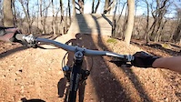
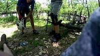
trail: The Boneyard
644 |
Dec 20, 2019 @ 8:24pm
Dec 20, 2019
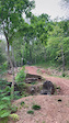
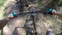
trail: The Boneyard
737 |
Nov 20, 2018 @ 5:31pm
Nov 20, 2018Videos of Slaughter Pen Trails Mountain Bike
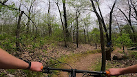
trail: The Boneyard
93 |
Mar 14, 2022
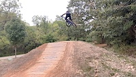
trail: The Boneyard
404 |
May 13, 2021
trail: Medusa
262 |
Apr 29, 2021
trail: All-American Heros
323 |
Nov 26, 2020
trail: Ozone
0:15 |
150 |
May 6, 2020
trail: Ozone
3:08 |
173 |
May 6, 2020
trail: The Boneyard
0:11 |
905 |
Dec 21, 2019
trail: Bone Yard
0:08 |
509 |
May 3, 2019
Current Trail Warnings
| status | trail | date | condition | user | info |
|---|---|---|---|---|---|
| Uwabami | Jun 29, 2022 @ 12:04pm Jun 29, 2022 | Ideal | nwatrailblazers | Closed due to construction. | |
| Lombard Connector | Jun 29, 2022 @ 12:03pm Jun 29, 2022 | Dry | nwatrailblazers | Closed due to construction. | |
| Lombard | Jun 29, 2022 @ 12:03pm Jun 29, 2022 | Dry | nwatrailblazers | Closed due to construction. |
Recent Trail Reports
| status | trail | date | condition | info | user |
|---|---|---|---|---|---|
| Rim Trail | Jul 5, 2022 @ 1:30pm 14 hours | Dry | protijy | ||
| Angus Chute | Jul 1, 2022 @ 7:06am Jul 1, 2022 | Ideal | Ribar6 | ||
| Free Ride Zone Large Drop | Jul 1, 2022 @ 7:06am Jul 1, 2022 | Dry | Ribar6 | ||
| Seed Tick Shuffle | Jul 1, 2022 @ 7:06am Jul 1, 2022 | Ideal | Ribar6 | ||
| Black Apple Creek | Jun 30, 2022 @ 7:03am Jun 30, 2022 | Ideal | Ribar6 | ||
| Medieval | Jun 29, 2022 @ 10:50am Jun 29, 2022 | Dry | nwatrailblazers | ||
| Entry to Downhill Area | Jun 29, 2022 @ 10:50am Jun 29, 2022 | Dry | nwatrailblazers | ||
| Catapult | Jun 29, 2022 @ 10:50am Jun 29, 2022 | Dry | nwatrailblazers | ||
| West Hand-Cut Hollow Connector | Jun 28, 2022 @ 1:06pm Jun 28, 2022 | Ideal | tbubier | ||
| Free Ride Zone Cut-through | Jun 28, 2022 @ 1:06pm Jun 28, 2022 | Ideal | tbubier |
Activity Feed
| username | action | type | title | date | |
|---|---|---|---|---|---|
 | Grasseater | comment | trail | Uwabami | Jul 5, 2022 @ 3:25pm 12 hours |
 | protijy | add | report | Rim Trail and 1 more | Jul 5, 2022 @ 1:30pm 14 hours |
| Ribar6 | add | report | Black Apple Creek and 4 more | Jul 5, 2022 @ 10:04am 18 hours |
| GaryDpgv4U | wishlist | trail | Medieval and 1 more | Jul 3, 2022 @ 2:12pm 3 days |
| nwatrailblazers | add | report | Loam Wolf and 7 more | Jun 29, 2022 @ 10:52am Jun 29, 2022 |
Recent Comments
| username | type | title | comment | date | |
|---|---|---|---|---|---|
| trail | Good little trail for beginners to practice... | Jul 5, 2022 @ 3:25pm 12 hours | ||
 | trail | Skip it! | Jun 9, 2022 @ 2:26pm Jun 9, 2022 | ||
| trail | Super fun but signage at the drop in show it... | May 31, 2022 @ 6:25pm May 31, 2022 | ||
 | report | Dry, good shape | May 16, 2022 @ 9:05pm May 16, 2022 | ||
 | report | This trail is closed | May 14, 2022 @ 8:42am May 14, 2022 |
Nearby Areas
| name | distance | ||||
|---|---|---|---|---|---|
| Park Spring Park | 9 | 9 | 3 | 1.1 km | |
| Crystal Bridges | 5 | 4 | 1.5 km | ||
| Coler Mountain Bike Preserve | 12 | 12 | 8 | 6 | 1.8 km |
| HandCut Hollow | 1 | 12 | 9 | 1.8 km | |
| Blowing Springs | 8 | 16 | 5 | 1 | 3.1 km |
Local Badges
-

Completionist10 awarded
Bike & Skill Parks
| name | type | city | rating |
|---|---|---|---|
| Freeride Park | skill park | Bentonville |
Local Trail Supporters
- Kreadiv Nadiv Concepts
![]()
Activity Type Stats
| activitytype | trails | distance | descent | descent distance | total vertical | rating | global rank | state rank | photos | reports | routes | ridelogs |
|---|---|---|---|---|---|---|---|---|---|---|---|---|
| Mountain Bike | 85 | 26 miles | 3,363 ft | 13 miles | 207 ft | #20 | #8 | 264 | 1,759 | 4 | 13,109 | |
| E-Bike | 80 | 25 miles | 3,281 ft | 13 miles | 207 ft | #10 | #3 | 1,680 | 1 | 511 | ||
| Hike | 77 | 23 miles | 2,723 ft | 11 miles | 207 ft | #13 | #7 | 1,735 | 138 | |||
| Trail Running | 77 | 23 miles | 2,723 ft | 11 miles | 207 ft | #12 | #6 | 1,735 | 379 |
- By brenthillier
 NSMBA TRAILFORKS & contributors
 - Admins: FAST, Bentonville, jpmcghee
- #3752 - 34,025 views
- slaughter pen trails activity log | embed map of Slaughter Pen Trails mountain bike trails | slaughter pen trails mountain biking points of interest
Downloading of trail gps tracks in kml & gpx formats is enabled for Slaughter Pen Trails.
You must login to download files.