4.6 miles
Distance
734 ft
Climb
-654 ft
Descent
01:00:48
Avg time
Supporters, Builders, Maintainers & Land Managers of Rocky Tops Trail

Moab Trail MixBuilder
BLMLand Manager
Rocky Tops Details
-
Activities
- Mountain Bike
- Hike
- Trail Running
-
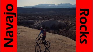
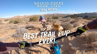
Riding AreaNavajo Rocks
Moab, Utah -
Difficulty Rating
-
Voted DifficultyBlue (1 vote)
-
Trail TypeSingletrack
-
Bike TypeAM, XC, Fat, Adaptive MTB
-
DirectionOne DirectionPopular direction shown
-
Dogs AllowedYes
-
eBike Allowed
-
Global Ranking
-
Local Popularity95 in Mountain Biking [+]
- 85 in Trail Running
- 85 in Hiking
-
Land ManagerBLM
A mix of every kind of trail you can think of, rolled into one great ride.
Adaptive Bike Info
aMTB 3 Rating: Major obstacles exist. You will not be able to ride this solo. Support rider needed.
This is an adventure on an adaptive mountain bike. We took 2 bombers and did a lot of spotting for them on off cambered spots, rock crawls etc. Doable for a lower level spinal cord injury if you have good spotting, excellent line selection, great endurance and even better attitude. No points in the trail where you must get out of the bike or the bike is too wide.
Local Trail Association
-

-
Please consider joining or donating to the local trail association to supportdonate to earn trail karma!
trail development & maintenance.
Traditionally Indigenous Territory
More Stats for Rocky Tops mountain bike trail trail
-
Altitude change80 ft
-
Altitude min5,001 ft
-
Altitude max5,280 ft
-
Altitude start5,051 ft
-
Altitude end5,131 ft
-
Grade0.333%
-
Grade max-58.489%
-
Grade min52.477%
-
Distance climb2 miles
-
Distance down2 miles
-
Distance flat2,869 ft
-
Avg time01:00:48
-
Avg reverse time01:05:30
- view trail stats
close
Trail Conditions
- Unknown
- Snow Groomed
- Snow Packed
- Snow Covered
- Snow Cover Inadequate
- Freeze/thaw Cycle
- Icy
- Prevalent Mud
- Wet
- Variable
- Ideal
- Dry
- Very Dry
Trail Flow (Ridden Direction)
Trailforks scans users ridelogs to determine the most popular direction each trail is ridden. A good flowing trail network will have most trails flowing in a single direction according to their intension.
The colour categories are based on what percentage of riders are riding a trail in its intended direction.
The colour categories are based on what percentage of riders are riding a trail in its intended direction.
- > 96%
- > 90%
- > 80%
- > 70%
- > 50%
- < 50%
- bi-directional trail
- no data
Trail Last Ridden
Trailforks scans ridelogs to determine the last time a trail was ridden.
- < 2 days
- < 1 week
- < 2 weeks
- < 1 month
- < 6 months
- > 6 months
Trail Ridden Direction
The intended direction a trail should be ridden.
- Downhill Only
- Downhill Primary
- Both Directions
- Uphill Primary
- Uphill Only
- One Direction
Contribute Details
Colors indicate trail is missing specified detail.
- Description
- Photos
- Description & Photos
- Videos
Trail Popularity ?
Trailforks scans ridelogs to determine which trails are ridden the most in the last 9 months.
Trails are compared with nearby trails in the same city region with a possible 25 colour shades.
Think of this as a heatmap, more rides = more kinetic energy = warmer colors.
- most popular
- popular
- less popular
- not popular
ATV/ORV/OHV Filter
Max Vehicle Width
inches
Radar Time
x
Activity Recordings
Trailforks users anonymized public ridelogs from the past 6 months.
- mountain biking recent
- mountain biking (>6 month)
- hiking (1 year)
- moto (1 year)
Activity Recordings
Trailforks users anonymized public skilogs from the past 12 months.
- Downhill Ski
- Backcountry Ski
- Nordic Ski
Jump Magnitude Heatmap
Heatmap of where riders jump on trails. Zoom in to see individual jumps, click circles to view jump details.
Trails Deemphasized
Trails are shown in grey.
Only show trails with NO bikes.
Save the current map location and zoom level as your default home location whenever this page is loaded.
Save
Directions to rocky-tops trailhead
(38.640300, -109.749240)
update trails status or condition
Rocky Tops Trail Reports
view all reports »
Recent Ridelog Activity on Trail
Past Week
- 3 rides
- 14 miles avg distance
6 Months
- 639 rides
- 15 miles avg distance
All
- 4,477 rides
Photos
more »
Routes with this trail
tommymcsass
(May 14, 2021 at 11:43)
I recommend getting a ride to this trailhead from Geoff at Hazard County shuttle, and starting with this uphill trail. Fun. Do the Navajo loop starting with this trail and you'll end on a nice downhill Ramble, then cruise all downhill back to town and enjoy a pint at Spitfire Smokehouse in town. Can't lose.
[Reply]
 aguynamedjoe
We had planned a larger ride, but the day we went the winds along the ridge lines were ferocious! My wife is waif and only weighs a biscuit and the wind was moving her all over. That wind made the day an exception, and while we had fun, we are looking forward to the next time here to feel the trail without that element of nature that had us head back at Middle Earth.
[Reply]
BCAndi
(Oct 22, 2019 at 21:24)
I loved this trail, fun punchy climbs, cool decentes, great views, borderline advanced. Rode it clockwise
[Reply]
imblake
(Oct 5, 2019 at 13:31)
Five trails making Navajo Loop, best riding and views in moab.
[Reply]
Videos
more »


Nearby Trails
- 7-up 2 miles
- Rt To 7up 3 miles
- 7-up 3 miles
- Coney Island 3 miles
- The Knoll 3 miles
- embed Rocky Tops trail on your website
- By todd
 Trailforks & contributors
 - #9043 - 5,482 views
- subscribe
- login to download gpx or kml files.
It’s a fun trail with lots of good ups and downs, none of which feel too long or grueling. Great views, fun tech!