close
Trail Conditions
- Unknown
- Snow Groomed
- Snow Packed
- Snow Covered
- Snow Cover Inadequate
- Freeze/thaw Cycle
- Icy
- Prevalent Mud
- Wet
- Variable
- Ideal
- Dry
- Very Dry
Trail Flow (Ridden Direction)
Trailforks scans users ridelogs to determine the most popular direction each trail is ridden. A good flowing trail network will have most trails flowing in a single direction according to their intension.
The colour categories are based on what percentage of riders are riding a trail in its intended direction.
The colour categories are based on what percentage of riders are riding a trail in its intended direction.
- > 96%
- > 90%
- > 80%
- > 70%
- > 50%
- < 50%
- bi-directional trail
- no data
Trail Last Ridden
Trailforks scans ridelogs to determine the last time a trail was ridden.
- < 2 days
- < 1 week
- < 2 weeks
- < 1 month
- < 6 months
- > 6 months
Trail Ridden Direction
The intended direction a trail should be ridden.
- Downhill Only
- Downhill Primary
- Both Directions
- Uphill Primary
- Uphill Only
- One Direction
Contribute Details
Colors indicate trail is missing specified detail.
- Description
- Photos
- Description & Photos
- Videos
Trail Popularity ?
Trailforks scans ridelogs to determine which trails are ridden the most in the last 9 months.
Trails are compared with nearby trails in the same city region with a possible 25 colour shades.
Think of this as a heatmap, more rides = more kinetic energy = warmer colors.
- most popular
- popular
- less popular
- not popular
ATV/ORV/OHV Filter
Max Vehicle Width
inches
Radar Time
x
Activity Recordings
Trailforks users anonymized public ridelogs from the past 6 months.
- mountain biking recent
- mountain biking (>6 month)
- hiking (1 year)
- moto (1 year)
Activity Recordings
Trailforks users anonymized public skilogs from the past 12 months.
- Downhill Ski
- Backcountry Ski
- Nordic Ski
Jump Magnitude Heatmap
Heatmap of where riders jump on trails. Zoom in to see individual jumps, click circles to view jump details.
Trails Deemphasized
Trails are shown in grey.
Only show trails with NO bikes.
Save the current map location and zoom level as your default home location whenever this page is loaded.
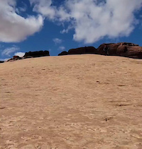
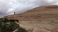
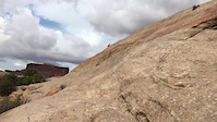
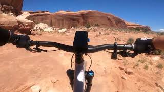
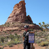
SaveVery popular new trail system, opened in 2014. Wide variety of trails and great views. Good mix of dirt and slickrock, wide variety of technical challenges. Some long extended downhill sections.
Primary Trail Type: All-Mountain & Downhill
eBikes Allowed:
No
 google parking directions
Links
Activities Click to view
- Mountain Bike
8 trails
- Hike
9 trails
- Trail Running
9 trails
Stats
- Avg Trail Rating
- Trails (view details)
- 9
- Trails Mountain Bike
- 8
- Trails Hike
- 9
- Trails Trail Running
- 9
- Total Distance
- 21 miles
- Total Descent
- 3,035 ft
- Total Vertical
- 776 ft
- Highest Trailhead
- 5,606 ft
- Reports
- 470
- Photos
- 191
- Ridden Counter
- 17,929
Popular Navajo Rocks Mountain Biking Trails
| status | title | difficulty | rating |
|---|---|---|---|
| Rocky Tops | |||
| Big Mesa | |||
| Middle Earth | |||
| Big Lonely | |||
| Ramblin | |||
| Coney Island | |||
| RT to 7UP | |||
| The Knoll |
Navajo Rocks Mountain Bike Routes
| title | rating | distance |
|---|---|---|
| Navajo Rocks Loop! | 17 miles | |
| Navajo Rocks full loop | 17 miles | |
| Navajo Rocks maximun dh loop | 19 miles | |
| Moab or Bust Intermediate Ride | 13 miles | |
| Navajo Half Loop | 15 miles | |
| Roam Retreat @ Moab: Navajo Rocks Long | 12 miles | |
| Roam Retreat @ Moab: Navajo Rocks Short + Shuttle | 6 miles | |
| Navajo Rocks DH loop | 19 miles | |
| 19 mile Navajo Rocks Cross-country Ride | popular ridelog | 19 miles |
| 9 mile Navajo Rocks All-Mountain Ride | popular ridelog | 9 miles |
Photos of Navajo Rocks Mountain Bike
trail: Rocky Tops
0 |
Jun 30, 2022 @ 10:39am
Jun 30, 2022
trail: Rocky Tops
0 |
Jun 30, 2022 @ 10:38am
Jun 30, 2022
trail: Big Mesa
294 |
Nov 6, 2018 @ 7:29am
Nov 6, 2018
trail: Big Mesa
221 |
Dec 3, 2017 @ 5:54pm
Dec 3, 2017
trail: Ramblin
455 |
Sep 9, 2017 @ 10:29am
Sep 9, 2017
trail: Rocky Tops
492 |
Apr 2, 2017 @ 7:37pm
Apr 2, 2017
trail: Ramblin
583 |
Oct 4, 2016 @ 9:37pm
Oct 4, 2016
trail: Rocky Tops
664 | | 2 comments
May 12, 2016 @ 9:03am
May 12, 2016Videos of Navajo Rocks Mountain Bike
trail: Ramblin
28 |
Oct 24, 2021
trail: Ramblin
0:31 |
372 |
Apr 9, 2017
trail: Ramblin
0:26 |
265 |
Apr 9, 2017
trail: Big Mesa
6:09 |
31 |
May 25, 2022 , Moab

15:59 |
50 |
Apr 6, 2022
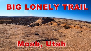
trail: Big Lonely
0:56 |
74 |
Mar 4, 2022 , Moab

trail: Big Mesa
5:31 |
101 |
Mar 4, 2022 , Moab

trail: Coney Island
5:05 |
193 |
Jun 9, 2021 , Moab
Recent Trail Reports
| status | trail | date | condition | info | user |
|---|---|---|---|---|---|
| The Knoll | Mar 7, 2020 @ 7:41pm Mar 7, 2020 | Ideal | UtahJohn TRAILFORKS |
Activity Feed
| username | action | type | title | date | |
|---|---|---|---|---|---|
 | jponeil | wishlist | route | Navajo Rocks full loop | Jul 3, 2022 @ 3:48pm 3 days |
| Krmoore42 | add | report | Ramblin | Jul 1, 2022 @ 1:45pm Jul 1, 2022 |
 | extrapulp | add | report | Rocky Tops and 3 more | Jun 30, 2022 @ 10:54am Jun 30, 2022 |
| mlmcoach4u | add | photo | in Brookeland, Texas, United States and 2 more | Jun 30, 2022 @ 10:38am Jun 30, 2022 |
| irishqueep | wishlist | route | Navajo Rocks full loop | Jun 29, 2022 @ 2:26pm Jun 29, 2022 |
Recent Comments
| username | type | title | comment | date | |
|---|---|---|---|---|---|
| trail | Road the loop counter clockwise as some... | Jun 6, 2022 @ 5:34pm Jun 6, 2022 | ||
| trail | I'm not an advanced rider and I've only ever... | Oct 12, 2021 @ 7:18pm Oct 12, 2021 | ||
 | trail | I would agree with the TF suggestion to ride... | Aug 2, 2021 @ 8:37am Aug 2, 2021 | ||
| trail | Lots of fun! A nice glimpse of what riding the... | Aug 2, 2021 @ 8:33am Aug 2, 2021 | ||
| trail | This trail ticks every box! Fun downhill... | Aug 2, 2021 @ 8:32am Aug 2, 2021 |
Nearby Areas
| name | distance | ||||
|---|---|---|---|---|---|
| Horsethief | 6 | 10 | 3 km | ||
| Moab Brand Trails | 9 | 10 | 4 | 1 | 6 km |
| Sovereign Trail System | 1 | 6 | 9 | 3 | 6.9 km |
| Mag 7 | 2 | 10 | 3 | 3 | 7.1 km |
| Klonzo | 11 | 16 | 4 | 8.6 km |
Activity Type Stats
| activitytype | trails | distance | descent | descent distance | total vertical | rating | global rank | state rank | photos | reports | routes | ridelogs |
|---|---|---|---|---|---|---|---|---|---|---|---|---|
| Mountain Bike | 8 | 19 miles | 2,323 ft | 8 miles | 643 ft | #305 | #145 | 191 | 470 | 8 | 7,556 | |
| Hike | 9 | 21 miles | 3,035 ft | 9 miles | 778 ft | #194 | #103 | 470 | 1 | 28 | ||
| Trail Running | 9 | 21 miles | 3,035 ft | 9 miles | 778 ft | #193 | #100 | 470 | 1 | 10 |
- By todd
 Trailforks & contributors
 - Admins: MTM, MMBA, GrandCountyTrails
- #6696 - 21,739 views
- navajo rocks activity log | embed map of Navajo Rocks mountain bike trails | navajo rocks mountain biking points of interest
Downloading of trail gps tracks in kml & gpx formats is enabled for Navajo Rocks.
You must login to download files.